
Red Mountain #1 in the San Juan Mountains of Colorado is an example of natural mineral weathering, where the USGS is working to understand metal mobilization processes in mine workings and groundwater.
Isotopic and environmental tracers for improved understanding of geochemical and hydrologic processes occurring near flooded mine workings
Active
By Colorado Water Science Center
August 24, 2023
Draining mine tunnels contribute metals and acidity to streams throughout the western United States. One remediation strategy that is increasing in usage is the emplacement of hydraulic bulkheads to impound water within the subsurface. Potential secondary effects of bulkhead usage are difficult to quantify however because of the inherent complexity of many mountain hydrologic systems.
In cooperation with the U.S. Environmental Protection Agency (EPA), the U.S. Geological Survey (USGS) is working to investigate processes controlling groundwater flow and acid mine drainage (AMD) geochemistry in several locations across the western United States with hydraulic bulkheading. This research assists in understanding the potential efficacy of the bulkhead remediation strategy at other locations within the western United States.
In order to gain understanding of the hydrologic and geochemical processes occurring in the subsurface the USGS collects water-quality data from draining mines, groundwater wells, and springs. A comprehensive suite of water-quality parameters are being utilized including trace metals, rare earth elements (REE), stable isotopes, tritium, carbon-14, and noble gases. These water-quality data are paired with hydrologic evaluation of the groundwater-flow regime to inform remedial decisions and to quantify hydrological and geochemical processes affecting water quality in flooded mine workings.
Results
Captain Jack mine, Boulder County, Colorado
Results from the Captain Jack mine site, located west of Boulder, Colorado, indicated that the groundwater system is disconnected and that the water within the mine workings has very little connection to the groundwater in the adjacent bedrock. Extremely high hydraulic gradients are maintained between the bedrock and mine groundwaters, even when water is impounded within the mine workings (figure below from https://www.usgs.gov/publications/hydrologic-compartmentalization-and-analytic-element-groundwater-flow-simulations-a).
Media

Sources/Usage: Public Domain. View Media Details
Based on stable isotopes and groundwater age indicators it appears that old groundwater sustains high metal concentrations flowing into the impounded mine water and that sulfide oxidation (the process that generates AMD) can still occur when the workings are flooded (see figure below from Mechanisms of water-rock interaction and implications for remediating flooded mine workings elucidated from environmental tracers, stable isotopes, and rare earth elements - ScienceDirect).
Media

Sources/Usage: Public Domain. View Media Details
Bonita Peak mining district, San Juan County, Colorado
Results from the Bonita Peak mining district superfund site indicate high degrees of hydrologic connectivity between numerous mine workings and bedrock, in contrast to the results from the Captain Jack mine site. Isotope and geochemical data from draining mine adits and springs indicates that groundwater flow is active deep beneath the subsurface and likely occurs across watershed divides, as illustrated in the conceptual hydrogeologic cross section below. Timeseries of metal loads illustrate that although there was greater metal discharge from some mines as a result of hydraulic bulkheading, the overall export of iron and zinc from the study area decreased over a 25-year period. These results provide examples of useful datasets to collect during mine remediation using hydraulic bulkheading.
Media

Sources/Usage: Public Domain. View Media Details
Hydrogeologic conceptual cross section through Bonita Peak mining district (Tracing metal sources and groundwater flow paths in the Upper Animas River watershed using rare earth elements and stable isotopes | U.S. Geological Survey) displaying surficial alteration styles, geologic units faults and mineralized veins, underground mine workings, and groundwater flow paths.
Related Links
- EPA Superfund Site: Captain Jack Mill, Ward, CO - https://cumulis.epa.gov/supercpad/cursites/csitinfo.cfm?id=0800892
- BONITA PEAK MINING DISTRICT | Superfund Site Profile | Superfund Site Information | US EPA
- FORMOSA MINE | Superfund Site Profile | Superfund Site Information | US EPA
- Geochemistry, mineralogy, and acid-generating behaviour of efflorescent sulphate salts in underground mines in Nevada, USA - https://doi.org/10.1144/geochem2018-074
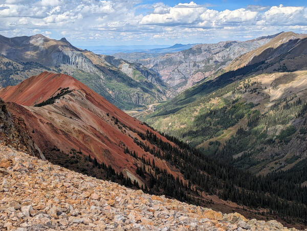
Red Mountain #1
Red Mountain #1 in the San Juan Mountains of Colorado is an example of natural mineral weathering, where the USGS is working to understand metal mobilization processes in mine workings and groundwater.

Conceptual model of groundwater site
Insights gained from stable isotopes and environmental tracers in this study allow a conceptual model to be built that provides information pertinent to groundwater mixing and transport, sulfide oxidation mechanisms, and timeframes of remediation. This conceptual model of the site (not to scale) is based on hydrologic and geochemical data.
Insights gained from stable isotopes and environmental tracers in this study allow a conceptual model to be built that provides information pertinent to groundwater mixing and transport, sulfide oxidation mechanisms, and timeframes of remediation. This conceptual model of the site (not to scale) is based on hydrologic and geochemical data.

Vertical and horizontal gradients in groundwater level elevations
Vertical and horizontal gradients in groundwater level elevationsGroundwater level elevations within the mine workings (indicated by the red dotted lines) and within crystalline bedrock outside the mine workings (indicated by the blue dotted lines) are substantially different from one another.

Captain Jack Superfund Site, Boulder County, Colorado
Captain Jack Superfund Site, Boulder County, ColoradoThe Captain Jack site is located in mountainous terrain northwest of Boulder, Colorado. Here the terrain is visible behind an old train track leading into a mine adit.
Location: Captain Jack Superfund site, Boulder County, Colorado

Calcite Precipitation at Captain Jack Superfund Site, Boulder County, CO
Calcite Precipitation at Captain Jack Superfund Site, Boulder County, COInteractions between water and minerals in the subsurface (including efflorescent sulfate salts and calcite such as this sample from the Big Five adit) are a primary control on water quality in mining environments. Research is evaluating the importance of these minerals in generating acid mine drainage.
Draining mine tunnels contribute metals and acidity to streams throughout the western United States. One remediation strategy that is increasing in usage is the emplacement of hydraulic bulkheads to impound water within the subsurface. Potential secondary effects of bulkhead usage are difficult to quantify however because of the inherent complexity of many mountain hydrologic systems.
In cooperation with the U.S. Environmental Protection Agency (EPA), the U.S. Geological Survey (USGS) is working to investigate processes controlling groundwater flow and acid mine drainage (AMD) geochemistry in several locations across the western United States with hydraulic bulkheading. This research assists in understanding the potential efficacy of the bulkhead remediation strategy at other locations within the western United States.
In order to gain understanding of the hydrologic and geochemical processes occurring in the subsurface the USGS collects water-quality data from draining mines, groundwater wells, and springs. A comprehensive suite of water-quality parameters are being utilized including trace metals, rare earth elements (REE), stable isotopes, tritium, carbon-14, and noble gases. These water-quality data are paired with hydrologic evaluation of the groundwater-flow regime to inform remedial decisions and to quantify hydrological and geochemical processes affecting water quality in flooded mine workings.
Results
Captain Jack mine, Boulder County, Colorado
Results from the Captain Jack mine site, located west of Boulder, Colorado, indicated that the groundwater system is disconnected and that the water within the mine workings has very little connection to the groundwater in the adjacent bedrock. Extremely high hydraulic gradients are maintained between the bedrock and mine groundwaters, even when water is impounded within the mine workings (figure below from https://www.usgs.gov/publications/hydrologic-compartmentalization-and-analytic-element-groundwater-flow-simulations-a).
Media
Sources/Usage: Public Domain. View Media Details
Based on stable isotopes and groundwater age indicators it appears that old groundwater sustains high metal concentrations flowing into the impounded mine water and that sulfide oxidation (the process that generates AMD) can still occur when the workings are flooded (see figure below from Mechanisms of water-rock interaction and implications for remediating flooded mine workings elucidated from environmental tracers, stable isotopes, and rare earth elements - ScienceDirect).
Media
Sources/Usage: Public Domain. View Media Details
Bonita Peak mining district, San Juan County, Colorado
Results from the Bonita Peak mining district superfund site indicate high degrees of hydrologic connectivity between numerous mine workings and bedrock, in contrast to the results from the Captain Jack mine site. Isotope and geochemical data from draining mine adits and springs indicates that groundwater flow is active deep beneath the subsurface and likely occurs across watershed divides, as illustrated in the conceptual hydrogeologic cross section below. Timeseries of metal loads illustrate that although there was greater metal discharge from some mines as a result of hydraulic bulkheading, the overall export of iron and zinc from the study area decreased over a 25-year period. These results provide examples of useful datasets to collect during mine remediation using hydraulic bulkheading.
Media
Sources/Usage: Public Domain. View Media Details
Hydrogeologic conceptual cross section through Bonita Peak mining district (Tracing metal sources and groundwater flow paths in the Upper Animas River watershed using rare earth elements and stable isotopes | U.S. Geological Survey) displaying surficial alteration styles, geologic units faults and mineralized veins, underground mine workings, and groundwater flow paths.
Related Links
- EPA Superfund Site: Captain Jack Mill, Ward, CO - https://cumulis.epa.gov/supercpad/cursites/csitinfo.cfm?id=0800892
- BONITA PEAK MINING DISTRICT | Superfund Site Profile | Superfund Site Information | US EPA
- FORMOSA MINE | Superfund Site Profile | Superfund Site Information | US EPA
- Geochemistry, mineralogy, and acid-generating behaviour of efflorescent sulphate salts in underground mines in Nevada, USA - https://doi.org/10.1144/geochem2018-074
Red Mountain #1
Red Mountain #1 in the San Juan Mountains of Colorado is an example of natural mineral weathering, where the USGS is working to understand metal mobilization processes in mine workings and groundwater.
Red Mountain #1 in the San Juan Mountains of Colorado is an example of natural mineral weathering, where the USGS is working to understand metal mobilization processes in mine workings and groundwater.
Conceptual model of groundwater site
Insights gained from stable isotopes and environmental tracers in this study allow a conceptual model to be built that provides information pertinent to groundwater mixing and transport, sulfide oxidation mechanisms, and timeframes of remediation. This conceptual model of the site (not to scale) is based on hydrologic and geochemical data.
Insights gained from stable isotopes and environmental tracers in this study allow a conceptual model to be built that provides information pertinent to groundwater mixing and transport, sulfide oxidation mechanisms, and timeframes of remediation. This conceptual model of the site (not to scale) is based on hydrologic and geochemical data.
Vertical and horizontal gradients in groundwater level elevations
Vertical and horizontal gradients in groundwater level elevationsGroundwater level elevations within the mine workings (indicated by the red dotted lines) and within crystalline bedrock outside the mine workings (indicated by the blue dotted lines) are substantially different from one another.
Captain Jack Superfund Site, Boulder County, Colorado
Captain Jack Superfund Site, Boulder County, ColoradoThe Captain Jack site is located in mountainous terrain northwest of Boulder, Colorado. Here the terrain is visible behind an old train track leading into a mine adit.
Location: Captain Jack Superfund site, Boulder County, Colorado
Calcite Precipitation at Captain Jack Superfund Site, Boulder County, CO
Calcite Precipitation at Captain Jack Superfund Site, Boulder County, COInteractions between water and minerals in the subsurface (including efflorescent sulfate salts and calcite such as this sample from the Big Five adit) are a primary control on water quality in mining environments. Research is evaluating the importance of these minerals in generating acid mine drainage.