
Data
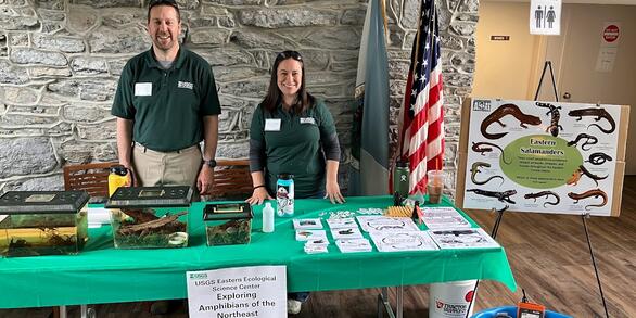
At the Eastern Ecological Science Center (EESC), we strive to provide world-class science to inform natural resource decisions that preserve and enhance our quality of life.
Connect with Us
Connect with Us
Find locations, staff profiles and contact information for our team.
EESC's Latest Findings
EESC's Latest Findings

Search for EESC publications by location, author, year or keyword.
Filter Total Items: 303
Spatial patterns of dewatering within watersheds of Shenandoah National Park, Virginia 2016 - 2021 (ver. 2.0, December 2021) Spatial patterns of dewatering within watersheds of Shenandoah National Park, Virginia 2016 - 2021 (ver. 2.0, December 2021)
These data describe longitudinal (upstream to downstream) patterns of dewatering during summer baseflow (July-September) conditions in nine watersheds in Shenandoah National park. In July-August of 2016 all nine watersheds (Jeremy's Run, Hazel River, Piney River, Hughes River, Staunton River, Whiteoak Canyon Run, Paine Run, Meadow Run, and Big Run) were evaluated for dewatering. In...
USGS Chesapeake Bay Study Locations Related to Theme 1 and Theme 2 Activities (ver. 3.0, October 2024) USGS Chesapeake Bay Study Locations Related to Theme 1 and Theme 2 Activities (ver. 3.0, October 2024)
This data includes point and polygon layers that are a compilation of study sites, watersheds, and areas of interest associated with the USGS Chesapeake Bay Theme 1 (factors affecting stream health, fish habitat, and aquatic conditions) and Theme 2 (coastal Habitats and Implications for Waterbirds) activities. Locations in this dataset were compiled from various USGS Chesapeake Bay...
Shoreline delineations for 21 Subestuaries in the Chesapeake Bay 2010-2014. Shoreline delineations for 21 Subestuaries in the Chesapeake Bay 2010-2014.
In many coastal regions throughout the world, there is increasing pressure to harden shorelines to protect human infrastructures against sea level rise, storm surge, and erosion. These data reflect the digitization of the shorelines of 21 sub-estuaries throughout the Chesapeake Bay (USA) as observed from 2010 through 2014. Shoreline segments are classified into one of seven shoreline...
Land Cover, Climate, and Geological conditions summarized within Maryland DNR Biological Stream Survery (MBSS) Catchments Land Cover, Climate, and Geological conditions summarized within Maryland DNR Biological Stream Survery (MBSS) Catchments
This dataset consists of several measures of landscape characteristics, each of which is summarized from raster data within spatial polygons. These spatial polygons represent the land area upstream of sampled stream reaches. These stream reaches were sampled by the Maryland Department of Natural Resources for the Maryland Biological Stream Survey program during survey rounds one, two...
Rusty Patched Bumble Bee Pollen Metagenome Rusty Patched Bumble Bee Pollen Metagenome
The rusty-patched bumble bee (Bombus affinis) is a listed species under the Endangered Species Act of the United States. While understood to be a highly generalist forager, little is known on the role that limited floral resources or shifting floral community composition could have played in B. affinis decline. Determining which floral species provide suitable B. affinis forage could...
Stream temperature and sculpin growth data collected from Catoctin Mountain Park in 2019 Stream temperature and sculpin growth data collected from Catoctin Mountain Park in 2019
This Data Release includes records of stream temperature during summer months of 2019 (10 sites) and records of Blue Ridge sculpin (Cottus caeruleomentum) weight for fish held in experimental enclosures for 45 days during the temperature sampling period (5 sites).
Multiscale resource selection by American Woodcock (Scolopax minor) during fall migration at Cape May, New Jersey Multiscale resource selection by American Woodcock (Scolopax minor) during fall migration at Cape May, New Jersey
This data set is measurements of the proportional area of 17 land-cover types at 5 different spatial scales in Cape May County, NJ at individual radio-tagged American woodcock (Scololpax minor) use locations and at random points across the county. The data set consists of a unique identifier, band number, year or season during which sampling was conducted, spatial coordinates (UTMs),
Topobathymetric elevation models of the upper Delaware River, USA - Version 1 - 10km tiles Topobathymetric elevation models of the upper Delaware River, USA - Version 1 - 10km tiles
This dataset includes topographic elevations (in meters) surrounding and bathymetric elevations within the upper Delaware River (USA). Bathymetric lidar data was acquired using the Experimental Advanced Airborne Research Lidar, version B. The EAARL-B is a successor instrument to the original EAARL bathymetric LiDAR sensor developed for mapping coral reef environments in clear water, but
2004-2010 Chesapeake Bay Smallmouth and Largemouth Bass Estrogenic Biomarker Data 2004-2010 Chesapeake Bay Smallmouth and Largemouth Bass Estrogenic Biomarker Data
The data was gathered to document the extent and severity of biomarkers of exposure to estrogenic chemicals in smallmouth and largemouth bass. Samples were collected from 2004 through 2010 at sites in five watersheds within the Chesapeake Bay watershed. A total of 281 largemouth bass were collected from the Potomac, Susquehanna, Patuxent and Rappahannock rivers and 1,384 smallmouth bass...
Physiological changes in response to salinity and cortisol treatment in Atlantic sturgeon Physiological changes in response to salinity and cortisol treatment in Atlantic sturgeon
The dataset are the results of studies examining the osmoregulatory physiology of Atlantic sturgeon (Acipenser oxyrinchus). Two experiments were conducted on physiological responses to salinity change, and another experiment on the effects of cortisol treatment on osmoregulation.
Abundance of 50 transcripts from microdissected liver samples of smallmouth bass Abundance of 50 transcripts from microdissected liver samples of smallmouth bass
There is an increasing emphasis on effects-based monitoring to document responses associated with exposure to complex mixtures of chemicals, climate change, pathogens, parasites and other environmental stressors in fish populations. For decades aquatic monitoring programs have included the collection of tissues preserved for microscopic pathology. Consequently, formalin-fixed, paraffin...
Assessing Nest Attentiveness of Common Terns (Sterna hirundo) via Video Cameras and Temperature Loggers Assessing Nest Attentiveness of Common Terns (Sterna hirundo) via Video Cameras and Temperature Loggers
While nest attentiveness plays a critical role in the reproductive success of avian species, little is known regarding the nest attentiveness patterns of many species during incubation. However, improvements in both video monitoring and temperature logging devices present an opportunity to improve our understanding of this aspect of avian behavior. To evaluate the ability of these...