
Data
At the Eastern Ecological Science Center (EESC), we strive to provide world-class science to inform natural resource decisions that preserve and enhance our quality of life.
Connect with Us
Connect with Us
Find locations, staff profiles and contact information for our team.
EESC's Latest Findings
EESC's Latest Findings
Search for EESC publications by location, author, year or keyword.
Filter Total Items: 304
Assessing Angler Honesty in Citizen Science, angler reported length data across North America from 2023-2025 Assessing Angler Honesty in Citizen Science, angler reported length data across North America from 2023-2025
This data release contains measurement‑accuracy information derived from angler‑reported fish lengths submitted through a smartphone mobile application. The dataset includes records from multiple fishing events across the United States and Canada in which participating anglers self‑reported total length (TL) for each catch. Lengths were subsequently reviewed and verified by app staff...
Model predictions of biological condition metrics for small streams in the Chesapeake Bay Watershed, USA from 1985 to 2023 Model predictions of biological condition metrics for small streams in the Chesapeake Bay Watershed, USA from 1985 to 2023
This data release contains predictions of stream biological condition as defined by the Chesapeake basin-wide index of biotic integrity for stream macroinvertebrates (Chessie BIBI) as well as prediction of the percentage of the benthic macroinvertebrate assemblage as 1) Ephemeroptera, Plecoptera, Trichoptera less Hydropsychidae, 2) Ephemeroptera, and 3) Clingers using Random Forest...
Northern mockingbird ileal virome variation in Texas (ver. 2.0, January 2026) Northern mockingbird ileal virome variation in Texas (ver. 2.0, January 2026)
A few studies have focused on avian gut virome variation in response to environmental stressors, but none have assessed virome in relation to chemically intensive crops, the production of which effects various aspects of avian health and fitness, and deleteriously alters available food resources. In this study we used shotgun metatranscriptomics (2 x 150bp; Illumina HiSeq 4000 with...
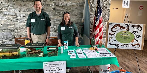
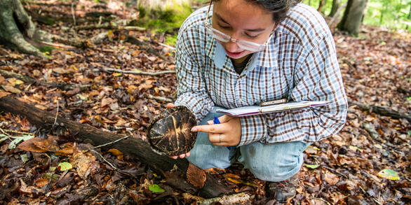
Salamander species in headwater streams on state and federal public lands in the eastern United States Salamander species in headwater streams on state and federal public lands in the eastern United States
This dataset includes stream and species data collected in headwater streams on public lands throughout the eastern United States. Data were collected to inform updated species range maps and provide data for large-scale modeling of species ranges using multiple data types. All salamander species encountered are included in the dataset.
Meadow vole data for fragmentation study Meadow vole data for fragmentation study
The dataset contains observational records of encounters of meadow voles (Microtus pennsylvanicus) trapped at Eastern Ecological Science Center (formerly Patuxent Wildlife Research Center) in Laurel, Maryland, USA. Animals were trapped using Sherman traps from 23 September 1991 to 24 August 1993. Data collected included id, date, age, sex, weight, location and reproductive status.
Wall diffuser velocity effects on American Shad (Alosa sapidissima) inside a fishway entrance channel Wall diffuser velocity effects on American Shad (Alosa sapidissima) inside a fishway entrance channel
In this dataset, there are six csv files that provide the raw fish behavior telemetry data and a single csv file that provides the processed velocity data.
The North American Breeding Bird Survey, Analysis Results 1966 - 2024 The North American Breeding Bird Survey, Analysis Results 1966 - 2024
This data product consists of a database of population change and abundance estimates for North American birds, estimated from North American Breeding Bird Survey (BBS) data. Data are presented for 544 species of birds in five spreadsheets containing trend estimates for three time periods and annual indices for two time periods. Estimates are derived for each species using the 1 of 4...
2025 Release - North American Breeding Bird Survey Dataset (1966 - 2024) 2025 Release - North American Breeding Bird Survey Dataset (1966 - 2024)
The 1966-2024 North American Breeding Bird Survey (BBS) dataset contains avian point count data for more than 700 North American bird taxa (species, races, and unidentified species groupings). These data are collected annually during the breeding season, primarily in June, along thousands of randomly established roadside survey routes in the United States and Canada. Routes are roughly...
PFAS in largemouth bass (Micropterus nigricans) and banded killifish (Fundulus diaphanus) from Select Waterbodies in Massachusetts PFAS in largemouth bass (Micropterus nigricans) and banded killifish (Fundulus diaphanus) from Select Waterbodies in Massachusetts
This study assessed site-specific differences in PFAS in fish from Ashumet Pond (2020 & 2022), Sudbury River (2023), and Great Herring Pond (reference site; 2022) in Massachusetts. Largemouth bass were collected from all sites and banded killifish were collected from Ashumet Pond only. Health assessments were performed and included histology of the liver, spleen, kidneys, gonad, and any
Effect of PFAS Exposure on American Kestrels, Eastern Ecological Science Center, 2024 Effect of PFAS Exposure on American Kestrels, Eastern Ecological Science Center, 2024
Serum samples were collected from an American Kestrel colony at the U.S. Geological Survey (USGS) Eastern Ecological Science Center and analyzed for per- and polyfluoroalkyl substances (PFAS). The sampling effort was undertaken as part of a Strategic Environmental Research and Development Program (SERDP) funded project (ER22-3388) to study the exposure effect of PFAS on immunomodulation...
Feeding and Trophic Ecology of Invasive Blue Catfish Ictalurus furcatus in an Eastern shore tributary of the Chesapeake Bay Feeding and Trophic Ecology of Invasive Blue Catfish Ictalurus furcatus in an Eastern shore tributary of the Chesapeake Bay
This study investigates the feeding and trophic ecology of invasive Blue Catfish (Ictalurus furcatus) in the Nanticoke River watershed on the Chesapeake Bay’s Eastern Shore (Maryland, U.S.A). From a total of 1,032 stomach samples collected, a subset of 88 was analyzed using 18S and COI metabarcoding primers to enhance taxonomic resolution of prey items. USGS-generated genetic reference...
Data describing IAV infection and seroprevalence in Lesser and Greater Scaup Data describing IAV infection and seroprevalence in Lesser and Greater Scaup
Clade 2.3.4.4b Eurasian-origin H5N1 entered North America in late 2021 and spread across the continent. While studies have characterized the antibody response mounted by dabbling ducks following exposure, little data is available for diving ducks. This study sought to identify influenza A virus (IAV) infection and antibodies in Lesser and Greater Scaup captured in Maryland, Illinois, and...