
Deriving Spatial and Temporal Waterfowl Inputs for Disease Risk Modeling
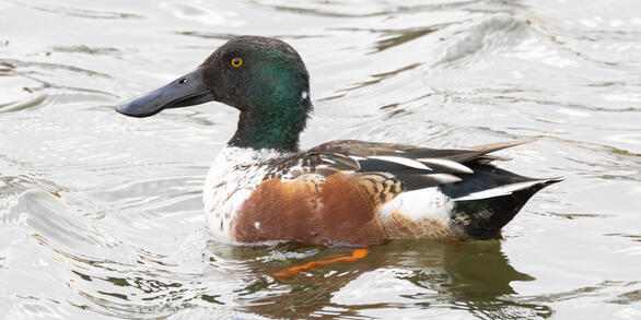
USGS is creating spatially and temporally explicit inputs to improve avian influenza transmission risk modeling. This project places special emphasis on wild bird distribution and abundance models as well as avian influenza prevalence models.

What is the issue?
Disease risk modeling can be an important tool for identifying areas of high transmission risk within and between animal populations, allowing for strategic allocation of limited resources for disease surveillance and prevention. However, such models rely upon advanced inputs reflecting all relevant components of the disease system.
What is at stake?
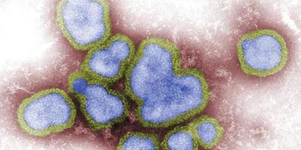
Emergence of avian influenza viruses with the potential to be highly pathogenic to poultry, wild birds, and humans are a serious concern for the global economic and public health sectors. Disease risk models can improve understanding of how the spread of avian influenza virus is influenced by environmental and human factors.
What is our approach?
USGS researchers have developed transmission risk models for avian influenza to better understand the spread of this disease. Ongoing research aims to continuously improve these models by better representing wild bird distributions and abundances, the spatial and temporal patterns of avian influenza within wild bird hosts, and spatial patterns in poultry production. Such inputs did not exist at suitable extents and resolution for the United States prior to their development by the USGS and collaborators.
What are the benefits?
Refining transmission risk model inputs and reducing uncertainty in any of these inputs will improve model performance and subsequent ability to use these models as tools to help protect against the spread of avian influenza virus.
<< Back to Avian Influenza Research at EESC
Identifying Spatial and Temporal Trends in Avian Influenza Prevalence in Wild Waterfowl Across the United States
USGS is creating spatially and temporally explicit inputs to improve avian influenza transmission risk modeling. This project places special emphasis on wild bird distribution and abundance models as well as avian influenza prevalence models.
What is the issue?
Disease risk modeling can be an important tool for identifying areas of high transmission risk within and between animal populations, allowing for strategic allocation of limited resources for disease surveillance and prevention. However, such models rely upon advanced inputs reflecting all relevant components of the disease system.
What is at stake?
Emergence of avian influenza viruses with the potential to be highly pathogenic to poultry, wild birds, and humans are a serious concern for the global economic and public health sectors. Disease risk models can improve understanding of how the spread of avian influenza virus is influenced by environmental and human factors.
What is our approach?
USGS researchers have developed transmission risk models for avian influenza to better understand the spread of this disease. Ongoing research aims to continuously improve these models by better representing wild bird distributions and abundances, the spatial and temporal patterns of avian influenza within wild bird hosts, and spatial patterns in poultry production. Such inputs did not exist at suitable extents and resolution for the United States prior to their development by the USGS and collaborators.
What are the benefits?
Refining transmission risk model inputs and reducing uncertainty in any of these inputs will improve model performance and subsequent ability to use these models as tools to help protect against the spread of avian influenza virus.
<< Back to Avian Influenza Research at EESC