
INHABIT: A web tool for invasive plant management across the contiguous United States
INHABIT is a desktop-optimized web application and decision support tool with mapped and tabular summaries of habitat suitability models for over two hundred fifty terrestrial invasive plant species of management concern across the contiguous United States. It is the product of a scientist-practitioner partnership and is designed to facilitate enhanced invasive species management actions, including species watch lists and targeted searches.
About
Once introduced, invasive species can be difficult to control or eradicate, and it is often difficult to determine where these species will invade next. Land managers need tools that can help them predict the potential spread of invasive species. INHABIT is one component of the National Early Detection and Rapid Response (EDRR) Framework, which is composed of several different projects, including the information hub Siren, that together provide tools to plan, detect, report, and respond to invasive species.
Highlights
- Includes 259 terrestrial invasive plant species
- Covers over 10,000 management areas
- Downloadable maps and summaries
Explore more features and uses of INHABIT on this page and receive updates by subscribing to the newsletter below.
The Web Application
Map invasive species habitat suitability for occurrence, abundance, and high abundance on one platform.
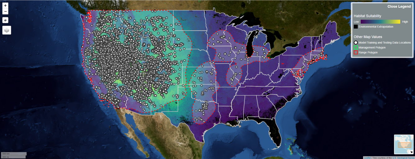
View both continuous and categorical maps of habitat suitability for over 250 terrestrial, invasive plant species of management importance. Continuous maps are for occurrence, abundance, or high abundance while categorical maps integrate the three continuous maps.


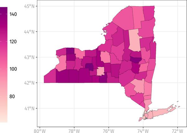
Summarize ranked risk across management areas

How to use INHABIT data
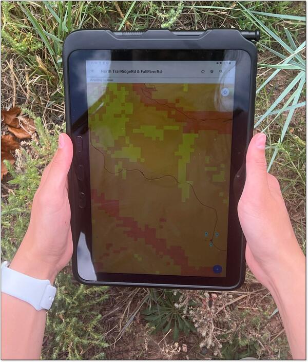
Integrate data with ArcGIS Field Maps.
Create watchlists.
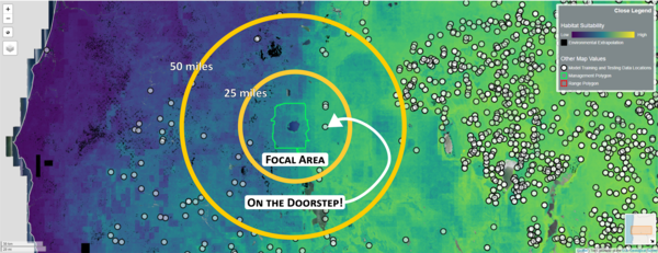
Identify doorstep species.
INHABIT is a desktop-optimized web application and decision support tool with mapped and tabular summaries of habitat suitability models for over two hundred fifty terrestrial invasive plant species of management concern across the contiguous United States. It is the product of a scientist-practitioner partnership and is designed to facilitate enhanced invasive species management actions, including species watch lists and targeted searches.
About
Once introduced, invasive species can be difficult to control or eradicate, and it is often difficult to determine where these species will invade next. Land managers need tools that can help them predict the potential spread of invasive species. INHABIT is one component of the National Early Detection and Rapid Response (EDRR) Framework, which is composed of several different projects, including the information hub Siren, that together provide tools to plan, detect, report, and respond to invasive species.
Highlights
- Includes 259 terrestrial invasive plant species
- Covers over 10,000 management areas
- Downloadable maps and summaries
Explore more features and uses of INHABIT on this page and receive updates by subscribing to the newsletter below.
The Web Application
Map invasive species habitat suitability for occurrence, abundance, and high abundance on one platform.
View both continuous and categorical maps of habitat suitability for over 250 terrestrial, invasive plant species of management importance. Continuous maps are for occurrence, abundance, or high abundance while categorical maps integrate the three continuous maps.
Summarize ranked risk across management areas
How to use INHABIT data
Integrate data with ArcGIS Field Maps.
Create watchlists.
Identify doorstep species.