



NUSO 2025 Research Missions
2025's missions showcased UAS as a versatile bridge between ground and satellite observations, using drone-based imaging to document historic ruins, calibrate and validate remote sensing data relative to satellite overpasses, and map minerals and biocrusts across arid dryland landscapes.
Research Missions for other years are listed under the Science tab.
* Any use of trade, firm, or product names is for descriptive purposes only and does not imply endorsement by the U.S. Government.
Mapping historic ruins with drone-based imagery and lidar at Salinas Pueblo Missions National Monument in New Mexico
In May 2025, the U.S. Geological Survey (USGS) National Uncrewed Systems Office collected uncrewed aircraft system (UAS, also known as drone) remote sensing data at the Salinas Pueblo Missions National Monument (SAPU) in central New Mexico to use for structural assessments and the development of a historic structure report by the National Park Service (NPS).
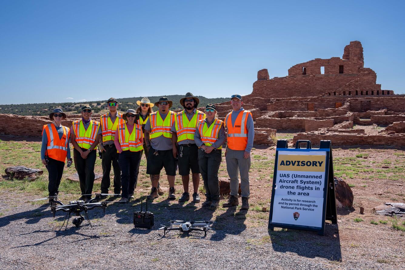
The SAPU’s Abó Unit is a unique site with rich history, featuring the weathered remnants of the 17th century Mission of San Gregorio de Abó and surrounding Pueblo mounds. The NPS Southern Arizona Office (SOAR) planned to collect terrestrial laser scans to non-invasively capture a detailed three-dimensional model of the historic church and convento ruins, but this ground-based tool cannot capture the tops of the tall walls.
USGS remote pilots provided technical support to the NPS by safely and efficiently collecting drone-based lidar and imagery, capturing essential data at the top of structure walls to combine with ground-based laser scans. These high-resolution, comprehensive data sets will support development of NPS management strategies and stabilization monitoring protocols to prevent degradation and improve the resiliency of the historic structures. This interagency project also provided an opportunity for USGS to compare cutting-edge UAS lidar and photogrammetry technologies and explore the integration of aerial and terrestrial lidar data for infrastructure mapping applications.
Spectral remote sensing radiometric calibration and validation research in Golden, Colorado
From drones to satellites, remote sensing systems can capture beautiful images of our world. Calibration and validation (cal/val) are essential steps to ensure that these images are also reliable for scientific use. Radiometric cal/val involves converting digital imagery data values to meaningful units and assessing their accuracy.
The U.S. Geological Survey (USGS) Earth Resources Observation and Science (EROS) CalVal Center of Excellence (ECCOE) excels in improving the quality of remote sensing data. Their standard radiometric data validation protocol requires a handheld spectrometer operator to walk back and forth across the area while collecting measurements. This procedure yields high-confidence measurements but is time- and labor-intensive.
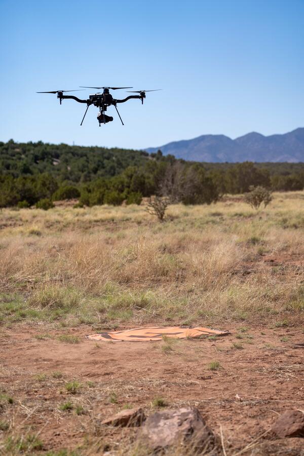
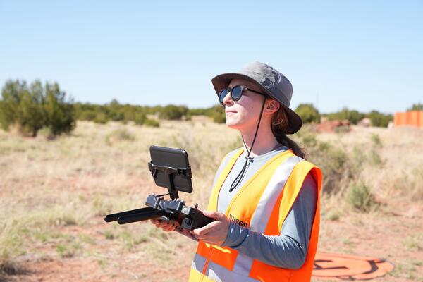
In collaboration with the USGS National Uncrewed Systems Office (NUSO), ECCOE researchers are exploring uncrewed aircraft system (UAS, also known as drones) remote sensing capabilities and procedures related to the selection of calibration reference materials, quantifying the radiometric accuracy of UAS-based spectral sensors, and potentially utilizing drones to aid in the validation of Earth-observing satellite data.
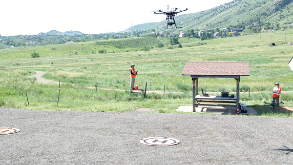
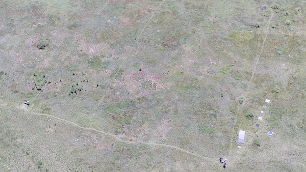
In June 2025, NUSO collected UAS hyperspectral and multispectral data coordinated with ECCOE field measurements at a large, flat, vegetated field in Golden, CO. This field work was timed to coincide with overpasses by Landsat, Sentinel, and EnMAP satellites, enabling radiometric cal/val comparisons and ultimately advancements in remote sensing data quality research.
From Drones to Space: Mapping Biocrusts and Mineral Resources in Moab, Utah
Airborne and satellite hyperspectral sensors are key to locating and mapping critical mineral resources in arid regions of the Western United States. Two recent missions aimed at mapping mineral and biological resources include the U.S. Geological Survey (USGS) and National Aeronautics and Space Administration (NASA)’s Geological Earth Mapping Experiment (GEMx) and NASA’s Earth Surface Mineral Dust Source Investigation (EMIT). While lab-based spectroscopy can identify pure spectral signatures of different minerals, field campaigns are needed to quantify the contribution of non-mineral spectra to the signals observed by GEMx and EMIT, helping to calibrate sensor data and improve algorithms to accurately map both biotic and mineral surface properties.
Within a single pixel of imagery captured by GEMx and EMIT, multiple soils, mineral types, and other materials of interest can be present. Biological soil crusts (biocrusts - communities of cyanobacteria, algae, lichens, mosses, fungi, and other microbes) are ubiquitous across dryland ecosystems, and biocrust community composition and cover are shown to differ across soil mineralogy and texture. Despite the important impact of biocrusts on soil stability, dust emissions, and soil resource availability, determining their spatial distribution, composition, and condition on a broad scale remains a challenge. Incorporating field observations and centimeter-level drone data will help USGS researchers develop data processing techniques to better discern mixed materials present within crewed airplane- and satellite-based spectral remote sensing imagery.
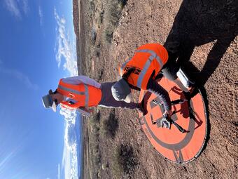
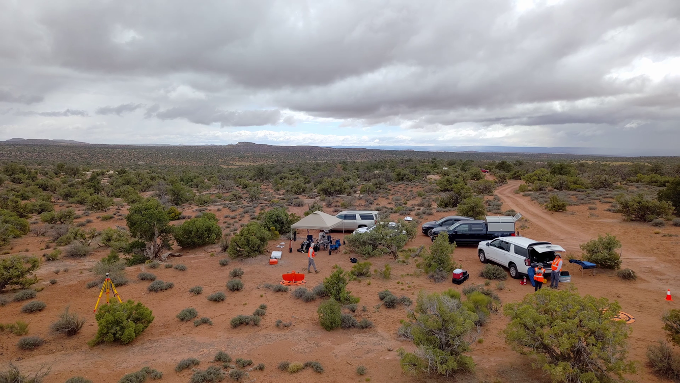
In May 2025, USGS Southwest Biological Science Center and Western Geographic Science Center researchers led a collaborative field campaign near Moab, Utah. The USGS National Uncrewed Systems Office (NUSO) collected hyperspectral and thermal drone imagery over dryland sites with different vegetation and soils to relate with field- and space-based observations. These efforts aim to improve hyperspectral remote sensing mapping capabilities in dryland environments, ultimately leading to more accurate maps of terrestrial natural resources including critical minerals, vegetation, soils, and biocrusts.
Learn more:
- Geological Earth Mapping Experiment (GEMx): https://science.nasa.gov/mission/gemx/
- Earth Surface Mineral Dust Source Investigation (EMIT): https://earth.jpl.nasa.gov/emit/
- Biological Soil Crust ("Biocrust") Science by Southwest Biological Science Center: https://www.usgs.gov/centers/southwest-biological-science-center/science/biological-soil-crust-biocrust-science

National Uncrewed Systems Office

NUSO Research Missions

NUSO 2024 Research Missions

NUSO 2023 Research Missions

NUSO 2022 Research Missions

NUSO 2021 Research Missions
NUSO 2019 Research Missions

NUSO 2018 Research Missions

NUSO 2017 Research Missions

NUSO 2016 Research Missions

NUSO 2015 Research Missions

NUSO 2014 Research Missions

NUSO 2013 Research Missions
2025's missions showcased UAS as a versatile bridge between ground and satellite observations, using drone-based imaging to document historic ruins, calibrate and validate remote sensing data relative to satellite overpasses, and map minerals and biocrusts across arid dryland landscapes.
Research Missions for other years are listed under the Science tab.
* Any use of trade, firm, or product names is for descriptive purposes only and does not imply endorsement by the U.S. Government.
Mapping historic ruins with drone-based imagery and lidar at Salinas Pueblo Missions National Monument in New Mexico
In May 2025, the U.S. Geological Survey (USGS) National Uncrewed Systems Office collected uncrewed aircraft system (UAS, also known as drone) remote sensing data at the Salinas Pueblo Missions National Monument (SAPU) in central New Mexico to use for structural assessments and the development of a historic structure report by the National Park Service (NPS).
The SAPU’s Abó Unit is a unique site with rich history, featuring the weathered remnants of the 17th century Mission of San Gregorio de Abó and surrounding Pueblo mounds. The NPS Southern Arizona Office (SOAR) planned to collect terrestrial laser scans to non-invasively capture a detailed three-dimensional model of the historic church and convento ruins, but this ground-based tool cannot capture the tops of the tall walls.
USGS remote pilots provided technical support to the NPS by safely and efficiently collecting drone-based lidar and imagery, capturing essential data at the top of structure walls to combine with ground-based laser scans. These high-resolution, comprehensive data sets will support development of NPS management strategies and stabilization monitoring protocols to prevent degradation and improve the resiliency of the historic structures. This interagency project also provided an opportunity for USGS to compare cutting-edge UAS lidar and photogrammetry technologies and explore the integration of aerial and terrestrial lidar data for infrastructure mapping applications.
Spectral remote sensing radiometric calibration and validation research in Golden, Colorado
From drones to satellites, remote sensing systems can capture beautiful images of our world. Calibration and validation (cal/val) are essential steps to ensure that these images are also reliable for scientific use. Radiometric cal/val involves converting digital imagery data values to meaningful units and assessing their accuracy.
The U.S. Geological Survey (USGS) Earth Resources Observation and Science (EROS) CalVal Center of Excellence (ECCOE) excels in improving the quality of remote sensing data. Their standard radiometric data validation protocol requires a handheld spectrometer operator to walk back and forth across the area while collecting measurements. This procedure yields high-confidence measurements but is time- and labor-intensive.
In collaboration with the USGS National Uncrewed Systems Office (NUSO), ECCOE researchers are exploring uncrewed aircraft system (UAS, also known as drones) remote sensing capabilities and procedures related to the selection of calibration reference materials, quantifying the radiometric accuracy of UAS-based spectral sensors, and potentially utilizing drones to aid in the validation of Earth-observing satellite data.
In June 2025, NUSO collected UAS hyperspectral and multispectral data coordinated with ECCOE field measurements at a large, flat, vegetated field in Golden, CO. This field work was timed to coincide with overpasses by Landsat, Sentinel, and EnMAP satellites, enabling radiometric cal/val comparisons and ultimately advancements in remote sensing data quality research.
From Drones to Space: Mapping Biocrusts and Mineral Resources in Moab, Utah
Airborne and satellite hyperspectral sensors are key to locating and mapping critical mineral resources in arid regions of the Western United States. Two recent missions aimed at mapping mineral and biological resources include the U.S. Geological Survey (USGS) and National Aeronautics and Space Administration (NASA)’s Geological Earth Mapping Experiment (GEMx) and NASA’s Earth Surface Mineral Dust Source Investigation (EMIT). While lab-based spectroscopy can identify pure spectral signatures of different minerals, field campaigns are needed to quantify the contribution of non-mineral spectra to the signals observed by GEMx and EMIT, helping to calibrate sensor data and improve algorithms to accurately map both biotic and mineral surface properties.
Within a single pixel of imagery captured by GEMx and EMIT, multiple soils, mineral types, and other materials of interest can be present. Biological soil crusts (biocrusts - communities of cyanobacteria, algae, lichens, mosses, fungi, and other microbes) are ubiquitous across dryland ecosystems, and biocrust community composition and cover are shown to differ across soil mineralogy and texture. Despite the important impact of biocrusts on soil stability, dust emissions, and soil resource availability, determining their spatial distribution, composition, and condition on a broad scale remains a challenge. Incorporating field observations and centimeter-level drone data will help USGS researchers develop data processing techniques to better discern mixed materials present within crewed airplane- and satellite-based spectral remote sensing imagery.
In May 2025, USGS Southwest Biological Science Center and Western Geographic Science Center researchers led a collaborative field campaign near Moab, Utah. The USGS National Uncrewed Systems Office (NUSO) collected hyperspectral and thermal drone imagery over dryland sites with different vegetation and soils to relate with field- and space-based observations. These efforts aim to improve hyperspectral remote sensing mapping capabilities in dryland environments, ultimately leading to more accurate maps of terrestrial natural resources including critical minerals, vegetation, soils, and biocrusts.
Learn more:
- Geological Earth Mapping Experiment (GEMx): https://science.nasa.gov/mission/gemx/
- Earth Surface Mineral Dust Source Investigation (EMIT): https://earth.jpl.nasa.gov/emit/
- Biological Soil Crust ("Biocrust") Science by Southwest Biological Science Center: https://www.usgs.gov/centers/southwest-biological-science-center/science/biological-soil-crust-biocrust-science
National Uncrewed Systems Office
NUSO Research Missions
NUSO 2024 Research Missions
NUSO 2023 Research Missions
NUSO 2022 Research Missions
NUSO 2021 Research Missions
NUSO 2019 Research Missions
NUSO 2018 Research Missions
NUSO 2017 Research Missions
NUSO 2016 Research Missions
NUSO 2015 Research Missions
NUSO 2014 Research Missions