Industrial activities have contaminated fractured rock aquifers
Industrial activities have contaminated fractured rock aquifersphoto of pond.

Official websites use .gov
A .gov website belongs to an official government organization in the United States.
Secure .gov websites use HTTPS
A lock () or https:// means you’ve safely connected to the .gov website. Share sensitive information only on official, secure websites.

photo of pond.

Delaware River on the upstream side of the bridge at Washington Crossing, 2 hours 45 minutes before cresting at the Delaware River at Trenton gage.
Delaware River on the upstream side of the bridge at Washington Crossing, 2 hours 45 minutes before cresting at the Delaware River at Trenton gage.

USGS Field Technician wading down river toward an arched stone bridge.
USGS Field Technician wading down river toward an arched stone bridge.

Two New Jersey Technicians gathering water quality samles with a bridgecrane for a public demo for the National Water Monitoring Day 2002 event in the Delaware and Raritan Canal State Park.
Two New Jersey Technicians gathering water quality samles with a bridgecrane for a public demo for the National Water Monitoring Day 2002 event in the Delaware and Raritan Canal State Park.

USGS Hydrologist Heidi Hoppe Preserving a water sample at Great Egg Harbor River at Weymouth, New Jersey
USGS Hydrologist Heidi Hoppe Preserving a water sample at Great Egg Harbor River at Weymouth, New Jersey

Split brick and wood stilling well gage house on the bank of the South Branch Raritan River near High Bridge, New Jersey
Split brick and wood stilling well gage house on the bank of the South Branch Raritan River near High Bridge, New Jersey
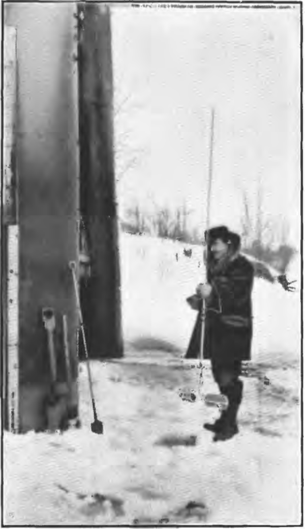
Winter Ice Measurement on the Rum River near Cambridge, MN, made by a USGS field person preparing to document ice effected streamflow. Found in the 1913 USGS Water Science Paper 337.
Winter Ice Measurement on the Rum River near Cambridge, MN, made by a USGS field person preparing to document ice effected streamflow. Found in the 1913 USGS Water Science Paper 337.