
Transboundary Aquifer Assessment Program (TAAP)
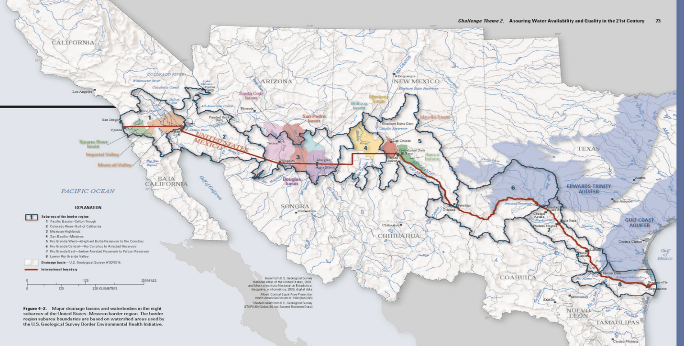
Transboundary aquifers are an essential source of water for United States – Mexico border communities. Declining water levels, deteriorating water quality, and increasing use of groundwater resources on both sides of the border raise concerns about the long-term availability of this supply.
The U.S. – Mexico Transboundary Aquifer Assessment Act (Public Law 109-448) of 2006 was enacted to conduct binational scientific research to systematically assess priority transboundary aquifers and to address water information needs of border communities. Collaborators include the USGS Water Science Centers and Water Resources Research Institutes of Arizona, New Mexico, and Texas, IBWC, stakeholders, and Mexican counterparts.
TAAP External Website - https://webapps.usgs.gov/taap/index.html
Approach:
- Sample groundwater from wells in the Mesilla Basin of various depths and spatiotemporal recharge conditions
- Use geochemical and isotopic composition of samples to characterize possible groundwater end-members and calculate volumes of mixing at various locations in the system
- Use geothermal techniques to explore temperature as an additional tracer of groundwater flowpaths.
Objectives:
In New Mexico,
- Characterize the deep groundwater system in the Mesilla Basin
- Determine the contribution of deep groundwater to flow and salinity in the shallow groundwater and surface-water systems.