



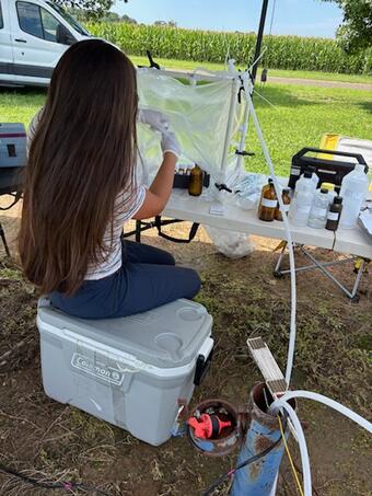
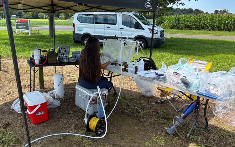
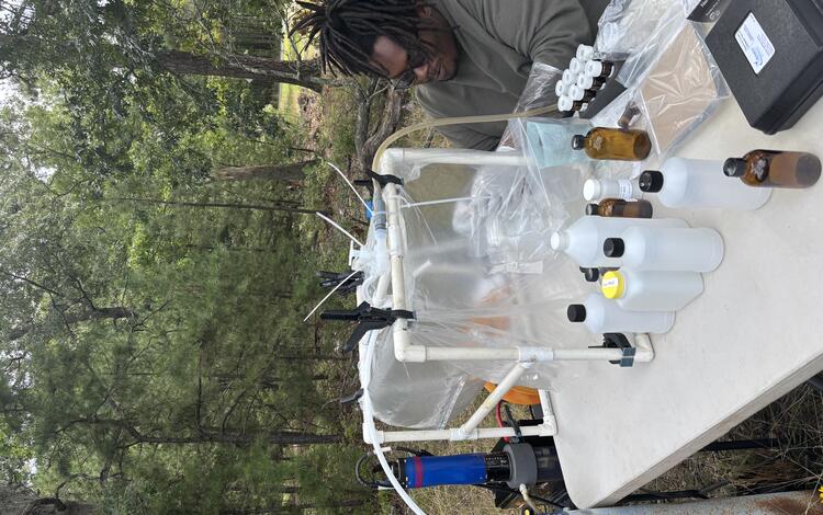
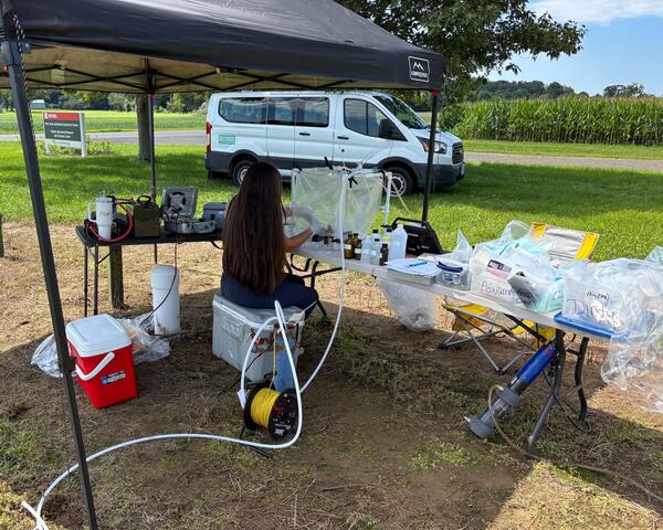
USGS Scientist Kate Bowen working in a "Clean-Hands" environment to collect and store ambient groundwater-quality samples for storage and transport to the lab. Samples are obtained inside a sealed chamber to prevent atmospheric contamination.
New Jersey Ambient Groundwater-Quality Monitoring Network
Active
By New Jersey Water Science Center
February 21, 2022
The USGS, in cooperation with the New Jersey Department of Environmental Protection, New Jersey Geological and Water Survey, operates the Ambient Groundwater-Quality Monitoring Network (AGWQMN), which is designed to characterize the status of unconfined groundwater quality as a function of land use. Shallow groundwater is typically the first part of the groundwater system to be affected by human activities at the land surface, making its quality an important indicator of environmental impact. Additionally, this shallow groundwater plays a critical role in recharging deeper aquifers used for potable supply and sustaining base flow to streams and wetlands, therefore understanding water-quality conditions is essential for safeguarding both drinking-water resources and local ecosystems.
Water Data for the Nation
Water Data for the Nation

All data are publicly available at the USGS Water Data for the Nation
New Jersey Long-Term Networks
New Jersey Long-Term Networks
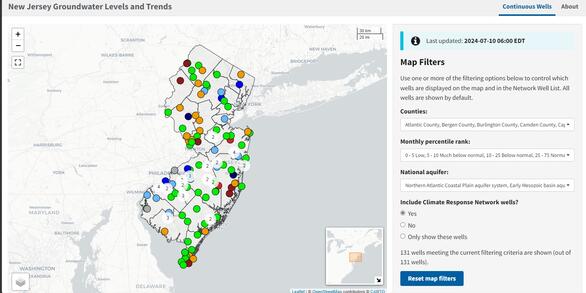
The accurate, long-term monitoring networks of New Jersey Water Science Center provide valuable data in real-time and historical perspective.
Media
Sources/Usage: Public Domain. View Media Details
The AGWQMN is a long-term monitoring network with goals to assess the status of groundwater quality by examining the concentrations of various constituents that can be used as environmental indicators, assess water-quality trends by examining data collected on a 3-year cycle, determine the effects of land use on shallow groundwater quality, identify threats from nonpoint sources of contamination, and identify emerging or new environmental issues of concern to the public.
The network consists of 150 shallow wells distributed among 3 land-use types throughout the State of New Jersey. Sixty wells are in agricultural areas, 60 are in urban/suburban areas, and 30 are in undeveloped areas. Beginning in Water Year 1999 wells across the state were sampled on a rotating cycle to represent different geographic and land-use areas. Over time the network has evolved and changed to its current structure. Each year 50 wells are sampled from across the State. Sites rotate on a 3-year cycle ensuring that all 150 wells are sampled every 3 years. The sites are geographically dispersed so emerging trends can be identified quickly.
CONSTITUENTS MEASURED
Water- quality samples from the wells are analyzed for field parameters, major ions, nutrients, organic carbon, trace elements, volatile organic compounds, pesticides, gross alpha and gross beta radioactivity, pre- and polyfluoroalkyl substances (PFAS), perchlorate, hexavalent chromium, and pharmaceuticals.
TECHNIQUES AND METHODS
All samples are collected using standard, documented USGS sampling techniques to ensure that USGS quality-assurance guidelines are met. All data are analyzed, reviewed, and verified, before publication.
Groundwater sample collection and preparation
USGS Scientist Kate Bowen working in a "Clean-Hands" environment to collect and store ambient groundwater-quality samples for storage and transport to the lab. Samples are obtained inside a sealed chamber to prevent atmospheric contamination.
Groundwater Clean-Hands Collection
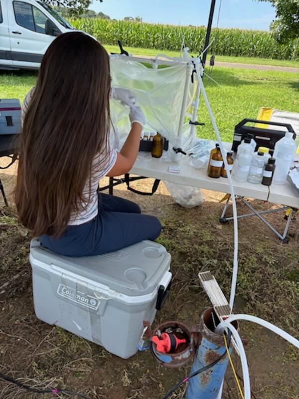
USGS Scientist Kate Bowen preforming "clean-hands" ambient groundwater-quality sample collection inside a sealed chamber to prevent atmospheric contamination.
USGS Scientist Kate Bowen preforming "clean-hands" ambient groundwater-quality sample collection inside a sealed chamber to prevent atmospheric contamination.
Groundwater Sample Collection
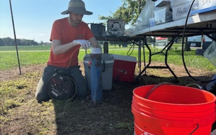
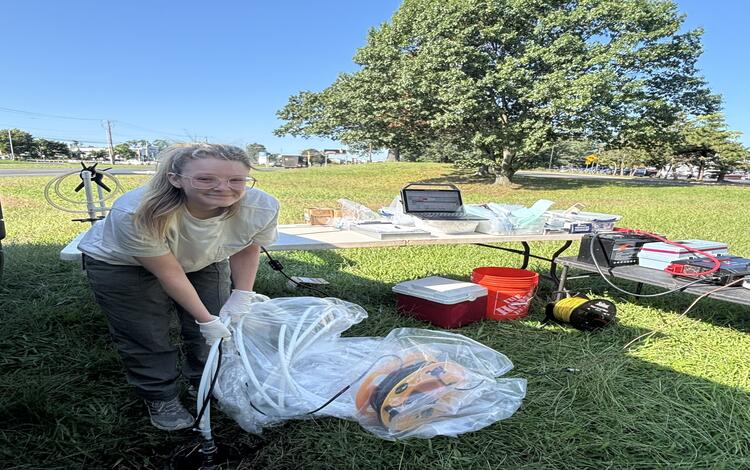
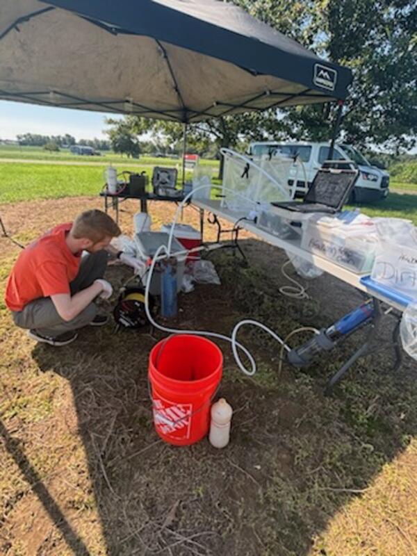
USGS Scientist Liam Kenefic checking the Groundwater-level after lowering the sampling pump into the 393104075122201 MW36 Observation well. This reading helps determine that the pump is in the appropriate placement once pumping begins to help ensure the sonde is collecting field parameters have reached stability to determine that sampling can occur.
USGS Scientist Liam Kenefic checking the Groundwater-level after lowering the sampling pump into the 393104075122201 MW36 Observation well. This reading helps determine that the pump is in the appropriate placement once pumping begins to help ensure the sonde is collecting field parameters have reached stability to determine that sampling can occur.
Groundwater Level Sampling
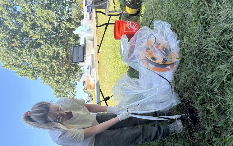
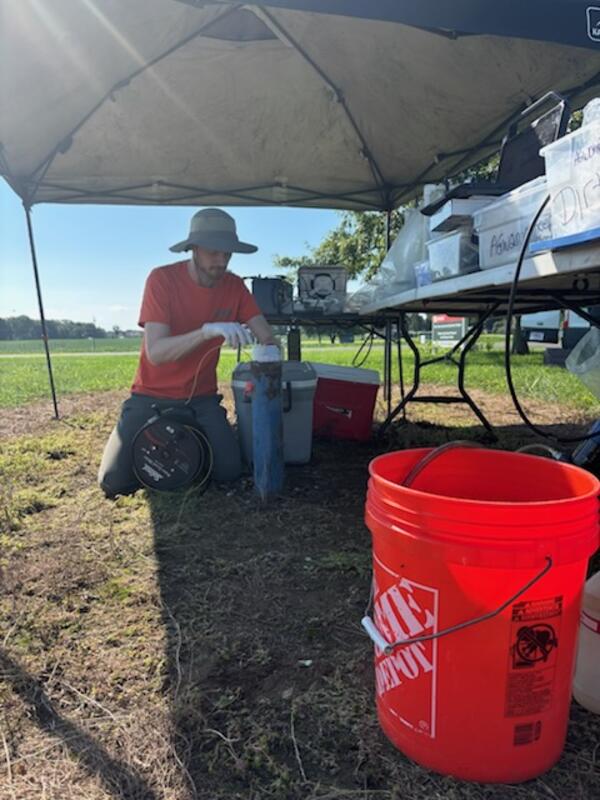
USGS Scientist Liam Kenefic lowering a calibrated electric tape into the 393104075122201 MW36 Observation well to collect groundwater‑level measurements to verify that the well remains inactive and that current water levels align with historic trends.
USGS Scientist Liam Kenefic lowering a calibrated electric tape into the 393104075122201 MW36 Observation well to collect groundwater‑level measurements to verify that the well remains inactive and that current water levels align with historic trends.
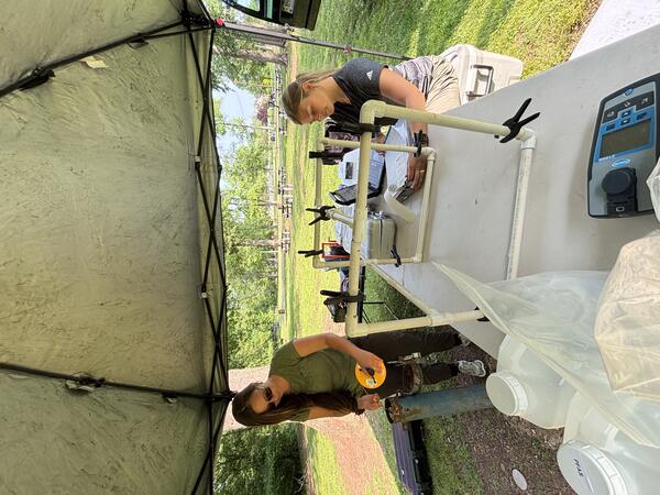
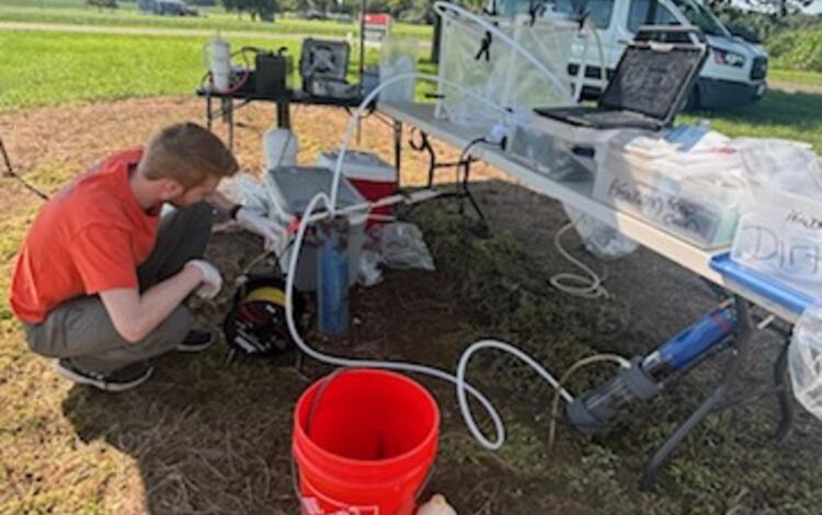
Groundwater sampling tent
USGS Scientists Kate Bowen and Nicole White extract water samples from groundwater well 403300074202901 MW134A Edison Twp and prepare them for transport to the National Laboratory for examination.
USGS Scientists Kate Bowen and Nicole White extract water samples from groundwater well 403300074202901 MW134A Edison Twp and prepare them for transport to the National Laboratory for examination.
The USGS, in cooperation with the New Jersey Department of Environmental Protection, New Jersey Geological and Water Survey, operates the Ambient Groundwater-Quality Monitoring Network (AGWQMN), which is designed to characterize the status of unconfined groundwater quality as a function of land use. Shallow groundwater is typically the first part of the groundwater system to be affected by human activities at the land surface, making its quality an important indicator of environmental impact. Additionally, this shallow groundwater plays a critical role in recharging deeper aquifers used for potable supply and sustaining base flow to streams and wetlands, therefore understanding water-quality conditions is essential for safeguarding both drinking-water resources and local ecosystems.
Water Data for the Nation
Water Data for the Nation
All data are publicly available at the USGS Water Data for the Nation
New Jersey Long-Term Networks
New Jersey Long-Term Networks
The accurate, long-term monitoring networks of New Jersey Water Science Center provide valuable data in real-time and historical perspective.
Media
Sources/Usage: Public Domain. View Media Details
The AGWQMN is a long-term monitoring network with goals to assess the status of groundwater quality by examining the concentrations of various constituents that can be used as environmental indicators, assess water-quality trends by examining data collected on a 3-year cycle, determine the effects of land use on shallow groundwater quality, identify threats from nonpoint sources of contamination, and identify emerging or new environmental issues of concern to the public.
The network consists of 150 shallow wells distributed among 3 land-use types throughout the State of New Jersey. Sixty wells are in agricultural areas, 60 are in urban/suburban areas, and 30 are in undeveloped areas. Beginning in Water Year 1999 wells across the state were sampled on a rotating cycle to represent different geographic and land-use areas. Over time the network has evolved and changed to its current structure. Each year 50 wells are sampled from across the State. Sites rotate on a 3-year cycle ensuring that all 150 wells are sampled every 3 years. The sites are geographically dispersed so emerging trends can be identified quickly.
CONSTITUENTS MEASURED
Water- quality samples from the wells are analyzed for field parameters, major ions, nutrients, organic carbon, trace elements, volatile organic compounds, pesticides, gross alpha and gross beta radioactivity, pre- and polyfluoroalkyl substances (PFAS), perchlorate, hexavalent chromium, and pharmaceuticals.
TECHNIQUES AND METHODS
All samples are collected using standard, documented USGS sampling techniques to ensure that USGS quality-assurance guidelines are met. All data are analyzed, reviewed, and verified, before publication.
Groundwater sample collection and preparation
USGS Scientist Kate Bowen working in a "Clean-Hands" environment to collect and store ambient groundwater-quality samples for storage and transport to the lab. Samples are obtained inside a sealed chamber to prevent atmospheric contamination.
USGS Scientist Kate Bowen working in a "Clean-Hands" environment to collect and store ambient groundwater-quality samples for storage and transport to the lab. Samples are obtained inside a sealed chamber to prevent atmospheric contamination.
Groundwater Clean-Hands Collection
USGS Scientist Kate Bowen preforming "clean-hands" ambient groundwater-quality sample collection inside a sealed chamber to prevent atmospheric contamination.
USGS Scientist Kate Bowen preforming "clean-hands" ambient groundwater-quality sample collection inside a sealed chamber to prevent atmospheric contamination.
Groundwater Sample Collection
USGS Scientist Liam Kenefic checking the Groundwater-level after lowering the sampling pump into the 393104075122201 MW36 Observation well. This reading helps determine that the pump is in the appropriate placement once pumping begins to help ensure the sonde is collecting field parameters have reached stability to determine that sampling can occur.
USGS Scientist Liam Kenefic checking the Groundwater-level after lowering the sampling pump into the 393104075122201 MW36 Observation well. This reading helps determine that the pump is in the appropriate placement once pumping begins to help ensure the sonde is collecting field parameters have reached stability to determine that sampling can occur.
Groundwater Level Sampling
USGS Scientist Liam Kenefic lowering a calibrated electric tape into the 393104075122201 MW36 Observation well to collect groundwater‑level measurements to verify that the well remains inactive and that current water levels align with historic trends.
USGS Scientist Liam Kenefic lowering a calibrated electric tape into the 393104075122201 MW36 Observation well to collect groundwater‑level measurements to verify that the well remains inactive and that current water levels align with historic trends.
Groundwater sampling tent
USGS Scientists Kate Bowen and Nicole White extract water samples from groundwater well 403300074202901 MW134A Edison Twp and prepare them for transport to the National Laboratory for examination.
USGS Scientists Kate Bowen and Nicole White extract water samples from groundwater well 403300074202901 MW134A Edison Twp and prepare them for transport to the National Laboratory for examination.