Heidi is the Associate Director for Observations at the USGS New Jersey Water Science Center (NJWSC) in Lawrenceville, NJ.
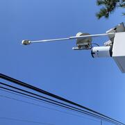
She oversees the New Jersey data collection operations and manages of a team of highly motivated hydrographers who collect and interpret water data including surface water, tide, groundwater and water-quality for Federal, State, County, and local governments, as well as numerous research partners. Heidi has responsibility of maintaining cooperative relationships and fostering new ones with local, state, and Federal agencies to develop complex multi-disciplinary hydrologic data collection programs while ensuring they meet the goals of the USGS Science Strategy.
Professional Experience
Heidi joined the USGS NJWSC in 1999 as a hydrologic technician in the Hydrologic Data Assessment Program (HDAP). She has served many roles at the New Jersey Water Science Center including senior field hydrologist in HDAP, Water Science Center Database Administrator, Project Chief for the New Jersey Tide Network and Flood Warning Systems and Data Chief.
Education and Certifications
Heidi received her Bachelor’s degree in Marine Science and Environmental Geology from Rider University.
Science and Products
Somerset County Flood Information System
New Jersey Tide Telemetry System
Water resources data, New Jersey, water year 2005. Volume 1 - surface-water data
Water resources data, New Jersey, water year 2004-volume 1. surface-water data
Water Resources Data, New Jersey, Water Year 2003; Volume 3. Water-Quality Data
Water Resources Data, New Jersey, Water Year 2002--Volume 3. Water-Quality Data
Water resources data, New Jersey, water year 2001. Volume 3. Water-quality data
Next Generation Water Observing System: Delaware River Basin
New Jersey Water Science Center Webcams
New Jersey Precipitation and Weather Short-Term Network
The New Jersey Streamgaging Network
New Jersey Coastal Surge, Wave, and Tide Hydrodynamics Network (SWaTH)
Long-term Water Monitoring Networks in New Jersey
New Jersey Tide Network
New Jersey Ambient Surface-Water-Quality Monitoring Network
New Jersey Water Data Reports
Summary of Monthly Hydrologic Conditions in New Jersey
New Jersey Ambient Groundwater-Quality Monitoring Network
Science and Products
- Publications
Somerset County Flood Information System
The timely warning of a flood is crucial to the protection of lives and property. One has only to recall the floods of August 2, 1973, September 16 and 17, 1999, and April 16, 2007, in Somerset County, New Jersey, in which lives were lost and major property damage occurred, to realize how costly, especially in terms of human life, an unexpected flood can be. Accurate forecasts and warnings cannotAuthorsHeidi L. HoppeNew Jersey Tide Telemetry System
Each summer the population of the barrier-island communities of New Jersey increases by tens of thousands. When a coastal storm threatens these communities, the limited number of bridges and causeways that connect the islands with the mainland become overcrowded, making evacuations from the barrier islands to the mainland difficult. Timely evacuation depends on well-defined emergency evacuation plAuthorsHeidi L. HoppeWater resources data, New Jersey, water year 2005. Volume 1 - surface-water data
Water-resources data for the 2005 water year for New Jersey are presented in three volumes, and consists of records of stage, discharge, and water-quality of streams; stage and contents of lakes and reservoirs; and water levels and water-quality of ground water. Volume 1 contains discharge records for 103 gaging stations; tide summaries at 28 tidal gaging stations; stage and contents at 34 lakes aAuthorsB.T. White, H.L. Hoppe, G.L. Centinaro, J.F. Dudek, B.S. Painter, A.R. Protz, T.J. Reed, J.C. Shvanda, A.F. WatsonWater resources data, New Jersey, water year 2004-volume 1. surface-water data
Water-resources data for the 2004 water year for New Jersey are presented in three volumes, and consists of records of stage, discharge, and water-quality of streams; stage and contents of lakes and reservoirs; and water levels and water-quality of ground water. Volume 1 contains discharge records for 105 gaging stations; tide summaries at 27 tidal gaging stations; stage and contents at 39 lakes aAuthorsG.L. Centinaro, B.T. White, H.L. Hoppe, J.F. Dudek, A.R. Protz, T.J. Reed, J.C. Shvanda, A.F. WatsonWater Resources Data, New Jersey, Water Year 2003; Volume 3. Water-Quality Data
Water-resources data for the 2003 water year for New Jersey are presented in three volumes, and consists of records of stage, discharge, and water-quality of streams; stage and contents of lakes and reservoirs; and water levels and water-quality of ground water. Volume 3 contains a summary of surface- and ground-water hydrologic conditions for the 2003 water year, a listing of current water-resourAuthorsMichael J. DeLuca, Heidi L. Hoppe, Heather A. Heckathorn, Melissa L. Riskin, Bonnie J. Gray, Emma-Lynn Melvin, Nicholas A. LiuWater Resources Data, New Jersey, Water Year 2002--Volume 3. Water-Quality Data
Water-resources data for the 2002 water year for New Jersey are presented in three volumes, and consists of records of stage, discharge, and quality of streams; stage and contents of lakes and reservoirs; and levels and quality of ground water. Volume 3 contains a summary of surface- and ground-water hydrologic conditions for the 2002 water year, a listing of current water-resources projects in NeAuthorsM.J. DeLuca, H.L. Hoppe, H.A. Heckathorn, B.J. Gray, M.L. RiskinWater resources data, New Jersey, water year 2001. Volume 3. Water-quality data
No abstract available.AuthorsM.J. DeLuca, H.L. Hoppe, H.A. Doyle, B.J. Gray - Science
Next Generation Water Observing System: Delaware River Basin
The USGS Next Generation Water Observing System (NGWOS) provides high-fidelity, real-time data on water quantity and quality necessary to support modern water prediction and decision support systems for water emergencies and daily water operations. The Delaware River Basin was the first NGWOS basin, providing an opportunity to implement the program in a nationally important, complex interstate...New Jersey Water Science Center Webcams
Static webcams have been installed at a number of real-time stream-gaging locations in New Jersey to allow you to view the current river-stage conditions. These webcams provide valuable information to the National Weather Service, emergency managers, and area residents to evaluate real-time conditions in river environments during storms.New Jersey Precipitation and Weather Short-Term Network
The New Jersey Water Science Center provides valuable short-term (120 day) data augmentation to many locations for: Precipitation, Water and Air Temperature, and even Wind speed and direction at some of our coastal sites. Our field technicians continuously make field measurements and maintain these networks to ensure the accuracy of these data.The New Jersey Streamgaging Network
The USGS New Jersey Water Science Center streamgage program is part of the nationwide program that provides streamflow information for a variety of purposes—including the protection of life and property, infrastructure design, recreational usage, and long-term trend assessment. This information is critical to resource managers, farmers, fishermen, kayakers, land-use planners, engineers...New Jersey Coastal Surge, Wave, and Tide Hydrodynamics Network (SWaTH)
Following Hurricane Sandy, the USGS began construction of an overland Surge, Wave, and Tide Hydrodynamics (SWaTH) Network along the Northeastern Atlantic Coast from North Carolina to Maine. This network, developed collaboratively with numerous partners, features the integration of long-term tide gage networks, with real-time rapid-deployment gages (RDG) and mobile storm-tide sensors (STS). An...Long-term Water Monitoring Networks in New Jersey
The accurate, long-term monitoring networks of New Jersey Water Science Center provide valuable data in real-time and historical perspective to compare that data to. The longer a monitoring location is in operation, the more valuable it becomes, since more statistical comparisons can be performed. Our field technicians continuously make field measurements and maintain these networks.New Jersey Tide Network
USGS monitors data for estuary and back-bay areas all along the New Jersey coast and links to related projects with more information about coastal flood hazards, water quality, and other topics. The USGS operates the most extensive satellite network of tide-gaging stations in the region, many of which form the backbone of flood-warning systems. The USGS provides current ("real-time") water-level...New Jersey Ambient Surface-Water-Quality Monitoring Network
The USGS New Jersey Water Science Center, in cooperation with the NJ Department of Environmental Protection (NJDEP), New Jersey Water Supply Authority, and the Delaware River Basin Commission, maintain the New Jersey Ambient Surface-Water-Quality Monitoring Network (ASWQMN) — a collection of monitoring stations on streams throughout New Jersey. Constituent concentration data from the ASWQMN are...New Jersey Water Data Reports
Water Resources Data reports were published annually for many decades for use by engineers, scientists, managers, educators, and the general public. These static archival products supplemented direct access to current and historical water data provided by the National Water Information System web interface (NWISWeb), the authoritative source for USGS water data.Summary of Monthly Hydrologic Conditions in New Jersey
The U.S. Geological Survey New Jersey Water Science Center’s monthly summary reports and tables of hydrologic conditions for surface and ground water are based on average monthly conditions for the period of record at each index station. Statistical analyses that correlate current conditions with previous climatic extremes are commonly used to develop these averages.New Jersey Ambient Groundwater-Quality Monitoring Network
The USGS, in cooperation with the New Jersey Department of Environmental Protection, New Jersey Geological and Water Survey, Ambient Groundwater-Quality Monitoring Network (AGWQMN), which is designed to characterize the status of groundwater quality at or near the water table as a function of land use. Shallow groundwater is generally the first and most significantly affected part of the...