
Water Chemistry Science in Oklahoma and Texas
Water chemistry studies allow USGS Oklahoma-Texas Water Science Center (OTWSC) scientists to look at what has been dissolved in the water, how different constituents in water may react together, and how constituents in water interact with the minerals along its flow path. Visit the links below for more information on our data and science.
WATER CHEMISTRY SCIENCE CAPABILITIES
OTWSC has expertise in water chemistry science applications, including, but not limited to:
- Analyzing trends in water chemistry and water quality
- Characterizing and quantify volume, suspended sediment, and nutrients in surface water
- Characterizing water-chemistry connection between surface water and groundwater
- Coupling water chemistry and stream-bed sediment data with changes in land cover
- Developing continuous regression models based on surrogate parameters to estimate water chemistry concentrations
- Developing local and regional conceptual models of geochemistry
- Integrated sampling networks including automated sampling, real-time data logging, and discrete sample collection
- Quantifying compounds using enzyme-linked immunosorbent assays (ELISA), gas chromatography, liquid chromatography, and mass spectrometry
- Low-level (parts per billion or lower) analytical techniques
- Age-date tracer testing
- Isotopic and radionuclide analysis
- Analytical methods development and testing
CURRENT WATER CHEMISTRY SCIENCE
Edwards Aquifer Recharge Zone Monitoring Network
Edwards Aquifer Recharge Zone Surface-water and Groundwater Interaction
Hydrogeologic Atlas for Fort Bliss
Hydrogeologic Framework of Gaines, Terry, and Yoakum Counties
Water-Quality Monitoring of the Lake Houston Watershed
National Water-Quality Assessment Project in Texas - Surface Water Activities
National Water-Quality Assessment Project in Texas - Groundwater Activities
Nutrient and Sediment Variability in the Lower San Jacinto River
Pecos River Basin Salinity Assessment
Salado Creek Bacteria Source Tracking
San Antonio River Sediment and Water Quality Monitoring in an Oil and Gas Production Area
Transboundary Aquifer Assessment Program
Projects related to water chemistry studies are listed below.

Pecos River Basin Salinity Assessment

Water-Quality Monitoring of the Lake Houston Watershed

Edwards Aquifer Recharge Zone Surface-water and Groundwater Interaction

San Antonio River Sediment and Water Quality Monitoring in an Oil and Gas Production Area

Transboundary Aquifer Assessment Program (TAAP)

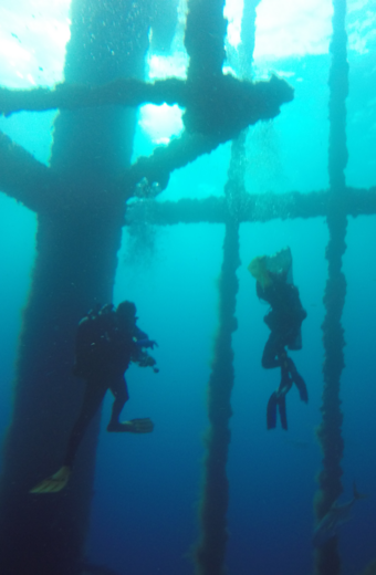
Water Quality Monitoring at Offshore Artificial Reefs

National Water-Quality Assessment Project in Texas - Surface Water Activities

Nutrient and Sediment Variability in the Lower San Jacinto River

Hydrogeologic Framework and Geochemistry of Gaines, Terry, and Yoakum Counties

Cyanobacteria Methods

Urban Waters Federal Partnership - Edwards Aquifer Recharge Zone Monitoring Network

Zebra Mussel Monitoring Program (ZMMP)
Water chemistry studies allow USGS Oklahoma-Texas Water Science Center (OTWSC) scientists to look at what has been dissolved in the water, how different constituents in water may react together, and how constituents in water interact with the minerals along its flow path. Visit the links below for more information on our data and science.
WATER CHEMISTRY SCIENCE CAPABILITIES
OTWSC has expertise in water chemistry science applications, including, but not limited to:
- Analyzing trends in water chemistry and water quality
- Characterizing and quantify volume, suspended sediment, and nutrients in surface water
- Characterizing water-chemistry connection between surface water and groundwater
- Coupling water chemistry and stream-bed sediment data with changes in land cover
- Developing continuous regression models based on surrogate parameters to estimate water chemistry concentrations
- Developing local and regional conceptual models of geochemistry
- Integrated sampling networks including automated sampling, real-time data logging, and discrete sample collection
- Quantifying compounds using enzyme-linked immunosorbent assays (ELISA), gas chromatography, liquid chromatography, and mass spectrometry
- Low-level (parts per billion or lower) analytical techniques
- Age-date tracer testing
- Isotopic and radionuclide analysis
- Analytical methods development and testing
CURRENT WATER CHEMISTRY SCIENCE
Edwards Aquifer Recharge Zone Monitoring Network
Edwards Aquifer Recharge Zone Surface-water and Groundwater Interaction
Hydrogeologic Atlas for Fort Bliss
Hydrogeologic Framework of Gaines, Terry, and Yoakum Counties
Water-Quality Monitoring of the Lake Houston Watershed
National Water-Quality Assessment Project in Texas - Surface Water Activities
National Water-Quality Assessment Project in Texas - Groundwater Activities
Nutrient and Sediment Variability in the Lower San Jacinto River
Pecos River Basin Salinity Assessment
Salado Creek Bacteria Source Tracking
San Antonio River Sediment and Water Quality Monitoring in an Oil and Gas Production Area
Transboundary Aquifer Assessment Program
Projects related to water chemistry studies are listed below.
Pecos River Basin Salinity Assessment
Water-Quality Monitoring of the Lake Houston Watershed
Edwards Aquifer Recharge Zone Surface-water and Groundwater Interaction
San Antonio River Sediment and Water Quality Monitoring in an Oil and Gas Production Area
Transboundary Aquifer Assessment Program (TAAP)
Water Quality Monitoring at Offshore Artificial Reefs
National Water-Quality Assessment Project in Texas - Surface Water Activities
Nutrient and Sediment Variability in the Lower San Jacinto River
Hydrogeologic Framework and Geochemistry of Gaines, Terry, and Yoakum Counties
Cyanobacteria Methods
Urban Waters Federal Partnership - Edwards Aquifer Recharge Zone Monitoring Network