
River Mapping
River Mapping
Filter Total Items: 1
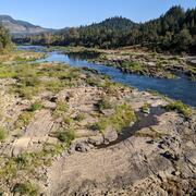
Alluvial reach identification and hydrogeomorphic characterization of Oregon rivers
The USGS, in partnership with the Environmental Protection Agency (EPA), is developing an objective mapping framework to systematically identify alluvial reaches in 13 river basins across Oregon to support EPA and Oregon’s Department of Environmental Quality (DEQ) in their implementation of the Clean Water Act’s water temperature Total Maximum Daily Loads (TMDLs), as well as to support the...