
Geometrics GeoEel Multi-Channel Streamer
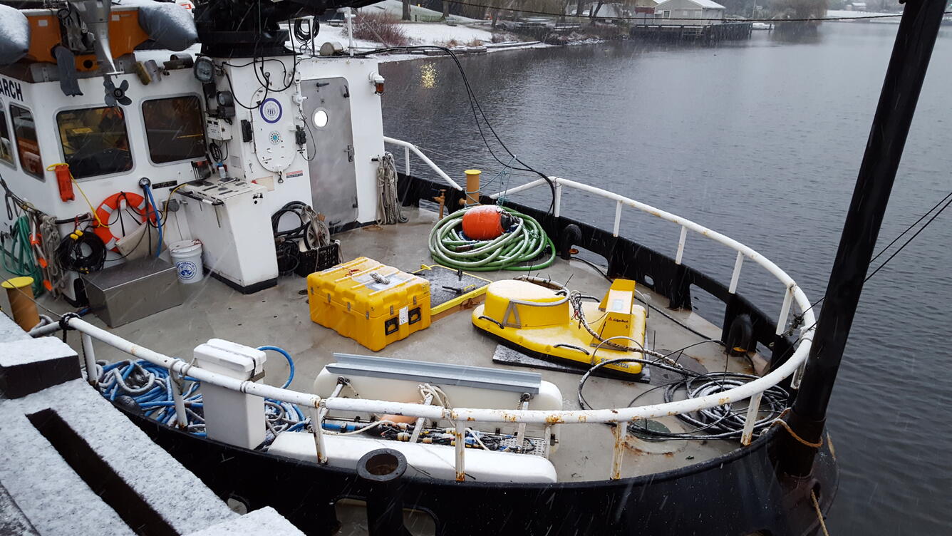
The GeoEel is a multichannel digital streamer system, with hydrophones in a long, green hose. The streamer is towed like a long snake in the water from a vessel, and the hydrophones "listen" for and record the signals from the seismic sound source.

The Geometrics GeoEel is a solid, multichannel digital streamer system. The system consists of a streamer power supply unit, analog to digital converters (one for each section of hydrophones), and streamer hydrophone sections. These sections can be connected together to increase the length of the streamer and the number of channels. Using the multichannel streamer to record reflections allows for one to identify subsurface structures meters to thousands of meters below the seafloor, depending on the sound source used.
Specifications
-
Manufacturer: Geometrics
-
Model: GeoEel Solid
-
150 m @ 3.125 m hydrophone group spacing (6 solid 25 m sections)
-
2 sections with bird coils
-
-
50 m @ 1.56 m hydrophone group spacing (4 solid 12.5 m sections)
-
Tow cables, isolation & stretch sections
-
(12) Digitizers
-
-
Weight: 156 kg/100 m
-
Dimensions: 44 mm diameter
-
Power Requirements: ~120 VAC

Operational Characteristics
-
Minimum Operational Depth: 10 m
-
Maximum Operational Depth: Streamer has a maximum tow depth of 35 m, but it can be used to record data in any depth of water. Results will be dependent on the choice of sound source.
-
Sediment Type: Any
-
Limitations: Length of the multi-channel streamer can vary from 50 m to many kilometers, and may be determined by how much the vessel can accommodate
-
Power Outputs / Freq. Ranges: 500 to 8000 Hz Bandwidth
-
Ship’s Requirements
-
Can be stored and deployed using a large streamer winch- footprint 8 ft by 8 ft
-
When stored without a winch, it requires 7 ft by 5 ft deck space
-
Additional Equipment Required
The multi-channel streamer requires a topside PC running the Geometrics Controller software to collect, display and record data.
The GeoEel hydrophone streamer is the “listening”/recording device for a seismic sound source. The sound source is chosen based on the goal of the survey as well as the environmental conditions.
See the multichannel seismic system for a comprehensive description. Also, check out the PCMSC Marine Facility (MarFac) web site for more information about field gear.

High-Resolution Multichannel Seismic System

PCMSC MarFac Field Equipment and Capabilities

PCMSC Marine Facility (MarFac)
The GeoEel is a multichannel digital streamer system, with hydrophones in a long, green hose. The streamer is towed like a long snake in the water from a vessel, and the hydrophones "listen" for and record the signals from the seismic sound source.
The Geometrics GeoEel is a solid, multichannel digital streamer system. The system consists of a streamer power supply unit, analog to digital converters (one for each section of hydrophones), and streamer hydrophone sections. These sections can be connected together to increase the length of the streamer and the number of channels. Using the multichannel streamer to record reflections allows for one to identify subsurface structures meters to thousands of meters below the seafloor, depending on the sound source used.
Specifications
-
Manufacturer: Geometrics
-
Model: GeoEel Solid
-
150 m @ 3.125 m hydrophone group spacing (6 solid 25 m sections)
-
2 sections with bird coils
-
-
50 m @ 1.56 m hydrophone group spacing (4 solid 12.5 m sections)
-
Tow cables, isolation & stretch sections
-
(12) Digitizers
-
-
Weight: 156 kg/100 m
-
Dimensions: 44 mm diameter
-
Power Requirements: ~120 VAC
Operational Characteristics
-
Minimum Operational Depth: 10 m
-
Maximum Operational Depth: Streamer has a maximum tow depth of 35 m, but it can be used to record data in any depth of water. Results will be dependent on the choice of sound source.
-
Sediment Type: Any
-
Limitations: Length of the multi-channel streamer can vary from 50 m to many kilometers, and may be determined by how much the vessel can accommodate
-
Power Outputs / Freq. Ranges: 500 to 8000 Hz Bandwidth
-
Ship’s Requirements
-
Can be stored and deployed using a large streamer winch- footprint 8 ft by 8 ft
-
When stored without a winch, it requires 7 ft by 5 ft deck space
-
Additional Equipment Required
The multi-channel streamer requires a topside PC running the Geometrics Controller software to collect, display and record data.
The GeoEel hydrophone streamer is the “listening”/recording device for a seismic sound source. The sound source is chosen based on the goal of the survey as well as the environmental conditions.
See the multichannel seismic system for a comprehensive description. Also, check out the PCMSC Marine Facility (MarFac) web site for more information about field gear.
High-Resolution Multichannel Seismic System
PCMSC MarFac Field Equipment and Capabilities