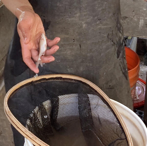
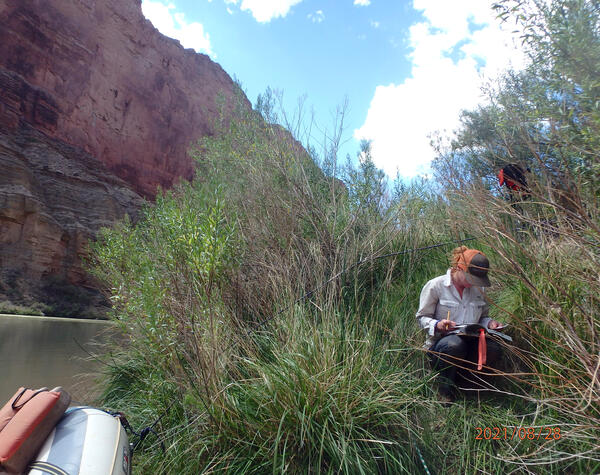
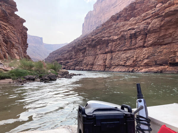
U.S. flag

An official website of the United States government

Images

Below are images associated with SBSC's science and staff. Images appear according to the year they were taken. To search, type a keyword or select a year from the dropdown menu. Or, click through the pages using the arrows at the bottom of the page. 

Filter Total Items: 641
A man captures insects using a net.
Powerlines & Pollinators

Connecting powerline rights-of-way vegetation management to improve pollinator habitat. A USGS RAMPS technician samples pollinating insects along the Salt River Project powerline that crosses through Apache-Sitgreaves and Tonto National Forests.

Connecting powerline rights-of-way vegetation management to improve pollinator habitat. A USGS RAMPS technician samples pollinating insects along the Salt River Project powerline that crosses through Apache-Sitgreaves and Tonto National Forests.

A SBSC technician collects data on native plants for restoration, near Escalante, UT, May 2021
A SBSC technician collects data on native plants for restoration, near Escalante, UT

A SBSC technician, Shannon Lencioni, collects data on native plants for restoration, near Escalante, UT, in May 2021. Photo by Morgan Andrews, SBSC, USGS.

Three researchers walk through shrubs with rock formations and blue in the distance in Canyonlands National Park
USGS researchers walk to a vegetation and drought study site in Canyonlands National Park, Utah

USGS researchers walk to a long-term vegetation and drought study site in a Canyonlands National Park grassland, Utah, where long-term monitoring has occurred since 1998.

A scientist holds a research grid like a frame around her while reaching over a drylands study plot in Canyonlands NP
Vegetation drought research in Canyonlands National Park

USGS scientist Dr. Erika Geiger gathers research at a vegetation drought monitoring study in Canyonlands National Park, Utah. Here Dr. Geiger collects data on warm season grasses at a control plot associated with a long-term drought experiment.

USGS scientist Dr. Erika Geiger gathers research at a vegetation drought monitoring study in Canyonlands National Park, Utah. Here Dr. Geiger collects data on warm season grasses at a control plot associated with a long-term drought experiment.

A pronghorn stands in front of oil and gas development infrastructure, Vernal, Utah
A pronghorn uses habitat with oil and gas development infrastructure, Utah

A pronghorn (Antilocapra americana) using habitat with oil and gas development near Vernal, Utah. Photo by Mike Duniway, SBSC, USGS.

A person's shadow is displayed on the rock as they look out over a panorama of Canyonlands National Park
Canyonlands National Park panorama

A panoramic photo of the Colorado River Basin in Canyonlands National Park. Photo by Mike Duniway, Southwest Biological Science Center, USGS.

A panoramic photo of the Colorado River Basin in Canyonlands National Park. Photo by Mike Duniway, Southwest Biological Science Center, USGS.

USGS staff collects vegetation data on reclaimed oil or gas pad in CO
USGS staff collects vegetation data on reclaimed oil or gas pad

USGS Southwest Biological Science Center staff collects vegetation data on reclaimed oil or gas pad, Grand Junction, CO, April 2021. Photo by Mike Duniway, SBSC, USGS.

A group of USGS researchers disembark from river research boats on a sandbar along the Colorado River, Grand Canyon
A group of researchers near boats on a sandbar along the Colorado River

A group of USGS and other researchers disembark from river research boats at a sandbar on the Colorado River in Grand Canyon. Photo by David Herasimtschuk, Freshwaters Illustrated.

River boats on a large sandbar on the Colorado River with canyon walls in the distance
Boats on a sandbar on the Colorado River, Grand Canyon

Boats on a sandbar on the Colorado River, Grand Canyon. Photo by David Herasimtschuk, Freshwaters Illustrated, for the USGS.

A landscape with a cluster of cholla cacti in the foreground and the Colorado River in Grand Canyon in the distance
Cholla cacti above the Colorado River in western Grand Canyon

Cholla cacti above the Colorado River in western Grand Canyon. Photo by David Herasimtschuk, Freshwaters Illustrated / USGS.

Research boats travel along the Colorado River in Grand Canyon
USGS research boats travel along the Colorado River in Grand Canyon

USGS research boats travel along the Colorado River in Grand Canyon during a science expedition to analyze resource effects during a low flow experiment. Photo by David Herasimtschuk, Freshwaters Illustrated. 

USGS research boats travel along the Colorado River in Grand Canyon during a science expedition to analyze resource effects during a low flow experiment. Photo by David Herasimtschuk, Freshwaters Illustrated. 

A rock covered with algae is exposed during an experimental low flow release from Glen Canyon Dam in March 2021.
FreshwatersIllustrated_USGS_GlenCanyonLowFlowMonitoring20210316b-134.jpg

A rock covered with algae is exposed during an experimental low flow release from Glen Canyon Dam in March 2021.

A USGS researcher is on a boat on the Colorado River, Glen Canyon looking a sonde, used for metabolism monitoring
A USGS researcher conducting a metabolism modeling study using a sonde, on the Colorado River below Glen Canyon Dam

A USGS researcher, Bridget Deemer, conducting a metabolism modeling study using a submerged sonde, on the Colorado River in Glen Canyon below Glen Canyon Dam. Photo by Freshwaters Illustrated for USGS.

Scientist on shore and in waders holds up a clear bag full of green algae and insects sampled from Glen Canyon National Recreational Area
FreshwatersIllustrated_USGS_GlenCanyonLowFlowMonitoring20210316b-62.jpg

Scientist on shore and in waders holds up a clear bag full of green algae and insects sampled from Glen Canyon National Recreational Area

Two people conduct monitoring on a Colorado River beach in Grand Canyon. A riparian grass is in the foreground.
Monitoring along the Colorado River in Grand Canyon during a low flow experiment

Monitoring riparian vegetation at Paria Beach along the Colorado River just below Lees Ferry. Photo by Freshwaters Illustrated / USGS.

A man and woman collect vegetation data on the bank of the Colorado River in Grand Canyon
Two scientists collect plant data during vegetation monitoring on the bank of the Colorado River in Grand Canyon

Two scientists collect plant data during vegetation monitoring on the bank of the Colorado River in Grand Canyon. Photo courtesy of Brad Butterfield, Northern Arizona University and Emily Palmquist, USGS.

A metal boat tied up at a landing at Lees Ferry, Colorado River, with a kayaker on the water and a person on the far shore.
A boat at a landing and a kayak on the water at Lees Ferry, Colorado River, Grand Canyon

A boat with fishing poles tied at a landing at Lees Ferry, Colorado River, downstream of Glen Canyon Dam in Grand Canyon National Park. A kayaker is on the water, and people are visible at the far shore. Photo taken during the spring "disturbance flow" in March, 2021 by Lucas Bair, SBSC, USGS.

A boat with fishing poles tied at a landing at Lees Ferry, Colorado River, downstream of Glen Canyon Dam in Grand Canyon National Park. A kayaker is on the water, and people are visible at the far shore. Photo taken during the spring "disturbance flow" in March, 2021 by Lucas Bair, SBSC, USGS.

Dylands near Moab, Utah
Drylands outside Moab, Utah

A photo of drylands near Moab, Utah. Image taken by Erika Geiger, SBSC. Public domain.

Was this page helpful?