
Oil painting of USGS monitoring Grand Canyon Monitoring and Research Center (GCMRC) Sandbar Monitoring trip on the Colorado River with Diamond Peak overlooking.
Images
Below are images associated with SBSC's science and staff. Images appear according to the year they were taken. To search, type a keyword or select a year from the dropdown menu. Or, click through the pages using the arrows at the bottom of the page.
Filter Total Items: 703
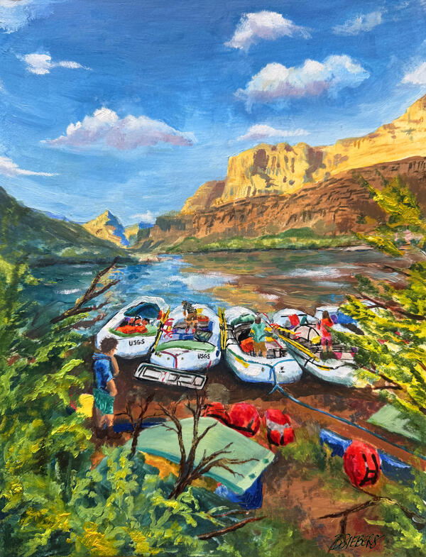
The Home Stretch
Oil painting of USGS monitoring Grand Canyon Monitoring and Research Center (GCMRC) Sandbar Monitoring trip on the Colorado River with Diamond Peak overlooking.
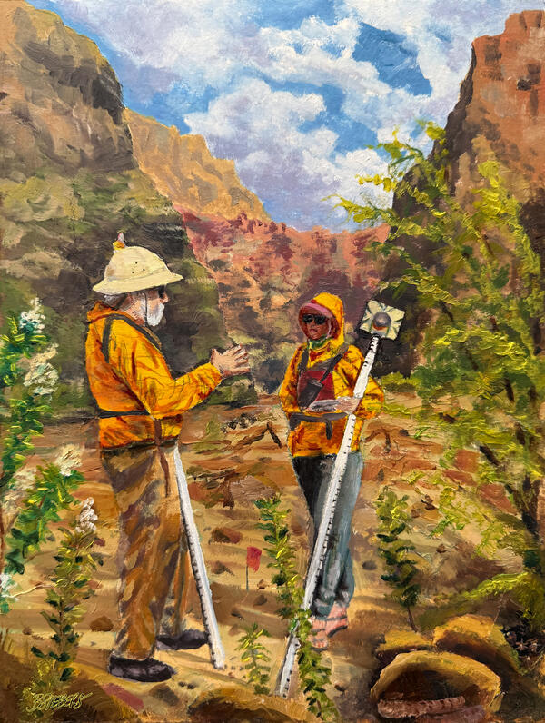
Lessons on the Sandbar
Oil painting of USGS Grand Canyon Monitoring and Research Center (GCMRC) surveying a sandbar monitoring site on the Colorado River in Grand Canyon National Park.
Oil painting of USGS Grand Canyon Monitoring and Research Center (GCMRC) surveying a sandbar monitoring site on the Colorado River in Grand Canyon National Park.
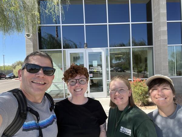
U.S. Geological Survey employees celebrate data collection for the Land Treatment Digital Library
U.S. Geological Survey employees celebrate data collection for the Land Treatment Digital LibraryU.S. Geological Survey employees (from left to right) Matthew Clark, Laura Shriver, Morgan Cheyney, and Sarah Birchard after collecting data for the Land Treatment Digital Library at the Bureau of Land Management Phoenix District Office.
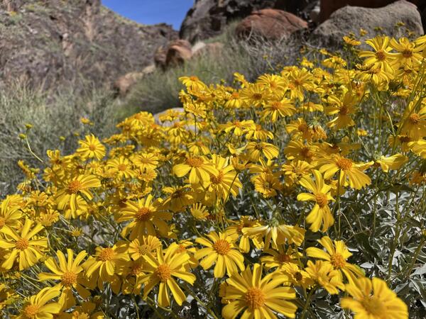
Brittlebush flowers in Grand Canyon
Brittlebush flowers in Grand Canyon. Photo by Kate Behn, USGS.
Brittlebush flowers in Grand Canyon. Photo by Kate Behn, USGS.
IMG_2112.jpg
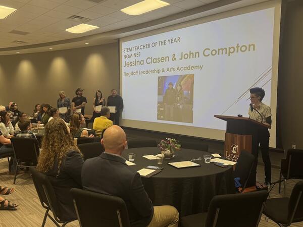
FALA teachers Jessina Clasen and John Compton were finalists for STEM Teacher of the Year in the 2026 Flagstaff STEMMY Awards. Photo of all finalists standing alongside a projector screen during the awards ceremony at Lowell Observatory..
FALA teachers Jessina Clasen and John Compton were finalists for STEM Teacher of the Year in the 2026 Flagstaff STEMMY Awards. Photo of all finalists standing alongside a projector screen during the awards ceremony at Lowell Observatory..
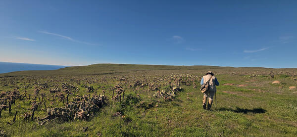
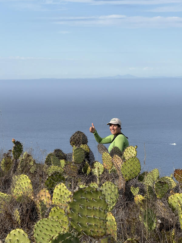
A scientist hiking on San Clemente Island during a population monitoring study
A scientist hiking on San Clemente Island during a population monitoring studyScientist Charles Drost hikes on San Clemente Island during a population monitoring study. Photo by Sarah Birchard, USGS.
A scientist hiking on San Clemente Island during a population monitoring study
A scientist hiking on San Clemente Island during a population monitoring studyScientist Charles Drost hikes on San Clemente Island during a population monitoring study. Photo by Sarah Birchard, USGS.
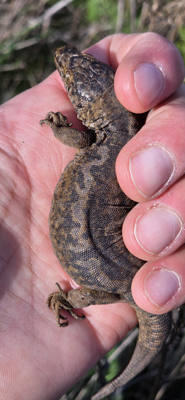
Island Night Lizard, San Clemente Island
An Island Night Lizard on San Clemente Island, Channel Islands, CA. Photo by Sarah Birchard, USGS.
An Island Night Lizard on San Clemente Island, Channel Islands, CA. Photo by Sarah Birchard, USGS.

Wild turkeys run along a path in an eastern US forest
Wild turkeys run along a path in an eastern US forestWild turkeys run along a path in Massachusetts. Photo by Meredith Hartwell, USGS.
Wild turkeys run along a path in an eastern US forest
Wild turkeys run along a path in an eastern US forestWild turkeys run along a path in Massachusetts. Photo by Meredith Hartwell, USGS.
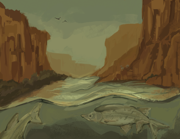
Untitled_Artwork_Izaiah_Chairez_September_2025_Flagstaff_Festival_of_Science_FALA_student.png
Untitled_Artwork_Izaiah_Chairez_September_2025_Flagstaff_Festival_of_Science_FALA_student.pngIllustration by Izaiah Chairez created in collaboration with Dr. Kimberly Dibble during Flagstaff Arts and Leadership Academy Project Based Learning course during Fall 2025. The art features Humpback Chub in the Colorado River in Grand Canyon. The artwork was displayed at the USGS campus digitally during the Art of Inquiry exhibit on September 22, 2025.
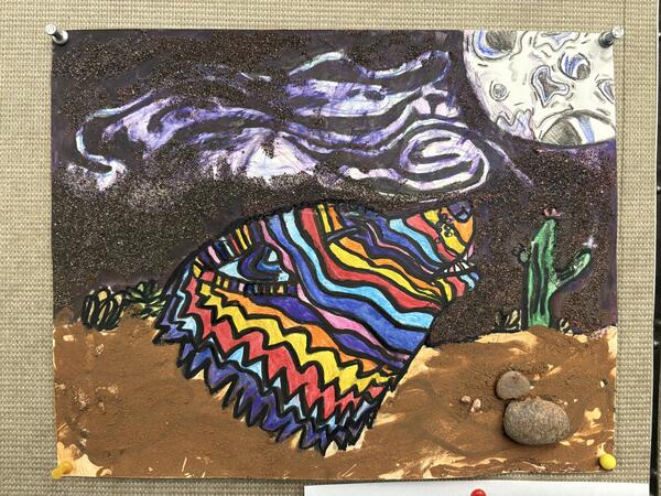
Illustration by Wally created in collaboration with Dr. Madeline Kelley during Flagstaff Arts and Leadership Academy Project Based Learning course during Fall 2025. The artwork was displayed at the USGS campus digitally during the Art of Inquiry exhibit o
Illustration by Wally created in collaboration with Dr. Madeline Kelley during Flagstaff Arts and Leadership Academy Project Based Learning course during Fall 2025. The artwork was displayed at the USGS campus digitally during the Art of Inquiry exhibit oIllustration by Wally created in collaboration with Dr. Madeline Kelley during Flagstaff Arts and Leadership Academy Project Based Learning course during Fall 2025. The artwork was displayed at the USGS campus digitally during the Art of Inquiry exhibit on September 22, 2025.
Illustration by Wally created in collaboration with Dr. Madeline Kelley during Flagstaff Arts and Leadership Academy Project Based Learning course during Fall 2025. The artwork was displayed at the USGS campus digitally during the Art of Inquiry exhibit o
Illustration by Wally created in collaboration with Dr. Madeline Kelley during Flagstaff Arts and Leadership Academy Project Based Learning course during Fall 2025. The artwork was displayed at the USGS campus digitally during the Art of Inquiry exhibit oIllustration by Wally created in collaboration with Dr. Madeline Kelley during Flagstaff Arts and Leadership Academy Project Based Learning course during Fall 2025. The artwork was displayed at the USGS campus digitally during the Art of Inquiry exhibit o
Illustration by Wally created in collaboration with Dr. Madeline Kelley during Flagstaff Arts and Leadership Academy Project Based Learning course during Fall 2025. The artwork was displayed at the USGS campus digitally during the Art of Inquiry exhibit oIllustration by Wally created in collaboration with Dr. Madeline Kelley during Flagstaff Arts and Leadership Academy Project Based Learning course during Fall 2025. The artwork was displayed at the USGS campus digitally during the Art of Inquiry exhibit on September 22, 2025.
FALA USGS art show Sept 2025.jpg
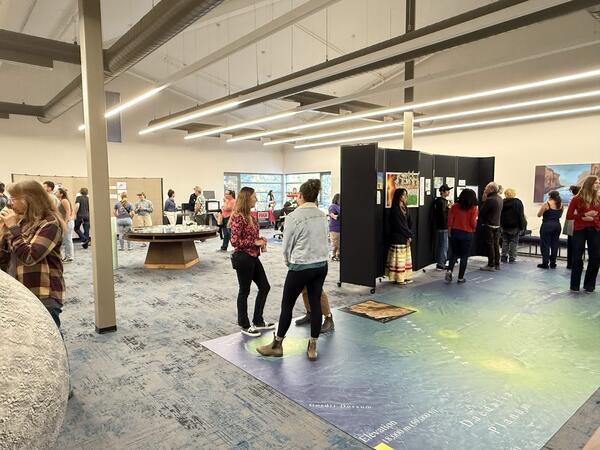
Art of Inquiry show hosted at USGS on 22 September, 2025 as part of Flagstaff Festival of Science and in collaboration with Flagstaff Arts and Leadership Academy
Art of Inquiry show hosted at USGS on 22 September, 2025 as part of Flagstaff Festival of Science and in collaboration with Flagstaff Arts and Leadership Academy
Leighanne art.jpg
Artwork by LeighAnne, Grade 10, as part of the Art of Inquiry exhibit at USGS Flagstaff Science Campus on Sept 22, 2025 featured artwork by students from Flagstaff Arts and Leadership Academy that was inspired by research and 1:1 collaboration with USGS scientists.
Artwork by LeighAnne, Grade 10, as part of the Art of Inquiry exhibit at USGS Flagstaff Science Campus on Sept 22, 2025 featured artwork by students from Flagstaff Arts and Leadership Academy that was inspired by research and 1:1 collaboration with USGS scientists.
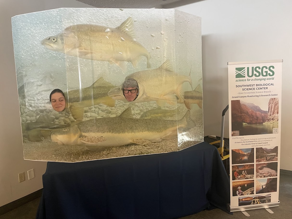
Two USGS scientists smile through a playful humpback chub cutout display
Two USGS scientists smile through a playful humpback chub cutout displayUSGS scientists Shannon Sartain and Paul Grams smile through a playful humpback chub cutout display. The display was part of the SBSC information table at the Flagstaff Biennial conference on Science and Technology, Sept 2025. Photo by Anya Metcalfe, USGS.
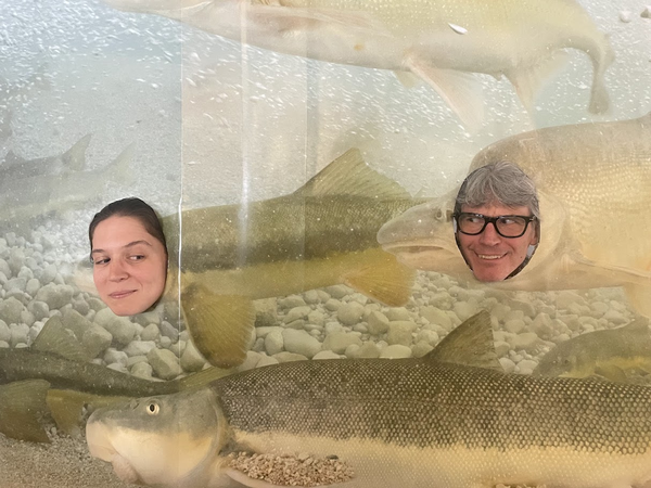
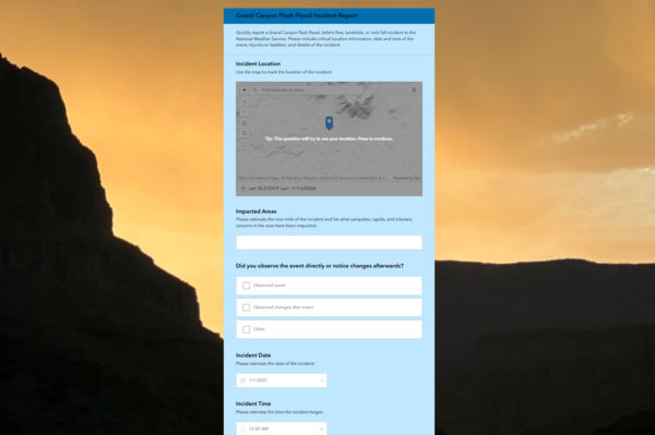
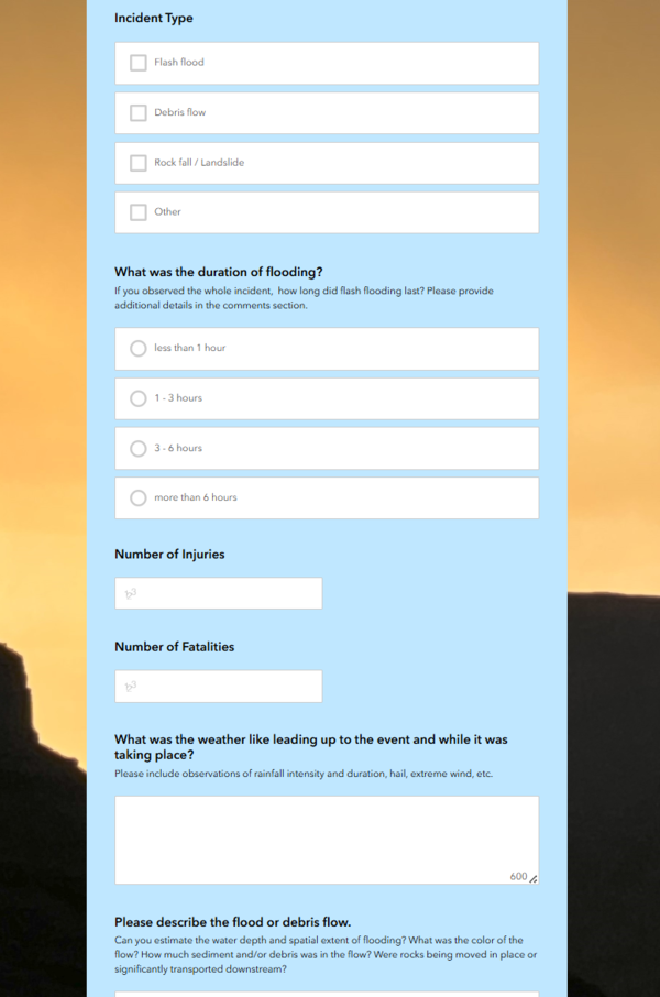
Grand Canyon community science natural hazard event reporting app
Grand Canyon community science natural hazard event reporting appA screenshot of the Grand Canyon community science natural hazard event reporting app form fields.
Grand Canyon community science natural hazard event reporting app
Grand Canyon community science natural hazard event reporting appA screenshot of the Grand Canyon community science natural hazard event reporting app form fields.
Grand Canyon community science natural hazard event reporting app screenshot
Grand Canyon community science natural hazard event reporting app screenshotA screenshot of the Grand Canyon community science natural hazard event reporting app form fields.
Grand Canyon community science natural hazard event reporting app screenshot
Grand Canyon community science natural hazard event reporting app screenshotA screenshot of the Grand Canyon community science natural hazard event reporting app form fields.
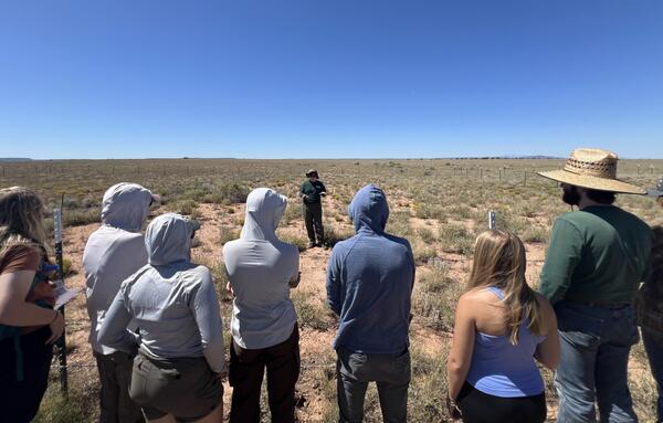
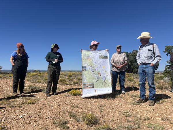
A USGS Ecologist gives a tour of a Northern Arizona RestoreNet site
A USGS Ecologist gives a tour of a Northern Arizona RestoreNet siteLaura Shriver, RAMPS coordinator, gives a tour of a Northern Arizona RestoreNet site to Northern Arizona University students. Photo by Jessica Archibald (Diablo Trust).
Researchers and ranchers discuss land management in Northern Arizona
Researchers and ranchers discuss land management in Northern ArizonaResearchers from the U.S. Geological Survey and University of Arizona collaborate with Diablo Trust ranchers on range improvement and restoration efforts on Northern Arizona rangelands. Photo by Jessica Archibald (Diablo Trust).
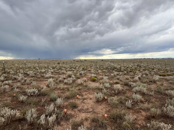
Monsoon season at a Northern Arizona RestoreNet site
Monsoon season at a Northern Arizona RestoreNet siteA RestoreNet site in Northern Arizona with late summer monsoon rain clouds in the background. Photo by Laura Shriver.
Monsoon season at a Northern Arizona RestoreNet site
Monsoon season at a Northern Arizona RestoreNet siteA RestoreNet site in Northern Arizona with late summer monsoon rain clouds in the background. Photo by Laura Shriver.
Biologist Sarah Birchard at Pyramid Point, San Clemente Island
Biologist Sarah Birchard at Pyramid Point, San Clemente IslandBiologist Sarah Birchard at Pyramid Point, San Clemente Island, Channel Islands, CA. Photo by Mark Sogge, USGS Emeritus.
Biologist Sarah Birchard at Pyramid Point, San Clemente Island
Biologist Sarah Birchard at Pyramid Point, San Clemente IslandBiologist Sarah Birchard at Pyramid Point, San Clemente Island, Channel Islands, CA. Photo by Mark Sogge, USGS Emeritus.
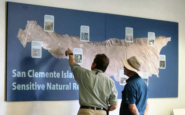
Scientist Charles Drost and Emeritus Mark Sogge look at a map of San Clemente Island
Scientist Charles Drost and Emeritus Mark Sogge look at a map of San Clemente IslandScientist Charles Drost and Emeritus Mark Sogge look at a map of San Clemente Island, Channel Islands, CA. Photo by Sarah Birchard, USGS.