U.S. flag

An official website of the United States government

Images

Below are images associated with SBSC's science and staff. Images appear according to the year they were taken. To search, type a keyword or select a year from the dropdown menu. Or, click through the pages using the arrows at the bottom of the page. 

Filter Total Items: 683
A USGS cartographer speaks to the public in the Photogrammetry Lab at the Flagstaff USGS Open House
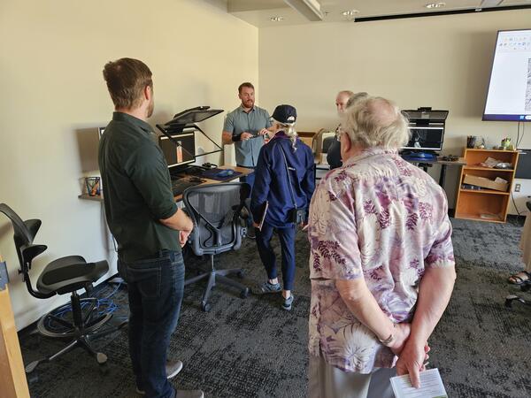
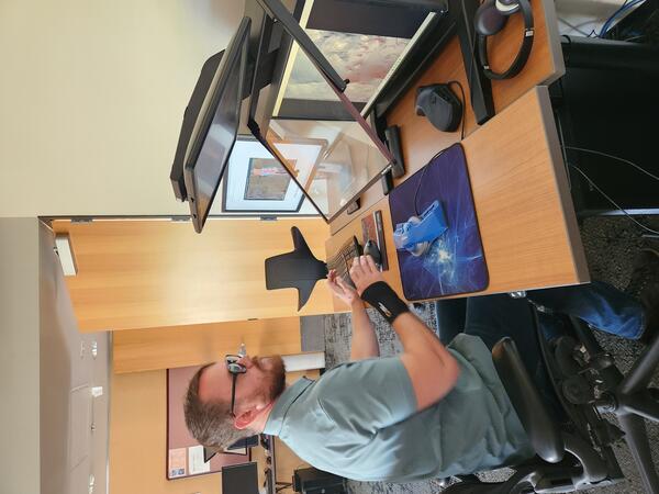
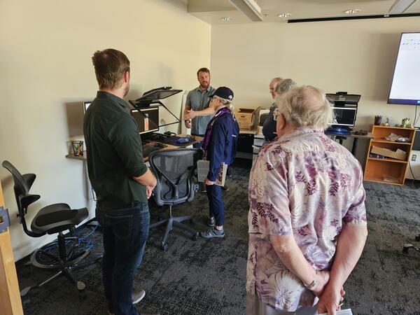
A USGS cartographer engages with the public in the Photogrammetry Lab at the Flagstaff USGS Open House

USGS cartographer Ben Wheeler engages with the public in the Photogrammetry Lab in the Astrogeology building at the 2024 USGS Flagstaff Open House. Photo by Lori Pigue, USGS.

A USGS cartographer engages with the public in the Photogrammetry Lab at the USGS Flagstaff Open House

USGS cartographer Ben Wheeler engages with the public in the Photogrammetry Lab in the Astrogeology building at the 2024 USGS Flagstaff Open House. Photo by Lori Pigue, USGS.

A man in a green shirt with glasses sits at a desk in the Astrogeology Photogrammetry Lab looking at monitor screens.
A USGS cartographer works in the Astrogeology Photogrammetry Lab

USGS cartographer Ben Wheeler works in the Astrogeology Photogrammetry Lab at the USGS Flagstaff science campus.

Illustration of Colorado River Upper and Lower Basins
Illustration of Colorado River Basin, showing upper and lower basins

Illustration of Colorado River Basin, showing upper and lower basins with a red text box around the Colorado River in Grand Canyon. Reduced-size map of the Colorado River Basin from the USGS ASIST Initiative, Sept. 3, 2024.

Illustration of Colorado River Basin, showing upper and lower basins with a red text box around the Colorado River in Grand Canyon. Reduced-size map of the Colorado River Basin from the USGS ASIST Initiative, Sept. 3, 2024.

Claudia Dimartini holds a long camelthorn rhizomes exposed in a wash at Wupatki National Monument
Long camelthorn rhizomes exposed in a wash at Wupatki National Monument

USGS Biological Science Technician Claudia Dimartini poses with a long camelthorn (Alhagi maurorum) rhizome (underground root structure from which new plants can propagate that was exposed in a wash at the Deadman Wash Confluence Area. Photo by Laura Shriver (USGS).

USGS Biological Science Technician Claudia Dimartini poses with a long camelthorn (Alhagi maurorum) rhizome (underground root structure from which new plants can propagate that was exposed in a wash at the Deadman Wash Confluence Area. Photo by Laura Shriver (USGS).

A person smiles while collecting soil stability data in southern Utah
Collecting soil stability data

Sarah Costanzo (USGS) collects soil stability data prior to installing RestoreNet version 2.0 treatments at Canyonlands Research Center near Moab, UT. Photo by Laura Shriver (USGS).

Sarah Costanzo (USGS) collects soil stability data prior to installing RestoreNet version 2.0 treatments at Canyonlands Research Center near Moab, UT. Photo by Laura Shriver (USGS).

Zach Harrison collects a water quality sample at Willow Spring, AZ

Zach Harrison collects a water quality sample at Willow Spring, AZ. Photo courtesy of Kat Cooney, AZ Water Science Center.

Kat Cooney smiles as she runs an alkalinity titration in a mobile lab
Kat Cooney runs an alkalinity titration in a mobile lab

Kat Cooney of the Arizona Water Science Center (AZWSC) runs an alkalinity titration in a mobile lab. Photo courtesy of Kat Cooney, USGS.

Laura Shriver at the soil and restoration science booth at the USGS Flagstaff Science Center Open House.
Soil and restoration science booth at USGS Flagstaff Science Center Open House

Laura Shriver at the soil and restoration science booth at the USGS Flagstaff Science Center Open House. The booth included native seeds, biocrusts, a soil texturing activity, and science brief handouts.

Pollinator garden tour at Santa Rita Experimental Range
Pollinator garden tour

Albert Klein (University of Arizona) shows the pollinator garden designed and installed by University of Arizona students at the Santa Rita Experimental Range. Photo by Laura Shriver (USGS).

Albert Klein (University of Arizona) shows the pollinator garden designed and installed by University of Arizona students at the Santa Rita Experimental Range. Photo by Laura Shriver (USGS).

four people smile in a southern Utah landscape
Celebrating a successful restoration experiment installation

From left to right, Ember Bradbury (Colorado State University), Sarah Costanzo (USGS), Sonoma Brill (USGS), and Laura Shriver (USGS) celebrate installing a RestoreNet site at Canyonlands Research Center near Moab, UT.

From left to right, Ember Bradbury (Colorado State University), Sarah Costanzo (USGS), Sonoma Brill (USGS), and Laura Shriver (USGS) celebrate installing a RestoreNet site at Canyonlands Research Center near Moab, UT.

A flash flood moves rapidly down a canyon carrying sediment and debris into the Colorado River during a storm
A flash flood down Galloway Canyon into Dubendorff Rapids, Colorado River

A flash flood carries sediment and debris down Galloway Canyon into Dubendorff Rapids, Colorado River, Grand Canyon. Photo by Larkin Carey.

Two boats navigate high rapids in the muddy sediment-filled Colorado River during a rainstorm
Two boats navigate Dubendorff Rapids during a flash flood from Galloway Canyon, Colorado River, during a rainstorm
Muddy flash flood waters rush down a desert canyon during a rainstorm
A flash flood through Galloway Canyon into the Colorado River, at Dubendorff Rapids

A flash flood through Galloway Canyon into the Colorado River at the beginning of Dubendorff Rapids in Grand Canyon during a rainstorm. Photo by Larkin Carey.

A research boat navigates high rapids in the brown sediment-filled Colorado River during a storm
A boat navigates Dubendorff Rapids during a flash flood at Galloway Canyon, Colorado River, during a rainstorm
Rocks and mud flow down a canyon watershed in Grand Canyon during a flash flood
Rocks and sediment flow down Galloway Canyon during a flash flood along the Colorado River

Rocks and sediment flow down Galloway Canyon during a flash flood along the bank and into Dubendorff Rapids, Colorado River, Grand Canyon. Photo by Larkin Carey.

A river trip group watches a flash flood from the opposite bank of the Colorado River as it rushes down a canyon
A river trip watches a flash flood across from Galloway Canyon into Dubendorff Rapids from the opposite bank of the Colorado River
Muddy floodwaters rush down a canyon into the Colorado River, Grand Canyon, during a flash flood event
Muddy floodwaters rush down Galloway Canyon into the Colorado River during a flash flood event at Dubendorff Rapids
A lightning bolt from a dark and stormy sky strikes a red rock plateau, with green grass fields in the foreground
Thunderstorm at Indian Creek, San Juan County, Utah

A lightening bolt strikes the plateau during a thunderstorm at Indian Creek, San Juan County, Utah. Photo by Mike Duniway, USGS.

Rock Corral Canyon, Tumacacori Mountains, southern Arizona
Western yellow-billed cuckoo habitat - Rock Corral Canyon, Tumacacori Mountains, southern Arizona

Rock Corral Canyon, a dry oak woodland in a drainage of the Tumacacori Mountains, a "Sky Island" in southern Arizona. This area is habitat used by threatened western yellow-billed cuckoos. Photo by Charles Drost, USGS, SBSC.

A rainstorm downburst moves across the top of mountains with pine trees in the foreground and a yellow sunset in the distance
A monsoon rainstorm at the north rim of the Grand Canyon

A monsoon rainstorm moves across the north rim of the Grand Canyon during sunset, August 2024. Photo by Tom Gushue, USGS.

Was this page helpful?