The Glen Canyon Dam Adaptive Management Program
In 1996, the Secretary of the Interior signed a formal decision altering the historical flows from Glen Canyon Dam and establishing the Glen Canyon Dam Adaptive Management Program (GCDAMP). In the context of the management of Glen Canyon Dam, adaptive management was selected to create a process whereby “the effects of dam operations on downstream resources would be assessed and the results of those assessments would form the basis of future modifications of dam operations.”
The Southwest Biological Science Center's Grand Canyon Monitoring and Research Center (GCMRC) is responsible for the scientific monitoring and research efforts of the program. Science in the adaptive management process is the “compass” used to evaluate the effects of Glen Canyon Dam operations on resources of concern and to inform changes in course when necessary.
One of the goals of the (GCDAMP) is the maintenance of a high-quality monitoring, research, and adaptive management program. To achieve this goal, GCMRC continues to refine a comprehensive ecosystem science program that is responsive to the needs of the program’s participants and the U.S. Department of Interior.
Administrative History and Guidance That Informs GCMRC Projects
GCMRC'S work plan and science projects align with the needs of the GCDAMP stakeholders. Each project described is organized around monitoring and research themes that are associated with the eleven resource goals identified in the LTEMP ROD: archaeological and cultural resources, natural processes, humpback chub, hydropower and energy, other native fish, recreational experience, sediment, tribal resources, rainbow trout fishery, nonnative invasive species, and riparian vegetation (U.S. Department of the Interior, 2016a; Attachment A).
The monitoring and research projects are responsive to guidance provided in the LTEMP ROD, which, in addition to identifying the priority resources, also identifies flow and non-flow experimental actions and compliance obligations for Glen Canyon Dam operations for the 20 years of the LTEMP. Additional guidance comes from the Science Plan developed by GCMRC (VanderKooi and others, 2017) in support of the LTEMP ROD which describes a general strategy for monitoring and research needed in support of implementation of operations and experimental actions.
Projects in the current TWP have been informed by and build upon previous research and monitoring projects that were responsive to guidance vetted through the GCDAMP and the Secretary of Interior’s office. While the LTEMP ROD defines broad resource goals and identifies new experimental actions and compliance requirements, some of the older guidance continues to have relevance for certain aspects of the current science program and continues to influence current research and monitoring directions in a general sense. Among this older guidance, the following documents describe the history of GCDAMP decisions and direction and help maintain continuity with GCDAMP goals as LTEMP is implemented:
- 2001 Glen Canyon Dam Adaptive Management Program draft strategic plan (Glen Canyon Dam Adaptive Management Program, 2001),
- 2007 Strategic Science Plan and Strategic Science Questions (SSQs) (U. S. Geological Survey, 2007),
- 2011 draft Core Monitoring Plan (U. S. Geological Survey, 2011), and
- 2012 AMWG Desired Future Conditions.
Monitoring and research themes described in these and other GCDAMP administrative documents have persisted throughout the life of the GCDAMP and are carried forward into the LTEMP. They include:
- Recovery of the endangered humpback chub (Gila cypha) and maintenance of populations of other native fish;
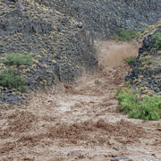
- Maintenance or improvement of the physical template, especially regarding fine sediment;
- Maintenance of culturally important sites, especially those that are of archaeological and historical significance under the National Historic Preservation Act
- Maintenance of the food base on which the native fish community depends;
- Maintenance of a high-quality sport fishery in the Lees Ferry reach; and
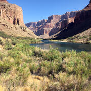
- Maintenance of the native riparian vegetation community.
The various goals, questions, information needs, and desired future conditions developed by GCDAMP committees also recognize the importance of maintaining high quality opportunities and conditions for recreational boaters and campers, and the role played by nonnative riparian vegetation in providing habitat for some desired fauna such as the endangered Southwestern willow flycatcher.