
Rio Grande/Rio Bravo Research
Sediment and Vegetation Change
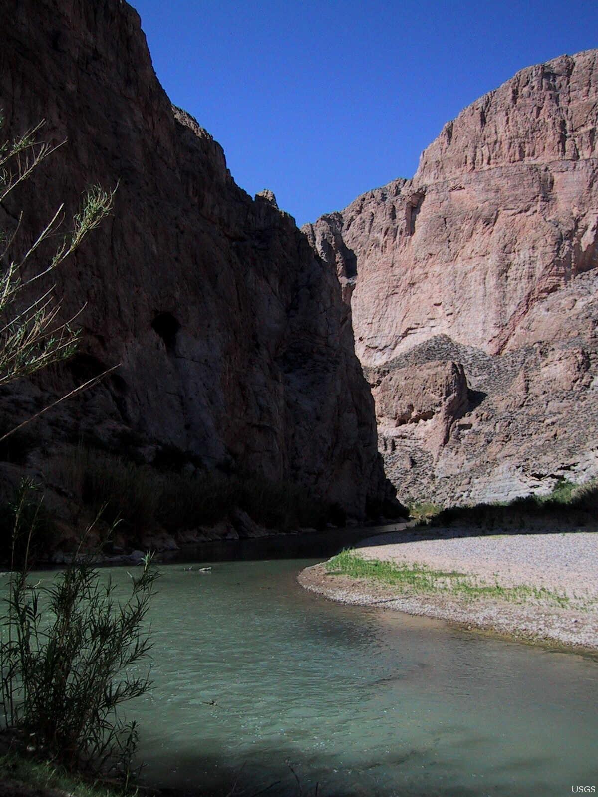
The Rio Grande/Rio Bravo (hereafter referred to as the Rio Grande) in the Big Bend region of Texas, USA, and Chihuahua and Coahuila, Mexico, has substantially narrowed since the early 1900s. This narrowing has been caused by the construction and operation of dams and irrigation diversions in upstream reaches of the Rio Grande in the U.S. and the Rio Conchos in Mexico that has reduced flows without similar reductions in the amount of sediment contributed to the river channel.
The projects outlined on this page are:
~ Suspended-Sediment Transport Dynamics of the Rio Grande/Rio Bravo
~ Effects of Nonnative Vegetation Management on the Rio Grande/Rio Bravo
Suspended-Sediment Transport Dynamics of the Rio Grande/Rio Bravo
Background
This project uses state-of-the art acoustic technology to continuously monitor suspended-sediment transport on the Rio Grande in Big Bend National Park. Suspended-sediment transport is also conducted on two large tributaries to the Rio Grande. Using these data, the amount of fine sediment contributed to the Rio Grande can be determined, and the effects of upstream dam operations on evacuating sediment from the river channel can be evaluated.
This information provides the opportunity for river managers to understand how different dam operation scenarios affects sediment transport and geomorphic form, both of which control the quality and quantity of available aquatic habitat.
General Methods
Suspended-sediment transport is monitored using side-looking acoustic Doppler profilers in two frequencies. Acoustic attenuation (sound loss) is used to calculate suspended silt-and-clay concentration within the river cross section, acoustic backscatter (scattering of sound) is used to calculate the apparent suspended-sand concentration in each frequency, corrected for the backscatter produced by silt and clay, and, the apparent suspended-sand concentration calculated at each frequency is used to calculate a two-frequency measure of the suspended-sand concentration and median grain size in the river cross section.
Acoustic data are calibrated with physical depth-integrated suspended-sediment samples and samples collected using automatic pump-samplers. Suspended-sediment concentration data are integrated over the river hydrograph to calculate suspended-sediment loads.
Suspended-sediment transport data at multiple stations, combined with inputs from tributaries, are then used to create a suspended-sediment budget to determine the amount of sediment that has accumulated or been evacuated from the river reach of interest.
Suspended-sediment concentrations, grain sizes, loads, and a combined suspended-sediment budget are all available at the following website: https://www.gcmrc.gov/discharge_qw_sediment/
Important Results
Results from this study shows that increases in the in-channel sediment supply primarily occur when short-duration, tributary-sourced, flash floods enter the mainstem Rio Grande. These floods quickly attenuate within the Rio Grande, and large proportions of the tributary-derived load are deposited within the mainstem river.
This causes fining of the channel bed and increases in the areal extent of fine sediment on the channel bed. In contrast, fine-sediment accumulation is small or fine sediment is eroded when moderate-magnitude, long-duration, upstream dam releases occur.
The effectiveness of dam releases in exporting fine sediment is dependent not only upon the discharge and duration of the dam release, but also upon the antecedent sediment-supply within the channel. The greatest erosional efficiency on the Rio Grande is achieved when moderate-magnitude dam releases occur following periods when there have been many tributary-sourced flash floods, and large amounts of fine sediment have been input into the channel of the Rio Grande.

Effects of Nonnative Vegetation Management on the Rio Grande/Rio Bravo
Background
The Rio Grande in the Big Bend region of Texas, USA, and Chihuahua, and Coahuila, MX has substantially narrowed since the early 1900s. This narrowing has been exacerbated by the widespread establishment of non-native giant cane (Arundo donax) and tamarisk (Tamarix spp.), both of which help trap sediment and protect banks from natural erosional processes. Substantial declines in tamarisk have occurred with the introduction of the tamarisk leaf beetle (Diorhabda spp.), and by mechanical removal.
Recently, large-scale removal of giant cane using fire and aquatic-approved herbicide has occurred. However, the relative impact of vegetation-management actions on channel morphology is unclear. This study aims to address that topic through repeated high-resolution surveys at a variety of study sites within Boquillas Canyon, Big Bend National Park, which has been the geographic focus of much of these removal efforts.
This project aims to quantify how the removal of dense stands of non-native vegetation effects channel morphology of the Rio Grande.
Historical geomorphic analyses showed that processes of channel narrowing and vertical-floodplain accretion was exacerbated by dense stands of non-native vegetation which stabilized the channel banks and helped trap additional sediment thereby affecting the lateral-channel dynamics that was historically an inherent geomorphic process of the river.
Removal of these species was conducted in order to restore some of these lateral channel dynamics, increase native riparian biodiversity, and restore overgrown campsites.
General Methods
Channel and floodplain topography is measured annually using terrestrial lidar, total stations, real-time-kinematic GPS, and acoustic Doppler current profilers (ADCP) at a number of study sites within Boquillas Canyon, Big Bend National Park.
These data are combined to build high-resolution digital-elevation models. Geomorphic change detection is then conducted to quantify the amount and style of topographic change between successive surveys. Geomorphic changes are then linked to the previous year’s hydrograph, the stage-discharge relations of that hydrograph, as well as the continuous suspended-sediment transport record to determine the dominant magnitude, duration, and seasonality of flows that caused the changes.
Vegetation surveys are conducted concurrent with the geomorphic surveys such that the post-removal vegetation response can be correlated with geomorphic change and process.
Topographic data from this project is also being used to help build and calibrate 1- and 2-dimensional hydraulic models such that floodplain inundation of various geomorphic surfaces can be determined, and that flood flows associated with historical flood deposits can be modeled. These data will provide insight into the geomorphic organization of the Rio Grande in Boquillas Canyon, and how flood flows control that organization.
Additionally, the combination of offshore topographic data collected using ADCPs and onshore topographic data collected using terrestrial lidar can help inform how topographic changes affect the distribution of aquatic habitats.


River Geomorphology, Sediment Storage, Sandbar and Campsite Monitoring in Grand Canyon
The Rio Grande/Rio Bravo (hereafter referred to as the Rio Grande) in the Big Bend region of Texas, USA, and Chihuahua and Coahuila, Mexico, has substantially narrowed since the early 1900s. This narrowing has been caused by the construction and operation of dams and irrigation diversions in upstream reaches of the Rio Grande in the U.S. and the Rio Conchos in Mexico that has reduced flows without similar reductions in the amount of sediment contributed to the river channel.
The projects outlined on this page are:
~ Suspended-Sediment Transport Dynamics of the Rio Grande/Rio Bravo
~ Effects of Nonnative Vegetation Management on the Rio Grande/Rio Bravo
Suspended-Sediment Transport Dynamics of the Rio Grande/Rio Bravo
Background
This project uses state-of-the art acoustic technology to continuously monitor suspended-sediment transport on the Rio Grande in Big Bend National Park. Suspended-sediment transport is also conducted on two large tributaries to the Rio Grande. Using these data, the amount of fine sediment contributed to the Rio Grande can be determined, and the effects of upstream dam operations on evacuating sediment from the river channel can be evaluated.
This information provides the opportunity for river managers to understand how different dam operation scenarios affects sediment transport and geomorphic form, both of which control the quality and quantity of available aquatic habitat.
General Methods
Suspended-sediment transport is monitored using side-looking acoustic Doppler profilers in two frequencies. Acoustic attenuation (sound loss) is used to calculate suspended silt-and-clay concentration within the river cross section, acoustic backscatter (scattering of sound) is used to calculate the apparent suspended-sand concentration in each frequency, corrected for the backscatter produced by silt and clay, and, the apparent suspended-sand concentration calculated at each frequency is used to calculate a two-frequency measure of the suspended-sand concentration and median grain size in the river cross section.
Acoustic data are calibrated with physical depth-integrated suspended-sediment samples and samples collected using automatic pump-samplers. Suspended-sediment concentration data are integrated over the river hydrograph to calculate suspended-sediment loads.
Suspended-sediment transport data at multiple stations, combined with inputs from tributaries, are then used to create a suspended-sediment budget to determine the amount of sediment that has accumulated or been evacuated from the river reach of interest.
Suspended-sediment concentrations, grain sizes, loads, and a combined suspended-sediment budget are all available at the following website: https://www.gcmrc.gov/discharge_qw_sediment/
Important Results
Results from this study shows that increases in the in-channel sediment supply primarily occur when short-duration, tributary-sourced, flash floods enter the mainstem Rio Grande. These floods quickly attenuate within the Rio Grande, and large proportions of the tributary-derived load are deposited within the mainstem river.
This causes fining of the channel bed and increases in the areal extent of fine sediment on the channel bed. In contrast, fine-sediment accumulation is small or fine sediment is eroded when moderate-magnitude, long-duration, upstream dam releases occur.
The effectiveness of dam releases in exporting fine sediment is dependent not only upon the discharge and duration of the dam release, but also upon the antecedent sediment-supply within the channel. The greatest erosional efficiency on the Rio Grande is achieved when moderate-magnitude dam releases occur following periods when there have been many tributary-sourced flash floods, and large amounts of fine sediment have been input into the channel of the Rio Grande.
Effects of Nonnative Vegetation Management on the Rio Grande/Rio Bravo
Background
The Rio Grande in the Big Bend region of Texas, USA, and Chihuahua, and Coahuila, MX has substantially narrowed since the early 1900s. This narrowing has been exacerbated by the widespread establishment of non-native giant cane (Arundo donax) and tamarisk (Tamarix spp.), both of which help trap sediment and protect banks from natural erosional processes. Substantial declines in tamarisk have occurred with the introduction of the tamarisk leaf beetle (Diorhabda spp.), and by mechanical removal.
Recently, large-scale removal of giant cane using fire and aquatic-approved herbicide has occurred. However, the relative impact of vegetation-management actions on channel morphology is unclear. This study aims to address that topic through repeated high-resolution surveys at a variety of study sites within Boquillas Canyon, Big Bend National Park, which has been the geographic focus of much of these removal efforts.
This project aims to quantify how the removal of dense stands of non-native vegetation effects channel morphology of the Rio Grande.
Historical geomorphic analyses showed that processes of channel narrowing and vertical-floodplain accretion was exacerbated by dense stands of non-native vegetation which stabilized the channel banks and helped trap additional sediment thereby affecting the lateral-channel dynamics that was historically an inherent geomorphic process of the river.
Removal of these species was conducted in order to restore some of these lateral channel dynamics, increase native riparian biodiversity, and restore overgrown campsites.
General Methods
Channel and floodplain topography is measured annually using terrestrial lidar, total stations, real-time-kinematic GPS, and acoustic Doppler current profilers (ADCP) at a number of study sites within Boquillas Canyon, Big Bend National Park.
These data are combined to build high-resolution digital-elevation models. Geomorphic change detection is then conducted to quantify the amount and style of topographic change between successive surveys. Geomorphic changes are then linked to the previous year’s hydrograph, the stage-discharge relations of that hydrograph, as well as the continuous suspended-sediment transport record to determine the dominant magnitude, duration, and seasonality of flows that caused the changes.
Vegetation surveys are conducted concurrent with the geomorphic surveys such that the post-removal vegetation response can be correlated with geomorphic change and process.
Topographic data from this project is also being used to help build and calibrate 1- and 2-dimensional hydraulic models such that floodplain inundation of various geomorphic surfaces can be determined, and that flood flows associated with historical flood deposits can be modeled. These data will provide insight into the geomorphic organization of the Rio Grande in Boquillas Canyon, and how flood flows control that organization.
Additionally, the combination of offshore topographic data collected using ADCPs and onshore topographic data collected using terrestrial lidar can help inform how topographic changes affect the distribution of aquatic habitats.