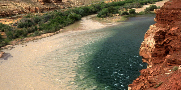
David Dean studies hydrology, geomorphology, and sediment transport of rivers in arid and semi-arid ecosystems.
As a research hydrologist with the GCMRC and SBSC, I conduct original research linking hydrology and sediment transport to fluvial geomorphic processes. My research is conducted in the Rio Grande in the Big Bend region of far west Texas, the Green and Yampa Rivers in Dinosaur National Monument, the Green and Colorado Rivers in Canyonlands National Park, the Little Colorado River and its tributaries in northern Arizona, and the Colorado River in Grand Canyon National Park. My research aims to quantify how hydrologic and geomorphic processes respond to factors such as climate change, large-scale water development and management, the widespread establishment of non-native riparian plants, and anthropogenic modifications to fluvial bottomlands. All of these perturbations directly affect how water and sediment are routed through fluvial drainage networks, which controls the geomorphic behavior, and biologic processes of these river systems.
Much of my work incorporates the use of acoustic instrumentation to passively monitor suspended-sediment transport processes on rivers with high suspended-sediment loads. This work is paired with measurements of geomorphic change using a variety of data and techniques including: high-resolution topographic data collected with real-time-kinematic GPS and LIDAR, aerial imagery, and analysis of historical hydrologic and geomorphic data. My work is directly relevant to the primary scientific understanding of the hydrologic and geomorphic behavior of these rivers, as well as the management actions that may help mitigate fluvial perturbations that have occurred. My work also focuses on the biogeomorphic interactions between stream flow, sediment transport, and riparian vegetation, and how those interactions can result in negative and/or positive feedbacks of geomorphic change.
Professional Experience
2014 - present: Research Hydrologist, USGS Southwest Biological Science Center, Grand Canyon Monitoring and Research Center
2009 - 2014: Research Associate/Lab Manager, Department of Watershed Sciences, Geomorphology Lab, Utah State University
2006: Staff Scientist, StreamLab 2006, National Center for Earth Surface Dynamics, Saint Anthony Falls Laboratory, University of MN
2005: Laboratory Instructor, Environmental Geology, University of Saint Thomas, St. Paul, MN
2002, 2004, 2006: Instructor, Geologic Field Camp in Southeastern U.S., University of Saint Thomas, St. Paul, MN
2002 - 2004: Staff Geologist, Meisch & Associates, Ltd., Environmental Consultants, Oakdale, MN
Education and Certifications
M.S., 2006-2009: Utah State University, Logan, UT. Thesis: "A River Transformed: Historic Geomorphic Changes of the Lower Rio Grande in the Big Bend Region of Texas, Chihuahua, and Coahuila"
B.A., 1997-2001: University of St. Thomas, St. Paul, MN, majors in geology and geography
Science and Products
Proceedings of the Fiscal Year 2022 Annual Reporting Meeting to the Glen Canyon Dam Adaptive Management Program
Colorado River Basin Actionable and Strategic Integrated Science and Technology Project—Science strategy
The use of continuous sediment-transport measurements to improve sand-load estimates in a large sand-bedded river: The Lower Chippewa River, WI
The effects of requested flows for native fish on sediment dynamics, geomorphology, and riparian vegetation for the Green River in Canyonlands National Park, Utah
A river of change—The Rio Grande in the Big Bend region
Instruments, methods, rationale, and derived data used to quantify and compare the trapping efficiencies of four types of pressure-difference bedload samplers
Monitoring the results of stream corridor restoration
Assessing the hydrologic and physical conditions of a drainage basin
Self-limitation of sand storage in a bedrock-canyon river arising from the interaction of flow and grain size
The roles of flood magnitude and duration in controlling channel width and complexity on the Green River in Canyonlands, Utah, USA
Does channel narrowing by floodplain growth necessarily indicate sediment surplus? Lessons from sediment‐transport analyses in the Green and Colorado rivers, Canyonlands, Utah
Channel narrowing by inset floodplain formation of the lower Green River in the Canyonlands region, Utah
Non-USGS Publications**
**Disclaimer: The views expressed in Non-USGS publications are those of the author and do not represent the views of the USGS, Department of the Interior, or the U.S. Government.
River Sediment Dynamics
Measuring Suspended-Sediment Concentrations, Grain Sizes and Bedload using Acoustic Doppler Velocity Meters and Echologgers in the Lower Chippewa River, Wisconsin
Measuring Suspended-Sediment Concentrations, Grain Sizes, and Bedload using Multiple Single-Frequency Acoustic Doppler Profilers and Echologgers in the Lower Chippewa River, Wisconsin.
Suspended-Sediment Transport Dynamics of the Rio Grande/Rio Bravo
Digital elevation models and water surface profiles for the Colorado River in Cataract Canyon, Canyonlands National Park and Glen Canyon National Recreation Area, Utah
Suspended-sediment, bedload, bed-sediment, and multibeam sonar data in the Chippewa River, WI
A snapshot of stakeholder science needs related to drought in the Colorado River Basin
Suspended-sediment, bed-sediment, and in-channel topographical data at the Green River at Mineral Bottom near Canyonlands National Park, and Colorado River at Potash, UT stream gages
Rio Grande 2012 Vegetation and Water Classification Data in the Big Bend Region
Geomorphic Change Data for the Little Colorado River, Arizona, USA

Colorado River Basin Projects
The Colorado River Basin Actionable and Strategic Integrated Science and Technology Team has created an interactive map of USGS projects to highlight the integrated science currently conducted within the Colorado River Basin. These projects are not all inclusive of the work conducted by the USGS within the CRB, but highlight the broad range of integrated science currently conducted.
Three podcasts about the Rio Grande with David Dean. Click the link below to listen and read the accompanying article.
Science and Products
- Publications
Filter Total Items: 21
Proceedings of the Fiscal Year 2022 Annual Reporting Meeting to the Glen Canyon Dam Adaptive Management Program
(Hartwell) This report is prepared primarily to account for work conducted and products delivered in FY 2022 by GCMRC and to inform the Technical Work Group of science conducted by GCMRC and its cooperators in support of the Glen Canyon Dam Adaptive Management Program (GCDAMP). It includes a summary of accomplishments, modifications to work plans, results, and recommendations related to projects iAuthorsDavid Topping, Paul Grams, Emily C. Palmquist, Joel B. Sankey, Helen C. Fairley, Bridget Deemer, Charles Yackulic, Theodore Kennedy, Anya Metcalfe, Maria C. Dzul, David Ward, Mariah Aurelia Giardina, Lucas Bair, Thomas Gushue, Caitlin M. Andrews, Ronald E. Griffiths, David Dean, Keith Kohl, Michael J Moran, Nicholas Voichick, Thomas A. Sabol, Laura A. Tennant, Kimberly Dibble, Michael C. RungeColorado River Basin Actionable and Strategic Integrated Science and Technology Project—Science strategy
The U.S. Geological Survey (USGS) conducts a wide variety of science that improves understanding of droughts and their effects on ecosystems and society. This work includes data collection and monitoring of aquatic and terrestrial systems; assessment and analysis of patterns, trends, drivers, and impacts of drought; development and application of predictive models; and delivery of information andAuthorsKatharine G. Dahm, Todd Hawbaker, Rebecca J. Frus, Adrian P. Monroe, John B. Bradford, William J. Andrews, Alicia Torregrosa, Eric D. Anderson, David Dean, Sharon L. QiThe use of continuous sediment-transport measurements to improve sand-load estimates in a large sand-bedded river: The Lower Chippewa River, WI
Accurately determining sediment loads is necessary for managing river environments but is difficult because multiple processes can lead to large discharge-independent changes in sediment transport. Thus, estimations of sediment load using discharge–sediment rating curves fit to sparse or historical sediment-transport measurements can be inaccurate, necessitating alternative approaches to reduce unAuthorsDavid Dean, David Topping, D. D. Buscombe, Joel T. Groten, Jeffrey R. Ziegeweid, Faith A. Fitzpatrick, John (William) Lund, Erin Nicole CoenenThe effects of requested flows for native fish on sediment dynamics, geomorphology, and riparian vegetation for the Green River in Canyonlands National Park, Utah
Releases of water from Flaming Gorge Dam together with climate-related variations in runoff determine the streamflow regime of the Green River, which affects the physical characteristics of the channel and riparian ecosystem of the Green River corridor in Canyonlands National Park. The dam has decreased peak streamflows and raised base streamflows, resulting in vegetation encroachment and channelAuthorsPaul E. Grams, Jonathan M. Friedman, David Dean, David J. ToppingA river of change—The Rio Grande in the Big Bend region
The Big Bend region is located within the heart of the Chihuahan Desert of North America. Within this region, the Rio Grande, referred to as the Rio Bravo in Mexico, is the international border between the United States and Mexico. The area known as the Big Bend is named after the large northerly bend that the river makes before flowing southeast to the Gulf of Mexico. This region is environmentalAuthorsDavid DeanInstruments, methods, rationale, and derived data used to quantify and compare the trapping efficiencies of four types of pressure-difference bedload samplers
Bedload and ancillary data were collected to calculate and compare the bedload trapping efficiencies of four types of pressure-difference bedload samplers as part of episodic, sediment-recirculating flume experiments at the St. Anthony Falls Laboratory, University of Minnesota, Minneapolis, in January–March 2006. The bedload-sampler experiments, which were conceived, organized, and led by the U.S.AuthorsJohn R. Gray, Gregory E. Schwarz, David Dean, Jonathan A. Czuba, Joel T. GrotenMonitoring the results of stream corridor restoration
Often overlooked and underfunded, ecological monitoring is an essential component of stream-restoration work. It helps practitioners to identify successful restoration practices, detect ineffective ones, and adjust their adaptive-management activities to improve efficacy (Bernhardt and Palmer 2011). Monitoring, along with research and modeling, are the three legs of the scientific stool that suppoAuthorsDaniel Bunting, Andrew M. Barton, Brooke M. Bushman, Barry Chernoff, Kelon Crawford, David Dean, Eduardo Gonzalez, Jeanmarie Haney, O. Hinojosa-Huerta, Helen M. Poulos, J Renfrow, Holly E. Richter, Carlos A. Sifuentes Lugo, Juliet C. Stromberg, Dale S. Turner, K. Urbanczyk, Mark K. BriggsAssessing the hydrologic and physical conditions of a drainage basin
An assessment of a drainage basin and its stream corridor will provide the data and information needed to understand current biophysical conditions and trends. Developing an understanding of the drivers of change is the next essential step for restoration success (Osterkamp and Toy, 1997; Corenbilt et al., 2007; Briggs and Osterkamp, 2003), Shields et al. 2003; Osterkamp et al., 2011). EstablishinAuthorsWaite Osterkamp, Mark K. Briggs, David Dean, Alfredo RodriquezSelf-limitation of sand storage in a bedrock-canyon river arising from the interaction of flow and grain size
Bedrock-canyon rivers tend to be supply limited because they are efficient transporters of sediment and not because the upstream supply of sediment is small. A byproduct of this supply limitation is that the finer alluvium stored in these rivers has shorter residence times and smaller volumes than in alluvial rivers. To improve our understanding of disequilibrium sediment transport and its effectAuthorsDavid Topping, Paul Grams, Ronald E. Griffiths, David Dean, Scott A. Wright, Joel A. UnemaThe roles of flood magnitude and duration in controlling channel width and complexity on the Green River in Canyonlands, Utah, USA
Predictions of river channel adjustment to changes in streamflow regime based on relations between mean channel characteristics and mean flood magnitude can be useful to evaluate average channel response. However, because these relations assume equilibrium sediment transport, their applicability to cases where streamflow and sediment transport are decoupled may be limited. These general relationsAuthorsPaul Grams, David Dean, Alexander E. Walker, Alan Kasprak, John C. SchmidtDoes channel narrowing by floodplain growth necessarily indicate sediment surplus? Lessons from sediment‐transport analyses in the Green and Colorado rivers, Canyonlands, Utah
Analyses of suspended sediment transport provide valuable insight into the role that sediment supply plays in causing geomorphic change. The sediment supply within a river system evolves depending on the discharge, flood frequency and duration, changes in sediment input, and ecohydraulic conditions that modify sediment transport processes. Changes in supply can be evaluated through analyses of couAuthorsDavid Dean, David Topping, Paul Grams, Alexander E. Walker, John C. SchmidtChannel narrowing by inset floodplain formation of the lower Green River in the Canyonlands region, Utah
The lower Green River episodically narrowed between the mid-1930s and present day through deposition of new floodplains within a wider channel that had been established and/or maintained during the early twentieth century pluvial period. Comparison of air photos spanning a 74-yr period (1940−2014) and covering a 61 km study area shows that the channel narrowed by 12% from 138 ± 3.4 m to 122 ± 2.1AuthorsAlexander E. Walker, Johnnie N. Moore, Paul Grams, David Dean, John C. SchmidtNon-USGS Publications**
Dean, D.J., Schmidt, J.C., 2011, The role of feedback mechanisms in historic channel changes of the Lower Rio Grande in the Big Bend Region: Geomorphology, v. 126, no. 3-4, p. 333–349, https://doi.org/10.1016/j.geomorph.2010.03.009.Keller, D.L, Laub, B.G., Birdsey, P., Dean, D.J., 2014, Effects of flooding and tamarisk removal on habitat for sensitive fish species in the San Rafael River, Utah—implications for fish habitat and enhancement and future restoration efforts: Environmental Management, v. 54.3, p. 465–478, https://doi.org/10.1007/s00267-014-0318-7.**Disclaimer: The views expressed in Non-USGS publications are those of the author and do not represent the views of the USGS, Department of the Interior, or the U.S. Government.
- Science
River Sediment Dynamics
Sediment controls the physical habitat of river ecosystems. Changes in the amount and areal distribution of different sediment types cause changes in river-channel form and river habitat. The amount and type of sediment suspended in the water column determines water clarity. Understanding sediment transport and the conditions under which sediment is deposited or eroded from the various...Measuring Suspended-Sediment Concentrations, Grain Sizes and Bedload using Acoustic Doppler Velocity Meters and Echologgers in the Lower Chippewa River, Wisconsin
Sediment from the Chippewa River deposits in the Mississippi River navigation channel, sometimes disrupting commercial barge traffic and resulting in expensive and ecologically disruptive dredging operations. The USGS is using new applications of hydroacoustic technologies to better understand sediment transport in the Chippewa River and associated effects on commercial navigation.Measuring Suspended-Sediment Concentrations, Grain Sizes, and Bedload using Multiple Single-Frequency Acoustic Doppler Profilers and Echologgers in the Lower Chippewa River, Wisconsin.
The Upper Mississippi River (UMR) provides critical habitat for hundreds of aquatic species and provides Minnesota with a transportation link to the rest of the world. Reliable measurements of sediment are important for making decisions as part of maintaining the channel. In 2014, sediment deposition in the navigation channel caused channel closures of the UMR delaying commercial navigation for 3...Suspended-Sediment Transport Dynamics of the Rio Grande/Rio Bravo
The Rio Grande/Rio Bravo (hereafter referred to as the Rio Grande) in the Big Bend region of Texas, USA, and Chihuahua, and Coahuila, MX has substantially narrowed since the early 1900s. This narrowing has been caused by the construction and operation of dams and irrigation diversions in upstream reaches of the Rio Grande in the U.S. and the Rio Conchos in Mexico that has reduced mean and peak... - Data
Digital elevation models and water surface profiles for the Colorado River in Cataract Canyon, Canyonlands National Park and Glen Canyon National Recreation Area, Utah
These data consist of measurements of riverbed and floodplain bathymetry and topography, measurements of water-surface elevations and ancillary data. These data are specific to the corridor of the Colorado River from the confluence of the Green and Colorado Rivers near Spanish Bottom, Utah in Canyonlands National Park to the confluence with the Dirty Devil River in Glen Canyon National RecreationSuspended-sediment, bedload, bed-sediment, and multibeam sonar data in the Chippewa River, WI
These data were compiled for analyses of sediment transport within the Chippewa River, WI. Objective(s) of our study were to determine sand loads contributed by the Chippewa River to the Mississippi River. These data include physical suspended-sediment samples, acoustical suspended-sediment measurements, acoustical suspended-sediment loads, quasi-continuous measurements of bed-elevation, multibeamA snapshot of stakeholder science needs related to drought in the Colorado River Basin
Stakeholder science needs were determined by reviewing more than 200 recently published literature items and web pages from Colorado River Basin (CRB) stakeholders. These stakeholder communications were used to characterize over 400 stakeholder science needs by reviewing their priorities, strategies, issues, missions, and concerns related to drought in the CRB. Members of the CRB Integrated SciencByArizona Water Science Center, California Water Science Center, Colorado Water Science Center, Fort Collins Science Center, Geology, Geophysics, and Geochemistry Science Center, Nevada Water Science Center, New Mexico Water Science Center, Southwest Biological Science Center, Utah Water Science Center, Wyoming-Montana Water Science Center, Colorado River Basin: Actionable and Strategic Integrated Science and TechnologySuspended-sediment, bed-sediment, and in-channel topographical data at the Green River at Mineral Bottom near Canyonlands National Park, and Colorado River at Potash, UT stream gages
Sediment Data: These data include (1) physical suspended-sediment sample data including suspended silt and clay concentration, suspended-sand concentration, and suspended-sand grain size distribution, (2) bed-sediment sample data with complete grain size analyses, and (3) 15-minute acoustical sediment data measured using a multifrequency array (1MHz and 2MHz) of sidelooking acoustic Doppler profilRio Grande 2012 Vegetation and Water Classification Data in the Big Bend Region
These data are spatial polygon data and remote sensing image-based classification maps of surface water and vegetation species for 2012 along the Rio Grande River in Big Bend National Park in Texas. The geographic extent of the classification spans from the end of Mariscal Canyon to 5 km after the end of Boquillas Canyon, totaling approximately 77 Km of the river. The maps are also restricted to aGeomorphic Change Data for the Little Colorado River, Arizona, USA
These data include geospatial files (shapefiles and orthorectified raster images) and an input hydrograph (csv) for a 1-dimensional unsteady hydrologic model. Shapefiles consist of active channel boundarys and channel centerlines of six reaches of the LCR beginning ~4.5 km above Grand Falls, AZ, and ending ~12.8 km downstream from Cameron, AZ. These reaches are (1) the ~4.5 km above Grand Falls re - Multimedia
Rio Grande in Big Bend National Park repeat photography from about 1945 and 2008 showing channel narrowing
- Web Tools
Colorado River Basin Projects
The Colorado River Basin Actionable and Strategic Integrated Science and Technology Team has created an interactive map of USGS projects to highlight the integrated science currently conducted within the Colorado River Basin. These projects are not all inclusive of the work conducted by the USGS within the CRB, but highlight the broad range of integrated science currently conducted.
- News
Three podcasts about the Rio Grande with David Dean. Click the link below to listen and read the accompanying article.