
Vegetation monitoring: How one square meter can tell the story of 255 river miles along the Colorado River
The goal of SBSC's Grand Canyon Monitoring and Research Center’s (GCMRC) riparian vegetation monitoring program is to assess changes and trends in plant species composition and cover and relate those changes to river hydrology, climate, geomorphology, and the operations of Glen Canyon Dam.
The GCMRC vegetation program collaborates with Glen Canyon National Recreation Area, Grand Canyon National Park, National Park Service (NPS) Northern Colorado Plateau Inventorying and Monitoring Network’s big-river program, the Navajo Nation botany program, and the Hualapai Tribe herbarium to connect these monitoring results to management needs across the Colorado River basin.
Monitoring is done by annual field campaigns collecting data on plant cover and diversity, and semi-decadal remote sensing. Together, these datasets can be analyzed to distinguish the effects of dam operations from other environmental and human-caused changes on riparian vegetation.

Each year, GCMRC’s ground-based riparian vegetation monitoring program samples 80-100 randomly selected sites between Glen Canyon Dam and Separation Canyon at river mile 240.
The program, along with a team of physical scientists, also samples the same 45 sandbars every year as part of a long-term monitoring project. At an average site, 27 one-square meter (m2) plots are surveyed. That’s approximately 3,600 distinct 1m2 plots surveyed every year!


Ground-based monitoring and remote sensing analyses of overflight imagery enables the classification of landscapes and detection of changes throughout the river corridor. These robust data sets help to tell the story of a changing riparian landscape.
General Methods:
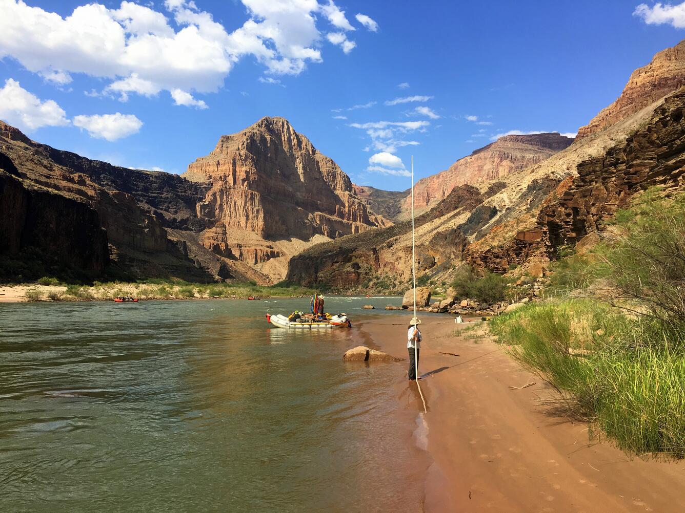
At the beginning of each year, equal numbers of sites containing different geomorphic features are selected using a random number generator. These three feature types: sandbars, debris fans, and channel margins, are the common features present along the edge of the river. Within a site, three distinct hydrologic zones are sampled.
The zone closest to the river that can be inundated daily by standard flows is called the active channel. Standard, daily releases from Glen Canyon Dam can reach up to 25,000 cubic feet per second (cfs).

Above the active channel lies the active floodplain. This zone is inundated by flows up to 45,000 cfs, which occur during High Flow Experiments (HFEs). The last hydrologic zone is the inactive floodplain, which could only be flooded by flows greater than 45,000 cfs. Under current dam operations, this zone is no longer inundated.


At a standard site, field personnel set up three transects perpendicular to the river along a feature. Nine plots are placed along each transect, three in each of the hydrologic zones.

For each square-meter plot, botanists record the types of plants present, the relative area covered by each plant species, and characteristics about the plot including soil type, organic litter, and presence of dead vegetation. Elevations of each plot are also recorded. Plants that can’t be identified in the field are collected and preserved for later identification.

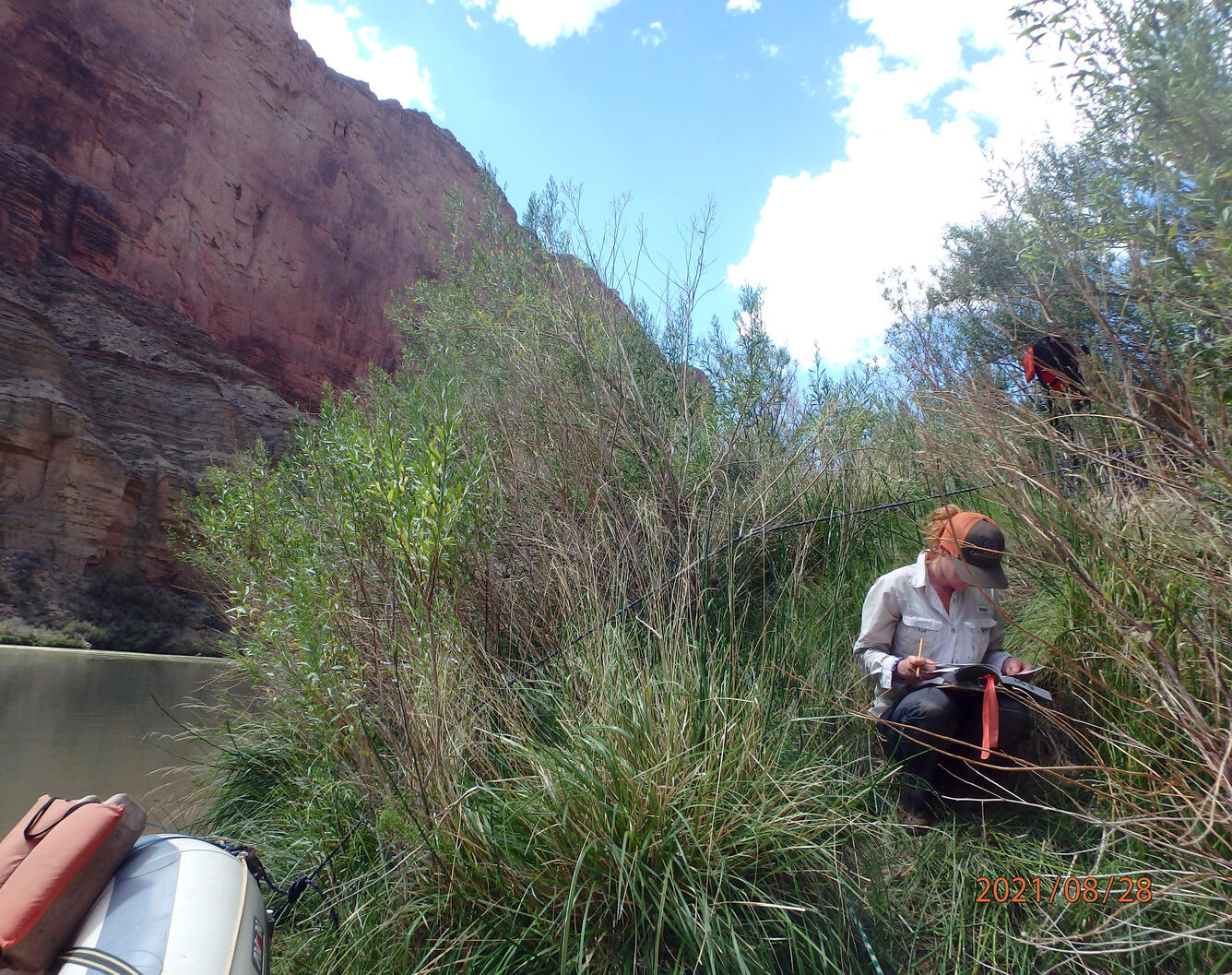
By surveying different geomorphic feature types and hydrologic zones, a comprehensive view of riparian plant communities along the Colorado River in Grand Canyon emerges.
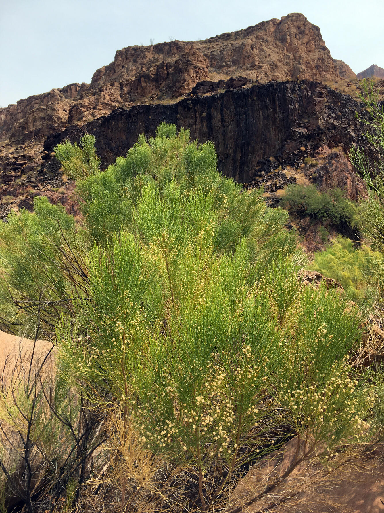
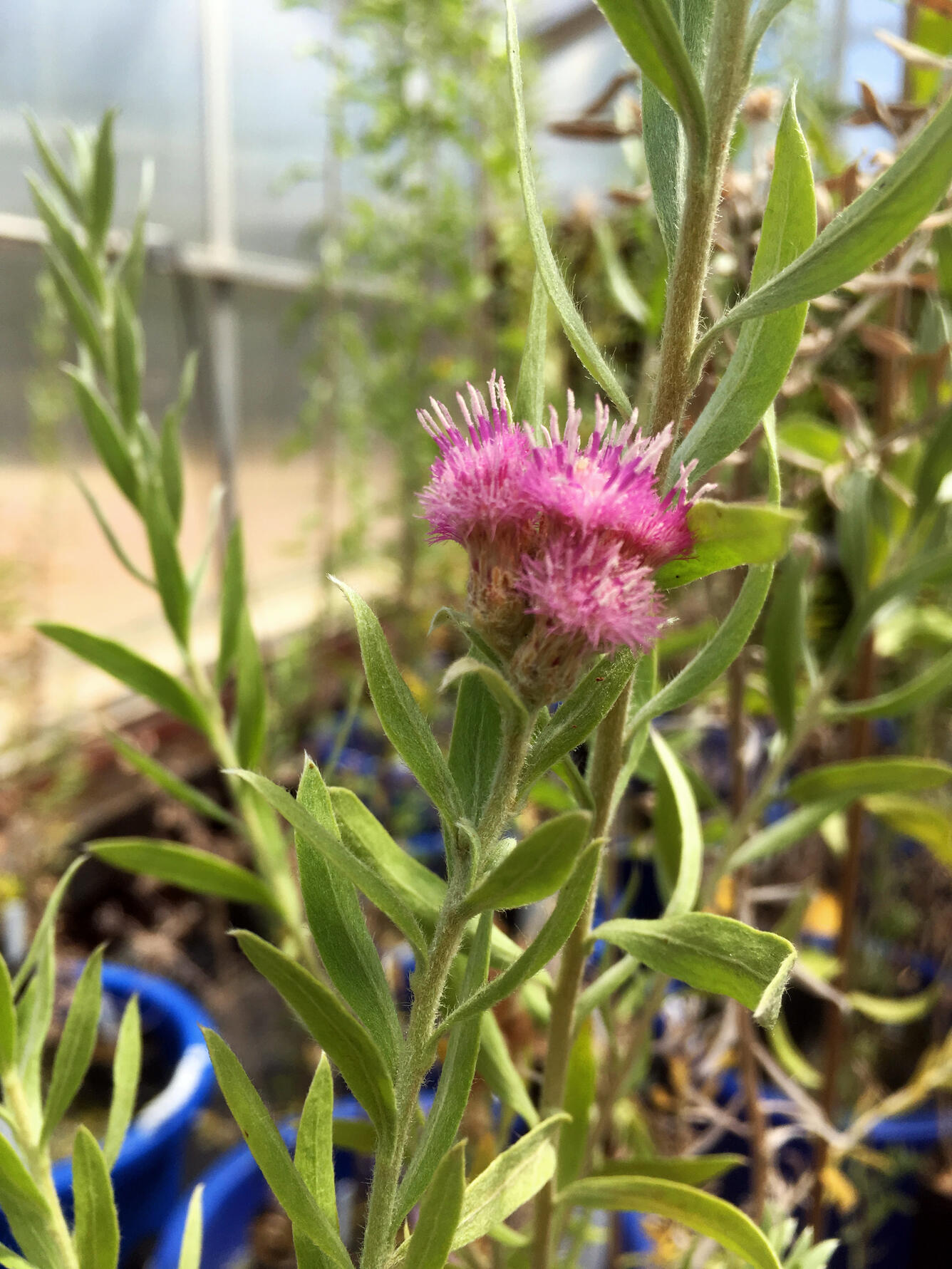
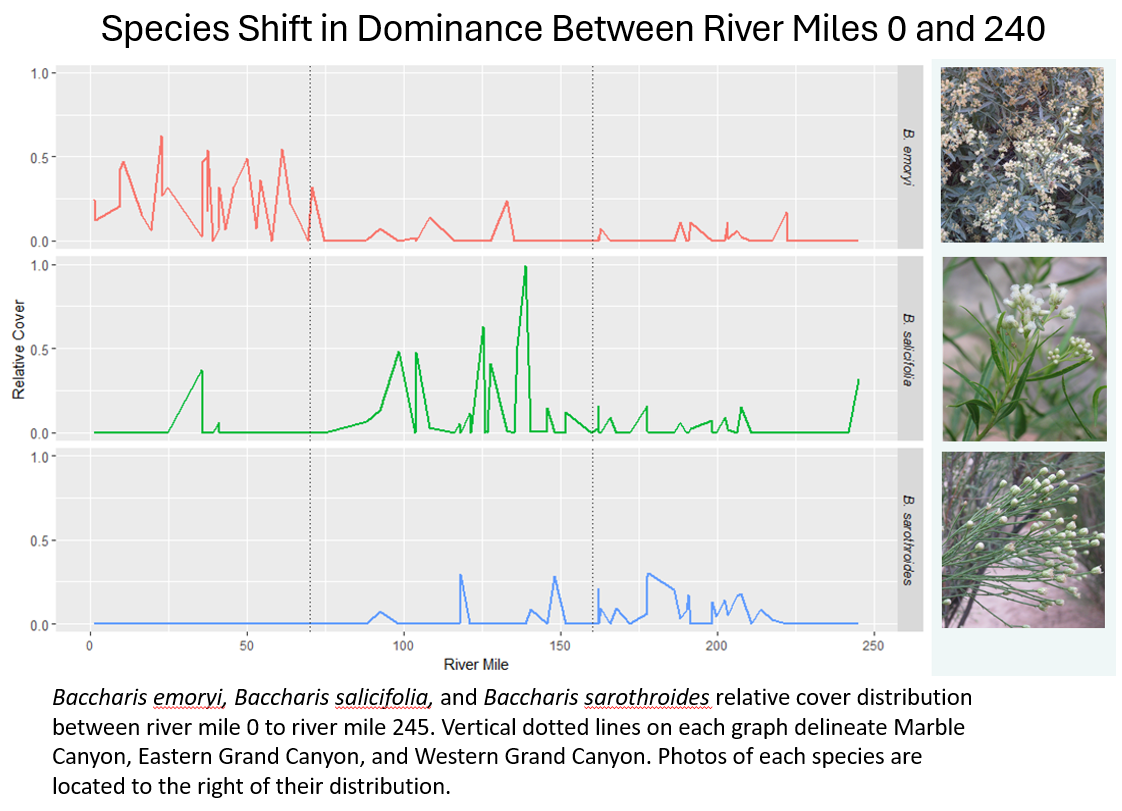
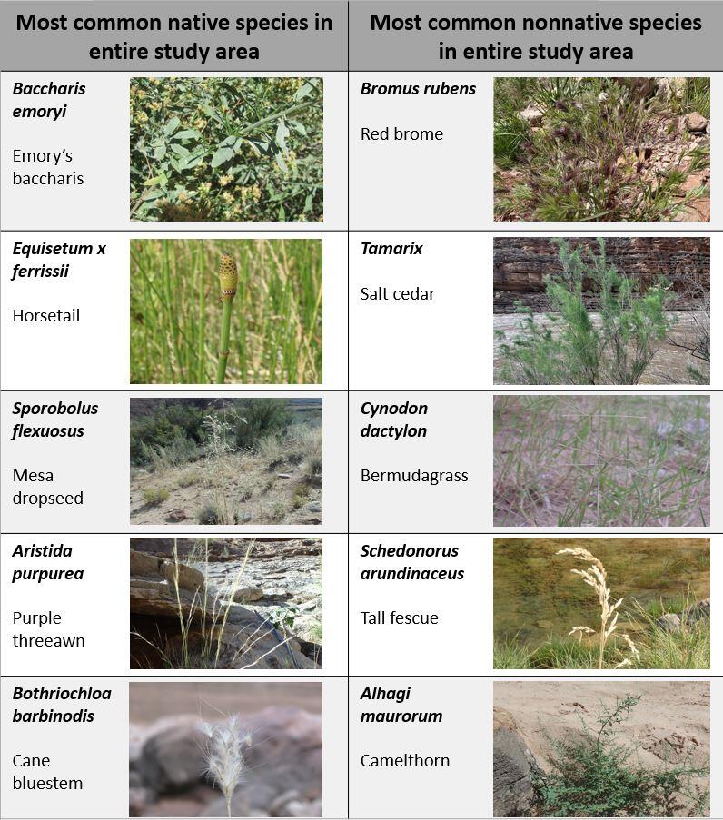
The upper reaches of Grand Canyon are at a higher elevation and closer to the Great Basin Desert, so some common plants in this reach, such as Emory’s baccharis (Baccharis salicina) and white sagebrush (Artemisia ludoviciana) are more typical of the Great Basin.
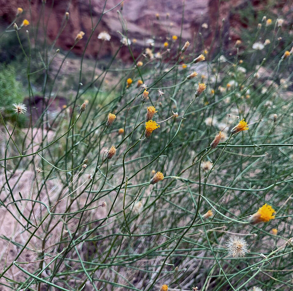
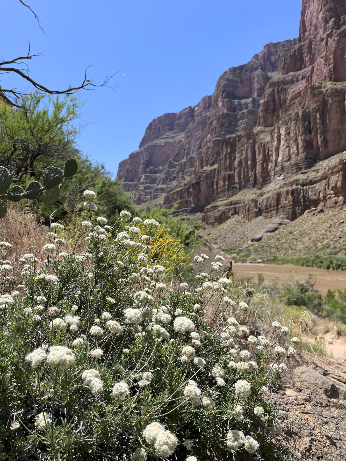
Moving downstream, changes in elevation, temperature, precipitation patterns, and geography support the growth of plants typically associated with the Sonoran Desert, including seep-willow (Baccharis salicifolia), desertbroom (Baccharis sarothroides), and arrowweed (Pluchea sericea).
Overall, ground-based vegetation monitoring along the Colorado River through Grand Canyon has found that the diversity of plant species is richest in Marble Canyon and decreases as one moves westward, downstream, and down in elevation. The communities along the river also change as one moves along these gradients.
Results
Analyses of the data collected by ground-based monitoring are released in five-year increments as Status and Trends reports. Findings about other topics including plant adaptations and physiology, plant community structure, and plant responses to flow regimes are published in scientific journals as studies are completed. You can access the most current articles and five-year status and trends reports under the Publications tab on this webpage.
Below are other science projects associated with this project.

Riparian Vegetation in Grand Canyon: An Overview

Riparian Remote Sensing in the Colorado River and Grand Canyon Region
The goal of SBSC's Grand Canyon Monitoring and Research Center’s (GCMRC) riparian vegetation monitoring program is to assess changes and trends in plant species composition and cover and relate those changes to river hydrology, climate, geomorphology, and the operations of Glen Canyon Dam.
The GCMRC vegetation program collaborates with Glen Canyon National Recreation Area, Grand Canyon National Park, National Park Service (NPS) Northern Colorado Plateau Inventorying and Monitoring Network’s big-river program, the Navajo Nation botany program, and the Hualapai Tribe herbarium to connect these monitoring results to management needs across the Colorado River basin.
Monitoring is done by annual field campaigns collecting data on plant cover and diversity, and semi-decadal remote sensing. Together, these datasets can be analyzed to distinguish the effects of dam operations from other environmental and human-caused changes on riparian vegetation.
Each year, GCMRC’s ground-based riparian vegetation monitoring program samples 80-100 randomly selected sites between Glen Canyon Dam and Separation Canyon at river mile 240.
The program, along with a team of physical scientists, also samples the same 45 sandbars every year as part of a long-term monitoring project. At an average site, 27 one-square meter (m2) plots are surveyed. That’s approximately 3,600 distinct 1m2 plots surveyed every year!
Ground-based monitoring and remote sensing analyses of overflight imagery enables the classification of landscapes and detection of changes throughout the river corridor. These robust data sets help to tell the story of a changing riparian landscape.
General Methods:
At the beginning of each year, equal numbers of sites containing different geomorphic features are selected using a random number generator. These three feature types: sandbars, debris fans, and channel margins, are the common features present along the edge of the river. Within a site, three distinct hydrologic zones are sampled.
The zone closest to the river that can be inundated daily by standard flows is called the active channel. Standard, daily releases from Glen Canyon Dam can reach up to 25,000 cubic feet per second (cfs).
Above the active channel lies the active floodplain. This zone is inundated by flows up to 45,000 cfs, which occur during High Flow Experiments (HFEs). The last hydrologic zone is the inactive floodplain, which could only be flooded by flows greater than 45,000 cfs. Under current dam operations, this zone is no longer inundated.
At a standard site, field personnel set up three transects perpendicular to the river along a feature. Nine plots are placed along each transect, three in each of the hydrologic zones.
For each square-meter plot, botanists record the types of plants present, the relative area covered by each plant species, and characteristics about the plot including soil type, organic litter, and presence of dead vegetation. Elevations of each plot are also recorded. Plants that can’t be identified in the field are collected and preserved for later identification.
By surveying different geomorphic feature types and hydrologic zones, a comprehensive view of riparian plant communities along the Colorado River in Grand Canyon emerges.
The upper reaches of Grand Canyon are at a higher elevation and closer to the Great Basin Desert, so some common plants in this reach, such as Emory’s baccharis (Baccharis salicina) and white sagebrush (Artemisia ludoviciana) are more typical of the Great Basin.
Moving downstream, changes in elevation, temperature, precipitation patterns, and geography support the growth of plants typically associated with the Sonoran Desert, including seep-willow (Baccharis salicifolia), desertbroom (Baccharis sarothroides), and arrowweed (Pluchea sericea).
Overall, ground-based vegetation monitoring along the Colorado River through Grand Canyon has found that the diversity of plant species is richest in Marble Canyon and decreases as one moves westward, downstream, and down in elevation. The communities along the river also change as one moves along these gradients.
Results
Analyses of the data collected by ground-based monitoring are released in five-year increments as Status and Trends reports. Findings about other topics including plant adaptations and physiology, plant community structure, and plant responses to flow regimes are published in scientific journals as studies are completed. You can access the most current articles and five-year status and trends reports under the Publications tab on this webpage.
Below are other science projects associated with this project.
Riparian Vegetation in Grand Canyon: An Overview