
Surface Water Modeling and Analysis
Surface Water Modeling and Analysis
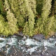
In order to understand complicated surface-water networks within a basin and conduct different land-planning scenarios that affect the hydrology of the system, computer models need to be constructed to account for all the variables in the water budget such as rainfall and evaporation and the effects of the land surface and soils on the timing and amount of runoff. These rainfall-runoff or watershed models use the comparison of observed runoff against simulated runoff to calibrate and validate the model. Hydraulic models examine channel geometry and channel features to simulate river channel velocity and stage for a given river discharge. These models are often used in flood-hazard studies and habitat analysis.
Filter Total Items: 21
Watersheds and Fluvial Systems Team
The Watersheds and Fluvial Systems Team at the Washington Water Science Center provides reliable science to understand how watersheds, rivers, and streams function—and how they respond to a changing world. We aim to build partnerships that foster informed decision-making and effective resource management throughout the Pacific Northwest region and across the U.S.
Integrating Stormwater Drainage into USGS StreamStats Application for the Duwamish and Lower Green River
The U.S. Geological Survey (USGS) is developing a Duwamish and Lower Green River Storm Drain StreamStats application to help communities and decision-makers address stormwater challenges in the Duwamish and lower Green River watershed. This free, publicly accessible tool will allow users to delineate stormwater drainage areas and calculate basin characteristics, supporting climate resiliency and...

Streamflow Permanence in the Pacific Northwest
Not all rivers and streams flow year-round. Understanding when and where streams flow or go dry is critical for managing land use, water quality, and water availability on landscapes. The USGS and partners are studying streamflow permanence in the Pacific Northwest. We are gathering data, developing new models, and providing data visualization and outreach tools.

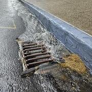
Integration of Urban Stormwater Infrastructure in Modeling Water Quality Patterns in Small Urban Streams
The Issue: Stormwater can quickly run off impervious surfaces delivering potentially polluted water to streams and rivers in the Puget Sound region. Runoff from impervious surfaces can either be directly connected to streams through stormwater pipes or indirectly connected if runoff is routed to some other surface such as grass or a feature like a stormwater management structure. It is currently...

Updated classifications of flow permanence on streams in the Colville National Forest
The Issue: Streamflow permanence refers to the probability that a stream will lose surface flow (become a dry channel), as well as the timing, duration, and frequency of drying. Patterns of streamflow permanence drive important decisions regarding forest management and other land uses. The Colville National Forest Land and Resource Management Plan (2019), for example, specifies riparian management...

Analysis of USGS Surface Water Monitoring Networks
The issue: National interests in water information are important but challenging to incorporate into planning and operation of a monitoring network driven by local information needs. These interests include an understanding of the spatial variability in water availability across the United States, anthro-physical factors including climate and land use that affect water availability, and federal...

Water use
The Issue: Comprehensive water-use data and analysis of water-use information are needed to quantify the stress on existing supplies and to better model and evaluate possible water-supply management options to supplement traditional water-supply approaches. Advances have been made in the ability to control, divert, and develop water, but little attention has been paid to keeping accurate accounts...

RRAWFLOW: Rainfall-Response Aquifer and Watershed Flow Model
RRAWFLOW: Rainfall-Response Aquifer and Watershed Flow Model

White River Bioenergetics
The White River Basin is located in western Washington and drains an area of about 500 square miles. Rivers in the White River Basin are fed by melt water from glaciers on Mt. Rainier, runoff from snowmelt and rain, and groundwater discharge. Beginning in the early to mid-twentieth century, the White River from river mile (RM) 9 to its confluence with the Puyallup River was extensively channelized...

NWIFC Water Assessment
Water resources are essential to Native American Tribes in western Washington for instream and out-of-stream uses. As the demand for water across the region increases, western Washington Tribes need critical information about water availability, water use, and ecological needs for water in order to manage their resources. To assess tribal water resources comprehensively in western Washington, the...

Hood Canal
In September 2002, fish in Hood Canal near Hoodsport were under stress from low concentrations of dissolved oxygen, prompting the Washington State Department of Fish and Wildlife to temporarily close parts of Hood Canal to some types of fishing during the month of October. In 2003, low dissolved oxygen conditions worsened, some fish kills were observed as early as June, and by October large fish...

Navigability Potential of Washington Rivers
U.S. Geological Survey (USGS) developed a method to map the navigability potential of Washington rivers using physical characteristics of river channels. The work supported efforts by the Washington Department of Natural Resources (DNR) to determine which rivers are navigable and fall under state ownership. According to the Washington State Constitution (Article XVII, Section 1), the state claims...