
Streamflow Permanence in the Pacific Northwest
Not all rivers and streams flow year-round. Understanding when and where streams flow or go dry is critical for managing land use, water quality, and water availability on landscapes.
The USGS and partners are studying streamflow permanence in the Pacific Northwest. We are gathering data, developing new models, and providing data visualization and outreach tools.
Streamflow permanence refers to the capacity of watersheds and their stream channels to support surface flows. Determination of streamflow permanence is critical for managing land use, water quality, and water availability on landscapes. Current patterns of streamflow permanence are highly uncertain, especially under land use changes and environmental extremes such as drought, both of which can profoundly alter the hydrologic cycle.
Study Overview
Our overall objective is to develop a new framework for updating information on streamflow permanence in Oregon, Washington, and Idaho. We also want to make it easier to integrate this information into nationwide streamflow permanence efforts internal and external to the USGS.
An important component of this effort is new data collection. Specifically, we are collecting field observations of whether streams have water or are dry (flow/no flow). We are partnering with the Bureau of Land Management, U.S. Forest Service, and others to collect data from small streams located throughout the Pacific Northwest region. The new data will be used to update hydrography (locations of streams), streamflow characteristics (presence of surface flows), and adapt new modeling and data delivery platforms for science and management applications.
The results of this project will integrate with the USGS Three-Dimensional Hydrography Program (3DHP), The results will also support efforts to provide improved streamflow presence predictions and water use and availability assessments. Cooperative development of streamflow permanence tools with USGS partners will ensure their applicability to land, water, and species management decisions.
This project includes four main components which will be pursued over three years (2023-2025). We may develop additional phases beyond the initial project. The tasks associated with each component are described below. Coordination with partners and interested parties is woven into each task.
Sample Design
We developed a statistically based sample design to identify priority locations for data collection. A Bayesian approach guided where sampling can be most useful (e.g., focusing on streams with an intermediate probability of having year-round flow). The methods used to generate the sample design will be published in a peer-reviewed data release. We uploaded the locations to the mobile applications we use for data collection to allow field crews to quickly prioritize where they collect observations.

Data Collection & Curation
Tiered approach to streamflow permanence data
We are taking a tiered approach to data collection. This means that we are integrating data sources that vary in spatial and temporal resolution as well as cost. Some of these data sources include:
Streamflow monitoring in select small streams during summer low flow (2023-2024). Continuous flow monitoring produces high-resolution data through time, but it only covers a small portion of the stream network. Additionally, streamgages are typically not located in headwater streams, so their spatial coverage is limited. We are operating streamgages in three small, forested basins in western Washington, central Oregon, and southern Idaho. Rating curves of the summer low flow period will be published in USGS National Water Information System (NWIS). These streamgages can provide information that links the simple one-time flow/no flow observation data in small streams to the streamgages that typically are located much farther downstream.
Learn more about streamgaging.
View data collected from these streamgages:
- USGS Current Conditions for USGS 12480840 BLUE CREEK AT FS 9738 NEAR LIBERTY, WA
- USGS Current Conditions for USGS 12480690 SWAUK CREEK AT MM 159.6 HWY 97 NEAR LIBERTY, WA
- USGS Current Conditions for USGS 12480700 HOVEY CREEK NEAR CLE ELUM, WA
- USGS Current Conditions for USGS 12480964 WILLIAMS CREEK NR LIBERTY, WA
- Field cameras. Field cameras at select locations in western Washington state provide a daily visual record of changes in streamflow along a stream section. This data can be visualized through the USGS Flow Photo Explorer
- Flow/No Flow observational data. Field observations of flow/no flow conditions in streams allow for a higher degree of spatial coverage, including targeted sampling. These are discrete (one-time) observations, so there is no record of change through time unless an observer returns to a location. Field observations are collected using the FLOwPER mobile application developed by USGS and USFS.
By mixing the types of data collected, we reach a more comprehensive understanding of streamflow permanence. Using “fit for purpose” data reduces the costs of data collection while achieving project goals.

Collecting Flow/No Flow observations with FLOwPER

We are organizing field campaigns to collect observations of flow/no flow conditions using the FLOwPER feature mapping application. The application is used to collect stream channel, streamflow permanence, and road-stream crossing data. We provide annual training to support data collection from our State and Federal partners.
FLOwPER field campaigns began in the Pacific Northwest region in 2019 and have facilitated thousands of observations in small streams that otherwise have no observed streamflow data. Our field campaigns focus on capturing late summer surface flow conditions. We review the datasets and release them to the public via ScienceBase.
Operational Streamflow Permanence Model Infrastructure
Development of Data Storage and Smart-Model Infrastructure
In order to run streamflow permanence models, field observations need to be processed to identify their location on a hydrographic (stream) network, a task referred to as georeferencing. There are several hydrographic networks in common use, including the NHDPlus High Resolution and new lidar-derived hydrographies from 3DHP. We are developing pipelines to more accurately georeference observations using multiple hydrographic datasets.
Additionally, we are developing operational streamflow permanence models that will ingest new data on a semi-annual schedule, are recalibrated based on this new data, and provide updated streamflow permanence predictions.
Translational Products
Guidelines for Use of Data Products
We are committed to making data products that are readily useful for decision-making. By providing guidelines, we prepare managers to use our data to answer questions like “Will my stream flow this year?”
In some locations, multiple types of streamflow permanence data are available. We will provide a workflow for how to reconcile these different types of data, which include PROSPER probabilities and NHD flowlines hydrographic classifications (perennial, intermittent, ephemeral).
FLOwPER flow/no flow field observations and predictions of streamflow permanence models are now available in the StreamStats application. Users can view data in the context of other important stream characteristics such as drainage area, precipitation, and flow probabilities. The results of this work will also be summarized and published in a journal article; the data reported in StreamsStats are available in the data releases.
- Probability of Streamflow Permanence (PROSPER) Model version 2.1 Output Layers for the Pacific Northwest region, 2004 - 2016
- Self-calibrating Palmer Drought Severity Index values averaged per water year with associated streamflow permanence data products for the HUC17 Pacific Northwest Region
Learn more about how to use these products in StreamStats.
Webpage for Project Team’s Streamflow Permanence Research
Our USGS Streamflow Permanence webpage serves as a hub for USGS and partner research. The page is meant to help researchers, resource managers, and decision-makers easily find information. It identifies the project need, who the partners are, and why they need these data and models. It also links to related products.

Dry stream near Blewett Pass, Washington.

Wet stream near Blewett Pass, Washington.
Explore other USGS research projects related to streamflow permanence in the Pacific Northwest.

Updated classifications of flow permanence on streams in the Colville National Forest
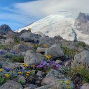
Drought preparedness in Mt. Rainier National Park

Probability of Streamflow Permanence (PROSPER)
Not all rivers and streams flow year-round. Understanding when and where streams flow or go dry is critical for managing land use, water quality, and water availability on landscapes.
The USGS and partners are studying streamflow permanence in the Pacific Northwest. We are gathering data, developing new models, and providing data visualization and outreach tools.
Streamflow permanence refers to the capacity of watersheds and their stream channels to support surface flows. Determination of streamflow permanence is critical for managing land use, water quality, and water availability on landscapes. Current patterns of streamflow permanence are highly uncertain, especially under land use changes and environmental extremes such as drought, both of which can profoundly alter the hydrologic cycle.
Study Overview
Our overall objective is to develop a new framework for updating information on streamflow permanence in Oregon, Washington, and Idaho. We also want to make it easier to integrate this information into nationwide streamflow permanence efforts internal and external to the USGS.
An important component of this effort is new data collection. Specifically, we are collecting field observations of whether streams have water or are dry (flow/no flow). We are partnering with the Bureau of Land Management, U.S. Forest Service, and others to collect data from small streams located throughout the Pacific Northwest region. The new data will be used to update hydrography (locations of streams), streamflow characteristics (presence of surface flows), and adapt new modeling and data delivery platforms for science and management applications.
The results of this project will integrate with the USGS Three-Dimensional Hydrography Program (3DHP), The results will also support efforts to provide improved streamflow presence predictions and water use and availability assessments. Cooperative development of streamflow permanence tools with USGS partners will ensure their applicability to land, water, and species management decisions.
This project includes four main components which will be pursued over three years (2023-2025). We may develop additional phases beyond the initial project. The tasks associated with each component are described below. Coordination with partners and interested parties is woven into each task.
Sample Design
We developed a statistically based sample design to identify priority locations for data collection. A Bayesian approach guided where sampling can be most useful (e.g., focusing on streams with an intermediate probability of having year-round flow). The methods used to generate the sample design will be published in a peer-reviewed data release. We uploaded the locations to the mobile applications we use for data collection to allow field crews to quickly prioritize where they collect observations.
Data Collection & Curation
Tiered approach to streamflow permanence data
We are taking a tiered approach to data collection. This means that we are integrating data sources that vary in spatial and temporal resolution as well as cost. Some of these data sources include:
Streamflow monitoring in select small streams during summer low flow (2023-2024). Continuous flow monitoring produces high-resolution data through time, but it only covers a small portion of the stream network. Additionally, streamgages are typically not located in headwater streams, so their spatial coverage is limited. We are operating streamgages in three small, forested basins in western Washington, central Oregon, and southern Idaho. Rating curves of the summer low flow period will be published in USGS National Water Information System (NWIS). These streamgages can provide information that links the simple one-time flow/no flow observation data in small streams to the streamgages that typically are located much farther downstream.
Learn more about streamgaging.
View data collected from these streamgages:
- USGS Current Conditions for USGS 12480840 BLUE CREEK AT FS 9738 NEAR LIBERTY, WA
- USGS Current Conditions for USGS 12480690 SWAUK CREEK AT MM 159.6 HWY 97 NEAR LIBERTY, WA
- USGS Current Conditions for USGS 12480700 HOVEY CREEK NEAR CLE ELUM, WA
- USGS Current Conditions for USGS 12480964 WILLIAMS CREEK NR LIBERTY, WA
- Field cameras. Field cameras at select locations in western Washington state provide a daily visual record of changes in streamflow along a stream section. This data can be visualized through the USGS Flow Photo Explorer
- Flow/No Flow observational data. Field observations of flow/no flow conditions in streams allow for a higher degree of spatial coverage, including targeted sampling. These are discrete (one-time) observations, so there is no record of change through time unless an observer returns to a location. Field observations are collected using the FLOwPER mobile application developed by USGS and USFS.
By mixing the types of data collected, we reach a more comprehensive understanding of streamflow permanence. Using “fit for purpose” data reduces the costs of data collection while achieving project goals.
Collecting Flow/No Flow observations with FLOwPER
We are organizing field campaigns to collect observations of flow/no flow conditions using the FLOwPER feature mapping application. The application is used to collect stream channel, streamflow permanence, and road-stream crossing data. We provide annual training to support data collection from our State and Federal partners.
FLOwPER field campaigns began in the Pacific Northwest region in 2019 and have facilitated thousands of observations in small streams that otherwise have no observed streamflow data. Our field campaigns focus on capturing late summer surface flow conditions. We review the datasets and release them to the public via ScienceBase.
Operational Streamflow Permanence Model Infrastructure
Development of Data Storage and Smart-Model Infrastructure
In order to run streamflow permanence models, field observations need to be processed to identify their location on a hydrographic (stream) network, a task referred to as georeferencing. There are several hydrographic networks in common use, including the NHDPlus High Resolution and new lidar-derived hydrographies from 3DHP. We are developing pipelines to more accurately georeference observations using multiple hydrographic datasets.
Additionally, we are developing operational streamflow permanence models that will ingest new data on a semi-annual schedule, are recalibrated based on this new data, and provide updated streamflow permanence predictions.
Translational Products
Guidelines for Use of Data Products
We are committed to making data products that are readily useful for decision-making. By providing guidelines, we prepare managers to use our data to answer questions like “Will my stream flow this year?”
In some locations, multiple types of streamflow permanence data are available. We will provide a workflow for how to reconcile these different types of data, which include PROSPER probabilities and NHD flowlines hydrographic classifications (perennial, intermittent, ephemeral).
FLOwPER flow/no flow field observations and predictions of streamflow permanence models are now available in the StreamStats application. Users can view data in the context of other important stream characteristics such as drainage area, precipitation, and flow probabilities. The results of this work will also be summarized and published in a journal article; the data reported in StreamsStats are available in the data releases.
- Probability of Streamflow Permanence (PROSPER) Model version 2.1 Output Layers for the Pacific Northwest region, 2004 - 2016
- Self-calibrating Palmer Drought Severity Index values averaged per water year with associated streamflow permanence data products for the HUC17 Pacific Northwest Region
Learn more about how to use these products in StreamStats.
Webpage for Project Team’s Streamflow Permanence Research
Our USGS Streamflow Permanence webpage serves as a hub for USGS and partner research. The page is meant to help researchers, resource managers, and decision-makers easily find information. It identifies the project need, who the partners are, and why they need these data and models. It also links to related products.
Dry stream near Blewett Pass, Washington.
Wet stream near Blewett Pass, Washington.
Explore other USGS research projects related to streamflow permanence in the Pacific Northwest.
Updated classifications of flow permanence on streams in the Colville National Forest
Drought preparedness in Mt. Rainier National Park