
Kīlauea's east rift zone eruption site. Pu`u `Ō `ō is to the right, and the TEB vent and upper tube system is to the left and behind Pu`u `Ō `ō.
Images
Images
Filter Total Items: 9448

Kilauea's east rift zone eruption site
Kīlauea's east rift zone eruption site. Pu`u `Ō `ō is to the right, and the TEB vent and upper tube system is to the left and behind Pu`u `Ō `ō.

Cushion Sea Star (Oreaster reticulata)
A Cushion Sea Star (Oreaster reticulata) moves slowly along the bottom near some bright green algae (Caulerpa racemosa).
A Cushion Sea Star (Oreaster reticulata) moves slowly along the bottom near some bright green algae (Caulerpa racemosa).


Gray Angelfish (Pomacanthus arcuatus)
A juvenile Gray Angelfish (Pomacanthus arcuatus) feeds on sponges with French Grunts nearby.
A juvenile Gray Angelfish (Pomacanthus arcuatus) feeds on sponges with French Grunts nearby.

Four Eye Butterflyfish (Chaetodon capistratus)
Juvenile Four Eye Butterflyfishes (Chaetodon capistratus) find protection in the prop roots and feed on coral polyps.
Juvenile Four Eye Butterflyfishes (Chaetodon capistratus) find protection in the prop roots and feed on coral polyps.

Bear River
Bear River below Smiths Fork, near Cokeville, WY; Martel Fisher streamgaging.
Bear River below Smiths Fork, near Cokeville, WY; Martel Fisher streamgaging.

Shipwreck
Photo of shipwreck beached in Southern CA.
Photo of shipwreck beached in Southern CA.

Clownfish
Clownfish and a living sea anemone survive in a coral reef that has been decimated by natural and human disasters.
Clownfish and a living sea anemone survive in a coral reef that has been decimated by natural and human disasters.

Sunrise over Kayak Island
Sunrise behind Kayak Island, near the mouth of the Copper River, coastal Gulf of Alaska.
Sunrise behind Kayak Island, near the mouth of the Copper River, coastal Gulf of Alaska.

Sunrise over Kayak Island
Sunrise behind Kayak Island, near the mouth of the Copper River, coastal Gulf of Alaska.
Sunrise behind Kayak Island, near the mouth of the Copper River, coastal Gulf of Alaska.

Reflections on Cordova, AK
Harbor in Cordova, AK.

Mountains over Copper River, AK
Mountains towering above the mouth of the Copper River from the coastal Gulf of Alaska.
Mountains towering above the mouth of the Copper River from the coastal Gulf of Alaska.
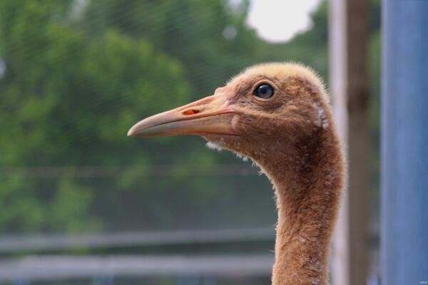
Adolescent Whooping Crane
Adolescent whooping crane.
Adolescent whooping crane.

Elwha River Restoration
A large cooperative project is taking place with Olympic National Park in the Elwha River in anticipation of removal of two dams. Restoration of the entire river to natural free flows will allow returning salmon access to historic spawning grounds.
A large cooperative project is taking place with Olympic National Park in the Elwha River in anticipation of removal of two dams. Restoration of the entire river to natural free flows will allow returning salmon access to historic spawning grounds.
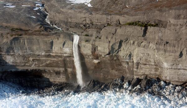
Shriveled and Cracked
When USGS mapped the glaciers in Icy Bay in the 1950s, the glacier in this image was flat and hundreds of meters thick. Bedrock is emerging as Guyot retreats very rapidly.
When USGS mapped the glaciers in Icy Bay in the 1950s, the glacier in this image was flat and hundreds of meters thick. Bedrock is emerging as Guyot retreats very rapidly.
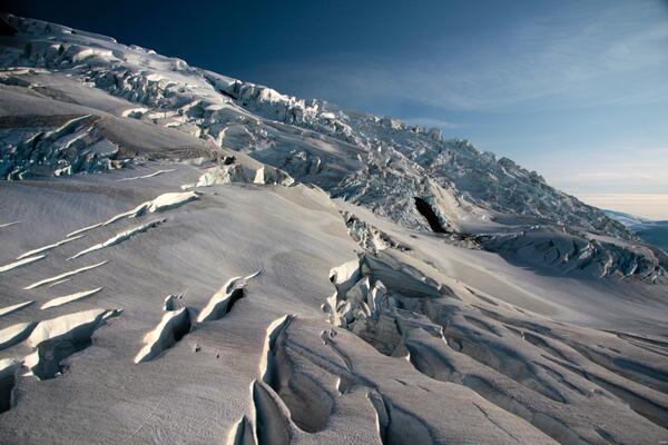
Rapid Erosion
Both ice and water sculpt the St. Elias range, forcing some of the fastest erosion rates on Earth.
Both ice and water sculpt the St. Elias range, forcing some of the fastest erosion rates on Earth.
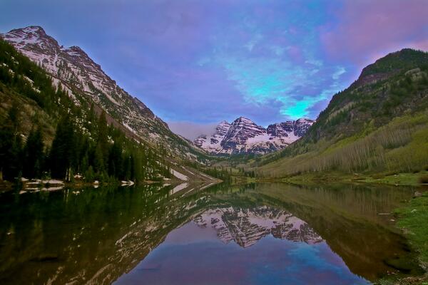
Maroon Bells at Sunrise
Maroon Bells at Sunrise.
Maroon Bells at Sunrise.

First Light
Sunrise on Marblehead Neck MA.
Sunrise on Marblehead Neck MA.

Sinkholes in West-central Florida, Freeze Event of 2010
Sinkholes in West-central Florida, Freeze Event of 2010Cracks shown here in the exterior and supporting structures of this home are indicative of subsidence damage associated with sinkhole activity.
Sinkholes in West-central Florida, Freeze Event of 2010
Sinkholes in West-central Florida, Freeze Event of 2010Cracks shown here in the exterior and supporting structures of this home are indicative of subsidence damage associated with sinkhole activity.

Sinkholes in West-central Florida, Freeze Event of 2010
Sinkholes in West-central Florida, Freeze Event of 2010More than 110 sinkholes formed in the Dover area of Florida during a freeze event in January 2010. Ground water levels dropped to record-setting lows as farmers pumped water to irrigate their plants for protection from the cold temperatures. The sinkholes destroyed homes, roads and sections of cultivated areas.