
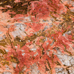
What are critical minerals?
We lead the government in developing the List of Critical Minerals.
We lead the government in developing the List of Critical Minerals.
Modernizing Mapping
The Earth Mapping Resources Initiative (Earth MRI) is modernizing mapping of the Nation's geology and critical mineral resources.
The Earth Mapping Resources Initiative (Earth MRI) is modernizing mapping of the Nation's geology and critical mineral resources.
Mineral Supply Chains
The National Mineral Information Center (NMIC) is the authoritative source of mineral resource information, including statistics on mineral production, trade and supply chain risks.
The National Mineral Information Center (NMIC) is the authoritative source of mineral resource information, including statistics on mineral production, trade and supply chain risks.
Educational Resources
Dive into lesson plans, activities, infographics, fact sheets and other materials related to Mineral Resources Program science.
Dive into lesson plans, activities, infographics, fact sheets and other materials related to Mineral Resources Program science.
Connect with Us
Mineral Resources Program
We are the Nation’s primary source of scientific information about the full life cycle and supply chains of mineral resources, including critical minerals. Our science is essential to responsibly managing natural resources and to procuring minerals needed to sustain and advance modern manufacturing, technology, infrastructure, and energy production.

Our Data
Our Data

Explore our featured geologic data, mineral assessments, life cycle research and mineral supply chain analyses.
Our Science
Our Science
Click each topic below to explore the impact of our science.
News
From Earth to Sky: How Minerals Create the Dazzling Colors of Independence Day Fireworks
From Earth to Sky: How Minerals Create the Dazzling Colors of Independence Day Fireworks
USGS: Lithium in Carolinas Could Replace Imports for a Century or More
USGS: Lithium in Carolinas Could Replace Imports for a Century or More
Media Alert: Low-level helicopter flights to image geology of Lake Superior Basin
Media Alert: Low-level helicopter flights to image geology of Lake Superior Basin
Publications
Global pegmatite-hosted lithium, cesium, and rubidium resources: A dataset for grade and tonnage modeling Global pegmatite-hosted lithium, cesium, and rubidium resources: A dataset for grade and tonnage modeling
Quantitative mineral resource assessments of potential undiscovered deposits can inform future mineral supply scenarios, but their accuracy is conditional on building robust grade and tonnage models of known deposits. This study presents an up-to-date global compilation and analysis of recently discovered and original, in-situ pegmatite-hosted Li, Cs, and Rb resources prior to historic...
Geochemical, mineralogical, and isotopic evidence for multi-stage genesis of the Hicks Dome REE + Y-HFSE-fluorite deposit, Illinois, USA Geochemical, mineralogical, and isotopic evidence for multi-stage genesis of the Hicks Dome REE + Y-HFSE-fluorite deposit, Illinois, USA
Hicks Dome hosts breccias enriched in rare earth elements (REE), Y, Th, F, Ba, Ti, Nb, and Be, alongside spatially associated lamprophyre dikes (ca. 271 Ma). Hicks Dome is located within the Illinois–Kentucky Fluorspar District, which hosts fluorite, Pb–Zn, and barite resources. This study investigates the genetic relationships between Hicks Dome mineralization in breccias, alkaline...
Critical minerals memory match game Critical minerals memory match game
An educational information packet about the 2025 List of Critical Minerals, which includes a memory match game about select critical minerals and how they are used.
Science

Geophysical and Geological Characterization of Mineral Deposit Localization in the Colorado Mineral Belt and Surrounding Lithosphere
The Colorado Mineral Belt (CMB) contains many important metallic and critical mineral deposits, concentrated (or localized) in a region that is geologically complex. The origins of these deposits are still not well understood making the CMB an ideal place to study how geologic processes concentrate minerals. This project aims to determine where, when, and how these mineral deposits form.

Assessing Mineral Resources
The Mineral Resources Program is the Nation’s primary provider of impartial estimates of known and undiscovered mineral resources. We study the full life cycle of mineral commodities, including critical minerals, to inform decisions about where and how to develop mineral resources.
Controls on Critical Element Enrichment in Carbonatite-Alkaline Igneous Complexes
The project seeks to determine the processes responsible for critical element enrichment in carbonatites and to enhance our ability to identify and assess economic deposits. This project will work at various scales to meet this objective and will primarily focus on deposits within the US or our USGS collaborative Nations.