Do volcanoes affect weather?
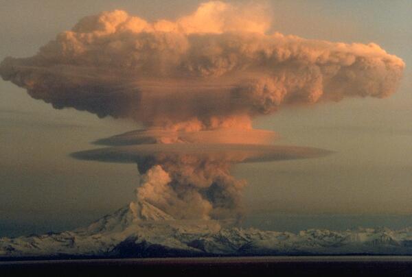
Yes, volcanoes can affect weather and the Earth's climate. Following the 1991 eruption of Mount Pinatubo in the Philippines, cooler than normal temperatures were recorded worldwide and brilliant sunsets and sunrises were attributed to this eruption that sent fine ash and gases high into the stratosphere, forming a large volcanic cloud that drifted around the world. The sulfur dioxide (SO2) in this cloud -- about 22 million tons -- combined with water to form droplets of sulfuric acid, blocking some of the sunlight from reaching the Earth and thereby cooling temperatures in some regions by as much as 0.5 degrees Celsius. An eruption the size of Mount Pinatubo could affect the weather for several years.
A similar phenomenon occurred in 1815 with the cataclysmic eruption of Tambora Volcano in Indonesia, the most powerful eruption in recorded history. Tambora's volcanic cloud lowered global temperatures by as much as 3 degrees Celsius. Even a year after the eruption, most of the northern hemisphere experienced sharply cooler temperatures during the summer months. In parts of Europe and in North America, 1816 was known as "the year without a summer."
Learn more: Volcanoes can affect climate
Related Content
Could a large Yellowstone eruption significantly change the climate?
How much sulfur dioxide (SO2) gas does Kīlauea emit?
Is there earthquake weather?
Why is it important to monitor volcanoes?
How are volcanic gases measured?
What was the largest volcanic eruption in the 20th century?
Where is the largest active volcano in the world?
What was the most destructive volcanic eruption in the history of the United States?
What are some benefits of volcanic eruptions?
Ash and Lightning Above the Eyjafjallajokull Volcano in 2010
Plume lightning during the volcanic eruption in Eyjafjallajokull glacier in Iceland in 2010.
Ash Coating from Rabaul Volcanic Eruption
Ash buries cars and buildings after the 1984 eruption of Rabaul, Papua New Guinea. Credit: USGS
Satellite image of eruption cloud from Pavlof Volcano in November 2014
Satellite image from the USGS/NASA Landsat-8 satellite showing the eruption cloud at Pavlof Volcano on November 15 at 12:46 pm AKST (21:46 UTC). This is just a portion of the eruption cloud, which extended for more than 250 miles to the northwest at the time this image was collected. In this image, the distance from the erupting vent to the upper left corner of the image
...Sakurajima Volcano - Ash and Plume Lightning, February 2013
Ash and plume lightning over the Sakurajima volcano, southern Japan eruption in February of 2013.
Volcano Hazards
The United States has 169 active volcanoes. More than half of them could erupt explosively, sending ash up to 20,000 or 30,000 feet where commercial air traffic flies. USGS scientists are working to improve our understanding of volcano hazards to help protect communities and reduce the risks.
Video Sections:
- Volcanoes: Monitoring Volcanoes
Eyjafjallajökull Eruption
Photograph of the eruption from the summit of Eyjafjallajökull from the north looking to the south across the Gígjökull outlet glacier, its "missing" proglacial (ice-margin) lake caused by the jökulhlaup that filled in the lake.
Ash is resuspended from Redoubt Volcano eruption
Giant ash cloud from the eruption of Mount Pinatubo, 1991
Giant ash cloud from the eruption of Mount Pinatubo, 1991 towering above farms and agricultural lands in the Philippines.
Mount Saint Helens eruption
On Sunday, May 18, 1980 at 8:32 a.m., the bulging north flank of Mount St. Helens slid away in a massive landslide -- the largest in recorded history. Seconds later, the uncorked volcano exploded and blasted rocks northward across forest ridges and valleys, destroying everything in its path within minutes.
Mount St. Helens 1980 Ash Cloud as Seen From Space
Eruptive activity at Mount St. Helens captured the world’s attention on May 18, 1980 when the largest historical landslide on Earth and a powerful explosion reshaped the volcano. A volcanic ash cloud spread across the US in 3 days, and encircled the Earth in 15 days.
This mini-movie compiled from individual satellite images taken in 1980 shows the ash cloud as it