
USGS monitors streamflow and sediment at Green River Below Meeker ST at Kent, WA.
Multimedia
Web Cams
We use web cams to monitor water across Washington State and the Nation
We use web cams to monitor water across Washington State and the Nation
Explore our multimedia below. You can filter and search by clicking "View All".
Images
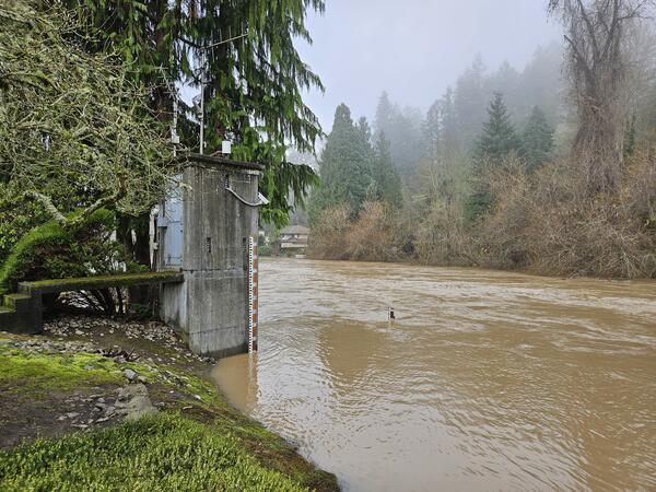
Green River, WA
USGS monitors streamflow and sediment at Green River Below Meeker ST at Kent, WA.
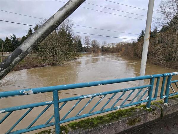
Green River Near Auburn, WA
USGS monitors streamflow and sediment at the Green River Near Auburn, WA. In December 2025, a storm event raised water levels and increased the turbidity (muddiness) of the river.
USGS monitors streamflow and sediment at the Green River Near Auburn, WA. In December 2025, a storm event raised water levels and increased the turbidity (muddiness) of the river.
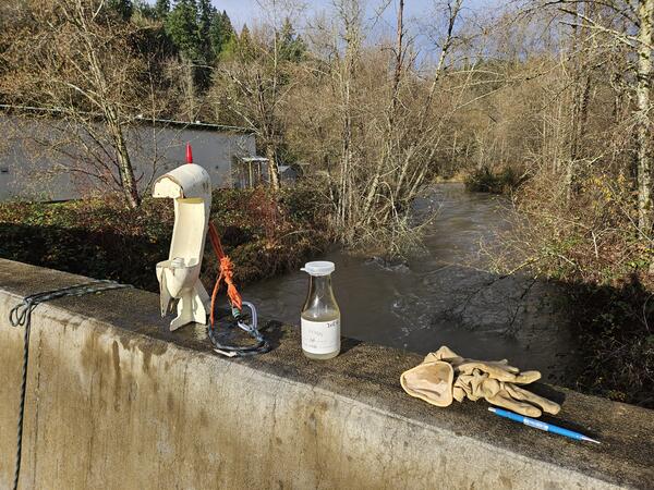
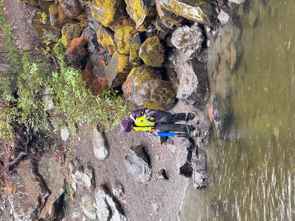
Sediment sampling at Big Soos Creek, WA
A hand-held sampler is used to collect suspended sediment concentration (SSC) data from Big Soos Creek, WA. SSC data helps USGS scientists understand sediment dynamics in rivers.
A hand-held sampler is used to collect suspended sediment concentration (SSC) data from Big Soos Creek, WA. SSC data helps USGS scientists understand sediment dynamics in rivers.
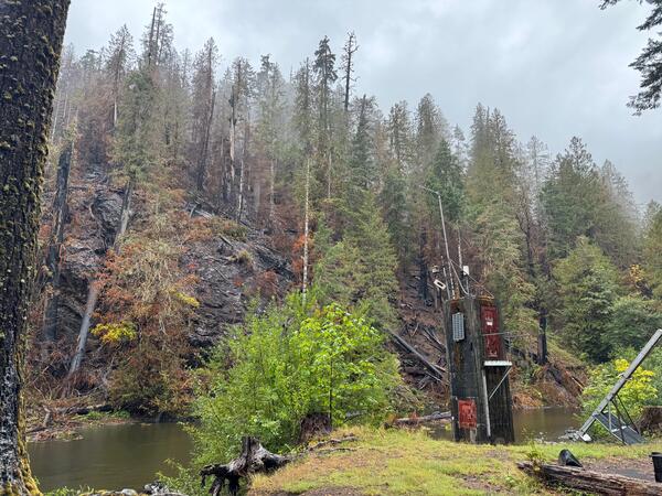
USGS NF Skokomish River streamgage near burned hillside
USGS NF Skokomish River streamgage near burned hillsideUSGS streamgage after 2025 Bear Gulch Fire.
USGS NF Skokomish River streamgage near burned hillside
USGS NF Skokomish River streamgage near burned hillsideUSGS streamgage after 2025 Bear Gulch Fire.
Water quality measurement on the NF Skokomish River, WA
Water quality measurement on the NF Skokomish River, WAUSGS scientist prepares to measure water quality parameters in the NF Skokomish River.
Water quality measurement on the NF Skokomish River, WA
Water quality measurement on the NF Skokomish River, WAUSGS scientist prepares to measure water quality parameters in the NF Skokomish River.
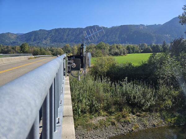
Non-contact radar sensor at the South Fork Nooksack River
Non-contact radar sensor at the South Fork Nooksack RiverNon-contact radar sensor installed at USGS Station 12210485. Real-time data are available at: South Fork Nooksack River Above Potter Bridge at Van Zandt, WA.
Non-contact radar sensor at the South Fork Nooksack River
Non-contact radar sensor at the South Fork Nooksack RiverNon-contact radar sensor installed at USGS Station 12210485. Real-time data are available at: South Fork Nooksack River Above Potter Bridge at Van Zandt, WA.
Videos

What Does a USGS Hydrologic Technician Do
What do USGS Hydrologic Technicians do on the job? This video features five different Hydrologic Technicians from Washington Water Science Center and Nevada Water Science Center sharing some of their work. This video was sponsored by the USGS Hydrologic Data Advisory Committee.
What do USGS Hydrologic Technicians do on the job? This video features five different Hydrologic Technicians from Washington Water Science Center and Nevada Water Science Center sharing some of their work. This video was sponsored by the USGS Hydrologic Data Advisory Committee.

Using a Continuous Flow Centrifuge to Collect Suspended Sediment
Using a Continuous Flow Centrifuge to Collect Suspended SedimentKathy Conn, a U.S. Geological Survey Water Quality Specialist, demonstrates a new USGS field method using a continuous flow centrifuge to collect suspended sediment from large volumes of water in the Duwamish River near Seattle Washington.

White Salmon River Riverine Dune Formation/Destruction
White Salmon River Riverine Dune Formation/DestructionFollowing the Condit Dam removal, a significant amount of bedload sediment was transported downstream. As the material moved along the river bottom, dunes began to form then collapse. This dune formation is seen through the waveform action as the stream's normal laminar flow is replaced by whitecap wave forms before returning, once again, to laminar flow.
Webcams
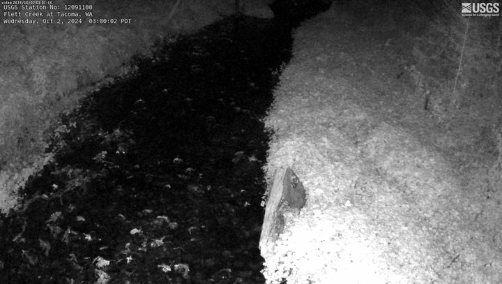
Flett Creek at Tacoma, WA
This webcam is located at USGS streamgage Flett Creek at Tacoma, WA - 12091100. Near real-time flow and water temperature data are available at this location. Water data back to 1989 are available online.
This webcam is located at USGS streamgage Flett Creek at Tacoma, WA - 12091100. Near real-time flow and water temperature data are available at this location. Water data back to 1989 are available online.
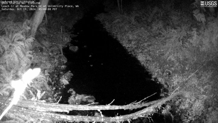
Leach CR at Meadow Park GC at University Place, WA
Leach CR at Meadow Park GC at University Place, WAThis webcam is located at USGS streamgage Leach CR at Meadow Park GC at University Place, WA - 12091290. Near real-time flow data are seasonally available at this location. Water data back to 2005 are available online.
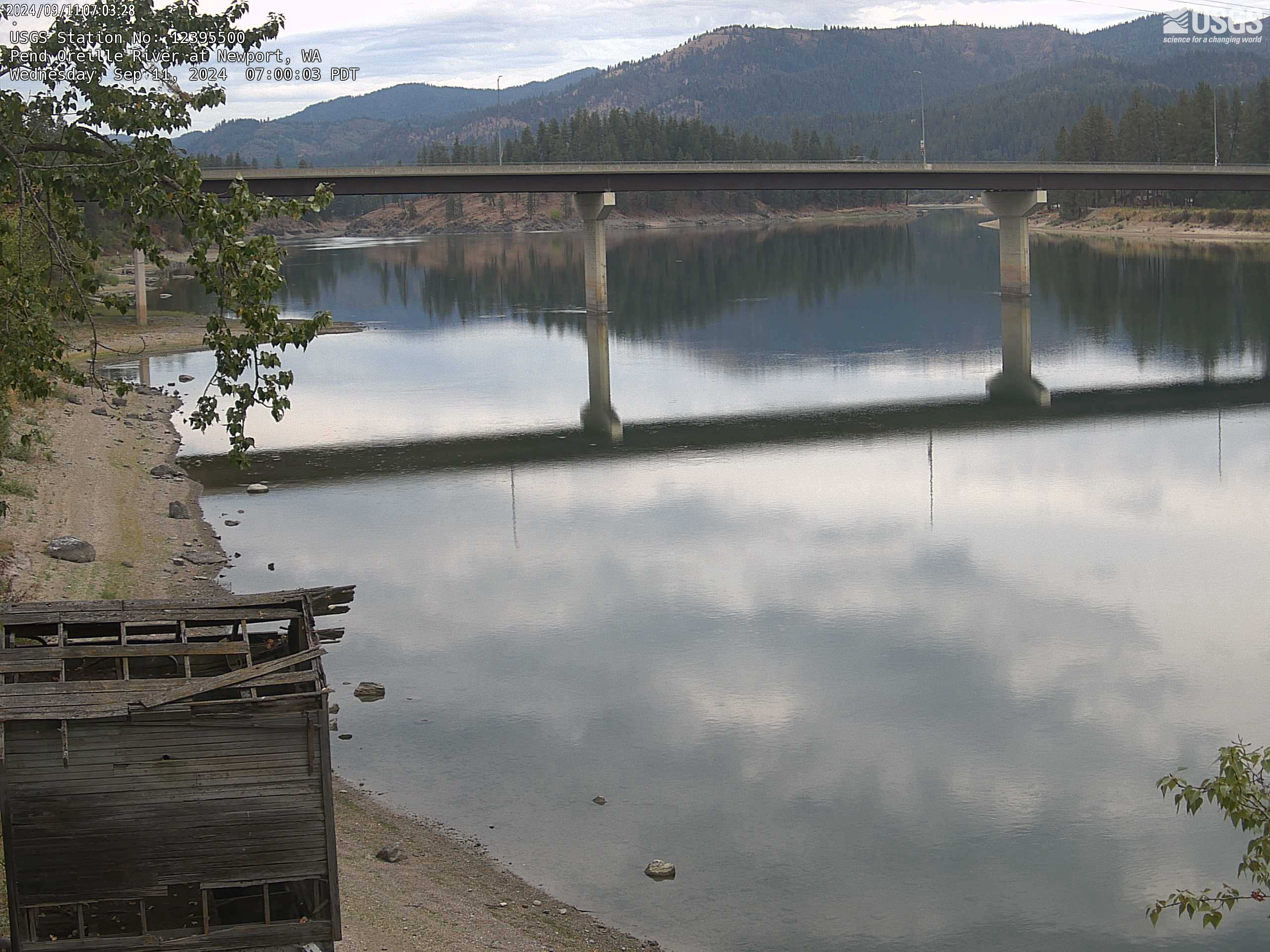
Pend Oreille River at Newport, WA
This webcam is located at USGS streamgage Pend Oreille River at Newport WA - 12395500. Near real-time water data are available at this location.
This webcam is located at USGS streamgage Pend Oreille River at Newport WA - 12395500. Near real-time water data are available at this location.
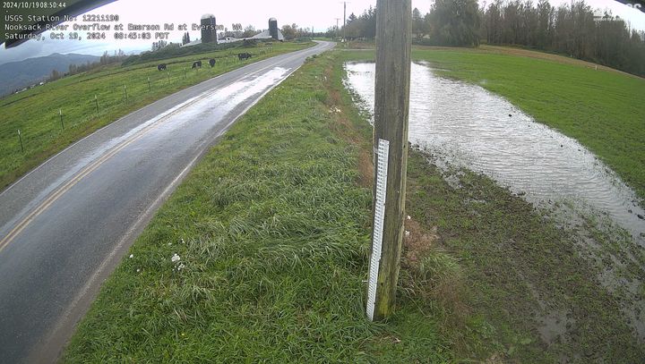
Nooksack River Overflow at Emerson Road at Everson, WA
Nooksack River Overflow at Emerson Road at Everson, WANooksack River Overflow at Emerson Road at Everson, WA. Check out this webcam to see the latest river conditions.
Nooksack River Overflow at Emerson Road at Everson, WA
Nooksack River Overflow at Emerson Road at Everson, WANooksack River Overflow at Emerson Road at Everson, WA. Check out this webcam to see the latest river conditions.
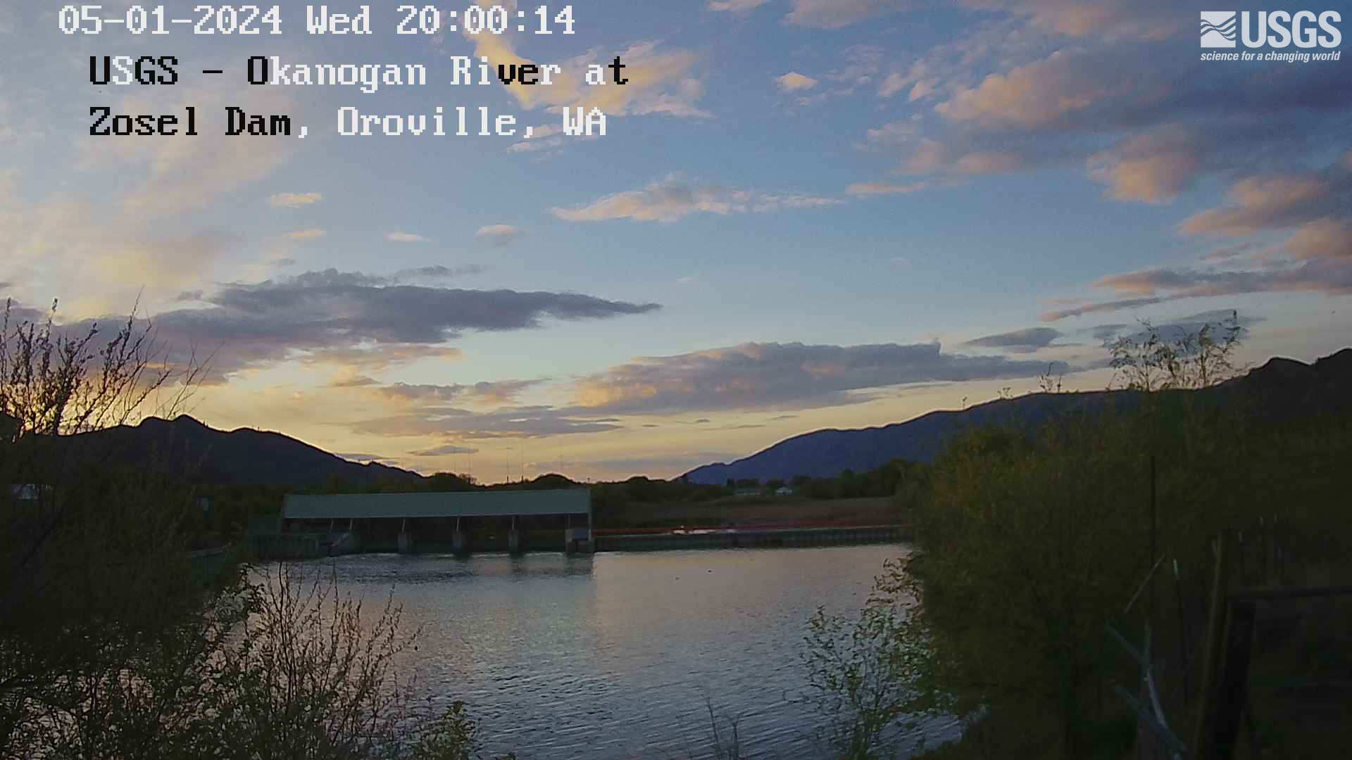
Okanogan River at Zosel Millpond at Oroville
This webcam is located at USGS streamgage 12439500 - Okanogan River at Oroville, WA. Near real-time flow and water temperature data are available at this location. Water data back to 1914 are available online.
This webcam is located at USGS streamgage 12439500 - Okanogan River at Oroville, WA. Near real-time flow and water temperature data are available at this location. Water data back to 1914 are available online.
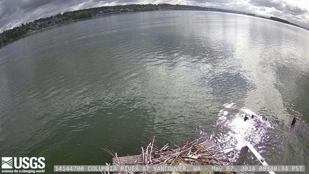
Columbia River at Vancouver
This webcam is located at USGS streamgage 14144700 - Columbia River at Vancouver, WA. The Columbia River is tidally influenced at this location and the station provides continuous monitoring of river flow and suspended sediment.
This webcam is located at USGS streamgage 14144700 - Columbia River at Vancouver, WA. The Columbia River is tidally influenced at this location and the station provides continuous monitoring of river flow and suspended sediment.