
USGS monitors streamflow and sediment at Green River Below Meeker ST at Kent, WA.
Images
Below are images associated with the Washington Water Science Center's science and staff. Images appear according to the year they were taken. To search, type a keyword or select a year from the dropdown menu. Or, click through the pages using the arrows at the bottom of the page.
Filter Total Items: 254
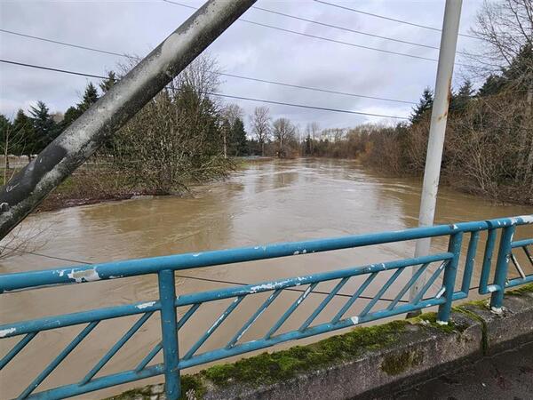
Green River, WA
USGS monitors streamflow and sediment at Green River Below Meeker ST at Kent, WA.
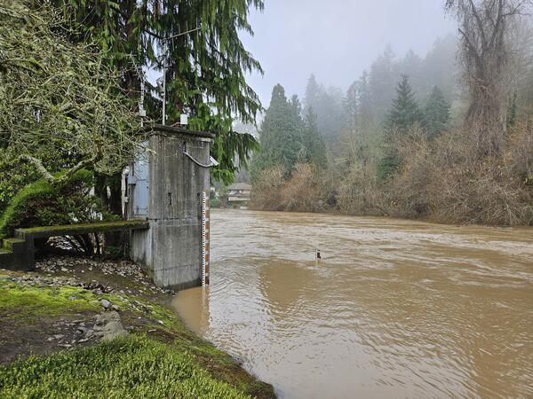
Green River Near Auburn, WA
USGS monitors streamflow and sediment at the Green River Near Auburn, WA. In December 2025, a storm event raised water levels and increased the turbidity (muddiness) of the river.
USGS monitors streamflow and sediment at the Green River Near Auburn, WA. In December 2025, a storm event raised water levels and increased the turbidity (muddiness) of the river.
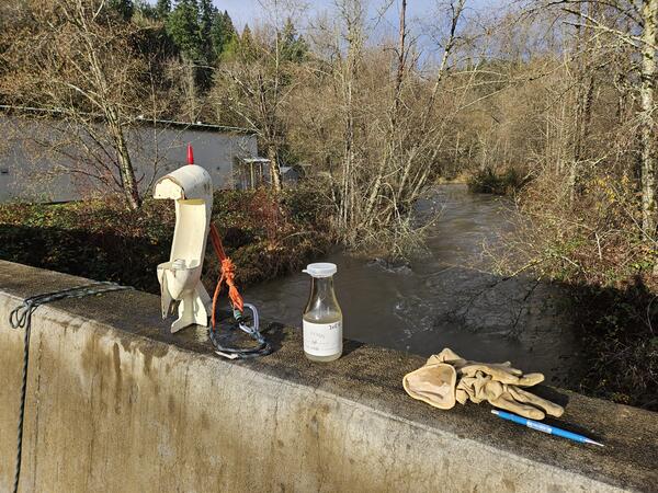
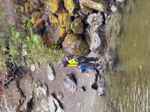
Sediment sampling at Big Soos Creek, WA
A hand-held sampler is used to collect suspended sediment concentration (SSC) data from Big Soos Creek, WA. SSC data helps USGS scientists understand sediment dynamics in rivers.
A hand-held sampler is used to collect suspended sediment concentration (SSC) data from Big Soos Creek, WA. SSC data helps USGS scientists understand sediment dynamics in rivers.
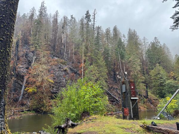
USGS NF Skokomish River streamgage near burned hillside
USGS NF Skokomish River streamgage near burned hillsideUSGS streamgage after 2025 Bear Gulch Fire.
USGS NF Skokomish River streamgage near burned hillside
USGS NF Skokomish River streamgage near burned hillsideUSGS streamgage after 2025 Bear Gulch Fire.
Water quality measurement on the NF Skokomish River, WA
Water quality measurement on the NF Skokomish River, WAUSGS scientist prepares to measure water quality parameters in the NF Skokomish River.
Water quality measurement on the NF Skokomish River, WA
Water quality measurement on the NF Skokomish River, WAUSGS scientist prepares to measure water quality parameters in the NF Skokomish River.
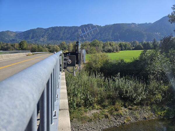
Non-contact radar sensor at the South Fork Nooksack River
Non-contact radar sensor at the South Fork Nooksack RiverNon-contact radar sensor installed at USGS Station 12210485. Real-time data are available at: South Fork Nooksack River Above Potter Bridge at Van Zandt, WA.
Non-contact radar sensor at the South Fork Nooksack River
Non-contact radar sensor at the South Fork Nooksack RiverNon-contact radar sensor installed at USGS Station 12210485. Real-time data are available at: South Fork Nooksack River Above Potter Bridge at Van Zandt, WA.
Passive Flux Meter Deployment
USGS scientists lower a passive flux meter into a groundwater well.
USGS scientists lower a passive flux meter into a groundwater well.
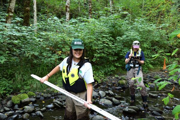
Puget Sound small stream survey
USGS scientists measure physical characteristics of small streams as part of a regional monitoring program.
USGS scientists measure physical characteristics of small streams as part of a regional monitoring program.
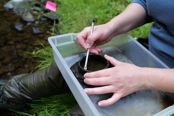
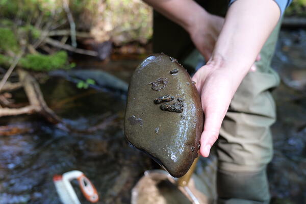
Collecting algae sample from small stream
A USGS scientist scrapes algae from a river rock. Algae samples provide information about the food web and health of small streams.
A USGS scientist scrapes algae from a river rock. Algae samples provide information about the food web and health of small streams.
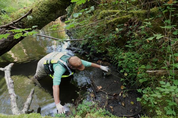
Sediment sampling in a small stream
A USGS scientist scoops streambed sediment into a container for laboratory analysis.
A USGS scientist scoops streambed sediment into a container for laboratory analysis.

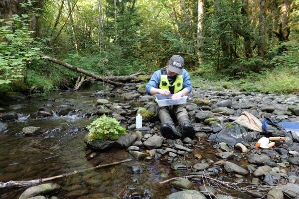
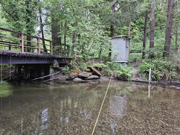
Small stream survey
USGS scientists measure the channel characteristics of a small stream.
USGS scientists measure the channel characteristics of a small stream.
Collecting algae sample from small stream
A USGS scientist scrapes algae off a river rock. The algae serves as an indicator of stream health.
A USGS scientist scrapes algae off a river rock. The algae serves as an indicator of stream health.
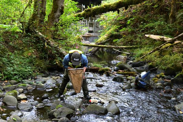
Macroinvertebrate sampling in small stream
USGS scientists collect macroinvertebrates in small streams to monitor habitat and water quality.
USGS scientists collect macroinvertebrates in small streams to monitor habitat and water quality.
Caddisfly larvae
Caddisfly larvae construct protective tubes attached to rocks in streambeds. Their presence can indicate water quality and habitat conditions.
Caddisfly larvae construct protective tubes attached to rocks in streambeds. Their presence can indicate water quality and habitat conditions.
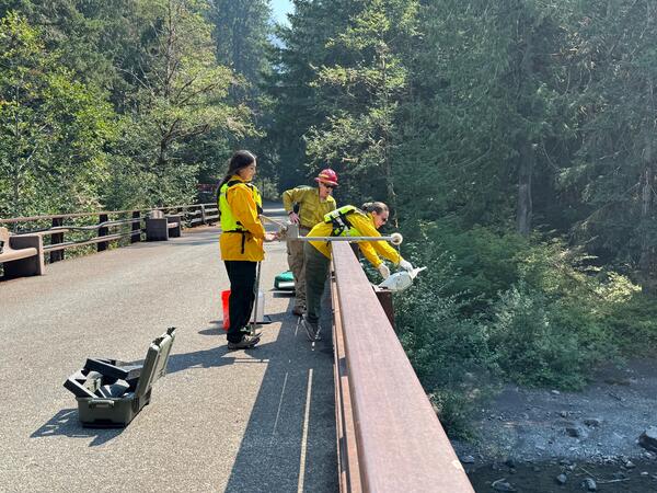
Sampling water quality on the NF Skokomish River
USGS and NPS scientists collect a water quality sample from the NF Skokomish River. They lower a sampling device from the bridge to obtain a representative sample. Interagency coordination allowed rapid data collection after the fire.
USGS and NPS scientists collect a water quality sample from the NF Skokomish River. They lower a sampling device from the bridge to obtain a representative sample. Interagency coordination allowed rapid data collection after the fire.
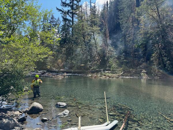
NF Skokomish River Streamflow Measurement during Bear Gulch Fire
NF Skokomish River Streamflow Measurement during Bear Gulch FireA USGS hydrologic technician measures streamflow in the NF Skokomish River (USGS 12056500) as the Bear Gulch fire smolders on the hillside.
NF Skokomish River Streamflow Measurement during Bear Gulch Fire
NF Skokomish River Streamflow Measurement during Bear Gulch FireA USGS hydrologic technician measures streamflow in the NF Skokomish River (USGS 12056500) as the Bear Gulch fire smolders on the hillside.
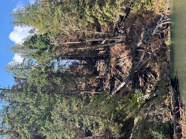
Burned hillside beside NF Skokomish River, WA
A tendril of smoke rises from a burned hillside above the NF Skokomish River. Burned trees and loose soil pose a risk for debris flows. USGS is monitoring post-fire impacts on this river.
A tendril of smoke rises from a burned hillside above the NF Skokomish River. Burned trees and loose soil pose a risk for debris flows. USGS is monitoring post-fire impacts on this river.
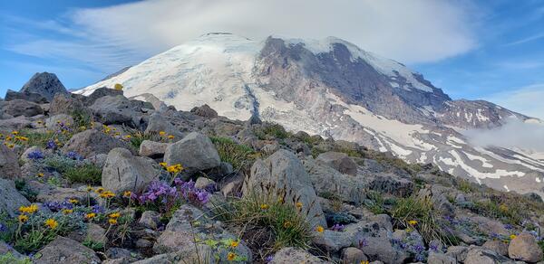
Wildflowers at Mount Rainier
Wildflowers bloom on a ridge in front of Mount Rainier. The USGS monitors the volcano and studies the water produced by its glaciers.
Wildflowers bloom on a ridge in front of Mount Rainier. The USGS monitors the volcano and studies the water produced by its glaciers.
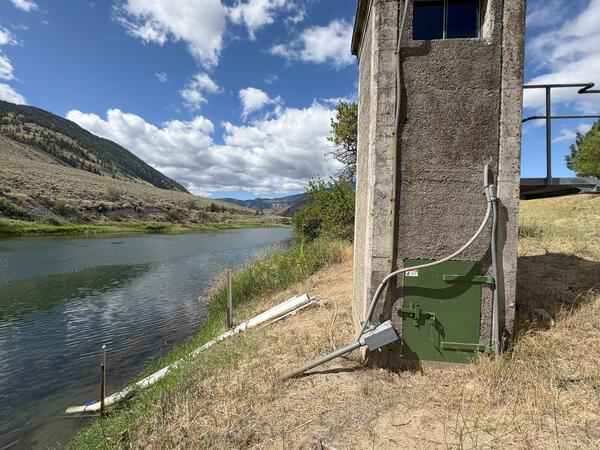
Similkameen River Near Nighthawk, WA Gagehouse
The USGS monitors water quality and streamflow at the Similkameen River Near Nighthawk, WA.
The USGS monitors water quality and streamflow at the Similkameen River Near Nighthawk, WA.
Big Soos Creek, WA
USGS monitors streamflow and sediment at Big Soos Creek Above Hatchery Near Auburn, WA.
USGS monitors streamflow and sediment at Big Soos Creek Above Hatchery Near Auburn, WA.
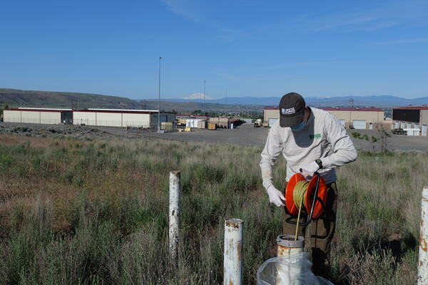
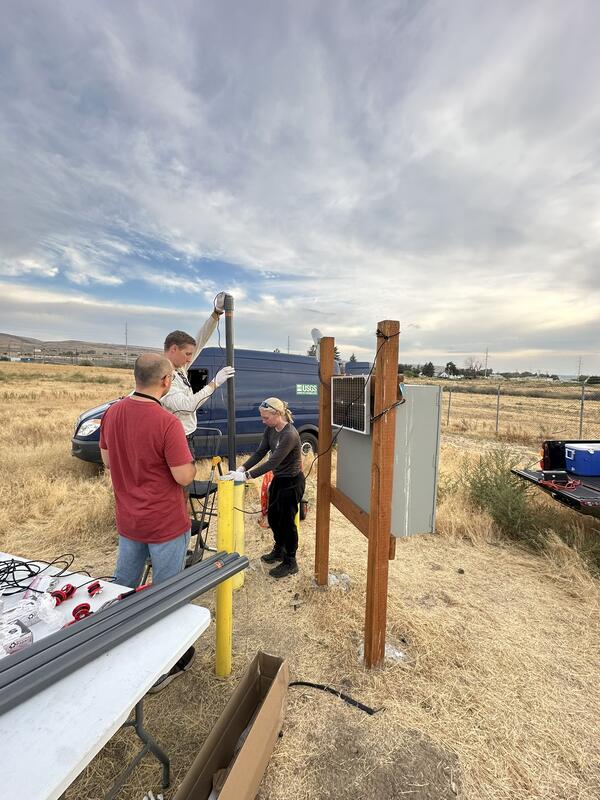
Measuring groundwater level in well
A USGS scientist uses an electronic tape to measure the depth to groundwater in a well in Washington.
A USGS scientist uses an electronic tape to measure the depth to groundwater in a well in Washington.