
Airborne electromagnetic (AEM) survey data collected along the Mississippi River and tributaries
By Upper Midwest Water Science Center
2021 (approx.)
Detailed Description
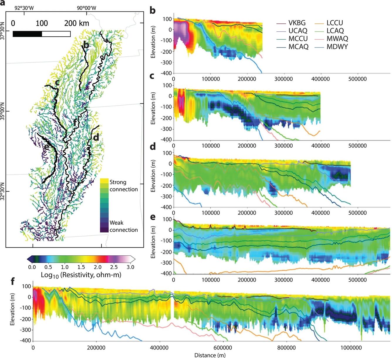
Airborne electromagnetic (AEM) survey data collected along the Mississippi River and tributaries used streambed resistivity to map the extent of groundwater connectivity from strong to weak (part a), and provided three-dimensional cross sections of the materials underlying the streams (parts b-f. Figure from Minsely et al., 2021).
Sources/Usage
Public Domain.
Related
Airborne Electromagnetic (AEM) Surveys for Southwest Michigan, 2026-2027
In partnership with the Michigan Department of Environment, Great Lakes, and Energy (EGLE), the U.S. Geological Survey (USGS) is conducting an Airborne Electromagnetic (AEM) Survey project in Southwestern Michigan during 2026 and 2027.