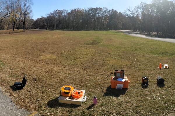
Burke Minsley is a Research Geophysicist with the Geology, Geophysics, and Geochemistry Science Center.
Burke Minsley joined the USGS in 2008 as a Research Geophysicist with the Geology, Geophysics, and Geochemistry Science Center in Denver, Colorado. After receiving a B.S. in Applied Physics from Purdue University in 1997, Burke began his career as a field geophysicist working on offshore seismic vessels before receiving a Ph.D. in Geophysics from MIT in 2007. His work involves the development and implementation of innovative ground-based and airborne geophysical methods used in interdisciplinary studies to improve our understanding of Earth's geosphere, hydrosphere, and cryosphere. Burke's projects are interdisciplinary and geographically diverse, including permafrost mapping in Alaska, critical zone studies in a mountain headwater system in Colorado, and a large regional water availability study in the lower Mississippi River valley. He also works on development of computational methods for uncertainty quantification in geophysical datasets and associated geologic or hydrologic interpretations. In 2012, Burke received the PECASE award for his fundamental research on advancing airborne electromagnetic survey methodology and its use in studying permafrost. He is currently serving as President of the Near-Surface Geophysics Section of AGU from 2021-2022.
Professional Experience
2008 - present: Research geophysicist, Geology, Geophysics, and Geochemistry Science Center, U.S. Geological Survey, Denver, CO
2007 - 2008: Postdoctoral research fellow, Department of Earth, Atmospheric, and Planetary Sciences, Massachusetts Institute of Technology, Cambridge, MA
2002 - 2007: Research assistant, Department of Earth, Atmospheric, and Planetary Sciences, Massachusetts Institute of Technology, Cambridge, MA
1997 - 2002: Field geophysicist with WesternGeco, offshore
Education and Certifications
Ph.D. Geophysics, Massachusetts Institute of Technology, 2007
B.S. Applied Physics, Purdue University, 1997
Affiliations and Memberships*
American Geophysical Union: President of the Near-Surface Geophysics Section of AGU from 2021-2022
Honors and Awards
USGS Unit Award for Excellence of Service - LandCarbon team member, 2017
Presidential Early Career Award for Science and Engineering (PECASE), 2012
USGS Superior Service Award, 2012
Paper one of 'Ten Best of SAGEEP' 2010, 2011
Outstanding Student Paper Award, Near Surface section, Fall AGU, 2006
Martin Family Society Fellowship for Sustainability, MIT, 2004 - 2005
Science and Products
Airborne Electromagnetic (AEM) Survey 2023 - Illinois River Basin
Arctic Biogeochemical Response to Permafrost Thaw (ABRUPT)
Interdisciplinary Methods and Applications in Geophysics (IMAGe)
Arctic Boreal Vulnerability Experiment (ABoVE)
Nome Creek Experimental Watershed
Floating and Towed Transient Electromagnetic Surveys used to Characterize Hydrogeology underlying Rivers and Estuaries: March - December 2018
Airborne Electromagnetic (AEM) Survey in Southwest and Southeast Areas, Wisconsin, 2022
Alaska permafrost characterization: Geophysical and related field data collected in 2021
Surface electrical resistivity tomography, magnetic, and gravity surveys in Redwell Basin and the greater East River watershed near Crested Butte, Colorado, 2017
Historical (1940–2006) and recent (2019–20) aquifer slug test datasets used to model transmissivity and hydraulic conductivity of the Mississippi River Valley alluvial aquifer from recent (2018–20) airborne electromagnetic (AEM) survey d
Airborne electromagnetic and magnetic survey data, northeast Wisconsin (ver. 1.1, June 2022)
Airborne electromagnetic, magnetic, and radiometric survey, upper East River and surrounding watersheds near Crested Butte, Colorado, 2017
Permafrost characterization at the Alaska Peatland Experiment (APEX) site: Geophysical and related field data collected from 2018-2020
Combined results and derivative products of hydrogeologic structure and properties from airborne electromagnetic surveys in the Mississippi Alluvial Plain
Airborne electromagnetic, magnetic, and radiometric survey of the Mississippi Alluvial Plain, November 2019 - March 2020
Alaska permafrost characterization: Geophysical and related field data collected from 2019-2020
Digital datasets documenting subsurface data locations, topographic metrics, fault scarp mapping, and revised fault network for Crowley's Ridge, New Madrid Seismic Zone
Estimating streambed hydraulic conductivity for selected streams in the Mississippi Alluvial Plain using continuous resistivity profiling methods—Delta region
High-resolution airborne geophysical survey of the Shellmound, Mississippi area
A model of transmissivity and hydraulic conductivity from electrical resistivity distribution derived from airborne electromagnetic surveys of the Mississippi River Valley Alluvial Aquifer, Midwest USA
Rapid and gradual permafrost thaw: A tale of two sites
Surface parameters and bedrock properties covary across a mountainous watershed: Insights from machine learning and geophysics
Mapped predictions of manganese and arsenic in an alluvial aquifer using boosted regression trees
Characterizing methane emission hotspots from thawing permafrost
Permafrost characterization and feature identification using public domain airborne electromagnetic data, interior Alaska
Incorporating uncertainty into groundwater salinity mapping using AEM data
Airborne geophysical surveys of the lower Mississippi Valley demonstrate system-scale mapping of subsurface architecture
The biophysical role of water and ice within permafrost nearing collapse: Insights from novel geophysical observations
Decadal-scale hotspot methane ebullition within lakes following abrupt permafrost thaw
USGS permafrost research determines the risks of permafrost thaw to biologic and hydrologic resources
Model structural uncertainty quantification and hydrogeophysical data integration using airborne electromagnetic data
Non-USGS Publications**
**Disclaimer: The views expressed in Non-USGS publications are those of the author and do not represent the views of the USGS, Department of the Interior, or the U.S. Government.
Mississippi Alluvial Plain: Shellmound, MS Geophysical Survey
A high-resolution airborne and ground-based geophysical survey was conducted near Shellmound, Mississippi as part of the Mississippi Alluvial Plain (MAP) Regional Water Availability Study. This geonarrative showcases the geophysical data used in support of this effort, compiles complementary datasets, and provides additional resources to the user.
GSpy: Geophysical Data Standard in Python
GeoBIPy – Geophysical Bayesian Inference in Python
GeoBIPy – Geophysical Bayesian Inference in Python – is an open-source algorithm for quantifying uncertainty in airborne electromagnetic (AEM) data and associated geological interpretations. This package uses a Bayesian formulation and Markov chain Monte Carlo sampling methods to derive posterior distributions of subsurface electrical resistivity based on measured AEM data.
Science and Products
- Science
Airborne Electromagnetic (AEM) Survey 2023 - Illinois River Basin
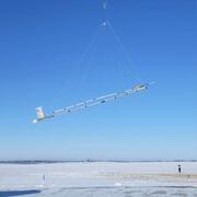
The U.S. Geological Survey (USGS) is conducting an Airborne ElectroMagnetic (AEM) Survey starting in late January 2023 and lasting three to four weeks. A helicopter towing a large hoop from a cable will begin making low-level flights over the Illinois River Basin, covering much of central Illinois and parts of northwest Indiana.Arctic Biogeochemical Response to Permafrost Thaw (ABRUPT)
Warming and thawing of permafrost soils in the Arctic is expected to become widespread over the coming decades. Permafrost thaw changes ecosystem structure and function, affects resource availability for wildlife and society, and decreases ground stability which affects human infrastructure. Since permafrost soils contain about half of the global soil carbon (C) pool, the magnitude of C losses...Interdisciplinary Methods and Applications in Geophysics (IMAGe)
The project focuses on the development of novel geophysical techniques that improve our ability to understand Earth's subsurface, with broad relevance to the Mineral Resources Program and the USGS Science Strategy. Our goal is to develop and maintain state-of-the art geophysical capabilities that support the diverse science needs of USGS projects that aim to meet the challenges of the 21st century...Arctic Boreal Vulnerability Experiment (ABoVE)
ABoVE: Vulnerability of inland waters and the aquatic carbon cycle to changing permafrost and climate across boreal northwestern North America. Carbon released from thawing permafrost may fuel terrestrial and aquatic ecosystems or contribute to greenhouse gas emission, leading to a potential warming feedback and further thaw.Nome Creek Experimental Watershed
The Nome Creek Experimental Watershed (NCEW) has been the site of multiple studies focused on understanding hydrology, biogeochemistry, and ecosystem changes related to permafrost thaw and fire in the boreal forest. - Data
Filter Total Items: 22
Floating and Towed Transient Electromagnetic Surveys used to Characterize Hydrogeology underlying Rivers and Estuaries: March - December 2018
Surface and water-borne geophysical methods can provide information for the characterization of the subsurface structure of the earth for aquifer investigations. Floating and towed transient electromagnetic (FloaTEM and tTEM) surveys provide resistivity soundings of the subsurface, which can be related to lithology and hydrogeology. In the TEM method, a primary electrical current is cycled throughAirborne Electromagnetic (AEM) Survey in Southwest and Southeast Areas, Wisconsin, 2022
Airborne electromagnetic (AEM) and magnetic survey data were collected during March 2022 over a distance of 2,574.6 line kilometers in southeast and southwest Wisconsin. These data were collected in support of an effort to improve estimates of depth to bedrock through a collaborative project between the U.S. Geological Survey (USGS), Wisconsin Department of Agriculture, Trade, and Consumer ProtectAlaska permafrost characterization: Geophysical and related field data collected in 2021
Geophysical measurements were collected by the U.S. Geological Survey (USGS) at five sites in Interior Alaska in September 2021 for the purposes of imaging permafrost structure and quantifying variations in subsurface moisture content in relation to thaw features. Electrical resistivity tomography (ERT) measurements were made along transects 110-222 meters (m) in length to quantify subsurface permSurface electrical resistivity tomography, magnetic, and gravity surveys in Redwell Basin and the greater East River watershed near Crested Butte, Colorado, 2017
Surface electrical resistivity tomography (ERT), time-domain electromagnetics (TEM), nuclear magnetic resonance (NMR), magnetics, and gravity data were acquired in 2016, 2017 and 2018 in the greater East River Watershed near Crested Butte Colorado with a focused effort in Redwell Basin. Five ERT profiles were acquired within Redwell Basin and Brush Creek to map geologic structure at depths up to 4Historical (1940–2006) and recent (2019–20) aquifer slug test datasets used to model transmissivity and hydraulic conductivity of the Mississippi River Valley alluvial aquifer from recent (2018–20) airborne electromagnetic (AEM) survey d
The Mississippi River Valley alluvial aquifer (“alluvial aquifer”) is one of the most extensively developed aquifers in the United States. The alluvial aquifer is present at the land surface in parts of southeastern Missouri, northeastern Louisiana, western Mississippi, western Tennessee and Kentucky near the Mississippi River, and throughout eastern Arkansas. Historical (1940–2006) and recent (20Airborne electromagnetic and magnetic survey data, northeast Wisconsin (ver. 1.1, June 2022)
Airborne electromagnetic (AEM) and magnetic survey data were collected during January and February 2021 over a distance of 3,170 line kilometers in northeast Wisconsin. These data were collected in support of an effort to improve estimates of depth to bedrock through a collaborative project between the U.S. Geological Survey (USGS), Wisconsin Department of Agriculture, Trade, and Consumer ProtectiAirborne electromagnetic, magnetic, and radiometric survey, upper East River and surrounding watersheds near Crested Butte, Colorado, 2017
This data release consists of 1,984 line-kilometers of airborne electromagnetic (AEM), magnetic data and radiometric data collected from October to November 2017 in the upper East River and surrounding watersheds in central Colorado. The U.S. Geological Survey contracted Geotech Ltd. to acquire these data as part of regional investigations into the geologic structure and hydrologic framework of thPermafrost characterization at the Alaska Peatland Experiment (APEX) site: Geophysical and related field data collected from 2018-2020
Geophysical measurements and related field data were collected by the U.S. Geological Survey (USGS) at the Alaska Peatland Experiment (APEX) site in Interior Alaska from 2018 to 2020 to characterize subsurface thermal and hydrologic conditions along a permafrost thaw gradient. The APEX site is managed by the Bonanza Creek LTER (Long Term Ecological Research). In April 2018, seven boreholes were emCombined results and derivative products of hydrogeologic structure and properties from airborne electromagnetic surveys in the Mississippi Alluvial Plain
Electrical resistivity results from two regional airborne electromagnetic (AEM) surveys (Minsley et al. 2021 and Burton et al. 2021) over the Mississippi Alluvial Plain (MAP) were combined by the U.S. Geological Survey to produce three-dimensional (3D) gridded models and derivative hydrogeologic products. Grids were discretized in the horizontal dimension to align with the 1 kilometer (km) x 1 kmAirborne electromagnetic, magnetic, and radiometric survey of the Mississippi Alluvial Plain, November 2019 - March 2020
Airborne electromagnetic (AEM), magnetic, and radiometric data were acquired November 2019 to March 2020 along 24,030 line-kilometers (line-km) over the Mississippi Alluvial Plain (MAP). Data were acquired by CGG Canada Services, Ltd. with three different airborne sensors: the CGG Canada Services, Ltd. TEMPEST time-domain AEM instrument that is used to map subsurface geologic structure at depths uAlaska permafrost characterization: Geophysical and related field data collected from 2019-2020
Geophysical measurements were collected by the U.S. Geological Survey (USGS) at two sites in Interior Alaska in 2019 and 2020 for the purposes of imaging permafrost structure and quantifying variations in subsurface moisture content in relation to thaw features. In September 2019, electrical resistivity tomography (ERT) and downhole nuclear magnetic resonance (NMR) data were used to quantify permaDigital datasets documenting subsurface data locations, topographic metrics, fault scarp mapping, and revised fault network for Crowley's Ridge, New Madrid Seismic Zone
This release provides the data and interpretations supporting evidence of late Quaternary faulting along Crowleys Ridge in the New Madrid seismic zone. The release includes location information for seismic reflection and airborne electromagnetic (AEM) data over Crowleys Ridge, a table of topographic metrics derived from analysis of the 10m National Elevation Dataset (NED) digital elevation model ( - Maps
Estimating streambed hydraulic conductivity for selected streams in the Mississippi Alluvial Plain using continuous resistivity profiling methods—Delta region
Introduction The Mississippi Alluvial Plain is one of the most important agricultural regions in the United States, and crop productivity relies on groundwater irrigation from an aquifer system whose full capacity is unknown. Groundwater withdrawals from the Mississippi River Valley alluvial aquifer have resulted in substantial groundwater-level declines and reductions in base flow in streams withHigh-resolution airborne geophysical survey of the Shellmound, Mississippi area
In late February to early March 2018, the U.S. Geological Survey acquired 2,364 line-kilometers (km) of airborne electromagnetic, magnetic, and radiometric data in the Shellmound, Mississippi study area. The purpose of this survey is to contribute high-resolution information about subsurface geologic structure to inform groundwater models, water resource infrastructure studies, and local decision - Multimedia
- Publications
Filter Total Items: 63
A model of transmissivity and hydraulic conductivity from electrical resistivity distribution derived from airborne electromagnetic surveys of the Mississippi River Valley Alluvial Aquifer, Midwest USA
Groundwater-flow models require the spatial distribution of the hydraulic conductivity parameter. One approach to defining this spatial distribution in groundwater-flow model grids is to map the electrical resistivity distribution by airborne electromagnetic (AEM) survey and establish a petrophysical relation between mean resistivity calculated as a nonlinear function of the resistivity layering aAuthorsScott Ikard, Burke J. Minsley, James Robert Rigby, Wade KressRapid and gradual permafrost thaw: A tale of two sites
Warming temperatures and increasing disturbance by wildfire and extreme weather events is driving permafrost change across northern latitudes. The state of permafrost varies widely in space and time, depending on landscape, climate, hydrologic, and ecological factors. Despite its importance, few approaches commonly measure and monitor the changes in deep (>1 m) permafrost conditions with high spatAuthorsBurke J. Minsley, Neal Pastick, Stephanie R. James, Dana R.N. Brown, Bruce K. Wylie, Mason A. Kass, Vladimir E. RomanovskySurface parameters and bedrock properties covary across a mountainous watershed: Insights from machine learning and geophysics
Bedrock property quantification is critical for predicting the hydrological response of watersheds to climate disturbances. Estimating bedrock hydraulic properties over watershed scales is inherently difficult, particularly in fracture-dominated regions. Our analysis tests the covariability of above- and belowground features on a watershed scale, by linking borehole geophysical data, near-surfaceAuthorsSebastian Uhlemann, Baptiste Dafflon, Haruko Murakami Wainwright, Kenneth Hurst Williams, Burke J. Minsley, Katrina D. Zamudio, Bradley Carr, Nicola Falco, Craig Ulrich, Susan S. HubbardMapped predictions of manganese and arsenic in an alluvial aquifer using boosted regression trees
Manganese (Mn) concentrations and the probability of arsenic (As) exceeding the drinking-water standard of 10 μg/L were predicted in the Mississippi River Valley alluvial aquifer (MRVA) using boosted regression trees (BRT). BRT, a type of ensemble-tree machine-learning model, were created using predictor variables that affect Mn and As distribution in groundwater. These variables included iron (FeAuthorsKatherine J. Knierim, James A. Kingsbury, Kenneth Belitz, Paul Stackelberg, Burke J. Minsley, James Robert RigbyCharacterizing methane emission hotspots from thawing permafrost
Methane (CH4) emissions from climate-sensitive ecosystems within the northern permafrost region represent a potentially large but highly uncertain source, with current estimates spanning a factor of seven (11–75 Tg CH4 yr−1). Accelerating permafrost thaw threatens significant increases in pan-Arctic CH4 emissions, amplifying the permafrost carbon feedback. We used airborne imaging spectroscopy witAuthorsClayton D. Elder, David R. Thompson, Andrew K Thorpe, Hrishikesh Chandanpurkar, Philip J Hanke, Nicholas Hasson, Stephanie R. James, Burke J. Minsley, Neal J. Pastick, David Olefeldt, Katey M Walter Anthony, Charles E. MillerPermafrost characterization and feature identification using public domain airborne electromagnetic data, interior Alaska
The Alaska Division of Geological & Geophysical Surveys (DGGS) airborne electromagnetic (AEM) data are an excellent resource for permafrost characterization. AEM data can be used for pingo identification, estimating permafrost thickness, estimating surface talik thickness, evaluating permafrost health (temperature), talik identification and more. Data examples are shown from discontinuous permafrAuthorsAbraham M. Emond, Ronald Daanen, Burke J. MinsleyIncorporating uncertainty into groundwater salinity mapping using AEM data
Airborne electromagnetic surveys provide spatially extensive resistivity information that can be useful for groundwater salinity mapping; however, the transformation from geophysical data to salinity interpretations carries uncertainty. We compare two quantitative approaches to salinity mapping recently applied to address water resource management objectives: the location of the depth to the freshAuthorsLyndsay B. Ball, Burke J. MinsleyAirborne geophysical surveys of the lower Mississippi Valley demonstrate system-scale mapping of subsurface architecture
The Mississippi Alluvial Plain hosts one of the most prolific shallow aquifer systems in the United States but is experiencing chronic groundwater decline. The Reelfoot rift and New Madrid seismic zone underlie the region and represent an important and poorly understood seismic hazard. Despite its societal and economic importance, the shallow subsurface architecture has not been mapped with the spAuthorsBurke J. Minsley, James Robert Rigby, Stephanie R. James, Bethany L. Burton, Katherine J. Knierim, Michael Pace, Paul A. Bedrosian, Wade KressThe biophysical role of water and ice within permafrost nearing collapse: Insights from novel geophysical observations
The impact of permafrost thaw on hydrologic, thermal, and biotic processes remains uncertain, in part due to limitations in subsurface measurement capabilities. To better understand subsurface processes in thermokarst environments, we collocated geophysical and biogeochemical instruments along a thaw gradient between forested permafrost and collapse-scar bogs at the Alaska Peatland Experiment (APEAuthorsStephanie R. James, Burke J. Minsley, Jack McFarland, Eugenie S. Euskirchen, Colin W. Edgar, Mark WaldropDecadal-scale hotspot methane ebullition within lakes following abrupt permafrost thaw
Thermokarst lakes accelerate deep permafrost thaw and the mobilization of previously frozen soil organic carbon. This leads to microbial decomposition and large releases of carbon dioxide (CO2) and methane (CH4) that enhance climate warming. However, the time scale of permafrost-carbon emissions following thaw is not well known but is important for understanding how abrupt permafrost thaw impactsAuthorsK.W. Anthony, P. Lindgren, P. Hanke, M. Engram, P. Anthony, R. Daanen, A. Bondurant, A.K. Liljedahl, J. Lenz, G. Grosse, B.M. Jones, L. S. Brosius, Stephanie R. James, Burke J. Minsley, Neal Pastick, J. Munk, J. P. Chanton, C.E. Miller, F.J. MeyerUSGS permafrost research determines the risks of permafrost thaw to biologic and hydrologic resources
The U.S. Geological Survey (USGS), in collaboration with university, Federal, Tribal, and independent partners, conducts fundamental research on the distribution, vulnerability, and importance of permafrost in arctic and boreal ecosystems. Scientists, land managers, and policy makers use USGS data to help make decisions for development, wildlife habitat, and other needs. Native villages and citiesAuthorsMark P. Waldrop, Lesleigh Anderson, Mark Dornblaser, Li H. Erikson, Ann E. Gibbs, Nicole M. Herman-Mercer, Stephanie R. James, Miriam C. Jones, Joshua C. Koch, Mary-Cathrine Leewis, Kristen L. Manies, Burke J. Minsley, Neal J. Pastick, Vijay Patil, Frank Urban, Michelle A. Walvoord, Kimberly P. Wickland, Christian ZimmermanByNatural Hazards Mission Area, Water Resources Mission Area, Climate Research and Development Program, Coastal and Marine Hazards and Resources Program, Land Change Science Program, Volcano Hazards Program, Earth Resources Observation and Science (EROS) Center , Geology, Geophysics, and Geochemistry Science Center, Geology, Minerals, Energy, and Geophysics Science Center, Geosciences and Environmental Change Science Center, Pacific Coastal and Marine Science Center, Volcano Science CenterModel structural uncertainty quantification and hydrogeophysical data integration using airborne electromagnetic data
Airborne electromagnetic (AEM) dataare usedto estimate large-scale model structural geometry, i.e. the spatial distribution of different lithological units based on assumed or estimated resistivity-lithology relationships, and the uncertainty in those structures given imperfect measurements. Geophysically derived estimates of model structural uncertainty are then combined with hydrologic observatiAuthorsBurke J. Minsley, Nikolaj K Christensen, Steen Christensen, Yusen Ley-CooperNon-USGS Publications**
Minsley, B., D. Coles, Y. Vichabian, and F.D. Morgan (2008), Minimization of self-potential survey mis-ties acquired with multiple reference locations, Geophysics, 73(2), F71-F81, doi:10.1190/1.2829390.Minsley, B. (2007), Modeling and inversion of self-potential data, Ph.D. Thesis, Massachusetts Institute of Technology, Cambridge, Massachusetts, 251 p.Ajo-Franklin, J.B., B.J. Minsley, and T.M. Daley (2007), Applying compactness constraints to seismic traveltime tomography, Geophysics, 72(4), R67-R75, doi:10.1190/1.2742496.Minsley, B., J. Sogade, and F.D. Morgan (2007), 3D source inversion of self-potential data, Journal of Geophysical Research, 112, B02202, doi:10.1029/2006JB004262.Minsley, B., J. Sogade, and F.D. Morgan (2007), Three dimensional self potential inversion for subsurface DNAPL contaminant detection at the Savannah River Site, South Carolina, Water Resources Research, 43(4), W04429, doi:10.1029/2005WR003996.Willis, M.E., D.R. Burns, R. Rao, B. Minsley, M.N. Toksöz, and L. Vetri (2006), Spatial orientation and distribution of reservoir fractures from scattered sesimic energy, Geophysics, 71(5), 43-51, doi:10.1190/1.2235977.**Disclaimer: The views expressed in Non-USGS publications are those of the author and do not represent the views of the USGS, Department of the Interior, or the U.S. Government.
- Web Tools
Mississippi Alluvial Plain: Shellmound, MS Geophysical Survey
A high-resolution airborne and ground-based geophysical survey was conducted near Shellmound, Mississippi as part of the Mississippi Alluvial Plain (MAP) Regional Water Availability Study. This geonarrative showcases the geophysical data used in support of this effort, compiles complementary datasets, and provides additional resources to the user.
- Software
GSpy: Geophysical Data Standard in Python
This package provides functions and workflows for standardizing geophysical datasets based on the NetCDF file format. The current implementation supports both time and frequency domain electromagnetic data, raw and processed, 1-D inverted models along flight lines, and 2-D/3-D gridded layers.GeoBIPy – Geophysical Bayesian Inference in Python
GeoBIPy – Geophysical Bayesian Inference in Python – is an open-source algorithm for quantifying uncertainty in airborne electromagnetic (AEM) data and associated geological interpretations. This package uses a Bayesian formulation and Markov chain Monte Carlo sampling methods to derive posterior distributions of subsurface electrical resistivity based on measured AEM data.
- News
*Disclaimer: Listing outside positions with professional scientific organizations on this Staff Profile are for informational purposes only and do not constitute an endorsement of those professional scientific organizations or their activities by the USGS, Department of the Interior, or U.S. Government