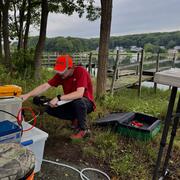
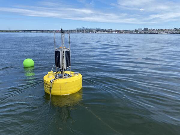
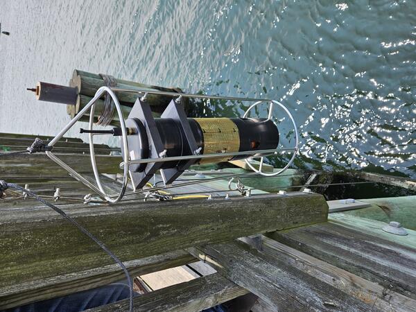
New England WSC scientist calibrating a continuous water quality monitor at 410606073245700, Norwalk River at the Norwalk Aquarium.
Kaitlin L Laabs
Kaitlin Laabs is a Supervisory Hydrologic Technician in the New England Water Science Center.
Kaitlin began her career at the USGS in 2014 as a Hydrologic Technician working primarily on the Connecticut water quality network. In her current position, Kaitlin's primary role involves both discrete water quality sampling as well as continuous monitor maintenance. Prior to working at the USGS, Kaitlin interned with Howard Laboratories testing homeowners well for drinking water quality.
Professional Experience
Supervisory Hydrologic Technician, U.S. Geological Survey, New England Water Science Center, 2024 to Present
Hydrologic Technician, U.S. Geological Survey, New England Water Science Center, 2014 to 2024
Education and Certifications
M.S. Sustainability Science, University of Massachusetts Amherst, 2014
B.S. Wildlife and Fisheries Conservation (Biology minor), University of Massachusetts Amherst, 2012
Science and Products
Evaluating water-quality conditions in the mainstem and tidal reaches of the Merrimack River in Massachusetts, June to September 2020
Water-quality monitoring of the Merrimack River watershed in Massachusetts
Surface-water-quality data to support implementation of revised freshwater aluminum water-quality criteria in Massachusetts, 2018–19
Hydrogeology and interactions of groundwater and surface water near Mill Creek and the Herring River, Wellfleet, Massachusetts, 2017–18
Continuous Water Quality Monitoring in the Norwalk River Estuary
Base-Flow Water Quality Sampling in Small Basins Draining to Long Island Sound
Water Quality Monitoring of Merrimack River Watershed
Water Quality Sampling and Monitoring of the Pawcatuck River Watershed
Surface Water Quality Monitoring in Rhode Island
Nitrogen Loads, Yields, and Associated Field Data Collected During Baseflow Conditions and Site Attributes for Small Basins Draining to Long Island Sound
Water-Quality Data for Discrete Samples and Continuous Monitoring on the Merrimack River, Massachusetts, June to September 2020
Data on Models to Describe Groundwater Levels and Stream Stage near the Herring River, Wellfleet, Cape Cod, Massachusetts, 2017-2022
Highway-Runoff Database (HRDB) Version 1.0.0b
New England WSC scientist calibrating a continuous water quality monitor at 410606073245700, Norwalk River at the Norwalk Aquarium.
Hydrologic technician preparing to complete discharge measurement at the USGS sample location 0119665996 (Denison Brook at Beach Pond Road near Voluntown, Connecticut).
Hydrologic technician collecting a discharge measurement in conjunction with a water quality sample at USGS site 01195149, Huzzle Guzzle Brook near Madison, Connecticut.
USGS sample location at 01208948, Sasco Brook at Southport, Connecticut on Ingleside Road above Banks Pond.
A new USGS sample location at 01193400, Fawn Brook near North Westchester, Connecticut. Pictured are scientists reconning the site for viability.
A new USGS sample location at 01193400, Fawn Brook near North Westchester, Connecticut. Pictured are hydrologists reconning the site for viability.
USGS sample location at 01201995, West Branch Shepaug River at Cornwall Bridge Connecticut.
A new USGS sample location at 01126908, Mount Misery Brook above Lowden Brook near Voluntown, Connecticut.
Hydrologic technician servicing continuous water quality monitor at Mystic River US Route I-95 Bridge near Old Mystic, Connecticut, (USGS site ID 412240071574700)
Hydrologic technician servicing continuous water quality monitor at Mystic Harbor at Safe Harbor Marina near Mystic, Connecticut (USGS site ID 412240071580800)
Hydrologic technician conducting a discharge measurement at USGS site 011006988, Merrimack River at Bates Bridge, Haverhill Massachusetts.
Hydrologic technicians collecting a water-quality sample from a boat at USGS site 011006988, Merrimack River at Bates Bridge, Haverhill, Massachusetts.
A bridge board sampler used for collecting water-quality samples set up at USGS site 01100000, Merrimack River, Lowell, Massachusetts.
Water-Quality Data Collection Sites in the Merrimack River Basin and its Major Tributaries
This interactive map displays the location of water-quality data-collection sites, the drainage area for the Merrimack River, and selected streams in the Merrimack River Basin.