
Oversaturation
Landsat data are systematic, geometric, radiometric, and terrain corrected to provide the highest quality data to the user communities. Occasionally, anomalies occur and artifacts are discovered that require research and monitoring.
Return to Landsat Known Issues Overview
When the detectors in a sensor view an object that is too bright, they record a flat value of 255 in the 8-bit data from the Landsat satellites (known as saturation). However, when the object viewed is much brighter than the sensor can handle, a semiconductor effect in the detectors causes an artifact known as Oversaturation.
In general, Oversaturation causes the detector to cease operating correctly for a short time, returning null values (or occasionally, quick oscillations between 0 and 255). Sometimes, a crosstalk effect occurs, creating brief periods of noise in other non-saturated detectors in the affected band.
Oversaturation on the Landsat satellites is common over fires, some bright city lights, and more rarely over large reflective surfaces that are oriented to reflect the Sun toward the satellite. Depending on the cause, Oversaturation artifacts may affect all reflective bands, or they may affect some bands but not others–for example, Bands 5 and 7 are often affected, with no artifact in the visible bands. Band 6 is the only band in which Oversaturation has never been found.

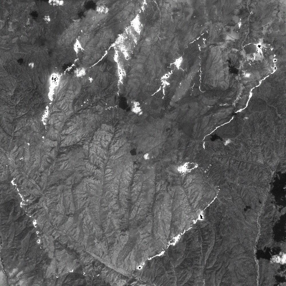
Fire Saturation
Wildfires and active volcanoes are common causes of Oversaturation. They usually cause Oversaturation in the Short Wavelength Infrared (SWIR) bands (Bands 5 and 7), but the artifact has been seen in other bands. Because wildfires can cover a wide area, the Oversaturation artifacts associated with them can be large.


Extraneous Line Fill
Landsat 5 Thematic Mapper (TM) Band 4 is especially vulnerable to Oversaturation, and it commonly exhibits this artifact when viewing well-lit clouds. The name "extraneous line fill" has been used in the past to describe this form of Oversaturation.

Despite their dramatic appearance, Oversaturation artifacts are considered to be minor, and they cause no permanent harm to the Landsat sensors. They are uncorrectable.