



Tapwater contaminant mixtures and cumulative risk screening on the Crow (Apsáalooke) Reservation
Remote detection of streambank erosion and channel incision using high-resolution, repeat lidar-derived metrics in Raleigh, North Carolina
SAWSC Participates in the North Carolina Drought Management Advisory Council Annual Meeting
SAWSC Meets with National Weather Service (NWS) and Henderson County Emergency Services
NWS uses USGS data for flood-forecast models
NWS uses USGS data for flood-forecast models
Bridge Construction and Streamflow
Water-quality and Channel Morphology, French Broad River, NC
Water-quality and Channel Morphology, French Broad River, NC
South Atlantic Water Science Center (SAWSC)
Welcome to USGS South Atlantic Water Science Center's (SAWSC) Website. We offer water information for Georgia, North Carolina, and South Carolina.
Hydrologic Data at SAWSC
Hydrologic Data at SAWSC

We provide current and historical surface-water, groundwater, water quality, water use, and ecological data in various formats (map, graphical, tabular).
Science at SAWSC
Science at SAWSC

The South Atlantic Water Science Center collects high-quality hydrologic data and conducts unbiased, scientifically sound research on Georgia's, North Carolina's, and South Carolina's water resources.
News
Low-Flow Statistics Flow Report Available in StreamStats
Low-Flow Statistics Flow Report Available in StreamStats
SAWSC Scientists Share Latest Research Results at North Carolina Water Resources Research Institute (NC WRRI) Conference
SAWSC Scientists Share Latest Research Results at North Carolina Water Resources Research Institute (NC WRRI) Conference
Wildfires continue to burn in Georgia, North and South Carolina
Wildfires continue to burn in Georgia, North and South Carolina
Publications
Tapwater contaminant mixtures and cumulative risk screening on the Crow (Apsáalooke) Reservation Tapwater contaminant mixtures and cumulative risk screening on the Crow (Apsáalooke) Reservation
Introduction: Water insecurity is a challenge for the Apsáalooke (Crow) Tribal Nation in south-central Montana, United States. Both private-well and public-supply tapwater (TW) are vulnerable to a range of contaminants, posing potential risks to community health and well-being. Ongoing community concerns about unrecognized inorganic, organic, and microbial contaminants underscore the...
Remote detection of streambank erosion and channel incision using high-resolution, repeat lidar-derived metrics in Raleigh, North Carolina Remote detection of streambank erosion and channel incision using high-resolution, repeat lidar-derived metrics in Raleigh, North Carolina
This study evaluated the use of lidar data to detect streambank erosion and channel incision throughout Raleigh, North Carolina. The study included five components. (1) Generation of lidar-derived rasters, including a digital elevation model of difference that represented channel erosion and positive openness rasters that represented channel incision. (2) Completion of site-based field...
Comparative screening of private, public, and bottled drinking water in vitro bioactivity Comparative screening of private, public, and bottled drinking water in vitro bioactivity
This study compares in vitro bioactivity profiles of extracts from private tapwater (51 samples), public tapwater (143 samples), and bottled water (31 samples), using high-throughput, multiplex, transcription factor screening. Of 48 biological end points tested, 25 showed significant (≥50% above the field blank) activity. Frequently detected (≥10% of samples) bioactivities (in decreasing...
Science

Raleigh Bank Erosion Project
The City of Raleigh partnered with the U.S. Geological Survey (USGS) to assist in assessing streambank erosion hotspots along the City of Raleigh’s stream network to support the City’s efforts of prioritizing future stream mitigation projects. Streambank erosion potential will be assessed using remotely sensed light detection and ranging (lidar) data, field assessments of streambank conditions...
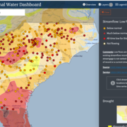
South Atlantic Water Science Center Drought Monitoring
When rainfall is less than normal for several weeks, months, or years, the flow of streams and rivers declines, water levels in lakes and reservoirs fall, and the depth to water in wells increases. If dry weather persists and water-supply problems develop, the dry period can become a drought.

South Atlantic Water Science Center (SAWSC) Employment Opportunities
SAWSC Current Job Openings: (There are currently no job openings) The United States Geological Survey’s (USGS) South Atlantic Water Science Center (SAWSC) offers full time, paid positions in North Carolina, South Carolina and Georgia to U.S. Citizens. These positions are ideally suited for talented individuals seeking hands on experience in environmental science, hydrology, physical science, and...