



Water data for Michigan, Minnesota, and Wisconsin
Access real-time and historical data for surface water, groundwater, water quality, and water use
Access real-time and historical data for surface water, groundwater, water quality, and water use
Edge-of-field monitoring
Testing the effectiveness of agricultural conservation practices for reducing nutrient and sediment runoff
Testing the effectiveness of agricultural conservation practices for reducing nutrient and sediment runoff
SPARROW models of streamflow and nitrogen, phosphorus, and suspended-s
SPARROW Watershed Models of Loads in Midwest Streams
SPARROW Watershed Models of Loads in Midwest Streams
Great Lakes urban stormwater monitoring
Assessing the ability of green infrastructure to reduce stormwater runoff in Great Lakes urban areas
Assessing the ability of green infrastructure to reduce stormwater runoff in Great Lakes urban areas
Great Lakes mercury sources revealed
Mercury "footprinting" identifies sources of pollution in the Great Lakes
Mercury "footprinting" identifies sources of pollution in the Great Lakes
Upper Midwest Water Science Center
Welcome to the Upper Midwest Water Science Center’s (UMid) Website. We offer information on streamflow, water quality, water-use, and groundwater data for Minnesota, Wisconsin and Michigan. We conduct unbiased, scientific hydrologic investigations and research projects to effectively manage the Upper Midwest's and our Nation's water resources through joint efforts with our partners.
Current conditions in MI, MN, and WI
Current conditions in MI, MN, and WI

Explore real-time streamflow, groundwater, and water-quality conditions and access data with our interactive map application.
Message from the Director
Message from the Director

Learn more about the Upper Midwest Water Science Center from Steve Peterson, our Center Director.
Upper Midwest Water Science Center Quick Links
Upper Midwest Water Science Center Quick Links
News
Media Alert: Low-level Flights to Image Geology over Northeastern Iowa and Southeastern Minnesota
Media Alert: Low-level Flights to Image Geology over Northeastern Iowa and Southeastern Minnesota
Media Alert: Low-level helicopter flights to image geology of Lake Superior Basin
Media Alert: Low-level helicopter flights to image geology of Lake Superior Basin
Summer 2026 Student Research Opportunities at the Upper Midwest Water Science Center
Summer 2026 Student Research Opportunities at the Upper Midwest Water Science Center
Publications
Association of runoff risk with private well contamination in a fractured dolostone aquifer Association of runoff risk with private well contamination in a fractured dolostone aquifer
In the United States, private well owners are responsible for monitoring and maintaining their drinking water but have little control over neighboring contamination sources and limited information about daily water quality. Potential for rapid contamination in karst settings exacerbates the challenge. The Runoff Risk Advisory Forecast (RRAF) is a real-time online tool available in five...
Evidence for contemporary soil mercury contamination from late 1700s North American fur trade Evidence for contemporary soil mercury contamination from late 1700s North American fur trade
Soils from Grand Portage National Monument, MN, are locally higher in mercury (Hg) than those of the western Great Lakes region, with enrichment up to 21-fold at its fur trade depots compared to off-site locations. A potential historical source was the trade of vermilion (containing HgS) along the Grand Portage Trail during the 17–19th centuries. Mercury stable isotope values in trade...
Decoding the oxidative digestion mechanism for polystyrene nanoplastic detection in the Great Lakes using a customizable Raman spectral processing algorithm Decoding the oxidative digestion mechanism for polystyrene nanoplastic detection in the Great Lakes using a customizable Raman spectral processing algorithm
Despite the concerns surging around nanoplastics (NPs) regarding their prevalence and bioavailability in freshwater systems, robust detection of NPs in complex environmental matrices is hindered by the lack of standardized sample pretreatment and a mechanistic understanding of oxidative digestion. Here, we systematically investigate the interaction between hydrogen peroxide (H2O2) and...
Science

SPARROW modeling: Estimating nutrient, sediment, and dissolved solids transport
SPARROW (SPAtially Referenced Regression On Watershed attributes) models estimate the amount of a contaminant transported from inland watersheds to larger water bodies by linking monitoring data with information on watershed characteristics and contaminant sources. Interactive, online SPARROW mapping tools allow for easy access to explore relations between human activities, natural processes, and...
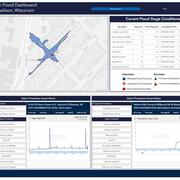
Low-Cost Sensor Networks for Pluvial Flash Flood Detection and Early Warning in Urban Areas
Flooding in urban areas is a serious weather-related threat to life and property. One type of flooding, called pluvial flooding, occurs during periods of intense rainfall where runoff overwhelms the capacity of soil to absorb it. In urban areas, pluvial flooding can be particularly dangerous because much of a city is covered by impervious surfaces such as streets, roofs, and parking lots forcing...
Oscillating Flows in the Milwaukee River Estuary
How do Lake Michigan water level variations and seiches affect the Milwaukee River estuary, its harbor, and rivers upstream?