
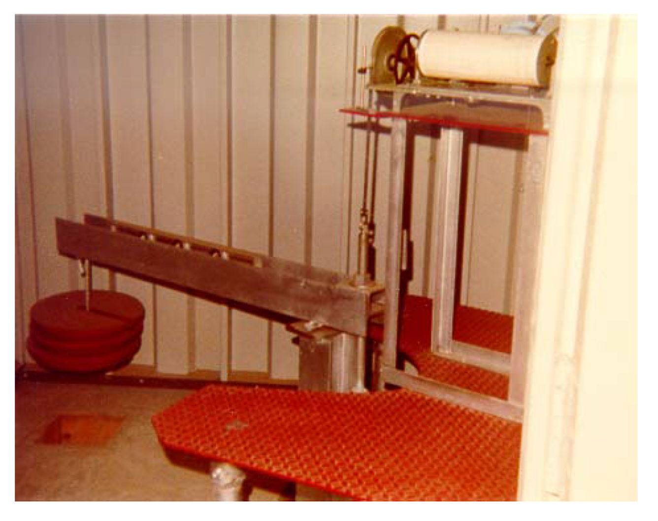
Franklin Extensometer Historical Photo
By Virginia and West Virginia Water Science Center
2002 (approx.)
Detailed Description
Image of the original extensometer at Franklin, Virginia, which recorded aquifer compaction from 1979 to 1995.
Originally published in:
Pope, J. P. (2002). Characterization and modeling of land subsidence due to groundwater withdrawals from the confined aquifers of the Virginia Coastal Plain (Doctoral dissertation, Virginia Tech).
Sources/Usage
Public Domain.
Pope, J. P. (2002). Characterization and modeling of land subsidence due to groundwater withdrawals from the confined aquifers of the Virginia Coastal Plain (Doctoral dissertation, Virginia Tech).
Related

The Virginia Extensometer Network
Borehole extensometers are instruments that monitor land subsidence caused by aquifer compaction. They provide precise, high-resolution measurements of changes in aquifer-system thickness. These changes in aquifer-system thickness contribute to vertical land motion (VLM) across the Virginia Coastal Plain, and are driven primarily by groundwater level decline due to human water usage. The Virginia...

Land Subsidence on the Virginia Coastal Plain
Land subsidence is a loss of ground elevation, often experienced as the ground slowly sinking over the course of years. In eastern Virginia, high rates of groundwater use is a major factor in the land subsidence affecting the area. The Virginia-West Virginia Water Science Center, with the help of our partners, has been monitoring land subsidence in the Virginia Coastal Plain since 1979 using a...
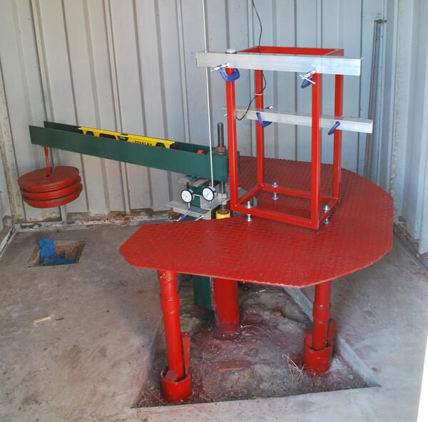
Franklin Extensometer
Franklin Extensometer


Related
The Virginia Extensometer Network
Borehole extensometers are instruments that monitor land subsidence caused by aquifer compaction. They provide precise, high-resolution measurements of changes in aquifer-system thickness. These changes in aquifer-system thickness contribute to vertical land motion (VLM) across the Virginia Coastal Plain, and are driven primarily by groundwater level decline due to human water usage. The Virginia...
Land Subsidence on the Virginia Coastal Plain
Land subsidence is a loss of ground elevation, often experienced as the ground slowly sinking over the course of years. In eastern Virginia, high rates of groundwater use is a major factor in the land subsidence affecting the area. The Virginia-West Virginia Water Science Center, with the help of our partners, has been monitoring land subsidence in the Virginia Coastal Plain since 1979 using a...
Franklin Extensometer
Franklin Extensometer