
Landsat Missions Timeline
Detailed Description
In a September 21, 1966 press release, Secretary of the Interior Stewart Udall announced that the DOI was launching "Project EROS (Earth Resources Observation Satellites)." Udall's vision was to observe the Earth for the benefit of all.
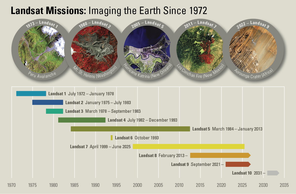
Since the July 23, 1972 launch of the Earth Resources Technology Satellite (ERTS-1, later renamed Landsat 1), the joint U.S. Geological Survey / NASA Landsat series of satellites have continuously acquired images of the Earth’s land surface, providing uninterrupted data to help land managers and policymakers make informed decisions about natural resources and the environment.
To learn more about each of the Earth observation missions, visit the Landsat Missions Web Site.
Sources/Usage
Public Domain.
Related

When was the Landsat 9 satellite launched? When was the Landsat 9 satellite launched?
Landsat 9—a partnership between the USGS and NASA—was launched from Space Launch Complex 3E at Vandenberg Air Force Base in California upon a United Launch Alliance Atlas V 401 launch vehicle on September 27, 2021. Learn more: Landsat 9 Mission
Related
When was the Landsat 9 satellite launched? When was the Landsat 9 satellite launched?
Landsat 9—a partnership between the USGS and NASA—was launched from Space Launch Complex 3E at Vandenberg Air Force Base in California upon a United Launch Alliance Atlas V 401 launch vehicle on September 27, 2021. Learn more: Landsat 9 Mission