

The St. Mary and Milk Rivers cross the U.S. and Canadian border and supply water to both countries. Managing that resource in the interest of both nations is a matter of international collaboration and cooperation, and Landsat data is helping offer objective information on water use.
Montana and Landsat

Discover How Landsat Benefits Montana
Discover How Landsat Benefits Montana
See Montana from Space
See Montana from Space
Use the links below to explore more Landsat resources highlighting Montana.
Detailed Description
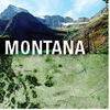
The landscapes beneath Montana’s big sky are as breathtaking as the State’s nickname would suggest. Visitors to the 41st State's "Big Sky Country" can take in the stunning icy hues of aquamarine at Glacier National Park; explore the northern swaths of Yellowstone National Park; or hike, bike, or boat through Bighorn Canyon National Recreation Area, and those are just the National parks.
Montana is the fourth-largest State by land area, with miles upon miles of forests, rolling prairie rangelands, croplands, badlands, and mountains, from which flow a sizable part of the Nation’s water supply. The headwaters of the Missouri River, which covers 2,341 miles before merging with the Mississippi River, are located in Three Forks, Montana. On the opposite side of the Continental Divide, the Kootenai, Clark Fork, Blackfoot, Bitterroot, and Flathead Rivers flow across Montana and into the Columbia River, which ultimately empties into the Pacific Ocean.
The Treasure State’s cherished landscapes face many threats, however: fire-fueling invasive grasses, increasing temperatures caused by climate change, shifting land use patterns, water supply contractions, and more. The U.S. Geological Survey Landsat satellite program’s imagery can improve Montanans’ understanding of land change and offer valuable insight for the ranchers, farmers, land and resource managers, firefighters, and urban planners.
Visit Landsat Benefits, State By State to learn more about how Landsat brings science to your state.
Sources/Usage
Public Domain.
Related
Explore related podcasts and videos!

Eyes on Earth Episode 43 - U.S.-Canada Water Use
The St. Mary and Milk Rivers cross the U.S. and Canadian border and supply water to both countries. Managing that resource in the interest of both nations is a matter of international collaboration and cooperation, and Landsat data is helping offer objective information on water use. On today’s episode of Eyes on Earth, we hear from Roy Sando of the USGS, who’s working with EROS experts and the...
The St. Mary and Milk Rivers cross the U.S. and Canadian border and supply water to both countries. Managing that resource in the interest of both nations is a matter of international collaboration and cooperation, and Landsat data is helping offer objective information on water use.

Image of the Week: Bird Island Ablaze
In Montana, wildfire swept across Flathead Lake's 30 acre Bird Island in early August of 2020. Landsat 8 captured this imagery one day after the fire began. The satellite's short wave infrared and near infrared bands reveal the active fire covering approximately half of the island. Smoke obscures the remainder.
In Montana, wildfire swept across Flathead Lake's 30 acre Bird Island in early August of 2020. Landsat 8 captured this imagery one day after the fire began. The satellite's short wave infrared and near infrared bands reveal the active fire covering approximately half of the island. Smoke obscures the remainder.

Landsat will help U.S. and Canada Share River’s Water Landsat will help U.S. and Canada Share River’s Water
A river meanders serenely through the northern prairie, waters flowing eastward. The scene’s simplicity belies the complex nature of how the water is used—especially when the river flows from one country to another and back.
Related
Explore related podcasts and videos!
Eyes on Earth Episode 43 - U.S.-Canada Water Use
The St. Mary and Milk Rivers cross the U.S. and Canadian border and supply water to both countries. Managing that resource in the interest of both nations is a matter of international collaboration and cooperation, and Landsat data is helping offer objective information on water use. On today’s episode of Eyes on Earth, we hear from Roy Sando of the USGS, who’s working with EROS experts and the...
Eyes on Earth Episode 43 - U.S.-Canada Water Use
The St. Mary and Milk Rivers cross the U.S. and Canadian border and supply water to both countries. Managing that resource in the interest of both nations is a matter of international collaboration and cooperation, and Landsat data is helping offer objective information on water use.
The St. Mary and Milk Rivers cross the U.S. and Canadian border and supply water to both countries. Managing that resource in the interest of both nations is a matter of international collaboration and cooperation, and Landsat data is helping offer objective information on water use.
Image of the Week: Bird Island Ablaze
In Montana, wildfire swept across Flathead Lake's 30 acre Bird Island in early August of 2020. Landsat 8 captured this imagery one day after the fire began. The satellite's short wave infrared and near infrared bands reveal the active fire covering approximately half of the island. Smoke obscures the remainder.
In Montana, wildfire swept across Flathead Lake's 30 acre Bird Island in early August of 2020. Landsat 8 captured this imagery one day after the fire began. The satellite's short wave infrared and near infrared bands reveal the active fire covering approximately half of the island. Smoke obscures the remainder.
Landsat will help U.S. and Canada Share River’s Water Landsat will help U.S. and Canada Share River’s Water
A river meanders serenely through the northern prairie, waters flowing eastward. The scene’s simplicity belies the complex nature of how the water is used—especially when the river flows from one country to another and back.