
Seafloor Offshore of Half Moon Bay
By Pacific Coastal and Marine Science Center
2012 (approx.)

Detailed Description
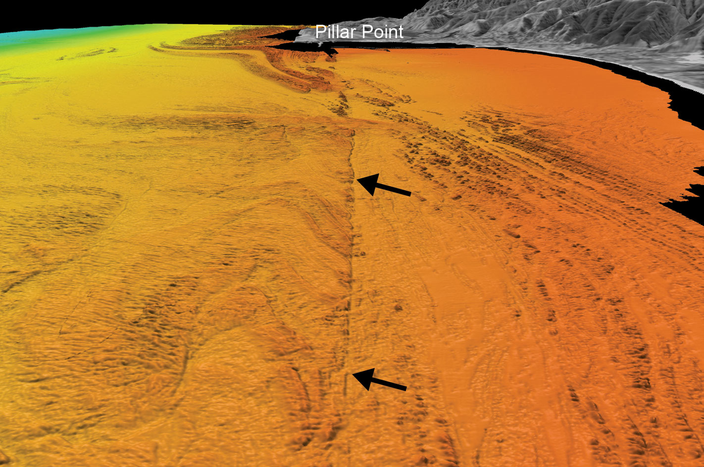
Perspective view of seafloor offshore of Half Moon Bay, showing scarp (arrows) along the eastern strand of the San Gregorio fault zone. Rocks are notably upwarped and folded adjacent to the fault.
Sources/Usage
Public Domain.
California State Waters Map Series—Offshore of Half Moon Bay, California
This comes specifically from Sheet 4, Data Integration and Visualization, and shows the colored shaded-relief bathymetry and various perspective views and bathymetric profiles combined with video-mosaic images created from seafloor digital video.
Related

Offshore Faults along Central and Northern California
From Point Conception to Cape Mendocino, seafloor faults have been, in the past, mapped in varying ways and without enough detail to assess their earthquake potential. To provide this important information, USGS uses advanced technology to image offshore faults that could trigger devastating earthquakes near densely populated areas and a nuclear power plant.

Coastal and Marine Geohazards of the U.S. West Coast and Alaska
Coastal and marine geohazards are sudden and extreme events beneath the ocean that threaten coastal populations. These underwater hazards include earthquakes, volcanic eruptions, landslides, and tsunamis. The tectonically active west coast of the Americas is prone to such hazards, as it lies along the boundaries of major tectonic plates that make up the Earth's crust—the North American, Caribbean...
Related
Offshore Faults along Central and Northern California
From Point Conception to Cape Mendocino, seafloor faults have been, in the past, mapped in varying ways and without enough detail to assess their earthquake potential. To provide this important information, USGS uses advanced technology to image offshore faults that could trigger devastating earthquakes near densely populated areas and a nuclear power plant.
Coastal and Marine Geohazards of the U.S. West Coast and Alaska
Coastal and marine geohazards are sudden and extreme events beneath the ocean that threaten coastal populations. These underwater hazards include earthquakes, volcanic eruptions, landslides, and tsunamis. The tectonically active west coast of the Americas is prone to such hazards, as it lies along the boundaries of major tectonic plates that make up the Earth's crust—the North American, Caribbean...