
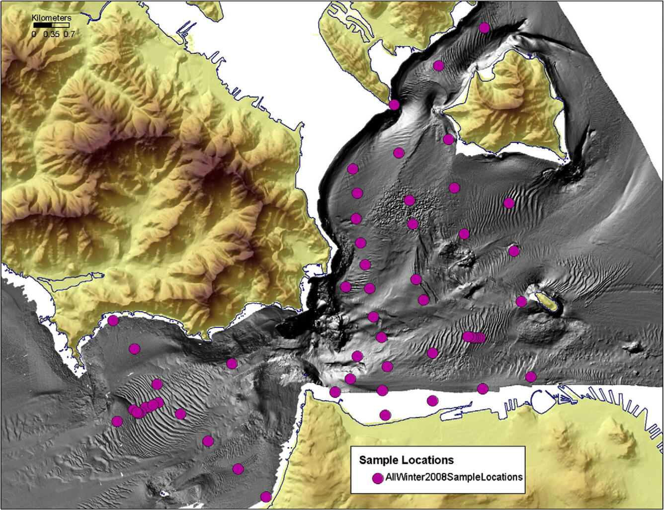
Sediment sample locations
By Pacific Coastal and Marine Science Center
2013 (approx.)
Detailed Description
Gray shaded-relief image (or map) is used to provide a 3D representation of the floor of San Francisco Bay, or bathymetry (water depth). The land surrounding San Francisco Bay is colored to also provide a 3D representation of relief, or topography (land elevation). Locations of USGS sediment samples collected in winter 2008 within the San Francisco Bay study area are shown as dots on the shaded-relief map, and these samples are used to verify, or groundtruth, the bathymetric map.
Sources/Usage
Public Domain.
Related

San Francisco Bay geomorphology
The primary objective of this task is to develop tools for predicting the long-term geomorphic evolution of estuaries. Sediment core and historical change analysis will be used in combination with interpretation of high-resolution seismic profiles to develop tools for predicting geomorphic evolution of estuaries. Historical change analysis will use hydrographic and lidar data. Longer-term data...
Related
San Francisco Bay geomorphology
The primary objective of this task is to develop tools for predicting the long-term geomorphic evolution of estuaries. Sediment core and historical change analysis will be used in combination with interpretation of high-resolution seismic profiles to develop tools for predicting geomorphic evolution of estuaries. Historical change analysis will use hydrographic and lidar data. Longer-term data...