
Santa Cruz Core Splitting Laboratory
Learn about the Core Splitting Lab at the USGS Pacific Coastal and Marine Science Center in Santa Cruz, California.
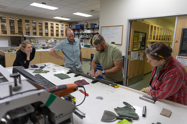
In the Core Splitting Lab we have a Geotek core splitter, shrink wrap system, and a wide assortment of sampling tools and balances for core sample preparation and analysis. Additionally, we have a microscope workstation available for dissection of sediment samples, microfossil analysis, and/or selecting organic material for radiocarbon sample preparation.
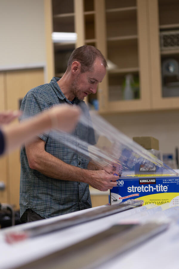
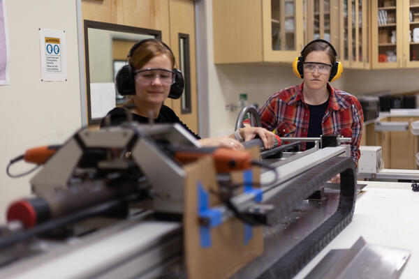
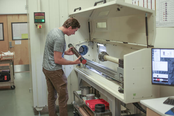
In this lab, aluminum-lined cores and acrylic-lined cores are split using our GeoTek Core Splitter, which uses a band saw that vibrates and melts the lining, allowing a utility blade to cut the liner for a clean and precise cut. Cores that are split can be shrink-wrapped using the lab’s shrink-wrap machine for better preservation and long-term storage. Cores, either whole or split, are stored in our in-house core repository or in our larger location located in Moffit Field. GeoTek Rotating X-ray CT System (RXCT) and Multi Sensor Core Logger (MSCL-S) are utilized for any core imaging and line scanning needs.
The Core Splitting Lab also houses a sub-sampling station for core analysis using various tools. Sediment intervals for radiocarbon analysis can be analyzed with the lab’s microscope station. Also available are ovens for drying needs. Any request for lab use or sample submission should be address to the lab manager Jason Padgett (jpadgett@usgs.gov)
The Core Splitting Lab is co-located alongside the Core Scanning Lab and the USGS Southwest Region Sample Repository.

News
New Video Offers Virtual Tour of the USGS Sediment Core Lab
Searching for Evidence of Past Tsunamis in Sediment Cores
South Korean Geoscientists Visit the USGS in Menlo Park and Santa Cruz, California
Publications
Marine paleoseismic evidence for seismic and aseismic slip along the Hayward-Rodgers Creek fault system in northern San Pablo Bay Marine paleoseismic evidence for seismic and aseismic slip along the Hayward-Rodgers Creek fault system in northern San Pablo Bay
Late Holocene environmental change in Celestun Lagoon, Yucatan, Mexico Late Holocene environmental change in Celestun Lagoon, Yucatan, Mexico
Plate boundary localization, slip-rates and rupture segmentation of the Queen Charlotte Fault based on submarine tectonic geomorphology Plate boundary localization, slip-rates and rupture segmentation of the Queen Charlotte Fault based on submarine tectonic geomorphology
Science

Cascadia Subduction Zone Marine Geohazards

Hazards: EXPRESS
