
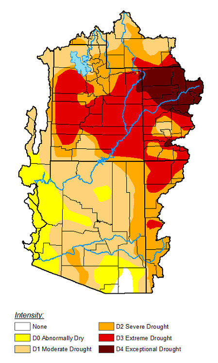
U.S. Drought Monitor Drought Conditions Map, National Weather Service Colorado River Basin Forecast Center, April 7, 2026
Detailed Description
Image for the USGS Colorado River Basin Actionable and Strategic Integrated Science and Technology (ASIST) Initiative, geonarrative about the intersection of water use for copper mining and historic drought in the Lower Colorado River Basin (primarily Arizona), April 7, 2026.
Sources/Usage
Public Domain.
Public Domain, published online by the U.S. Drought Monitor
Related

Copper mining, critical minerals, and long-term drought in the Southwest United States
Long-term drought in the Southwest U.S. affects water use across many sectors as well as the natural environment. The Southwest U.S. is an important area for mining porphyry copper deposits, which consist of copper minerals disseminated in breccia, a type of rock composed of coarse rock fragments held together by cement or a fine-grained matrix, that are the World's largest source of copper...
Related
Copper mining, critical minerals, and long-term drought in the Southwest United States
Long-term drought in the Southwest U.S. affects water use across many sectors as well as the natural environment. The Southwest U.S. is an important area for mining porphyry copper deposits, which consist of copper minerals disseminated in breccia, a type of rock composed of coarse rock fragments held together by cement or a fine-grained matrix, that are the World's largest source of copper...