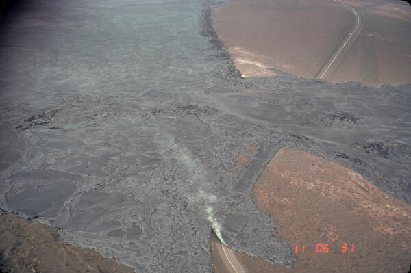
Arching fountain of lava approximately 10 meters high issuing from the western end of the 0740 vents, a series of spatter cones 170 meters long, south of Pu'u Kahaualea on Hawai'i Island's Kilauea Volcano (episode 2). Episodes 2 and 3 were characterized by spatter and cinder cones, such as Pu'u Halulu, which was 60 meters high by episode 3.
Images
Images related to natural hazards.
Arching fountain of lava approximately 10 meters high issuing from the western end of the 0740 vents, a series of spatter cones 170 meters long, south of Pu'u Kahaualea on Hawai'i Island's Kilauea Volcano (episode 2). Episodes 2 and 3 were characterized by spatter and cinder cones, such as Pu'u Halulu, which was 60 meters high by episode 3.
Forest of lava trees resulting from eruption of a 1-km-line of vents east of Pu'u Kahaulea on Hawai'i Island's Kilauea Volcano. The bulbous top of each lava tree marks the high stand of the lava flow as it spread through the trees.
Lava fountains erupting from fissures, Kīlauea, Hawai‘i
Lava fountains erupting from fissures, Kīlauea, Hawai‘iLava fountains erupt from fissures during the first week of the Pu‘u ‘Ō‘ō eruption south of Pu‘u Kahaualea, approximately 2.4 km (1.5 miles) northeast of where subsequent eruptions built the Pu‘u ‘Ō‘ō cone. The early fissures cut through old forested lava flows in a remote section of Kīlauea's east rift zone.
Early Warning Gage on Coldwater Lake at Mount St. Helens continuous...
Early Warning Gage on Coldwater Lake at Mount St. Helens continuous...One major concern to people living downstream of Mount St. Helens was a breakout of any of the impounded lakes, such as Coldwater or Castle Lakes, due to the instability of the debris dams blocking them. Flood waters from a breakout could be more catastrophic than the lahars of May 18, 1980.
The September 25, 1982, Kaluapele eruption was a brief but vigorous event that followed nearly two hours of seismic unrest and rapid summit inflation. Lava erupted from a 1,150-foot-long fissure near the southern end of the caldera, producing fountains up to 220 feet high.
Plume rises from Mount St. Helens' dome, Spirit Lake in foreground;...
Plume rises from Mount St. Helens' dome, Spirit Lake in foreground;...Plume rises from Mount St. Helens' dome, Spirit Lake in foreground; view from the north. May 19, 1982.
Plume rises from Mount St. Helens' dome, Spirit Lake in foreground;...
Plume rises from Mount St. Helens' dome, Spirit Lake in foreground;...Plume rises from Mount St. Helens' dome, Spirit Lake in foreground; view from the north. May 19, 1982.
Plume of steam, gas, and ash viewed from Harry's Ridge (8 km/5 mi n...
Plume of steam, gas, and ash viewed from Harry's Ridge (8 km/5 mi n...Plumes of steam, gas, and ash often occured at Mount St. Helens in the early 1980s. On clear days they could be seen from Portland, Oregon, 50 miles (81 kilometers) to the south.
The April 30, 1982, Kaluapele eruption was a short-lived summit event that lasted about 19 hours. Lava erupted from a 3,200-foot-long fissure northeast of Halemaʻumaʻu crater, producing low fountains 15–30 feet high, with bursts up to 160 feet.
Lahar (dark deposit on the snow) originating in the Mount St. Helen...
Lahar (dark deposit on the snow) originating in the Mount St. Helen...The lahar flowed from the crater into the North Fork Toutle River valley and eventually reached the Cowlitz River 80 km (50 mi) downstream. The lahar also entered Spirit Lake, which can be seen in the lower left corner.
Erosion along the banks of the Toutle River results in resedimentat...
Erosion along the banks of the Toutle River results in resedimentat...People living adjacent to streams and rivers that flow away from the volcano are continually impacted by the upstream erosion and downstream sedimentation of the large volume of material erupted in 1980. The decrease in carrying capacity in downstream channels increases the chance for flooding.
Glacier extent maps from before and after May 18, 1980.
Glacier extent maps from before and after May 18, 1980.Glacier extent maps on Mount St. Helens from before and after the May 18, 1980 eruption.
Glacier extent maps from before and after May 18, 1980.
Glacier extent maps from before and after May 18, 1980.Glacier extent maps on Mount St. Helens from before and after the May 18, 1980 eruption.
Outlet channels were built at Castle Lake and Coldwater Lake (shown...
Outlet channels were built at Castle Lake and Coldwater Lake (shown...Outlet channels were built at Castle Lake and Coldwater Lake (shown here) to stabilize water levels and prevent overtopping of the debris dams.
Outlet channels were built at Castle Lake and Coldwater Lake (shown...
Outlet channels were built at Castle Lake and Coldwater Lake (shown...Outlet channels were built at Castle Lake and Coldwater Lake (shown here) to stabilize water levels and prevent overtopping of the debris dams.
USGS geologists gathered samples by hand from vents on the dome and crater floor. Additionally, sulfur dioxide gas was measured from a specially equipped airplane before, during, and after eruptions to determine "emission rates" for the volcano.
Gas sampling around the Mount St. Helens dome. Analyzed results us...
Gas sampling around the Mount St. Helens dome. Analyzed results us...USGS geologists gathered samples by hand from vents on the dome and crater floor. Additionally, sulfur dioxide gas was measured from a specially-equipped airplane before, during, and after eruptions to determine "emission rates" for the volcano. During eruptions, emission rates typically increased to 5 to 10 times their pre-eruptive value.
Lava dome in Mount St. Helens' crater, Aug. 1981, viewed from a pho...
Lava dome in Mount St. Helens' crater, Aug. 1981, viewed from a pho...In this view the dome is 535 feet (163 meters) high and nearly 1/4 mile (0.4 kilometers) wide, making it taller than a 44-story building (or, nearly the height of the Washington Monument) and wider than the length of four football fields. Compare with image taken August 12, 1985 from the same location with the same camera.
Seismic station installation in Mount St. Helens's crater 1982
Seismic station installation in Mount St. Helens's crater 1982The U.S. Geological Survey, in conjunction with the University of Washington, maintain seismic stations at Mount St. Helens. An increase in seismicity (earthquakes) is often the first precursor to an approaching eruption.
Seismic station installation in Mount St. Helens's crater 1981 lava dome
Seismic station installation in Mount St. Helens's crater 1981 lava domeSeismic station installation in Mount St. Helens's crater 1981 lava dome. USGS, in conjunction with the University of Washington, maintain seismic stations at Mount St. Helens. An increase in seismicity (earthquakes) is often the first precursor to an approaching eruption.
Pyroclastic flow deposit from 7,700 year old Mount Mazama eruption ...
Pyroclastic flow deposit from 7,700 year old Mount Mazama eruption ...These pyroclastic-flow deposits of the climactic eruption of Mount Mazama, during which Crater Lake caldera formed, are eroded into spectacular spires at The Pinnacles on Wheeler Creek.
Pinnacles left by erosion of fumaroles that formed as layered pyroc...
Pinnacles left by erosion of fumaroles that formed as layered pyroc...Pinnacles left by erosion of fumaroles that formed as layered pyroclastic flow deposit released gas and solidified into chimneys that eventually eroded, Crater Lake, Oregon.
Lahars originating from Mount St. Helens after the 1980 eruption de...
Lahars originating from Mount St. Helens after the 1980 eruption de...Lahars originating from Mount St. Helens after the 1980 eruption destroyed more than 200 homes and over 185 miles (300 kilometers) of roads. Pictured here is a damaged home along the South Fork Toutle River.
Dome within Mount St. Helens crater (aerial view) from June 1981 wi...
Dome within Mount St. Helens crater (aerial view) from June 1981 wi...Between 1980 and 1986, Mount St. Helens' dome grew in different ways. From 1980 through 1982 the dome grew in periodic extrusions of stubby lava flows, called lobes. During this time frame Mount St. Helens' lobes grew at a rate of 3 to 10 feet per hour (1-3 meters/hour).