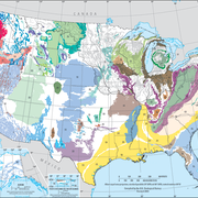
The Colorado River Basin (UCRB) drains parts of Wyoming, Utah, Colorado, New Mexico, Arizona, Nevada, California, and Mexico, and is divided into upper and lower basins at the compact point of Lee Ferry, Arizona. Aquifers in the UCRB are composed of permeable, moderately to well-consolidated sedimentary rocks ranging in age from Permian to Tertiary.

At least three groups of regional, productive water-yielding geologic units have been identified in the Colorado River Basin (UCRB) including Tertiary aquifers of limited extent in the northern and southeastern parts of the basin, Mesozoic aquifers throughout most of the study area, and deeper Paleozoic aquifers also throughout much of the study area. The Chinle-Moenkopi confining unit limits communication of water between Mesozoic and Paleozoic aquifers throughout much of the UCRB.
A regional Soil-Water-Balance model (USGS Techniques and Methods 6-A31) was constructed to estimate the water budget for UCRB groundwater system. As part of this effort, data were compiled for land use, soil hydrologic properties (available water content and hydrologic soil group) and overland flow direction at two resolutions (coarse and fine).
The data files listed below are supplemental to Documentation of input datasets for the soil-water-balance groundwater recharge model of the Upper Colorado River Basin (USGS Open-File Report 2015-1160). The report includes a description of methods used to derive the data.
Click on the links below to download files for this aquifer. For information about the available file types, see Aquifer data: Explanation of spatial data formats.
Soil-Water-Balance model inputs: Metadata
Non-spatial information: Text Files
- Soil-Water-Balance model control file (coarse resolution)
- Soil-Water-Balance model control file (fine resolution)
- Soil-Water-Balance model land use lookup table
Soil available water content:
- Coarse resolution Metadata ASCII grid
- Fine resolution Metadata ASCII grid
Hydrologic soil group:
- Coarse resolution Metadata ASCII grid
- Fine resolution Metadata ASCII grid
Land use:
- Coarse resolution Metadata ASCII grid
- Fine resolution Metadata ASCII grid
Overland flow direction:
- Coarse resolution Metadata ASCII grid
- Fine resolution Metadata ASCII grid
Below are other webpages associated with this aquifer.
Principal Aquifers of the United States
Regional Groundwater Availability Studies
Below are publications associated with this aquifer.
Documentation of input datasets for the soil-water balance groundwater recharge model of the Upper Colorado River Basin Documentation of input datasets for the soil-water balance groundwater recharge model of the Upper Colorado River Basin
SWB: A modified Thornthwaite-Mather Soil-Water-Balance code for estimating groundwater recharge SWB: A modified Thornthwaite-Mather Soil-Water-Balance code for estimating groundwater recharge
Ground Water Atlas of the United States Ground Water Atlas of the United States
Principal aquifers [of the United States] Principal aquifers [of the United States]
The Colorado River Basin (UCRB) drains parts of Wyoming, Utah, Colorado, New Mexico, Arizona, Nevada, California, and Mexico, and is divided into upper and lower basins at the compact point of Lee Ferry, Arizona. Aquifers in the UCRB are composed of permeable, moderately to well-consolidated sedimentary rocks ranging in age from Permian to Tertiary.

At least three groups of regional, productive water-yielding geologic units have been identified in the Colorado River Basin (UCRB) including Tertiary aquifers of limited extent in the northern and southeastern parts of the basin, Mesozoic aquifers throughout most of the study area, and deeper Paleozoic aquifers also throughout much of the study area. The Chinle-Moenkopi confining unit limits communication of water between Mesozoic and Paleozoic aquifers throughout much of the UCRB.
A regional Soil-Water-Balance model (USGS Techniques and Methods 6-A31) was constructed to estimate the water budget for UCRB groundwater system. As part of this effort, data were compiled for land use, soil hydrologic properties (available water content and hydrologic soil group) and overland flow direction at two resolutions (coarse and fine).
The data files listed below are supplemental to Documentation of input datasets for the soil-water-balance groundwater recharge model of the Upper Colorado River Basin (USGS Open-File Report 2015-1160). The report includes a description of methods used to derive the data.
Click on the links below to download files for this aquifer. For information about the available file types, see Aquifer data: Explanation of spatial data formats.
Soil-Water-Balance model inputs: Metadata
Non-spatial information: Text Files
- Soil-Water-Balance model control file (coarse resolution)
- Soil-Water-Balance model control file (fine resolution)
- Soil-Water-Balance model land use lookup table
Soil available water content:
- Coarse resolution Metadata ASCII grid
- Fine resolution Metadata ASCII grid
Hydrologic soil group:
- Coarse resolution Metadata ASCII grid
- Fine resolution Metadata ASCII grid
Land use:
- Coarse resolution Metadata ASCII grid
- Fine resolution Metadata ASCII grid
Overland flow direction:
- Coarse resolution Metadata ASCII grid
- Fine resolution Metadata ASCII grid
Below are other webpages associated with this aquifer.
Principal Aquifers of the United States
Regional Groundwater Availability Studies
Below are publications associated with this aquifer.


