
USGS geologist discusses erosion at Fort Funston for ABC7 News segment on landslide fatality
On Monday, February 25, 2019, research geologist Jonathan Warrick of the USGS Pacific Coastal and Marine Science Center spoke with ABC7 News about a February 22 landslide that injured one woman and buried another at San Francisco’s Fort Funston beach.
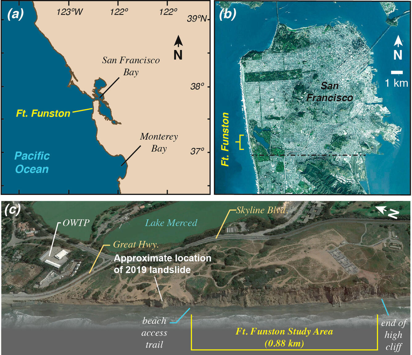
USGS research geologist Jonathan Warrick leads a project that analyzed historical aerial photographs to measure cliff change at Fort Funston from 2002 to 2010. He described USGS research on rates of cliff erosion and why they are higher at Fort Funston. The interview, conducted over Facetime, was arranged in collaboration with the USGS Geology, Minerals, Energy and Geophysics Science Center and the Office of Communication and Publishing. It was used in an evening news segment and an online article posted later that day. Related stories also mention USGS work:
- https://abc7news.com/timeline-fort-funstons-long-history-of-erosion/5152440/,
- https://abc7news.com/recovery-efforts-resume-after-woman-buried-in-landslide-at-fort-funston/5153206/,
- https://abc7news.com/recovery-efforts-ended-for-the-night-after-woman-buried-in-landslide-at-fort-funston/5152106/
Related

Remote Sensing Coastal Change
Related