
100K OnDemand Topo Cartographic Specifications - Geographic Names
100K OnDemand Topo cartographic specifications including feature symbology and labels for Natural Features, Landforms, and Populated Places.
Geographic Names Feature Types
Table of Contents
Natural Features
- Arch
- Area
- Arroyo
- Bar
- Basin
- Bay
- Beach
- Bench
- Bend
- Cape
- Channel
- Cliff
- Crater
- Crossing
- Falls
- Flat
- Gap
- Gut
- Island
- Isthmus
- Lava
- Pillar
- Plain
- Rapids
- Ridge
- Slope
- Spring
- Summit
- Swamp
- Valley
- Woods
Landforms
Populated Places (PPL) – Point
Populated Places (PPL) – Polygon
NATURAL FEATURES
Arch
Subtype of Natural Features
- FType: Arch
- FCode: Not applicable
- Feature Description: Natural arch-like opening in a rock mass (bridge, natural bridge, sea arch).
- Feature Geometry: Features not symbolized
Graphic Depiction
- Point Graphic Depiction: Not applicable
- Linear Graphic Depiction: Not applicable
- Polygon Graphic Depiction: Not applicable
Symbology Specifications
- Features Not Symbolized
Labeling

- Labeling Graphic Depiction:
- Label: Arch - Label
- Label Description: Brown italic text with official name of natural feature.
- Font Style: Segoe UI, Italic
- Font Size: 7.50 pt
- Font Color (R,G,B): 142, 91, 50
- Font Halo Size: 0.80 pt
- Font Halo Color (R,G,B): 240, 240, 240
- Placement Properties: Best position around point; Preferred offset 1 point, maximum 100%; Simplified label zones (center; then top center going clockwise): 0, 2, 1, 3, 5, 7, 8, 6, 4
Area
Subtype of Natural Features
- FType: Area
- FCode: Not applicable
- Feature Description: Any one of several areally extensive natural features not included in other categories (badlands, barren, delta, fan, garden).
- Feature Geometry: Features not symbolized
Graphic Depiction
- Point Graphic Depiction: Not applicable
- Linear Graphic Depiction: Not applicable
- Polygon Graphic Depiction: Not applicable
Symbology Specifications
- Features Not Symbolized
Labeling
- Labeling Graphic Depiction:
- Label: Area - Label
- Label Description: Brown italic text showing official name of feature.
- Font Style: Segoe UI, Italic
- Font Size: 7.50 pt
- Font Color (R,G,B): 142, 91, 50
- Font Halo Size: 0.80 pt
- Font Halo Color (R,G,B): 240, 240, 240
- Placement Properties: Best position around point; Preferred offset 1 point, maximum 100%; Simplified label zones (center; then top center going clockwise): 0, 2, 1, 3, 5, 7, 8, 6, 4
Arroyo
Subtype of Natural Features
- FType: Arroyo
- FCode: 15006
- Feature Description: Colloquial usage in southwestern United States. The valley of an ephemeral stream with a flat floor and steep banks or the ephemeral stream flowing through a valley with a flat floor and steep banks, either hydrographic or hypsographic (‘āwa‘a, draw, wash, gully).
- Feature Geometry: Features not symbolized
Graphic Depiction
- Point Graphic Depiction: Not applicable
- Linear Graphic Depiction: Not applicable
- Polygon Graphic Depiction: Not applicable
Symbology Specifications
- Features Not Symbolized
Labeling
- Labeling Graphic Depiction:
- Label: Arroyo - Label
- Label Description: Brown italic text showing official name of feature.
- Font Style: Segoe UI, Italic
- Font Size: 7.50 pt
- Font Color (R,G,B): 142, 91, 50
- Font Halo Size: 0.80 pt
- Font Halo Color (R,G,B): 240, 240, 240
- Placement Properties: Best position around point; Preferred offset 1 point, maximum 100%; Simplified label zones (center; then top center going clockwise): 0, 2, 1, 3, 5, 7, 8, 6, 4
Bar
Subtype of Natural Features
- FType: Bar
- FCode: Not applicable
- Feature Description: Natural accumulation of sand, gravel, or alluvium forming an underwater or exposed embankment (ledge, reef, sandbar, shoal, spit).
- Feature Geometry: Features not symbolized
Graphic Depiction
- Point Graphic Depiction: Not applicable
- Linear Graphic Depiction: Not applicable
- Polygon Graphic Depiction: Not applicable
Symbology Specifications
- Features Not Symbolized
Labeling
- Labeling Graphic Depiction:
- Label: Bar - Label
- Label Description: Brown italic text showing official name of feature.
- Font Style: Segoe UI, Italic
- Font Size: 7.50 pt
- Font Color (R,G,B): 142, 91, 50
- Font Halo Size: 0.80 pt
- Font Halo Color (R,G,B): 240, 240, 240
- Placement Properties: Best position around point; Preferred offset 1 point, maximum 100%; Simplified label zones (center; then top center going clockwise): 0, 2, 1, 3, 5, 7, 8, 6, 4
Basin
Subtype of Natural Features
- FType: Basin
- FCode: Not applicable
- Feature Description: Natural depression or relatively low area enclosed by higher land (amphitheater, bolson, cirque, depression, hole, lua, pit, sink).
- Feature Geometry: Features not symbolized
Graphic Depiction
- Point Graphic Depiction: Not applicable
- Linear Graphic Depiction: Not applicable
- Polygon Graphic Depiction: Not applicable
Symbology Specifications
- Features Not Symbolized
Labeling
- Labeling Graphic Depiction:
- Label: Basin - Label
- Label Description: Brown italic text showing official name of feature.
- Font Style: Segoe UI, Italic
- Font Size: 7.50 pt
- Font Color (R,G,B): 142, 91, 50
- Font Halo Size: 0.80 pt
- Font Halo Color (R,G,B): 240, 240, 240
- Placement Properties: Best position around point; Preferred offset 1 point, maximum 100%; Simplified label zones (center; then top center going clockwise): 0, 2, 1, 3, 5, 7, 8, 6, 4
Bay
Subtype of Natural Features
- FType: Bay
- FCode: Not applicable
- Feature Description: Indentation of a coastline or shoreline enclosing a part of a body of water; a body of water partly surrounded by land (arm, bahía, bight, cove, estuary, gulf, hono, inlet, kū‘ono, sound).
- Feature Geometry: See 100K OnDemand Topo Cartographic Specifications - Hydrography | U.S. Geological Survey for details.
Graphic Depiction
- Point Graphic Depiction: See 100K OnDemand Topo Cartographic Specifications - Hydrography | U.S. Geological Survey for details.
- Linear Graphic Depiction: See 100K OnDemand Topo Cartographic Specifications - Hydrography | U.S. Geological Survey for details.
- Polygon Graphic Depiction: See 100K OnDemand Topo Cartographic Specifications - Hydrography | U.S. Geological Survey for details.
Symbology Specifications
- Features Not Symbolized
Labeling

- Labeling Graphic Depiction:
- Label: Bay - Label
- Label Description: Blue text showing official name of feature.
- Font Style: Charis SIL
- Font Size: 7.50 pt
- Font Color (R,G,B): 48, 102, 166
- Font Halo Size: 0.80 pt
- Font Halo Color (R,G,B): 240, 240, 240
- Placement Properties: Best position around point; Preferred offset 1 point, maximum 100%; Simplified label zones: 0, 2, 1, 3, 5, 7, 8, 6, 4
Beach
Subtype of Natural Features
- FType: Beach
- FCode: Not applicable
- Feature Description: The sloping shore along a body of water that is washed by waves or tides and is usually covered by sand or gravel (coast, kahakai, kapa kai, shore, strand).
- Feature Geometry: Features not symbolized
Graphic Depiction
- Point Graphic Depiction: Not applicable
- Linear Graphic Depiction: Not applicable
- Polygon Graphic Depiction: Not applicable
Symbology Specifications
- Features Not Symbolized
Labeling
- Labeling Graphic Depiction:
- Label: Beach - Label
- Label Description: Brown italic text showing official name of feature.
- Font Style: Segoe UI, Italic
- Font Size: 7.50 pt
- Font Color (R,G,B): 142, 91, 50
- Font Halo Size: 0.80 pt
- Font Halo Color (R,G,B): 240, 240, 240
- Placement Properties: Best position around point; Preferred offset 1 point, maximum 100%; Simplified label zones (center; then top center going clockwise): 0, 2, 1, 3, 5, 7, 8, 6, 4
Bench
Subtype of Natural Features
- FType: Bench
- FCode: Not applicable
- Feature Description: Area of level to gently sloping land on the flank of an elevation such as a hill, ridge, or mountain where the slope of the land rises on one side and descends on the opposite side (first bottom, flood-plain step, level, terrace, tread).
- Feature Geometry: Features not symbolized
Graphic Depiction
- Point Graphic Depiction: Not applicable
- Linear Graphic Depiction: Not applicable
- Polygon Graphic Depiction: Not applicable
Symbology Specifications
- Features Not Symbolized
Labeling
- Labeling Graphic Depiction:
- Label: Bench - Label
- Label Description: Brown italic text showing official name of feature.
- Font Style: Segoe UI, Italic
- Font Size: 7.50 pt
- Font Color (R,G,B): 142, 91, 50
- Font Halo Size: 0.80 pt
- Font Halo Color (R,G,B): 240, 240, 240
- Placement Properties: Best position around point; Preferred offset 1 point, maximum 100%; Simplified label zones (center; then top center going clockwise): 0, 2, 1, 3, 5, 7, 8, 6, 4
Bend
Subtype of Natural Features
- FType: Bend
- FCode: Not applicable
- Feature Description: Curve in the course of a stream or the land within the curve; A curve in a linear body of water (bottom, loop, meander).
- Feature Geometry: Features not symbolized
Graphic Depiction
- Point Graphic Depiction: Not applicable
- Linear Graphic Depiction: Not applicable
- Polygon Graphic Depiction: Not applicable
Symbology Specifications
- Features Not Symbolized
Labeling
- Labeling Graphic Depiction:
- Label: Bend - Label
- Label Description: Brown italic text showing official name of feature.
- Font Style: Segoe UI, Italic
- Font Size: 7.50 pt
- Font Color (R,G,B): 142, 91, 50
- Font Halo Size: 0.80 pt
- Font Halo Color (R,G,B): 240, 240, 240
- Placement Properties: Best position around point; Preferred offset 1 point, maximum 100%; Simplified label zones (center; then top center going clockwise): 0, 2, 1, 3, 5, 7, 8, 6, 4
Cape
Subtype of Natural Features
- FType: Cape
- FCode: Not applicable
- Feature Description: Projection of land extending into a body of water (lae, neck, peninsula, point).
- Feature Geometry: Features not symbolized
Graphic Depiction
- Point Graphic Depiction: Not applicable
- Linear Graphic Depiction: Not applicable
- Polygon Graphic Depiction: Not applicable
Symbology Specifications
- Features Not Symbolized
Labeling
- Labeling Graphic Depiction:
- Label: Cape - Label
- Label Description: Brown italic text showing official name of feature.
- Font Style: Segoe UI, Italic
- Font Size: 7.50 pt
- Font Color (R,G,B): 142, 91, 50
- Font Halo Size: 0.80 pt
- Font Halo Color (R,G,B): 240, 240, 240
- Placement Properties: Best position around point; Preferred offset 1 point, maximum 100%; Simplified label zones (center; then top center going clockwise): 0, 2, 1, 3, 5, 7, 8, 6, 4
Channel
Subtype of Natural Features
- FType: Channel
- FCode: Not applicable
- Feature Description: Linear deep part of a body of water through which the main volume of water flows and is frequently used as a route for watercraft (passage, reach, strait, thalweg, thoroughfare, throughfare). Not a stream or valley.
- Feature Geometry: See 100K OnDemand Topo Cartographic Specifications - Hydrography | U.S. Geological Survey for details.
Graphic Depiction
- Point Graphic Depiction: See 100K OnDemand Topo Cartographic Specifications - Hydrography | U.S. Geological Survey for details.
- Linear Graphic Depiction: See 100K OnDemand Topo Cartographic Specifications - Hydrography | U.S. Geological Survey for details.
- Polygon Graphic Depiction: See 100K OnDemand Topo Cartographic Specifications - Hydrography | U.S. Geological Survey for details.
Symbology Specifications
- Features Not Symbolized
Labeling
- Labeling Graphic Depiction:
- Label: Channel - Label
- Label Description: Blue text showing official name of feature.
- Font Style: Charis SIL
- Font Size: 7.50 pt
- Font Color (R,G,B): 48, 102, 166
- Font Halo Size: 0.80 pt
- Font Halo Color (R,G,B): 240, 240, 240
- Placement Properties: Best position around point; Preferred offset 1 point, maximum 100%; Simplified label zones: 0, 2, 1, 3, 5, 7, 8, 6, 4
Cliff
Subtype of Natural Features
- FType: Cliff
- FCode: Not applicable
- Feature Description: Very steep or vertical slope on one side (bluff, crag, escarpment, head, headland, nose, pali, palisades, precipice, promontory, rim, rimrock, scarp).
- Feature Geometry: Features not symbolized
Graphic Depiction
- Point Graphic Depiction: Not applicable
- Linear Graphic Depiction: Not applicable
- Polygon Graphic Depiction: Not applicable
Symbology Specifications
- Features Not Symbolized
Labeling
- Labeling Graphic Depiction:
- Label: Cliff - Label
- Label Description: Brown italic text showing official name of feature.
- Font Style: Segoe UI, Italic
- Font Size: 7.50 pt
- Font Color (R,G,B): 142, 91, 50
- Font Halo Size: 0.80 pt
- Font Halo Color (R,G,B): 240, 240, 240
- Placement Properties: Best position around point; Preferred offset 1 point, maximum 100%; Simplified label zones (center; then top center going clockwise): 0, 2, 1, 3, 5, 7, 8, 6, 4
Crater
Subtype of Natural Features
- FType: Crater
- FCode: Not applicable
- Feature Description: Circular-shaped depression at the summit of a volcanic cone or one on the surface of the land caused by the impact of a meteorite; a manmade depression caused by an explosion (bowl, caldera, lua, maar).
- Feature Geometry: Features not symbolized
Graphic Depiction
- Point Graphic Depiction: Not applicable
- Linear Graphic Depiction: Not applicable
- Polygon Graphic Depiction: Not applicable
Symbology Specifications
- Features Not Symbolized
Labeling
- Labeling Graphic Depiction:
- Label: Crater - Label
- Label Description: Brown italic text showing official name of feature.
- Font Style: Segoe UI, Italic
- Font Size: 7.50 pt
- Font Color (R,G,B): 142, 91, 50
- Font Halo Size: 0.80 pt
- Font Halo Color (R,G,B): 240, 240, 240
- Placement Properties: Best position around point; Preferred offset 1 point, maximum 100%; Simplified label zones (center; then top center going clockwise): 0, 2, 1, 3, 5, 7, 8, 6, 4
Crossing
Subtype of Natural Features
- FType: Crossing
- FCode: Not applicable
- Feature Description: A place at which a river or stream may be crossed (landing, ferry, ford).
- Feature Geometry: Features not symbolized
Graphic Depiction
- Point Graphic Depiction: Not applicable
- Linear Graphic Depiction: Not applicable
- Polygon Graphic Depiction: Not applicable
Symbology Specifications
- Features Not Symbolized
Labeling
- Labeling Graphic Depiction:
- Label: Crossing - Label
- Label Description: Brown italic text showing official name of feature.
- Font Style: Segoe UI, Italic
- Font Size: 7.50 pt
- Font Color (R,G,B): 142, 91, 50
- Font Halo Size: 0.80 pt
- Font Halo Color (R,G,B): 240, 240, 240
- Placement Properties: Best position around point; Preferred offset 1 point, maximum 100%; Simplified label zones (center; then top center going clockwise): 0, 2, 1, 3, 5, 7, 8, 6, 4
Falls
Subtype of Natural Features
- FType: Falls
- FCode: Not applicable
- Feature Description: Perpendicular or very steep fall of water in the course of a stream (cascade, cataract, wailele, waterfall).
- Feature Geometry: See 100K OnDemand Topo Cartographic Specifications - Hydrography | U.S. Geological Survey for details.
Graphic Depiction
- Point Graphic Depiction: See 100K OnDemand Topo Cartographic Specifications - Hydrography | U.S. Geological Survey for details.
- Linear Graphic Depiction: See 100K OnDemand Topo Cartographic Specifications - Hydrography | U.S. Geological Survey for details.
- Polygon Graphic Depiction: See 100K OnDemand Topo Cartographic Specifications - Hydrography | U.S. Geological Survey for details.
Symbology Specifications
- Features Not Symbolized
Labeling

- Labeling Graphic Depiction:
- Label: Falls - Label
- Label Description: Blue text showing official name of feature.
- Font Style: Charis SIL
- Font Size: 7.00 pt
- Font Color (R,G,B): 48, 102, 166
- Font Halo Size: 0.80 pt
- Font Halo Color (R,G,B): 240, 240, 240
- Placement Properties: Best position around point; Preferred offset 5 point, maximum 100%; Simplified label zones: 0, 2, 1, 3, 5, 7, 8, 6, 4
Flat
Subtype of Natural Features
- FType: Flat
- FCode: Not applicable
- Feature Description: Relative level area within a region of greater relief (clearing, glade, pan, park, playa lake, salina, upland, papa).
- Feature Geometry: Features not symbolized
Graphic Depiction
- Point Graphic Depiction: Not applicable
- Linear Graphic Depiction: Not applicable
- Polygon Graphic Depiction: Not applicable
Symbology Specifications
- Features Not Symbolized
Labeling
- Labeling Graphic Depiction:
- Label: Flat - Label
- Label Description: Brown italic text showing official name of feature.
- Font Style: Segoe UI, Italic
- Font Size: 7.50 pt
- Font Color (R,G,B): 142, 91, 50
- Font Halo Size: 0.80 pt
- Font Halo Color (R,G,B): 240, 240, 240
- Placement Properties: Best position around point; Preferred offset 1 point, maximum 100%; Simplified label zones (center; then top center going clockwise): 0, 2, 1, 3, 5, 7, 8, 6, 4
Gap
Subtype of Natural Features
- FType: Gap
- FCode: Not applicable
- Feature Description: Low point or opening between hills or mountains or in a ridge or mountain range (col, notch, pass, saddle, water gap, wind gap).
- Feature Geometry: Features not symbolized
Graphic Depiction
- Point Graphic Depiction: Not applicable
- Linear Graphic Depiction: Not applicable
- Polygon Graphic Depiction: Not applicable
Symbology Specifications
- Features Not Symbolized
Labeling
- Labeling Graphic Depiction:
- Label: Gap - Label
- Label Description: Brown italic text showing official name of feature.
- Font Style: Segoe UI, Italic
- Font Size: 7.50 pt
- Font Color (R,G,B): 142, 91, 50
- Font Halo Size: 0.80 pt
- Font Halo Color (R,G,B): 240, 240, 240
- Placement Properties: Best position around point; Preferred offset 1 point, maximum 100%; Simplified label zones (center; then top center going clockwise): 0, 2, 1, 3, 5, 7, 8, 6, 4
Gut
Subtype of Natural Features
- FType: Gut
- FCode: Not applicable
- Feature Description: Relatively small coastal waterway connecting larger bodies of water or other waterways (creek, inlet, slough).
- Feature Geometry: See 100K OnDemand Topo Cartographic Specifications - Hydrography | U.S. Geological Survey for details.
Graphic Depiction
- Point Graphic Depiction: See 100K OnDemand Topo Cartographic Specifications - Hydrography | U.S. Geological Survey for details.
- Linear Graphic Depiction: See 100K OnDemand Topo Cartographic Specifications - Hydrography | U.S. Geological Survey for details.
- Polygon Graphic Depiction: See 100K OnDemand Topo Cartographic Specifications - Hydrography | U.S. Geological Survey for details.
Symbology Specifications
- Features Not Symbolized
Labeling
- Labeling Graphic Depiction:
- Label: Gut - Label
- Label Description: Blue text showing official name of feature.
- Font Style: Charis SIL
- Font Size: 7.50 pt
- Font Color (R,G,B): 48, 102, 166
- Font Halo Size: 0.80 pt
- Font Halo Color (R,G,B): 240, 240, 240
- Placement Properties: Best position around point; Preferred offset 1 point, maximum 100%; Simplified label zones: 0, 2, 1, 3, 5, 7, 8, 6, 4
Island
Subtype of Natural Features
- FType: Island
- FCode: Not applicable
- Feature Description: Area of dry or relatively dry land surrounded by water or low wetland (archipelago, atoll, cay, hammock, hummock, isla, isle, key, moku, mokupuni, rock).
- Feature Geometry: Features not symbolized
Graphic Depiction
- Point Graphic Depiction: Not applicable
- Linear Graphic Depiction: Not applicable
- Polygon Graphic Depiction: Not applicable
Symbology Specifications
- Features Not Symbolized
Labeling
- Labeling Graphic Depiction:
- Label: Island - Label
- Label Description: Brown italic text showing official name of feature.
- Font Style: Segoe UI, Italic
- Font Size: 7.50 pt
- Font Color (R,G,B): 142, 91, 50
- Font Halo Size: 0.80 pt
- Font Halo Color (R,G,B): 240, 240, 240
- Placement Properties: Best position around point; Preferred offset 1 point, maximum 100%; Simplified label zones (center; then top center going clockwise): 0, 2, 1, 3, 5, 7, 8, 6, 4
Isthmus
Subtype of Natural Features
- FType: Isthmus
- FCode: Not applicable
- Feature Description: Narrow section of land in a body of water connecting two larger land areas.
- Feature Geometry: See 100K OnDemand Topo Cartographic Specifications - Hydrography | U.S. Geological Survey for details.
Graphic Depiction
- Point Graphic Depiction: See 100K OnDemand Topo Cartographic Specifications - Hydrography | U.S. Geological Survey for details.
- Linear Graphic Depiction: See 100K OnDemand Topo Cartographic Specifications - Hydrography | U.S. Geological Survey for details.
- Polygon Graphic Depiction: See 100K OnDemand Topo Cartographic Specifications - Hydrography | U.S. Geological Survey for details.
Symbology Specifications
- Features Not Symbolized
Labeling
- Labeling Graphic Depiction:
- Label: Isthmus - Label
- Label Description: Blue text showing official name of feature.
- Font Style: Charis SIL
- Font Size: 7.50 pt
- Font Color (R,G,B): 48, 102, 166
- Font Halo Size: 0.80 pt
- Font Halo Color (R,G,B): 240, 240, 240
- Placement Properties: Best position around point; Preferred offset 1 point, maximum 100%; Simplified label zones: 0, 2, 1, 3, 5, 7, 8, 6, 4
Lava
Subtype of Natural Features
- FType: Lava
- FCode: Not applicable
- Feature Description: Formations resulting from the consolidation of molten rock on the surface of the Earth (lava flow, kīpuka, māwae, traps).
- Feature Geometry: Features not symbolized
Graphic Depiction
- Point Graphic Depiction: Not applicable
- Linear Graphic Depiction: Not applicable
- Polygon Graphic Depiction: Not applicable
Symbology Specifications
- Features Not Symbolized
Labeling
- Labeling Graphic Depiction:
- Label: Lava - Label
- Label Description: Brown italic text showing official name of feature.
- Font Style: Segoe UI, Italic
- Font Size: 7.50 pt
- Font Color (R,G,B): 142, 91, 50
- Font Halo Size: 0.80 pt
- Font Halo Color (R,G,B): 240, 240, 240
- Placement Properties: Best position around point; Preferred offset 1 point, maximum 100%; Simplified label zones (center; then top center going clockwise): 0, 2, 1, 3, 5, 7, 8, 6, 4
Pillar
Subtype of Natural Features
- FType: Pillar
- FCode: Not applicable
- Feature Description: Vertical, standing, often spire-shaped, natural rock formation (chimney, hoodoo, monument, pinnacle, pōhaku, rock tower).
- Feature Geometry: Features not symbolized
Graphic Depiction
- Point Graphic Depiction: Not applicable
- Linear Graphic Depiction: Not applicable
- Polygon Graphic Depiction: Not applicable
Symbology Specifications
- Features Not Symbolized
Labeling
- Labeling Graphic Depiction:
- Label: Pillar - Label
- Label Description: Brown italic text showing official name of feature.
- Font Style: Segoe UI, Italic
- Font Size: 7.50 pt
- Font Color (R,G,B): 142, 91, 50
- Font Halo Size: 0.80 pt
- Font Halo Color (R,G,B): 240, 240, 240
- Placement Properties: Best position around point; Preferred offset 1 point, maximum 100%; Simplified label zones (center; then top center going clockwise): 0, 2, 1, 3, 5, 7, 8, 6, 4
Plain
Subtype of Natural Features
- FType: Plain
- FCode: Not applicable
- Feature Description: A region of general uniform slope, comparatively level and of considerable extent; can refer to the flat area of a large mesa (desert, grassland, highland, kula, plateau, savanna).
- Feature Geometry: Features not symbolized
Graphic Depiction
- Point Graphic Depiction: Not applicable
- Linear Graphic Depiction: Not applicable
- Polygon Graphic Depiction: Not applicable
Symbology Specifications
- Features Not Symbolized
Labeling
- Labeling Graphic Depiction:
- Label: Plain - Label
- Label Description: Brown italic text showing official name of feature.
- Font Style: Segoe UI, Italic
- Font Size: 7.50 pt
- Font Color (R,G,B): 142, 91, 50
- Font Halo Size: 0.80 pt
- Font Halo Color (R,G,B): 240, 240, 240
- Placement Properties: Best position around point; Preferred offset 1 point, maximum 100%; Simplified label zones (center; then top center going clockwise): 0, 2, 1, 3, 5, 7, 8, 6, 4
Rapids
Subtype of Natural Features
- FType: Rapids
- FCode: Not applicable
- Feature Description: Fast-flowing section of a stream with turbulent flow, often shallow and with exposed rock or boulders, where discharge is mostly influenced by velocity rather than width and depth (dalles, riffle, ripple).
- Feature Geometry: See 100K OnDemand Topo Cartographic Specifications - Hydrography | U.S. Geological Survey for details.
Graphic Depiction
- Point Graphic Depiction: See 100K OnDemand Topo Cartographic Specifications - Hydrography | U.S. Geological Survey for details.
- Linear Graphic Depiction: See 100K OnDemand Topo Cartographic Specifications - Hydrography | U.S. Geological Survey for details.
- Polygon Graphic Depiction: See 100K OnDemand Topo Cartographic Specifications - Hydrography | U.S. Geological Survey for details.
Symbology Specifications
- Features Not Symbolized
Labeling

- Labeling Graphic Depiction:
- Label: Rapids - Label
- Label Description: Blue text showing official name of feature.
- Font Style: Charis SIL
- Font Size: 7.00 pt
- Font Color (R,G,B): 48, 102, 166
- Font Halo Size: 0.80 pt
- Font Halo Color (R,G,B): 240, 240, 240
- Placement Properties: Best position around point; Preferred offset 5 point, maximum 100%; Simplified label zones: 0, 2, 1, 3, 5, 7, 8, 6, 4
Ridge
Subtype of Natural Features
- FType: Ridge
- FCode: 15044
- Feature Description: Elevation with a narrow, elongated crest that can be part of a hill or mountain (arête, crest, chenier, cuesta, divide, esker, hogback, mogote, lae, ridge, spur).
- Feature Geometry: Features not symbolized
Graphic Depiction
- Point Graphic Depiction: Not applicable
- Linear Graphic Depiction: Not applicable
- Polygon Graphic Depiction: Not applicable
Symbology Specifications
- Features Not Symbolized
Labeling
- Labeling Graphic Depiction:
- Label: Ridge - Label
- Label Description: Brown italic text showing official name of feature.
- Font Style: Segoe UI, Italic
- Font Size: 7.50 pt
- Font Color (R,G,B): 142, 91, 50
- Font Halo Size: 0.80 pt
- Font Halo Color (R,G,B): 240, 240, 240
- Placement Properties: Best position around point; Preferred offset 1 point, maximum 100%; Simplified label zones (center; then top center going clockwise): 0, 2, 1, 3, 5, 7, 8, 6, 4
Slope
Subtype of Natural Features
- FType: Slope
- FCode: Not applicable
- Feature Description: A gently inclined part of the Earth's surface (grade, pitch).
- Feature Geometry: Features not symbolized
Graphic Depiction
- Point Graphic Depiction: Not applicable
- Linear Graphic Depiction: Not applicable
- Polygon Graphic Depiction: Not applicable
Symbology Specifications
- Features Not Symbolized
Labeling
- Labeling Graphic Depiction:
- Label: Slope - Label
- Label Description: Brown italic text showing official name of feature.
- Font Style: Segoe UI, Italic
- Font Size: 7.50 pt
- Font Color (R,G,B): 142, 91, 50
- Font Halo Size: 0.80 pt
- Font Halo Color (R,G,B): 240, 240, 240
- Placement Properties: Best position around point; Preferred offset 1 point, maximum 100%; Simplified label zones (center; then top center going clockwise): 0, 2, 1, 3, 5, 7, 8, 6, 4
Spring
Subtype of Natural Features
- FType: Spring
- FCode: Not applicable
- Feature Description: Place where underground water flows naturally to the surface of the Earth (puna, seep).
- Feature Geometry: See 100K OnDemand Topo Cartographic Specifications - Hydrography | U.S. Geological Survey for details.
Graphic Depiction
- Point Graphic Depiction: See 100K OnDemand Topo Cartographic Specifications - Hydrography | U.S. Geological Survey for details.
- Linear Graphic Depiction: See 100K OnDemand Topo Cartographic Specifications - Hydrography | U.S. Geological Survey for details.
- Polygon Graphic Depiction: See 100K OnDemand Topo Cartographic Specifications - Hydrography | U.S. Geological Survey for details.
Symbology Specifications
- Features Not Symbolized
Labeling

- Labeling Graphic Depiction:
- Label: Spring - Label
- Label Description: Blue text showing official name of feature.
- Font Style: Charis SIL
- Font Size: 7.00 pt
- Font Color (R,G,B): 48, 102, 166
- Font Halo Size: 0.80 pt
- Font Halo Color (R,G,B): 240, 240, 240
- Placement Properties: Best position around point; Preferred offset 5 point, maximum 100%; Simplified label zones: 0, 2, 1, 3, 5, 7, 8, 6, 4
Summit
Subtype of Natural Features
- FType: Summit
- FCode: 15048
- Feature Description: Prominent elevation rising above the surrounding level of the Earth's surface; does not include pillars, ridges, or ranges; can occur as a single isolated mass or in a group (ahu, ballon, berg, bald, butte, cerro, colina, cone, cumbre, dome, head, hill, horn, knob, knoll, mauna, mesa, mesita, mound, mount, mountain, nu‘u, peak, puʻu, rock, sugarloaf, table, volcano).
- Feature Geometry: Features not symbolized
Graphic Depiction
- Point Graphic Depiction: Not applicable
- Linear Graphic Depiction: Not applicable
- Polygon Graphic Depiction: Not applicable
Symbology Specifications
- Features Not Symbolized
Labeling
- Labeling Graphic Depiction:
- Label: Summit - Label
- Label Description: Brown italic text showing official name of feature.
- Font Style: Segoe UI, Italic
- Font Size: 7.50 pt
- Font Color (R,G,B): 142, 91, 50
- Font Halo Size: 0.80 pt
- Font Halo Color (R,G,B): 240, 240, 240
- Placement Properties: Best position around point; Preferred offset 1 point, maximum 100%; Simplified label zones (center; then top center going clockwise): 0, 2, 1, 3, 5, 7, 8, 6, 4
Swamp
Subtype of Natural Features
- FType: Swamp
- FCode: Not applicable
- Feature Description: Poorly drained wetland, fresh or saltwater, wooded or grassy, possibly covered with open water (bog, cienega, everglades, fen, marais, marsh, pocosin, slough).
- Feature Geometry: See 100K OnDemand Topo Cartographic Specifications - Hydrography | U.S. Geological Survey for details.
Graphic Depiction
- Point Graphic Depiction: See 100K OnDemand Topo Cartographic Specifications - Hydrography | U.S. Geological Survey for details.
- Linear Graphic Depiction: See 100K OnDemand Topo Cartographic Specifications - Hydrography | U.S. Geological Survey for details.
- Polygon Graphic Depiction: See 100K OnDemand Topo Cartographic Specifications - Hydrography | U.S. Geological Survey for details.
Symbology Specifications
- Features Not Symbolized
Labeling

- Labeling Graphic Depiction:
- Label: Swamp - Label
- Label Description: Blue text showing official name of feature.
- Font Style: Charis SIL
- Font Size: 7.50 pt
- Font Color (R,G,B): 48, 102, 166
- Font Halo Size: 0.80 pt
- Font Halo Color (R,G,B): 240, 240, 240
- Placement Properties: Best position around point; Preferred offset 1 point, maximum 100%; Simplified label zones: 0, 2, 1, 3, 5, 7, 8, 6, 4
Valley
Subtype of Natural Features
- FType: Valley
- FCode: 15050
- Feature Description: Linear depression in the Earth's surface that generally slopes from one end to the other (awāwa, barranca, canyon, chasm, cirque, cove, coulee, draw, fjord, glen, gorge, gulch, gulf, gully, hollow, ravine).
- Feature Geometry: Features not symbolized
Graphic Depiction
- Point Graphic Depiction: Not applicable
- Linear Graphic Depiction: Not applicable
- Polygon Graphic Depiction: Not applicable
Symbology Specifications
- Features Not Symbolized
Labeling
- Labeling Graphic Depiction:
- Label: Valley - Label
- Label Description: Brown italic text showing official name of feature.
- Font Style: Segoe UI, Italic
- Font Size: 7.50 pt
- Font Color (R,G,B): 142, 91, 50
- Font Halo Size: 0.80 pt
- Font Halo Color (R,G,B): 240, 240, 240
- Placement Properties: Best position around point; Preferred offset 1 point, maximum 100%; Simplified label zones (center; then top center going clockwise): 0, 2, 1, 3, 5, 7, 8, 6, 4
Woods
Subtype of Natural Features
- FType: Woods
- FCode: Not applicable
- Feature Description: Small area covered with a dense growth of trees; does not include an area of trees under the administration of a political agency.
- Feature Geometry: Features not symbolized
Graphic Depiction
- Point Graphic Depiction: Not applicable
- Linear Graphic Depiction: Not applicable
- Polygon Graphic Depiction: Not applicable
Symbology Specifications
- Features Not Symbolized
Labeling
- Labeling Graphic Depiction:
- Label: Woods - Label
- Label Description: Brown italic text showing official name of feature.
- Font Style: Segoe UI, Italic
- Font Size: 7.50 pt
- Font Color (R,G,B): 142, 91, 50
- Font Halo Size: 0.80 pt
- Font Halo Color (R,G,B): 240, 240, 240
- Placement Properties: Best position around point; Preferred offset 1 point, maximum 100%; Simplified label zones (center; then top center going clockwise): 0, 2, 1, 3, 5, 7, 8, 6, 4
LANDFORMS
Arroyo
Subtype of Landforms
- FType: Arroyo
- FCode: 15006
- Feature Description: Colloquial usage in southwestern United States. The valley of an ephemeral stream with a flat floor and steep banks or the ephemeral stream flowing through a valley with a flat floor and steep banks, either hydrographic or hypsographic (‘āwa‘a, draw, wash, gully).
- Feature Geometry: Features not symbolized
Graphic Depiction
- Point Graphic Depiction: Not applicable
- Linear Graphic Depiction: Not applicable
- Polygon Graphic Depiction: Not applicable
Symbology Specifications
- Features Not Symbolized
Labeling

- Labeling Graphic Depiction:
- Label: Arroyo - Label
- Label Description: Brown italic text showing official name of feature.
- Font Style: Segoe UI, Italic
- Font Size: 8.50 pt
- Font Color (R,G,B): 142, 91, 50
- Font Halo Size: 0.50 pt
- Font Halo Color (R,G,B): 240, 240, 240
- Placement Properties: Regular placement, avoid holes; Straight in polygon; Spread words up to fixed limit maximum 150%; Spread letters up to fixed limit maximum 25%
Range
Subtype of Landforms
- FType: Range
- FCode: 15042
- Feature Description: A single mass of hills or mountains; a complex, interconnected series of mountain ranges having a well-defined longitudinal trend (cordillera, mountain belt, sierra).
- Feature Geometry: Features not symbolized
Graphic Depiction
- Point Graphic Depiction: Not applicable
- Linear Graphic Depiction: Not applicable
- Polygon Graphic Depiction: Not applicable
Symbology Specifications
- Features Not Symbolized
Labeling
- Labeling Graphic Depiction:
- Label: Range - Label
- Label Description: Brown italic text showing official name of feature.
- Font Style: Segoe UI, Italic
- Font Size: 8.50 pt
- Font Color (R,G,B): 142, 91, 50
- Font Halo Size: 0.50 pt
- Font Halo Color (R,G,B): 240, 240, 240
- Placement Properties: Regular placement, avoid holes; Straight in polygon; Spread words up to fixed limit maximum 150%; Spread letters up to fixed limit maximum 25%
Ridge
Subtype of Landforms
- FType: Ridge
- FCode: 15044
- Feature Description: Elevation with a narrow, elongated crest that can be part of a hill or mountain (arête, crest, chenier, cuesta, divide, esker, hogback, mogote, lae, ridge, spur).
- Feature Geometry: Features not symbolized
Graphic Depiction
- Point Graphic Depiction: Not applicable
- Linear Graphic Depiction: Not applicable
- Polygon Graphic Depiction: Not applicable
Symbology Specifications
- Features Not Symbolized
Labeling
- Labeling Graphic Depiction:
- Label: Ridge - Label
- Label Description: Brown italic text showing official name of feature.
- Font Style: Segoe UI, Italic
- Font Size: 8.50 pt
- Font Color (R,G,B): 142, 91, 50
- Font Halo Size: 0.50 pt
- Font Halo Color (R,G,B): 240, 240, 240
- Placement Properties: Regular placement, avoid holes; Straight in polygon; Spread words up to fixed limit maximum 150%; Spread letters up to fixed limit maximum 25%
Summit
Subtype of Landforms
- FType: Summit
- FCode: 15048
- Feature Description: Prominent elevation rising above the surrounding level of the Earth's surface; does not include pillars, ridges, or ranges; can occur as a single isolated mass or in a group (ahu, ballon, berg, bald, butte, cerro, colina, cone, cumbre, dome, head, hill, horn, knob, knoll, mauna, mesa, mesita, mound, mount, mountain, nu‘u, peak, puʻu, rock, sugarloaf, table, volcano).
- Feature Geometry: Features not symbolized
Graphic Depiction
- Point Graphic Depiction: Not applicable
- Linear Graphic Depiction: Not applicable
- Polygon Graphic Depiction: Not applicable
Symbology Specifications
- Features Not Symbolized
Labeling

- Labeling Graphic Depiction:
- Label: Summit - Label
- Label Description: Brown italic text showing official name of feature.
- Font Style: Segoe UI, Italic
- Font Size: 8.50 pt
- Font Color (R,G,B): 142, 91, 50
- Font Halo Size: 0.50 pt
- Font Halo Color (R,G,B): 240, 240, 240
- Placement Properties: Regular placement, avoid holes; Horizontal in polygon
Valley
Subtype of Landforms
- FType: Valley
- FCode: 15050
- Feature Description: Linear depression in the Earth's surface that generally slopes from one end to the other (awāwa, barranca, canyon, chasm, cirque, cove, coulee, draw, fjord, glen, gorge, gulch, gulf, gully, hollow, ravine).
- Feature Geometry: Features not symbolized
Graphic Depiction
- Point Graphic Depiction: Not applicable
- Linear Graphic Depiction: Not applicable
- Polygon Graphic Depiction: Not applicable
Symbology Specifications
- Features Not Symbolized
Labeling
- Labeling Graphic Depiction:
- Label: Valley - Label
- Label Description: Brown italic text showing official name of feature.
- Font Style: Segoe UI, Italic
- Font Size: 8.50 pt
- Font Color (R,G,B): 142, 91, 50
- Font Halo Size: 0.50 pt
- Font Halo Color (R,G,B): 240, 240, 240
- Placement Properties: Regular placement, avoid holes; Straight in polygon; Spread words up to fixed limit maximum 150%; Spread letters up to fixed limit maximum 25%
POPULATED PLACES (PPL) - POINT
Populated Place
Subtype of Populated Places (PPL) - Point
- FType: Populated Place
- FCode: Not applicable
- Feature Description: Place labels include populated place, civil, and census features. A populated place is a place or area with clustered or scattered buildings and a permanent human population (city, settlement, town, village). A populated place is usually not incorporated and by definition has no legal boundaries. However, a populated place may have a corresponding "civil" record, the legal boundaries of which may or may not coincide with the perceived populated place. A civil feature is political division formed for administrative purposes (borough, county, incorporated place, municipio, parish, town, township). A census feature is a statistical area delineated locally specifically for the tabulation of Census Bureau data (census-designated place, census county division, unorganized territory, various types of American Indian/Alaska Native statistical areas).
- Feature Geometry: Features not symbolized
Graphic Depiction
- Point Graphic Depiction: Not applicable
- Linear Graphic Depiction: Not applicable
- Polygon Graphic Depiction: Not applicable
Symbology Specifications
- Features Not Symbolized
Labeling

- Labeling Graphic Depiction:
- Label: Populated Place - Label
- Label Description: Dark gray text with official name of populated place.
- Font Style: Charis SIL
- Font Size: 8.00 pt
- Font Color (R,G,B): 52, 52, 52
- Font Halo Size: 0.70 pt
- Font Halo Color (R,G,B): 240, 240, 240
- Placement Properties: Best position; Preferred offset 1 point; Maximum offset 100%; External zones: 2, 1, 3, 5, 7, 8, 6, 4
POPULATED PLACES (PPL) - POLYGON
PPL 1-100,000
Subtype of Populated Places (PPL) - Polygon
- FType: Not applicable
- FCode: Not applicable
- Feature Description: Place labels include populated place, civil, and census features. A populated place is a place or area with clustered or scattered buildings and a permanent human population (city, settlement, town, village). A populated place is usually not incorporated and by definition has no legal boundaries. However, a populated place may have a corresponding "civil" record, the legal boundaries of which may or may not coincide with the perceived populated place. A civil feature is political division formed for administrative purposes (borough, county, incorporated place, municipio, parish, town, township). A census feature is a statistical area delineated locally specifically for the tabulation of Census Bureau data (census-designated place, census county division, unorganized territory, various types of American Indian/Alaska Native statistical areas).
- Feature Geometry: Features not symbolized
Graphic Depiction
- Point Graphic Depiction: Not applicable
- Linear Graphic Depiction: Not applicable
- Polygon Graphic Depiction: Not applicable
Symbology Specifications
- Features Not Symbolized
Labeling
- Labeling Graphic Depiction:
- Label: PPL 1-100,000 - Label
- Label Description: Dark gray text with official name of populated place.
- Font Style: Charis SIL
- Font Size: 8.50 pt
- Font Color (R,G,B): 52, 52, 52
- Font Halo Size: 0.70 pt
- Font Halo Color (R,G,B): 240, 240, 240
- Placement Properties: Regular placement, avoid holes in polygon; Horizontal in polygon; May place label outside polygon boundary; Preferred offset 1 point; Maximum offset 100%; External zones: 2, 1, 3, 5, 7, 8, 6, 4
PPL 100,001-500,000
Subtype of Populated Places (PPL) - Polygon
- FType: Not applicable
- FCode: Not applicable
- Feature Description: Place labels include populated place, civil, and census features. A populated place is a place or area with clustered or scattered buildings and a permanent human population (city, settlement, town, village). A populated place is usually not incorporated and by definition has no legal boundaries. However, a populated place may have a corresponding "civil" record, the legal boundaries of which may or may not coincide with the perceived populated place. A civil feature is political division formed for administrative purposes (borough, county, incorporated place, municipio, parish, town, township). A census feature is a statistical area delineated locally specifically for the tabulation of Census Bureau data (census-designated place, census county division, unorganized territory, various types of American Indian/Alaska Native statistical areas).
- Feature Geometry: Features not symbolized
Graphic Depiction
- Point Graphic Depiction: Not applicable
- Linear Graphic Depiction: Not applicable
- Polygon Graphic Depiction: Not applicable
Symbology Specifications
- Features Not Symbolized
Labeling

- Labeling Graphic Depiction:
- Label: PPL 100,001-500,000 - Label
- Label Description: Dark gray text with official name of populated place.
- Font Style: Charis SIL
- Font Size: 9.00 pt
- Font Color (R,G,B): 52, 52, 52
- Font Halo Size: 0.70 pt
- Font Halo Color (R,G,B): 240, 240, 240
- Placement Properties: Best placement; Preferred offset 1 point; Maximum offset 100%; External zones: 2, 1, 3, 5, 7, 8, 6, 4
PPL 500,001-2,000,000
Subtype of Populated Places (PPL) - Polygon
- FType: Not applicable
- FCode: Not applicable
- Feature Description: Place labels include populated place, civil, and census features. A populated place is a place or area with clustered or scattered buildings and a permanent human population (city, settlement, town, village). A populated place is usually not incorporated and by definition has no legal boundaries. However, a populated place may have a corresponding "civil" record, the legal boundaries of which may or may not coincide with the perceived populated place. A civil feature is political division formed for administrative purposes (borough, county, incorporated place, municipio, parish, town, township). A census feature is a statistical area delineated locally specifically for the tabulation of Census Bureau data (census-designated place, census county division, unorganized territory, various types of American Indian/Alaska Native statistical areas).
- Feature Geometry: Features not symbolized
Graphic Depiction
- Point Graphic Depiction: Not applicable
- Linear Graphic Depiction: Not applicable
- Polygon Graphic Depiction: Not applicable
Symbology Specifications
- Features Not Symbolized
Labeling

- Labeling Graphic Depiction:
- Label: PPL 500,001-2,000,000 - Label
- Label Description: Dark gray text with official name of populated place.
- Font Style: Charis SIL
- Font Size: 10.00 pt
- Font Color (R,G,B): 52, 52, 52
- Font Halo Size: 0.70 pt
- Font Halo Color R,G,B: 240, 240, 240
- Placement Properties: Best placement; Preferred offset 1 point; Maximum offset 100%; External zones: 2, 1, 3, 5, 7, 8, 6, 4
PPL 2,000,000+
Subtype of Populated Places (PPL) - Polygon
- FType: Not applicable
- FCode: Not applicable
- Feature Description: Place labels include populated place, civil, and census features. A populated place is a place or area with clustered or scattered buildings and a permanent human population (city, settlement, town, village). A populated place is usually not incorporated and by definition has no legal boundaries. However, a populated place may have a corresponding "civil" record, the legal boundaries of which may or may not coincide with the perceived populated place. A civil feature is political division formed for administrative purposes (borough, county, incorporated place, municipio, parish, town, township). A census feature is a statistical area delineated locally specifically for the tabulation of Census Bureau data (census-designated place, census county division, unorganized territory, various types of American Indian/Alaska Native statistical areas).
- Feature Geometry: Features not symbolized
Graphic Depiction
- Point Graphic Depiction: Not applicable
- Linear Graphic Depiction: Not applicable
- Polygon Graphic Depiction: Not applicable
Symbology Specifications
- Features Not Symbolized
Labeling

- Labeling Graphic Depiction:
- Label: PPL 2,000,000+ - Label
- Label Description: Dark gray text with official name of populated place.
- Font Style: Charis SIL, Uppercase
- Font Size: 10.50 pt
- Font Color (R,G,B): 0, 0, 0
- Font Halo Size: 0.70 pt
- Font Halo Color (R,G,B): 240, 240, 240
- Placement Properties: Best placement; Preferred offset 1 point; Maximum offset 100%; External zones: 2, 1, 3, 5, 7, 8, 6, 4
Related Information
-
100K OnDemand Topo Cartographic Specifications - Map Symbol Guide 100K OnDemand Topo Cartographic Specifications - Map Symbol Guide
100K OnDemand Topo cartographic specifications Map Symbol Guide.
100K OnDemand Topo Cartographic Specifications 100K OnDemand Topo Cartographic Specifications
This page and associated links define the U.S. Geological Survey (USGS) 100K OnDemand Topo cartographic specifications including feature symbology and labels. The specifications are organized by data sets and themes listed within.
100K OnDemand Topo Cartographic Specifications - Version History 100K OnDemand Topo Cartographic Specifications - Version History
This page highlights version history and details the refinements made to the published 100K Topo Cartographic Specifications.
100K OnDemand Topo Cartographic Specifications - Elevation 100K OnDemand Topo Cartographic Specifications - Elevation
100K OnDemand Topo cartographic specifications including feature symbology and labels for Elevation Generated Contours and Shaded Relief.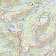
100K OnDemand Topo Cartographic Specifications - Geographic Names 100K OnDemand Topo Cartographic Specifications - Geographic Names
100K OnDemand Topo cartographic specifications including feature symbology and labels for Natural Features, Landforms, and Populated Places.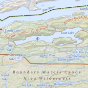
100K OnDemand Topo Cartographic Specifications - Government Units 100K OnDemand Topo Cartographic Specifications - Government Units
100K OnDemand Topo cartographic specifications including feature symbology and labels for Government Units including Counties or Equivalent, Designated Areas, Federally Managed Lands (Bureau of Land Management, Forest Service, Fish and Wildlife Service, National Park Service, and National Monuments), International, Military, National Cemetery, and State Boundaries.
100K OnDemand Topo Cartographic Specifications - Hydrography 100K OnDemand Topo Cartographic Specifications - Hydrography
100K OnDemand Topo cartographic specifications including feature symbology and labels for Hydrography including NHDArea, NHDFlowline, NHDLine, NHDPoint, NHDWaterbody, and National Wetland Inventory.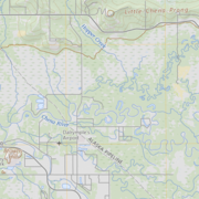
100K OnDemand Topo Cartographic Specifications - Land Cover 100K OnDemand Topo Cartographic Specifications - Land Cover
100K OnDemand Topo cartographic specifications including feature symbology and labels for Land Cover including Barren, Cropland, Grassland, Sedge, Shrubland and Woodland.
100K OnDemand Topo Cartographic Specifications - Structures 100K OnDemand Topo Cartographic Specifications - Structures
100K OnDemand Topo cartographic specifications including feature symbology and labels for Structures including Emergency Services, Medical Services, Alaska Pipeline, Public Structures and Recreation.
100K OnDemand Topo Cartographic Specifications - Transportation 100K OnDemand Topo Cartographic Specifications - Transportation
100K OnDemand Topo cartographic specifications including feature symbology and labels for Transportation including Airports, Railroads, Roads, and Road Shields.