U.S. flag

An official website of the United States government

Multimedia

Webcams—Near-real-time images from webcams.

Videos—Collection of videos recorded during field excursions or caught on our webcams.

Image Galleries—Galleries of images and events with expanded descriptions.

The Kīlauea Photo and Video Chronology and Mauna Loa Photo and Video Chronology webpages also feature photos. 

Images

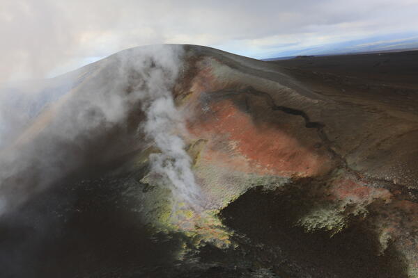
A brown hill of volcanic tephra with a crack and yellow and orange areas of alteration
October 22, 2026—Tephra hill during helicopter overflight of Halema‘uma‘u

During a USGS Hawaiian Volcano Observatory helicopter overflight of Halema‘uma‘u crater, this close-up image was taken of the tephra hill on the southwest rim of Kaluapele (the Kīlauea summit caldera). This hill of tephra formed during the ongoing episodic summit eruption as tephra fallout from many high fountaining episodes accumulated here.
During a USGS Hawaiian Volcano Observatory helicopter overflight of Halema‘uma‘u crater, this close-up image was taken of the tephra hill on the southwest rim of Kaluapele (the Kīlauea summit caldera). This hill of tephra formed during the ongoing episodic summit eruption as tephra fallout from many high fountaining episodes accumulated here.
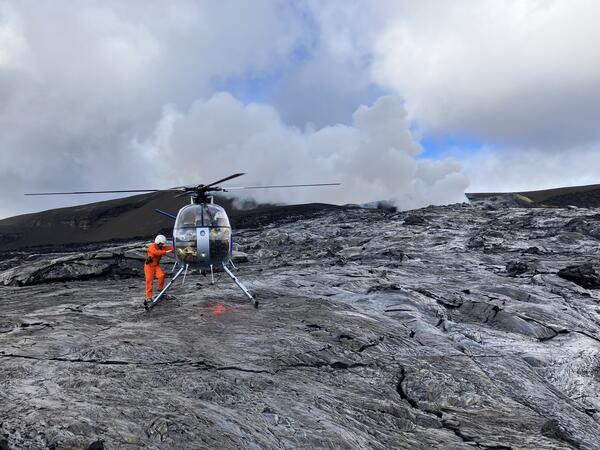
Helicopter landed on black lava flows for scientists to collect samples
October 22, 2026—Helicopter landing site in Halema‘uma‘u

On October 22, 2026, a crew of USGS Hawaiian Volcano Observatory geologists traveled via helicopter to the Halema‘uma‘u crater floor to collect lava samples from Kīlauea summit eruption episode 55, which occurred on October 17.

On October 22, 2026, a crew of USGS Hawaiian Volcano Observatory geologists traveled via helicopter to the Halema‘uma‘u crater floor to collect lava samples from Kīlauea summit eruption episode 55, which occurred on October 17.

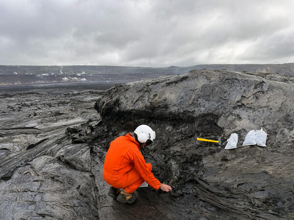
A scientist picking up pieces of lava from a lava flow surface
October 22, 2026—Lava sampling of Halema‘uma‘u crater floor

A USGS Hawaiian Volcano Observatory geologist collects cooled lava samples from episode 55 lava flows on the Halema‘uma‘u crater floor. During a helicopter overflight, HVO scientists landed on the crater floor to collect samples from an episode 55 lava channel for chemical analysis.

A USGS Hawaiian Volcano Observatory geologist collects cooled lava samples from episode 55 lava flows on the Halema‘uma‘u crater floor. During a helicopter overflight, HVO scientists landed on the crater floor to collect samples from an episode 55 lava channel for chemical analysis.

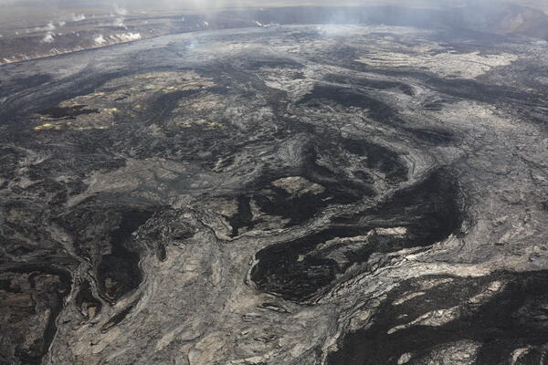
Black and light gray lava flows cover a volcanic crater floor
October 22, 2026—Helicopter overflight of Halema‘uma‘u

An aerial view of the episode 55 lava channels and flows on Halema‘uma‘u crater floor taken on October 22, 2026, during a Kīlauea summit overflight. On October 17, lava flows from episode 55 covered a large portion of the crater floor.

An aerial view of the episode 55 lava channels and flows on Halema‘uma‘u crater floor taken on October 22, 2026, during a Kīlauea summit overflight. On October 17, lava flows from episode 55 covered a large portion of the crater floor.

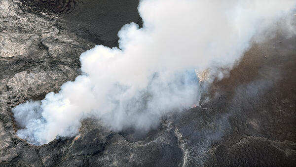
White volcanic gas plume being emitted from vents
October 22, 2026—Helicopter overflight of Halema‘uma‘u

An aerial view of the vent complex within Halema‘uma‘u crater at the summit of Kīlauea, taken during a helicopter overflight on October 22, 2026. Deep within the north vent (lower left) a small area of incandescence was visible during the flight but isn’t visible in this photo.

An aerial view of the vent complex within Halema‘uma‘u crater at the summit of Kīlauea, taken during a helicopter overflight on October 22, 2026. Deep within the north vent (lower left) a small area of incandescence was visible during the flight but isn’t visible in this photo.

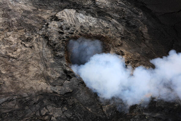
Volcanic vent emitting a thick white volcanic gas plume
October 22, 2026—Helicopter overflight of Halema‘uma‘u

A close-up aerial view of the north vent within Halema‘uma‘u crater taken during a Hawaiian Volcano Observatory helicopter overflight on October 22, 2026. During the flight, a small area of incandescence was visible deep within the vent but can’t be seen in this image.

A close-up aerial view of the north vent within Halema‘uma‘u crater taken during a Hawaiian Volcano Observatory helicopter overflight on October 22, 2026. During the flight, a small area of incandescence was visible deep within the vent but can’t be seen in this image.

Videos

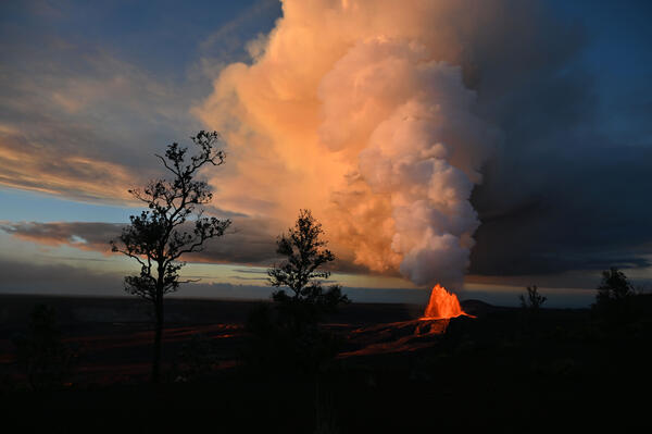
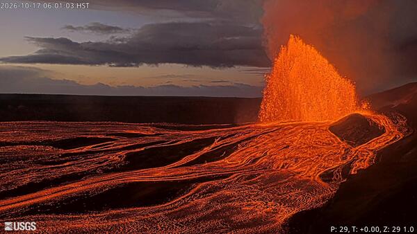
Color photograph of lava fountain and eruptive plume Color photograph of lava fountain and eruptive plume
October 17, 2026 — VIDEO of Kīlauea summit lava fountaining episode 55

A video showing the Kīlauea summit eruptive plume rising over the episode 55 fountains at dawn, reaching about 25,000 feet (7,600 meters) above sea level on October 17, 2026. The fountain from the north vent reached a maximum height of just over 700 feet (220 m) by 5:00 a.m. HST, an hour before this video was taken. USGS video by L. Gallant.


A video showing the Kīlauea summit eruptive plume rising over the episode 55 fountains at dawn, reaching about 25,000 feet (7,600 meters) above sea level on October 17, 2026. The fountain from the north vent reached a maximum height of just over 700 feet (220 m) by 5:00 a.m. HST, an hour before this video was taken. USGS video by L. Gallant.


Color photograph of lava fountain Color photograph of lava fountain
October 17, 2026 — VIDEO of Kīlauea summit episode 55 lava fountain from V3cam

The V3 livestreaming camera, located on the south rim of Halemaʻumaʻu crater at the summit of  Kīlauea, captured this timelapse video of the six hours of episode 55 lava fountaining on October 17, 2026. USGS webcam image. 


The V3 livestreaming camera, located on the south rim of Halemaʻumaʻu crater at the summit of  Kīlauea, captured this timelapse video of the six hours of episode 55 lava fountaining on October 17, 2026. USGS webcam image. 


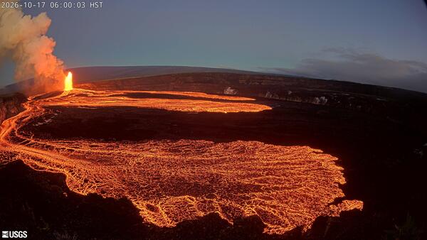
Color photograph of lava fountain Color photograph of lava fountain
October 17, 2026 — VIDEO of Kīlauea summit episode 55 lava fountain from V1cam

The V1 livestreaming camera, located on the northwest rim of Halemaʻumaʻu crater at the summit of  Kīlauea, captured this timelapse of the 6 hours of episode 55 lava fountaining on October 17, 2026. USGS webcam video. 


The V1 livestreaming camera, located on the northwest rim of Halemaʻumaʻu crater at the summit of  Kīlauea, captured this timelapse of the 6 hours of episode 55 lava fountaining on October 17, 2026. USGS webcam video. 


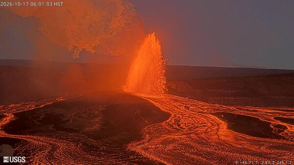
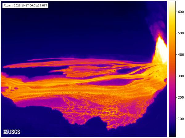
Color thermal image of eruption Color thermal image of eruption
October 17, 2026 — VIDEO of Kīlauea summit episode 55 lava fountain from F1cam

The F1cam, located on the northwest rim of Halemaʻumaʻu crater at the summit of Kīlauea, captured this timelapse video of the six hours of episode 55 lava fountaining and lava flows on October 17, 2026. USGS webcam video. 


The F1cam, located on the northwest rim of Halemaʻumaʻu crater at the summit of Kīlauea, captured this timelapse video of the six hours of episode 55 lava fountaining and lava flows on October 17, 2026. USGS webcam video. 


Color photograph of lava fountain and lava flows Color photograph of lava fountain and lava flows
October 17, 2026 — VIDEO of Kīlauea summit episode 55 lava fountain from B1cam

The B1cam, located on the south rim of Halemaʻumaʻu crater at the summit of  Kīlauea, captured this timelapse video of the six hours of episode 55 lava fountaining on October 17, 2026. USGS webcam video. 

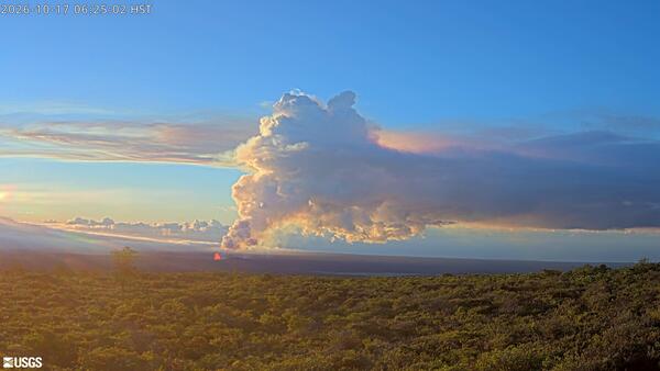
Color webcam image of eruptive plume Color webcam image of eruptive plume
October 17, 2026 — VIDEO of Kīlauea summit episode 55 lava fountain and plume from KPcam

The KPcam, located on the south flank of Mauna Loa, has views of Halemaʻumaʻu crater at the summit of  Kīlauea. The camera captured this timelapse video of the six hours of episode 55 lava fountaining and the associated eruptive plume. USGS webcam video. 


The KPcam, located on the south flank of Mauna Loa, has views of Halemaʻumaʻu crater at the summit of  Kīlauea. The camera captured this timelapse video of the six hours of episode 55 lava fountaining and the associated eruptive plume. USGS webcam video. 


Audio

Color logo for weekly audio update on volcanic activity in Hawaii
Volcano Minute Logo
Volcano Minute Logo
Volcano Minute — Patterns of eruptions and intrusions at Kīlauea
Color logo for weekly audio update on volcanic activity in Hawaii
Volcano Minute Logo
Volcano Minute Logo
Volcano Minute — Patterns of eruptions and intrusions at Kīlauea

The Volcano Minute is a brief audio update about eruptions, earthquakes, or ongoing volcano science in Hawaii, brought to you by scientists and affiliates of the U.S. Geological Survey Hawaiian Volcano Observatory.

The Volcano Minute is a brief audio update about eruptions, earthquakes, or ongoing volcano science in Hawaii, brought to you by scientists and affiliates of the U.S. Geological Survey Hawaiian Volcano Observatory.

Color logo for a podcast about volcanic activity
Volcano Minute Logo (square)
Volcano Minute — Learning from lava erupted at the summit of Kīlauea
Color logo for a podcast about volcanic activity
Volcano Minute Logo (square)
Volcano Minute — Learning from lava erupted at the summit of Kīlauea

The Volcano Minute is a brief audio update about eruptions, earthquakes, or ongoing volcano science in Hawaii, brought to you by scientists and affiliates of the U.S. Geological Survey Hawaiian Volcano Observatory.

The Volcano Minute is a brief audio update about eruptions, earthquakes, or ongoing volcano science in Hawaii, brought to you by scientists and affiliates of the U.S. Geological Survey Hawaiian Volcano Observatory.

Color graphic with words and cartoons advertising an earthquake drill
The Great Hawaii ShakeOut: Get ready to Drop, Cover, and Hold on!
Volcano Minute —Great Hawaii Shakeout Earthquake Drill 2026
Color graphic with words and cartoons advertising an earthquake drill
The Great Hawaii ShakeOut: Get ready to Drop, Cover, and Hold on!
Volcano Minute —Great Hawaii Shakeout Earthquake Drill 2026

The Volcano Minute is a brief audio update about eruptions, earthquakes, or ongoing volcano science in Hawaii, brought to you by scientists and affiliates of the U.S. Geological Survey Hawaiian Volcano Observatory.

The Volcano Minute is a brief audio update about eruptions, earthquakes, or ongoing volcano science in Hawaii, brought to you by scientists and affiliates of the U.S. Geological Survey Hawaiian Volcano Observatory.

Color logo for a podcast about volcanic activity
Volcano Minute Logo (square)
Volcano Minute — Intrusion and eruption at Kīlauea
Color logo for a podcast about volcanic activity
Volcano Minute Logo (square)
Volcano Minute — Intrusion and eruption at Kīlauea

The Volcano Minute is a brief audio update about eruptions, earthquakes, or ongoing volcano science in Hawaii, brought to you by scientists and affiliates of the U.S. Geological Survey Hawaiian Volcano Observatory.

The Volcano Minute is a brief audio update about eruptions, earthquakes, or ongoing volcano science in Hawaii, brought to you by scientists and affiliates of the U.S. Geological Survey Hawaiian Volcano Observatory.

Color logo for a podcast about volcanic activity
Volcano Minute Logo (square)
Volcano Minute — Volcano monitoring work in American Samoa: aloha to talofa
Color logo for a podcast about volcanic activity
Volcano Minute Logo (square)
Volcano Minute — Volcano monitoring work in American Samoa: aloha to talofa

The Volcano Minute is a brief audio update about eruptions, earthquakes, or ongoing volcano science in Hawaii, brought to you by scientists and affiliates of the U.S. Geological Survey Hawaiian Volcano Observatory.

The Volcano Minute is a brief audio update about eruptions, earthquakes, or ongoing volcano science in Hawaii, brought to you by scientists and affiliates of the U.S. Geological Survey Hawaiian Volcano Observatory.

Color logo for weekly audio update on volcanic activity in Hawaii
Volcano Minute Logo
Volcano Minute Logo
Volcano Minute — Changes in eruptive activity at Kīlauea summit
Color logo for weekly audio update on volcanic activity in Hawaii
Volcano Minute Logo
Volcano Minute Logo
Volcano Minute — Changes in eruptive activity at Kīlauea summit

The Volcano Minute is a brief audio update about eruptions, earthquakes, or ongoing volcano science in Hawaii, brought to you by scientists and affiliates of the U.S. Geological Survey Hawaiian Volcano Observatory. 

The Volcano Minute is a brief audio update about eruptions, earthquakes, or ongoing volcano science in Hawaii, brought to you by scientists and affiliates of the U.S. Geological Survey Hawaiian Volcano Observatory. 

Webcams

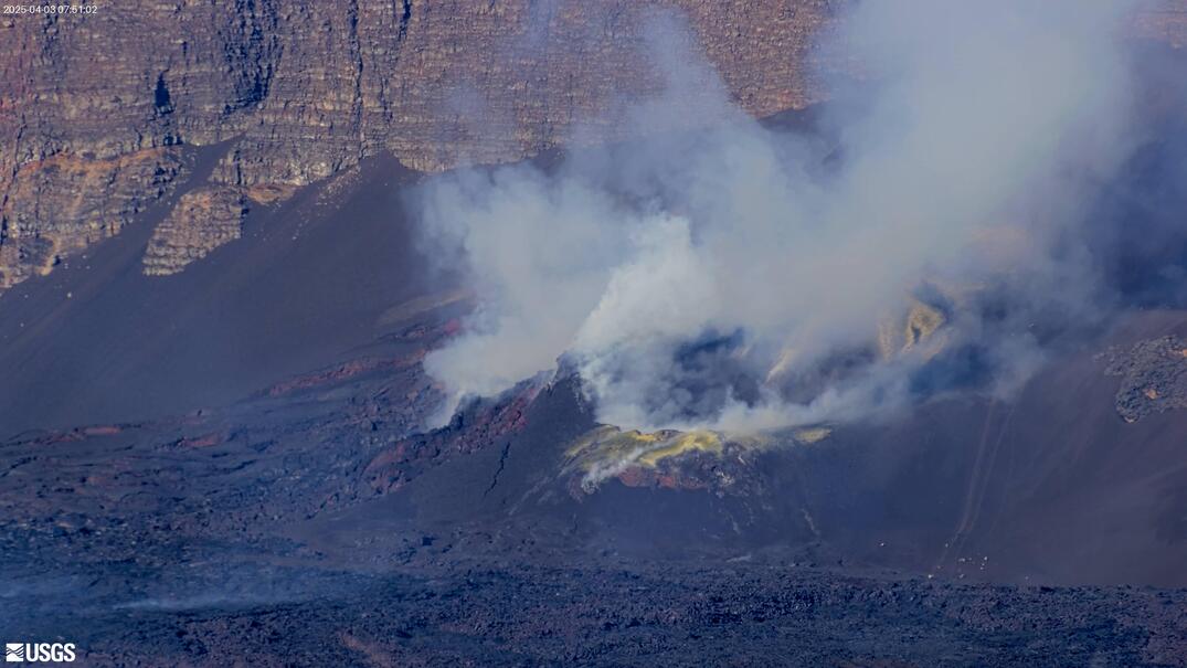
webcam image of flank of volcano
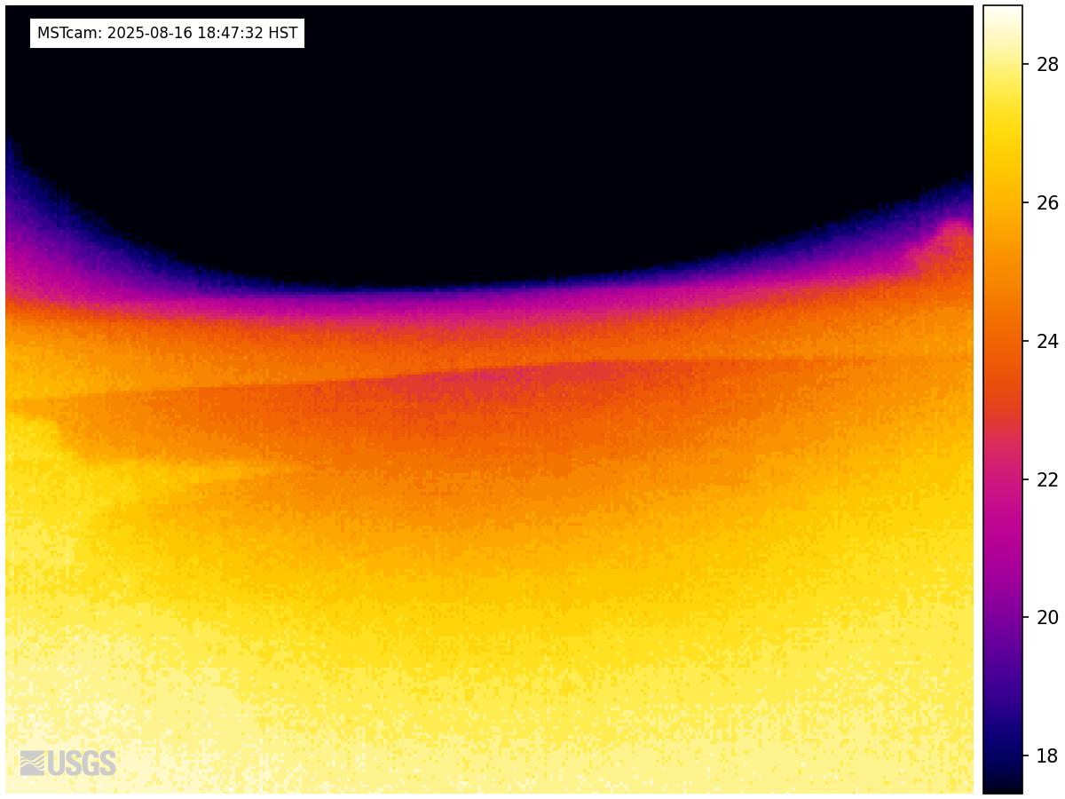
[MSTcam] South Pit and Upper Southwest Rift Zone - thermal image from Moku‘āweoweo south rim
[MSTcam] South Pit and Upper Southwest Rift Zone - thermal image from Moku‘āweoweo south rim
[MSTcam] South Pit and Upper Southwest Rift Zone - thermal image from Moku‘āweoweo south rim

This image is from a research camera positioned on the south rim of Mokuʻāweoweo, Mauna Loa's summit caldera, in Hawaiʻi Volcanoes National Park. The camera looks west-southwest, across South Pit, focusing on the south part of Mauna Loa's summit region and upper Southwest Rift Zone.

This image is from a research camera positioned on the south rim of Mokuʻāweoweo, Mauna Loa's summit caldera, in Hawaiʻi Volcanoes National Park. The camera looks west-southwest, across South Pit, focusing on the south part of Mauna Loa's summit region and upper Southwest Rift Zone.

Color webcam image
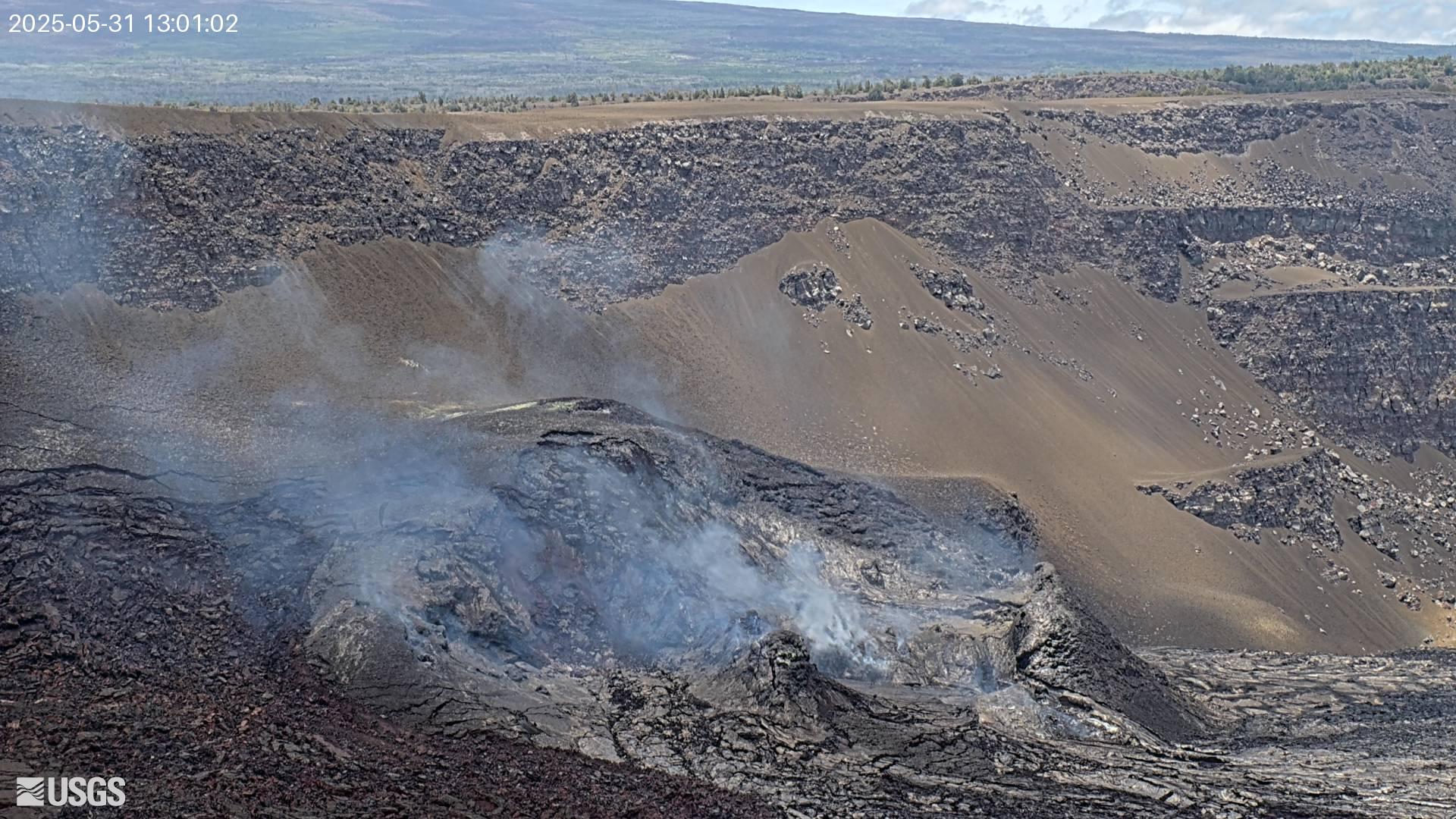
[V3cam] Kīlauea volcano, Hawaii (south Halemaʻumaʻu crater)
[V3cam] Kīlauea volcano, Hawaii (south Halemaʻumaʻu crater)
[V3cam] Kīlauea volcano, Hawaii (south Halemaʻumaʻu crater)

Last 24 Hours - Live view of Halemaʻumaʻu crater within Kaluapele (Kīlauea caldera), from the south rim of the crater [V3cam]. This camera is a pan-tilt-zoom model and the view may change depending on activity.

Disclaimer

Last 24 Hours - Live view of Halemaʻumaʻu crater within Kaluapele (Kīlauea caldera), from the south rim of the crater [V3cam]. This camera is a pan-tilt-zoom model and the view may change depending on activity.

Disclaimer

Color image of caldera
[V2cam] Kīlauea volcano, Hawaii (east Halemaʻumaʻu crater)
[V2cam] Kīlauea volcano, Hawaii (east Halemaʻumaʻu crater)
[V2cam] Kīlauea volcano, Hawaii (east Halemaʻumaʻu crater)

Live view of Kaluapele (Kīlauea caldera) and Halemaʻumaʻu crater, from the northeast rim of the caldera [V2cam]. This camera is a pan-tilt-zoom model and the view may change depending on activity.

Disclaimer

Live view of Kaluapele (Kīlauea caldera) and Halemaʻumaʻu crater, from the northeast rim of the caldera [V2cam]. This camera is a pan-tilt-zoom model and the view may change depending on activity.

Disclaimer

Color image of volcano
[KOcam] Live Image of upper East Rift Zone from Maunaulu
[KOcam] Live Image of upper East Rift Zone from Maunaulu
[KOcam] Live Image of upper East Rift Zone from Maunaulu

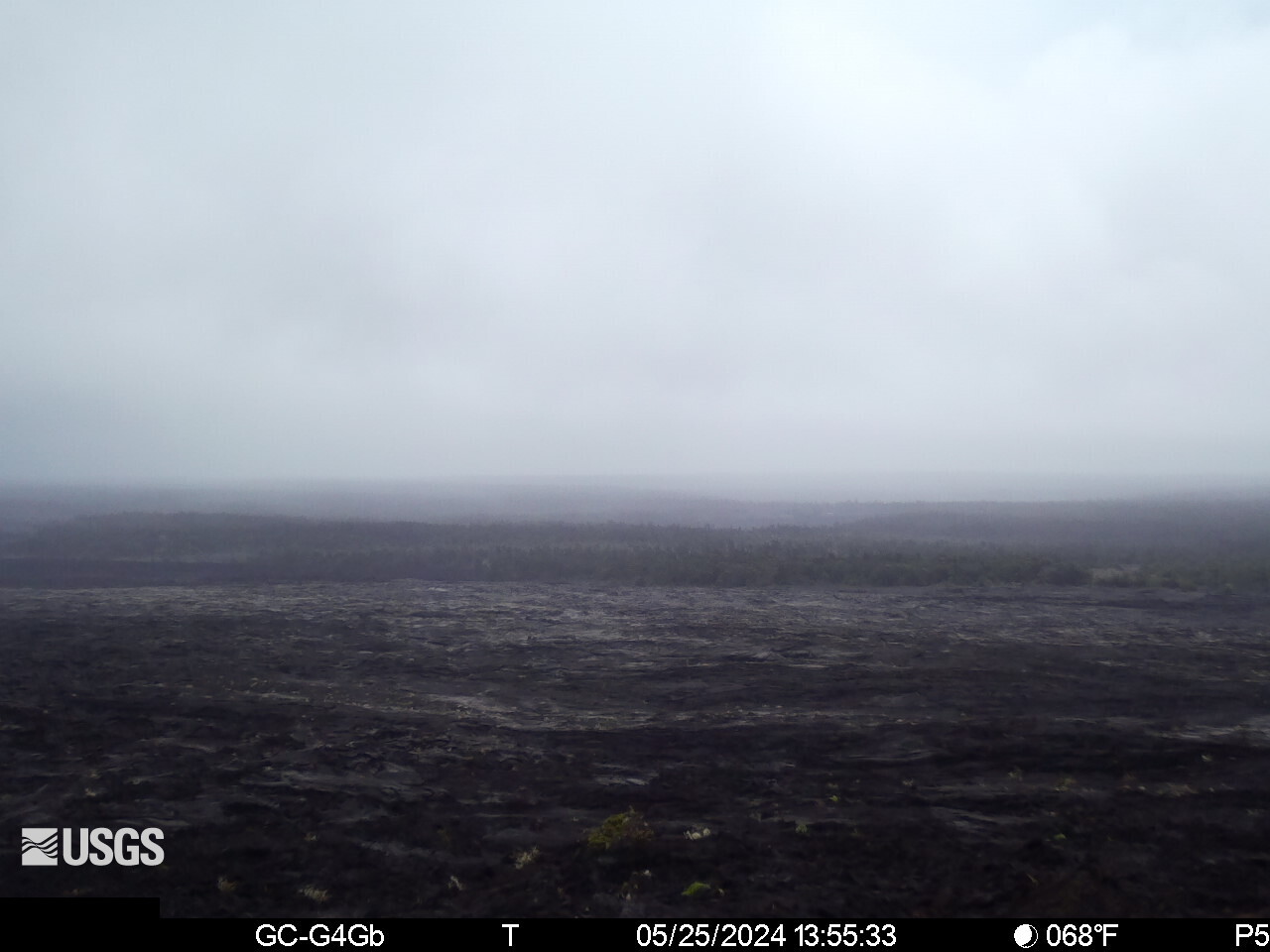
This image is from a temporary research camera positioned near Maunaulu, looking northwest toward the upper East Rift Zone of Kīlauea.

Disclaimer

Color webcam image showing rift zone of volcano
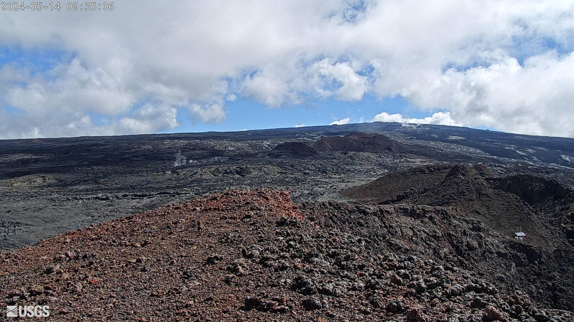
[MDLcam] The Upper and Middle Parts of Mauna Loa's Southwest Rift Zone
[MDLcam] The Upper and Middle Parts of Mauna Loa's Southwest Rift Zone
[MDLcam] The Upper and Middle Parts of Mauna Loa's Southwest Rift Zone

Live image of Mauna Loa's upper and middle Southwest Rift Zone from Dandelion Cone along the middle part of the rift zone [MDLcam]. This camera is a pan-tilt-zoom model and the view may change depending on activity.


Disclaimer

Live image of Mauna Loa's upper and middle Southwest Rift Zone from Dandelion Cone along the middle part of the rift zone [MDLcam]. This camera is a pan-tilt-zoom model and the view may change depending on activity.


Disclaimer

Color webcam image showing flank of volcano
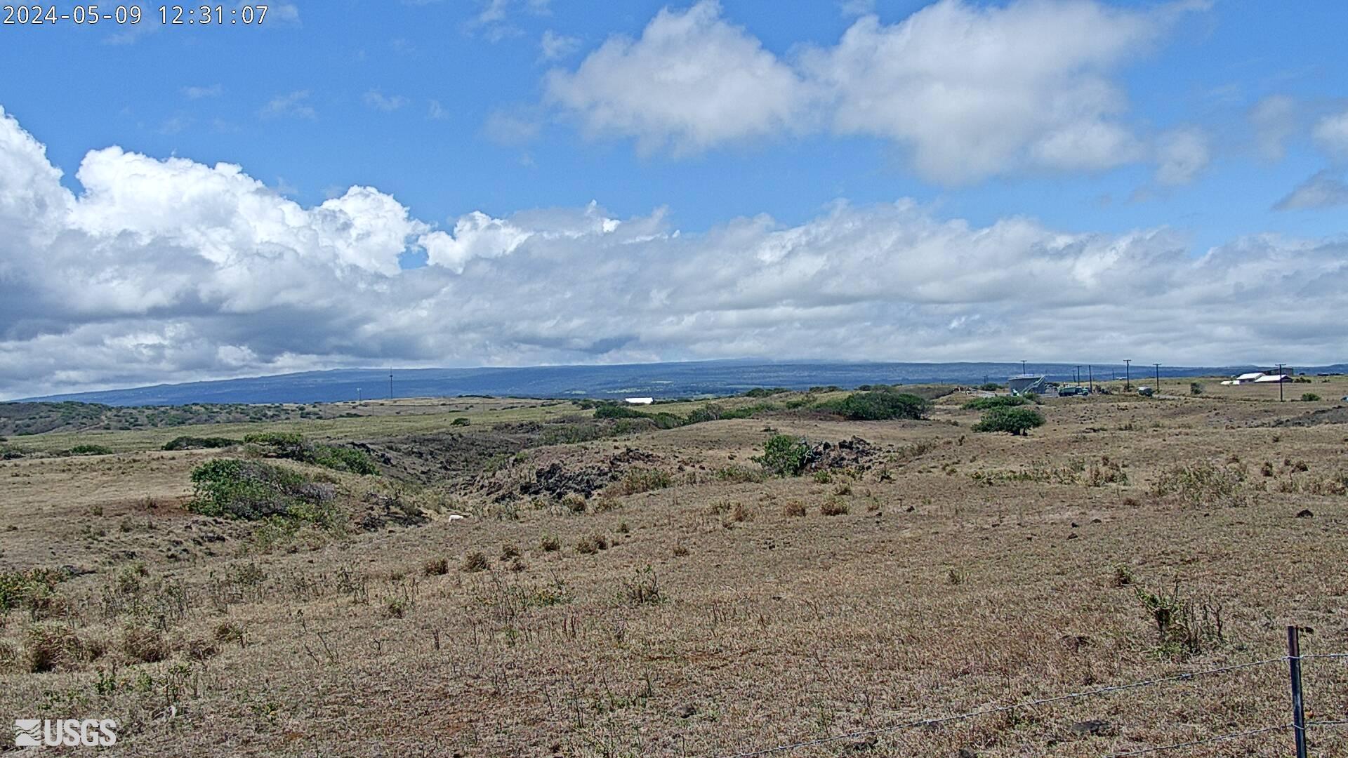
[MSPcam] Mauna Loa's Southwest Rift Zone from the South Point area
[MSPcam] Mauna Loa's Southwest Rift Zone from the South Point area
[MSPcam] Mauna Loa's Southwest Rift Zone from the South Point area

Live image of Mauna Loa's Southwest Rift Zone from the South Point area [MSPcam]. This camera is a pan-tilt-zoom model and the view may change depending on activity.


Disclaimer

Live image of Mauna Loa's Southwest Rift Zone from the South Point area [MSPcam]. This camera is a pan-tilt-zoom model and the view may change depending on activity.


Disclaimer

Was this page helpful?