
Sulphur Caldron -- an example of an acid-sulfate hydrothermal feature in Yellowstone National Park. Photo taken by Blaine McCleskey, September 2008.
All Multimedia
Access all multimedia to include images, video, audio, webcams, before-after imagery, and more. Filter and explore with filtering options to refine search.
Filter Total Items: 24926

Sulphur Caldron
Sulphur Caldron -- an example of an acid-sulfate hydrothermal feature in Yellowstone National Park. Photo taken by Blaine McCleskey, September 2008.

Eyes on Earth Episode 10 – Landsat and Water Quality
Eyes on Earth Episode 10 – Landsat and Water QualityWe tend to associate Landsat satellites with what we see on solid Earth, but they can also tell us much about the health of our inland and coastal ecosystems. Landsat can be used to monitor harmful algal blooms, for example. Eyes on Earth guest Dr.

Hydrologic Technician inspects gage on the Cooper River, SC.
Hydrologic Technician inspects gage on the Cooper River, SC.Hydrologic Technician, Brady Long, performs routine water quality inspection of streamgage 0217206935 Cooper River in Charleston, SC. Cooperator/funding provided by the US Army Core of Engineers.

Hydrologic Technician performs routine water quality inspection
Hydrologic Technician performs routine water quality inspectionHydrologic Technician, Brady Long, performs routine water quality inspection at the Cooper River, South Carolina.
Hydrologic Technician performs routine water quality inspection
Hydrologic Technician performs routine water quality inspectionHydrologic Technician, Brady Long, performs routine water quality inspection at the Cooper River, South Carolina.

Yellowstone Volcano Observatory Monthly Update: December 2, 2019
Yellowstone Volcano Observatory Monthly Update: December 2, 2019Mike Poland, Scientist-in-Charge of the Yellowstone Volcano Observatory, describes activity at Yellowstone during the month of November 2019.
Yellowstone Volcano Observatory Monthly Update: December 2, 2019
Yellowstone Volcano Observatory Monthly Update: December 2, 2019Mike Poland, Scientist-in-Charge of the Yellowstone Volcano Observatory, describes activity at Yellowstone during the month of November 2019.

On board the IODP vessel JOIDES Resolution
Several instruments visible on board the research vessel JOIDES Resolution. Photo taken from the ship bridge roof. USGS logo visible on one of the pieces of equipment. Research cruises taken on the JOIDES Resolution are often interdisciplinary and collaborative across many universities, scientific agencies, and other research institutions.
Several instruments visible on board the research vessel JOIDES Resolution. Photo taken from the ship bridge roof. USGS logo visible on one of the pieces of equipment. Research cruises taken on the JOIDES Resolution are often interdisciplinary and collaborative across many universities, scientific agencies, and other research institutions.

Volcano Awareness Month 2020
Volcano Awareness Month programs offered in January 2020 are depicted by these images. Clockwise from top left: ground cracks opened at HVO's former location atop Kīlauea in 2018; fissure erupting on Mauna Loa in March 1984; crater lake within Halema‘uma‘u at Kīlauea's summit; and visitors hiking a Kahuku trail in Hawai‘i Volcanoes National Park (NPS).
Volcano Awareness Month programs offered in January 2020 are depicted by these images. Clockwise from top left: ground cracks opened at HVO's former location atop Kīlauea in 2018; fissure erupting on Mauna Loa in March 1984; crater lake within Halema‘uma‘u at Kīlauea's summit; and visitors hiking a Kahuku trail in Hawai‘i Volcanoes National Park (NPS).

Great-Horned Owl and Eurasian Collared-Dove found dead in Utah
Great-Horned Owl and Eurasian Collared-Dove found dead in UtahPhotographs from a Great-Horned Owl and Eurasian Collared-Dove found dead in a residential yard in Utah, U.S. (A) The owl had singeing of the rictal bristles on the right side of the face (inset), swollen right eyelids, and a cloudy and thickened right cornea.

Photomicrographs from a Great-Horned Owl
Photomicrographs from a Great-Horned Owl showing (A) moderate acute hemorrhage in the right atrial epicardium extending into the myocardium and (B) a focally extensive area of coagulative necrosis of the epidermis and dermis (arrow) consistent with an electrical burn.
Photomicrographs from a Great-Horned Owl showing (A) moderate acute hemorrhage in the right atrial epicardium extending into the myocardium and (B) a focally extensive area of coagulative necrosis of the epidermis and dermis (arrow) consistent with an electrical burn.

USGS HVO geophysicist Jefferson Chang presenting
USGS Hawaiian Volcano Observatory geophysicist Jefferson Chang during his presentation at the 2019 National Diversity in STEM Conference in Honolulu. Chang and Kevan Kamibayashi (left) were two of four HVO scientists who spoke about their work monitoring Hawaiian volcanoes at the SACNAS conference.
USGS Hawaiian Volcano Observatory geophysicist Jefferson Chang during his presentation at the 2019 National Diversity in STEM Conference in Honolulu. Chang and Kevan Kamibayashi (left) were two of four HVO scientists who spoke about their work monitoring Hawaiian volcanoes at the SACNAS conference.

Jefferson Chang at meeting
Jefferson Chang (far left) was one of four USGS Hawaiian Volcano Observatory scientists who spoke about monitoring Hawaiian volcanoes and mentored students at the 2019 National Diversity in STEM Conference in Honolulu.
Jefferson Chang (far left) was one of four USGS Hawaiian Volcano Observatory scientists who spoke about monitoring Hawaiian volcanoes and mentored students at the 2019 National Diversity in STEM Conference in Honolulu.

Map of seismicity in the Yellowstone region during 2019.
Map of seismicity in the Yellowstone region during 2019.Map of seismicity (yellow circles) in the Yellowstone region during 2019. Gray lines are roads, red line shows the caldera boundary, Yellowstone National Park is outlined by black dashed line, and gray dashed lines denote state boundaries.

Sampling the Unuk River, Alaska
USGS Hydrologist Randy Host performs compass calibrations for discharge measurements at the Unuk River. The Unuk River is one of the transboundary watersheds of Southeast Alaska. This site has a Super Gage which is a conventional streamflow gage equipped with continuous water-quality monitors.
USGS Hydrologist Randy Host performs compass calibrations for discharge measurements at the Unuk River. The Unuk River is one of the transboundary watersheds of Southeast Alaska. This site has a Super Gage which is a conventional streamflow gage equipped with continuous water-quality monitors.

Still image from January 2, 2020, YVO video update.
Still image from January 2, 2020, YVO video update.Still image from January 2, 2020, YVO video update.
Still image from January 2, 2020, YVO video update.
Still image from January 2, 2020, YVO video update.Still image from January 2, 2020, YVO video update.

USGS gage 330428079214800 Skrine Creek Near McClellenville, SC

Thermal map of Kīlauea summit
The December 18 overflight provided updated thermal images of Kīlauea summit, covering the caldera floor and showing the warm surface of the water pond in Halema‘uma‘u crater. A band of warm temperatures persists along the new cliff formed during the 2018 subsidence.
The December 18 overflight provided updated thermal images of Kīlauea summit, covering the caldera floor and showing the warm surface of the water pond in Halema‘uma‘u crater. A band of warm temperatures persists along the new cliff formed during the 2018 subsidence.

Updated aerial map of Kīlauea summit
The December 18 overflight provided updated aerial photographs of Kīlauea summit, covering the caldera floor and showing the current size of the water pond in Halema‘uma‘u crater. The label "downdropped block" shows the large portion of the caldera floor that subsided, along with the Halema‘uma‘u region, during the 2018 eruption.
The December 18 overflight provided updated aerial photographs of Kīlauea summit, covering the caldera floor and showing the current size of the water pond in Halema‘uma‘u crater. The label "downdropped block" shows the large portion of the caldera floor that subsided, along with the Halema‘uma‘u region, during the 2018 eruption.

Sampling the water in Halema‘uma‘u - Kīlauea Volcano
Sampling the water in Halema‘uma‘u - Kīlauea VolcanoUSGS Hawaiian Volcano Observatory scientists Frank Younger and Patricia Nadeau talk about sampling the water at the bottom of Halemaʻumaʻu, a crater at the summit of Kīlauea Volcano. The water appeared in July 2019 and has steadily risen since then.

Scientist adjusts equipment mounted on tower at the Suisun Marsh
Scientist adjusts equipment mounted on tower at the Suisun MarshUSGS Research Scientist Ellen Goodrich-Stuart adjusts a CH4 (Methane) analyzer mounted on the eddy covariance flux tower at the Rush Ranch site at Suisun Marsh.
Scientist adjusts equipment mounted on tower at the Suisun Marsh
Scientist adjusts equipment mounted on tower at the Suisun MarshUSGS Research Scientist Ellen Goodrich-Stuart adjusts a CH4 (Methane) analyzer mounted on the eddy covariance flux tower at the Rush Ranch site at Suisun Marsh.

An HVO geologist uses a high-precision Global Positioning System (GPS) unit to c
An HVO geologist uses a high-precision Global Positioning System (GPS) unit to cAn HVO geologist uses a high-precision Global Positioning System (GPS) unit to collect latitude, longitude, and altitude data on a down-dropped portion of Kīlauea's caldera.
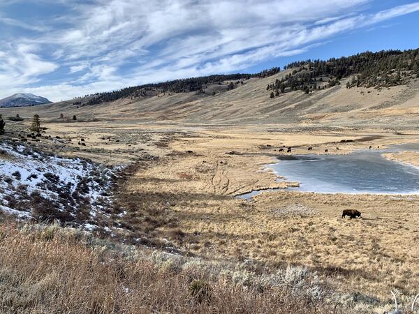
Bison in Yellowstone National Park’s Northern Range
Bison in Yellowstone National Park’s Northern RangeBison in Yellowstone National Park’s Northern Range, where scenario planning work is currently underway.
Bison in Yellowstone National Park’s Northern Range
Bison in Yellowstone National Park’s Northern RangeBison in Yellowstone National Park’s Northern Range, where scenario planning work is currently underway.