Kentucky River at Lock 2 at Lockport KY - gage house
Kentucky River at Lock 2 at Lockport KY - gage houseKentucky River at Lock 2 at Lockport KY - gage house

Official websites use .gov
A .gov website belongs to an official government organization in the United States.
Secure .gov websites use HTTPS
A lock () or https:// means you’ve safely connected to the .gov website. Share sensitive information only on official, secure websites.
Explore our planet through photography and imagery, including climate change and water all the way back to the 1800s when the USGS was surveying the country by horse and buggy.

Kentucky River at Lock 2 at Lockport KY - gage house
Kentucky River at Lock 2 at Lockport KY - gage house

Kentucky River at Lock 2 at Lockport KY - walkway across the dam
Kentucky River at Lock 2 at Lockport KY - walkway across the dam

There was an educational outreach event to describe the fish conservation and Powell expedition involving SCREE and Bureau of Reclamation.
There was an educational outreach event to describe the fish conservation and Powell expedition involving SCREE and Bureau of Reclamation.

Tildon Jones (Fish Biologist, USFWS) and Jim Prairie (hydro modeler, BOR) lecture to a public audience at Dinosaur the intricacies of the modern Adaptive Management Program for hydropower operation that considers the ecological needs of 3 endangered, endemic fish species in the Basin.
Tildon Jones (Fish Biologist, USFWS) and Jim Prairie (hydro modeler, BOR) lecture to a public audience at Dinosaur the intricacies of the modern Adaptive Management Program for hydropower operation that considers the ecological needs of 3 endangered, endemic fish species in the Basin.

Split Mountain Campground was the beginning of our jouney. We met up with the SCREE expedition in this cozy spot tucked beneath the imposing Split Mountains.
Split Mountain Campground was the beginning of our jouney. We met up with the SCREE expedition in this cozy spot tucked beneath the imposing Split Mountains.

Looking at the route we would be taking the next day, we pondered what lay ahead. Vast, open country and lots of rocks were in our future.
Looking at the route we would be taking the next day, we pondered what lay ahead. Vast, open country and lots of rocks were in our future.

Tom, Tildon Jones (USFWS), and Jim Prairie (BoR) present at the Green River Campground for an "evening program" at Dinosaur National Monument. Many campers were in attendance, as were several deer across the river.
Tom, Tildon Jones (USFWS), and Jim Prairie (BoR) present at the Green River Campground for an "evening program" at Dinosaur National Monument. Many campers were in attendance, as were several deer across the river.

Yellow Creek near Oak Grove, IN - view from left bank of site
Yellow Creek near Oak Grove, IN - view from left bank of site

Matt Kauffman, Unit Leader, USGS Wyoming Cooperative Fish and Wildlife Research Unit, second from left, works with Wyoming Game and Fish Department and University of Wyoming collaborators to release an elk fitted with a global positioning system (GPS) tracking collar.
Matt Kauffman, Unit Leader, USGS Wyoming Cooperative Fish and Wildlife Research Unit, second from left, works with Wyoming Game and Fish Department and University of Wyoming collaborators to release an elk fitted with a global positioning system (GPS) tracking collar.

Geologists from the USGS and the New Mexico Bureau of Geology and Mineral Resources examining a carbonatite dike in the Lemitar Mountains, New Mexico
Geologists from the USGS and the New Mexico Bureau of Geology and Mineral Resources examining a carbonatite dike in the Lemitar Mountains, New Mexico

Image of the poster hall at the 2019 CDI Workshop, held in Boulder, CO.
Image of the poster hall at the 2019 CDI Workshop, held in Boulder, CO.

USGS Research Scientist Nicholas Johnson Releasing Sterilized Male Sea Lamprey into the Pigeon River in 2019.
USGS Research Scientist Nicholas Johnson Releasing Sterilized Male Sea Lamprey into the Pigeon River in 2019.

Virginia McLemore, New Mexico Bureau of Geology and Mineral Resources, discussing a carbonatite dike in the Lemitar Mountains, New Mexico
Virginia McLemore, New Mexico Bureau of Geology and Mineral Resources, discussing a carbonatite dike in the Lemitar Mountains, New Mexico
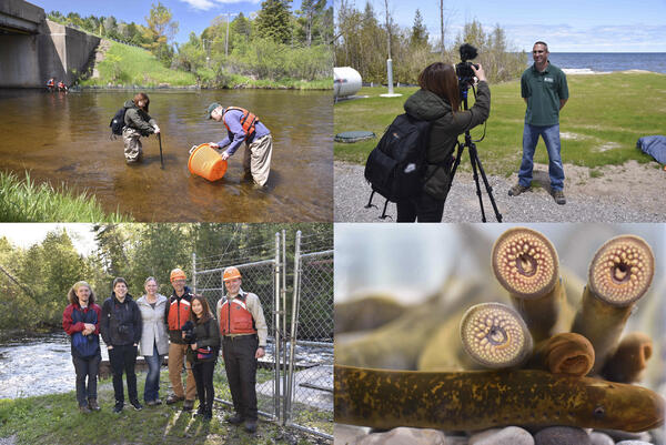
GLSC Hammond Bay Biological Station research was filmed by Voice of America (VOA) News on June 2-3, 2019.
GLSC Hammond Bay Biological Station research was filmed by Voice of America (VOA) News on June 2-3, 2019.

COSMO-SkyMed (CSK) Interferogram for the period from April 6 to June 2, 2019, covering Kīlauea Volcano’s summit region. Each color fringe represents 1.65 centimeters (0.65 inches) of ground displacement.
COSMO-SkyMed (CSK) Interferogram for the period from April 6 to June 2, 2019, covering Kīlauea Volcano’s summit region. Each color fringe represents 1.65 centimeters (0.65 inches) of ground displacement.

Night 2 Milky Way galaxy with panorama near Firehole

A photo of a Common tern holding an Atlantic herring in its bill. Photo credit Michelle Staudinger, PhD.
A photo of a Common tern holding an Atlantic herring in its bill. Photo credit Michelle Staudinger, PhD.

Dark Hollow Falls - Shenandoah National Park, VA
Dark Hollow Falls - Shenandoah National Park, VA

Computer model of Lone Star Geyser constructed from multiple overlapping and scaled photographs and looking down into the geyser vent. This is a perspective that is only possible with images collected specifically to build a 3D model. Only the inner portion is obscured because in all the images, this area is continuously blanketed in opaque vapor.
Computer model of Lone Star Geyser constructed from multiple overlapping and scaled photographs and looking down into the geyser vent. This is a perspective that is only possible with images collected specifically to build a 3D model. Only the inner portion is obscured because in all the images, this area is continuously blanketed in opaque vapor.

A view looking down on the river from the hills above camp. View is upstream and shows a nice river meander with a point bar and scenic hills in the background. This is in Brown's Park.
A view looking down on the river from the hills above camp. View is upstream and shows a nice river meander with a point bar and scenic hills in the background. This is in Brown's Park.

View looking upstream from the hiking trail at Dinosaur national monument. Shows Brown's Park, our camp and the boats, beach, river, scenic background with cottonwoods
View looking upstream from the hiking trail at Dinosaur national monument. Shows Brown's Park, our camp and the boats, beach, river, scenic background with cottonwoods