U.S. flag

An official website of the United States government

A selection of coastal and marine images and videos from across the USGS.
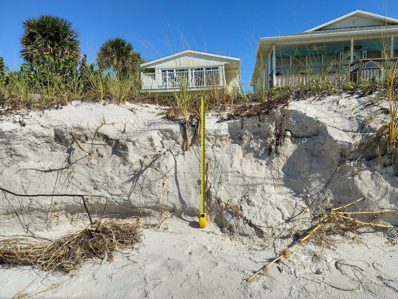
A smiling woman in a hard hat and life jacket gives two-thumbs-up on the deck of a ship standing next to a sediment core tube.
Dr. Nora Nieminski is a research geologist and Mendenhall Fellow at the USGS Pacific Coastal and Marine Science Center in Santa Cruz, California. She is pictured here, on board Marine Vessel Bold Horizon, with a piston core sample collected from the southern Cascadia subduction zone offshore of northern California/southern Oregon. The research cruise ran from September-October of 2019 as part of the USGS project, “Cascadia Subduction Zone Marine Geohazards.” The research is focused on characterizing offshore marine geohazards like tsunamis, earthquakes, and underwater landslides along this tectonic boundary, which is prone to megathrust earthquakes.Once recovered, the cores were extruded and sectioned on deck. Dr. Nieminski is studying these cores to investigate sediment routing and storage along the Cascadia margin and to identify any structural evidence of past earthquake activity that may be present in the sediment.
A dark image looking down from a vegetated coastal bluff at a sandy beach and the ocean.
Far out, man... where science meets artThis is an image produced from one of two video cameras, which were installed to overlook the coast at Sunset State Beach in Watsonville, California. The cameras are part of the USGS Pacific Coastal and Marine Science Center’s Remote Sensing Coastal Change project.Every half hour during daylight hours, the cameras shoot video for 10 minutes. The camera system then processes the imagery it collects, to produce visualizations that highlight or track different pixel changes that occur throughout the 10-minute window.As an example of the imagery produced, this is a "variance" image from Camera 2, from November 19th, 2020. A “variance” image shows the standard deviation of pixel intensity throughout the video, and it is useful for determining how much variation or movement is occurring at a given location. A single image like this can show features that are not always obvious to the naked eye - like sandbar and rip-channel locations. Collecting such imagery over many months or a year or more enables researchers to see how these features change through time, and how big storms, king tides, and other extreme events influence and shape our coastal regions.Visit the Camera 2 Variance image page (which changes every half hour during daylight hours), or the Sunset State Beach web cam page to view all 5 image types produced by each of the two cameras installed on the coastal bluff. See if you can detect how the beach and nearshore features vary (or don't vary!) between the current view and this view from 11/19/20.
USGS employee measures water chemistry underwater in Double Keyhole Cave, FL
Robert Scharping, a post-doctoral fellow jointly appointed by the USGS and the Woods Hole Oceanographic Institution (WHOI) measures water chemistry 40’ underwater and underground in Double Keyhole Cave near the coastline of Tampa Bay Florida. Robert is identifying the microbes and chemical conditions supporting chemosynthetic production of organic matter that is expelled from springs along the coast line and may contribute to recurring harmful algal blooms in that region. Diving in this habitat requires both courage and extensive training.
A woman, wearing a lab coat and protective equipment in a laboratory, holds a core in a device that will split the core in half.
In the core lab, the Geotek core splitter cuts sediment cores in half lengthwise using oscillating saws and a wire cutter.
A man wearing safety gear and a warm hat sits in a pontoon boat in very calm water setting up equipment, bridge in background.
Marine engineering technician Pete Dal Ferro sets up a newly acquired, portable, single-beam echo sounder on the San Lorenzo River in Santa Cruz, California. The new device, called CEESCOPE, collects bathymetric (depth) data and also records features of the subsurface. All the components are easy for one person to set up and operate, with GPS and an LCD touch screen. This day survey is part of ongoing, seasonal surveys in the nearshore regions of Monterey Bay to help characterize the sediment budget of the area.
Two people install instruments atop a permanent mooring called a dolphin, large wooden pilings affixed in shallow water.
Pete Dal Ferro and Andrew Stevens, both from the USGS Pacific Coastal and Marine Science Center (PCMSC) in Santa Cruz, California, install a Vaisala WXT weather station in Grizzly Bay, east of San Pablo Bay and northeast of San Francisco. The weather station collects wind speed, temperature, air pressure, relative humidity, and rainfall, and data are transmitted to a web page in real time via a custom-built data logger and modem designed by PCMSC oceanographer Dan Nowacki. Other sensors installed in Grizzly and San Pablo Bays, collecting wave and current speed, water temperature, salinity, pressure, and more, can be used with data from this weather station to help gain a better understanding of the conditions that influence sediment movement through the Bays.The weather station is installed on this structure which is called a "dolphin," in the middle of Grizzly Bay. Obviously, someone (not us!) long ago thought it woud be funny to install a "pedestrian crossing" sign!
Photo of the ocean, beach, dunes, and back of dunes on a barrier island.
Photo showing multiple geomorphic environments including from left to right: the Atlantic Ocean, beach, dunes, and island interior.
a dune that has been eroded several feet
Tropical Storm Eta affected beaches along Florida's Gulf Coast in November 2020. Some dunes were eroded up to several feet due to the high water levels associated with the storm. Madeira Beach is home to many people and animals, and erosion events such as this can affect both habitat and infrastructure. The USGS Coastal Change Hazards team works to predict these erosion events so we can better prepare for coastal change. Learn more: USGS Coastal Change Hazards
Aerial view of a beach under a stormy sky, the ocean with waves reaching all the way across the beach, pushing sand onto a patio
Tropical Storm Eta had effects on Florida's Gulf Coast beaches, including dune erosion and overwash. This image from the coast cam at Madeira Beach, Florida captured high water levels and resulting overwash of sand onto the patio of the Shoreline Resort. The USGS Coastal Change Hazards team works to predict these types of events to provide forecasts to coastal communities. Learn more: USGS Coastal Change Hazards
A white-fronted goose flies over a nesting area near Point Lonely, Alaska
A white-fronted goose flies over a nesting area near Point Lonely, Alaska.

For more information about the USGS goose study, read "Effects of industrial and investigator disturbance on Arctic-nesting geese."

five scientists on and standing near a small vessel at a dock with scuba gear on board.


Get Our News

These items are in the RSS feed format (Really Simple Syndication) based on categories such as topics, locations, and more. You can install and RSS reader browser extension, software, or use a third-party service to receive immediate news updates depending on the feed that you have added. If you click the feed links below, they may look strange because they are simply XML code. An RSS reader can easily read this code and push out a notification to you when something new is posted to our site.