
Shoreline Forecasting Takes a Leap Forward in Global Modeling Challenge
USGS Model Tops International Competition with Near-Satellite Accuracy
How well can we predict the future of changing shorelines? That question was put to the test in ShoreShop2.0, a recently published collaborative benchmarking study that pitted dozens of scientific teams against one of coastal science’s toughest challenges: forecasting shoreline change with limited data.
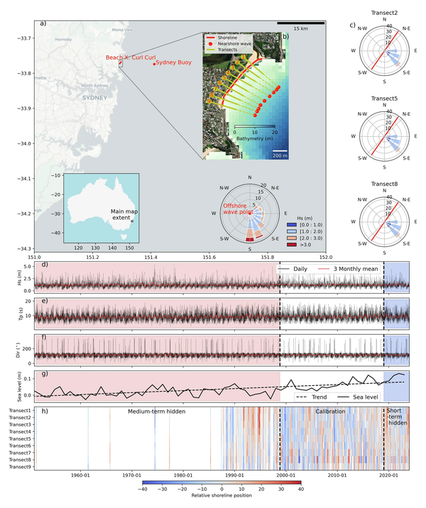
Robust predictions of shoreline change are critical for sustainable coastal management. Despite advancements in shoreline models, objective benchmarking (a means to evaluate model accuracy by comparison with observations) remains limited. To address this, ShoreShop2.0 was designed to stress-test the current generation of shoreline models—the tools used to project how coastlines will respond to erosion, sea level rise, and extreme wave events.
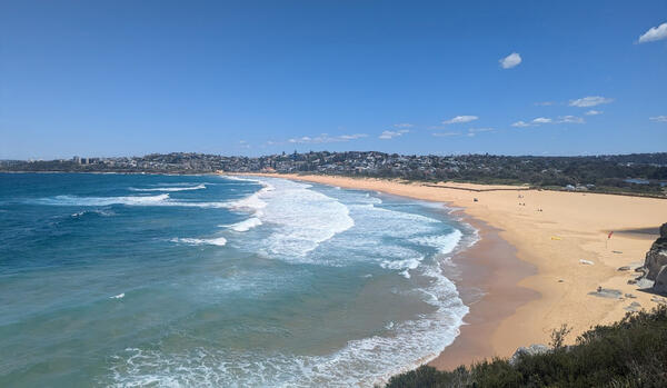
Organized as a blind benchmarking workshop, 34 teams from around the world submitted predictions of shoreline movement at an undisclosed location referred to as BeachX. Participants were given partial historical shoreline data derived from satellites but were denied access to critical segments of the record spanning short-term (5-year) and medium-term (50-year) timeframes. These hidden datasets were later used to objectively assess how well each model performed.
Machine-learning models generally dominated the competition. However, the top-performing model, the USGS-developed CoSMoS-COAST, used a simplified physics-based approach that was able to predict shoreline positions with an accuracy of about 10 meters, nearly matching the precision of the satellite data itself.
“I’ve been following the recent advancements in AI shoreline models [e.g., Long Short-Term Memory models, Convolutional Neural Network models, and Transformers], and I was worried that they would crush our older models in the competition,” said USGS Research Oceanographer Sean Vitousek, who led the development of CoSMoS-COAST. “Luckily, I was able to pull of the victory—just barely.”
By benchmarking the results across a diverse set of modeling techniques, the workshop offered detailed insights into what works, what doesn’t, and why. Results from ShoreShop2.0 highlight both the promise and the limitations of current predictive capabilities. While the best models performed impressively at BeachX, the results demonstrate that shoreline behavior is highly site-specific—affected by factors like wave exposure, sediment availability, human development, and underlying geology.
“ShoreShop2.0 shows us that with high-quality input data and thoughtful model design, accurate shoreline predictions are within reach,” said Vitousek. “But it also reveals the need for continued monitoring and model development, especially for more complex or data-limited coasts.”
Read the study, Benchmarking shoreline prediction models over multi-decadal timescales, in Nature Communications: Earth & Environment.
Related

Remote Sensing Coastal Change

CoSMoS-COAST
Related
Remote Sensing Coastal Change