
American Samoa Mapping Project
USGS Releases Expedition Report for Samoa Basin Box Coring Effort
USGS scientists are leading a sampling effort to the Samoa Basin, offshore of American Samoa. This work is part of an interagency-supported three-month hydrograph survey project led by NOAA and in partnership with BOEM.
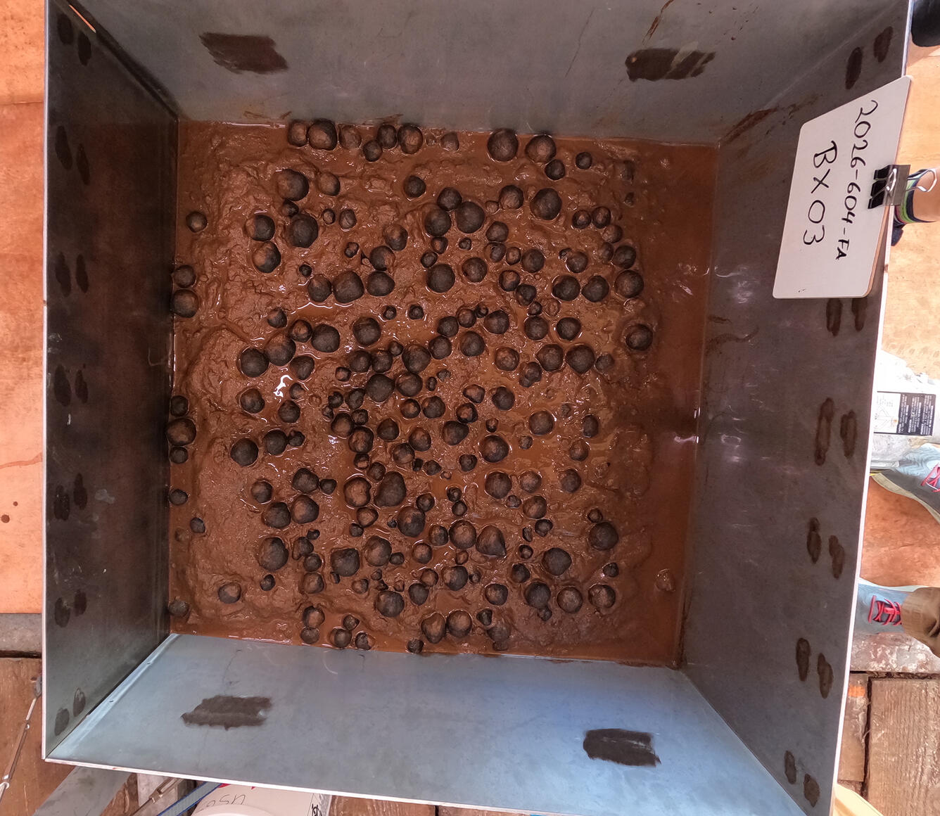
USGS scientists will be conducting box coring across part of the Samoa Basin to collect sediment and mineral samples. Previous abyssal work through this area is quite limited; a 2005 USGS report, Marine Mineral Resources of Pacific Islands—A Review of the Exclusive Economic Zones of Islands of U.S. Affiliation, Excluding the State of Hawaii, notes that of “12 sediment samples previously collected, 6 contained nodules along with sediment, with abundances estimated as low to medium.” Any minerals collected as well as the surrounding sediments will be subsampled for mineralogy; organic and inorganic geochemistry; micro, meio, and macrobiology; pore waters; and geochronology.
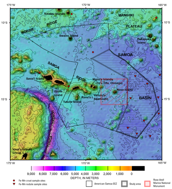
The study area is more than 70,000 km2. Most of the 35 box cores to be deployed will be located at least 50 km away from each other. For context, on land this is the equivalent of taking a sample, then walking a full day before then taking another. This work is part of ongoing efforts to understand the minerals and ecosystems of the Pacific Ocean.
Learn about our team’s previous work offshore Hawaii and watch an expedition recap video.
What is the USGS doing in American Samoa?
We will be leading the geologic sampling leg of NOAA’s American Samoa Mapping Project. Scientists on the expedition are experts on seabed research from the Global Seabed Mineral Resources Project, the Wetland and Aquatic Research Center, and the Pacific Ocean Palaeoceanographic Team.
Why is USGS doing this work?
USGS serves the public through providing information on how minerals form, where they occur, how they become concentrated in elements, especially critical minerals, and environmental issues associated with potential extraction.
Where can I learn about ocean science careers at USGS?
A good place to start is the USGS Youth and Education in Science website.
Where can I find out more about the project?
For more about the overall project, please visit the NOAA project page. Mapping data are displayed here. Photos of box cores are displayed here. For more about USGS’s role in the project, please reach out to our project scientists or read the expedition report.
Where can I learn more about American Samoan culture?
Waters offshore of American Samoa hold deep cultural significance for Pacific Islanders and are integral to Fa‘a Samoa, the Samoan way of life.

Mesophotic and Deep Benthic Communities: Habitat Assessment and Evaluation

Global Seabed Mineral Resources

Pacific Ocean Patterns, Processes, and Productivity (POP3): Impacts of ancient warming on marine ecosystems and western North America
USGS scientists are leading a sampling effort to the Samoa Basin, offshore of American Samoa. This work is part of an interagency-supported three-month hydrograph survey project led by NOAA and in partnership with BOEM.
USGS scientists will be conducting box coring across part of the Samoa Basin to collect sediment and mineral samples. Previous abyssal work through this area is quite limited; a 2005 USGS report, Marine Mineral Resources of Pacific Islands—A Review of the Exclusive Economic Zones of Islands of U.S. Affiliation, Excluding the State of Hawaii, notes that of “12 sediment samples previously collected, 6 contained nodules along with sediment, with abundances estimated as low to medium.” Any minerals collected as well as the surrounding sediments will be subsampled for mineralogy; organic and inorganic geochemistry; micro, meio, and macrobiology; pore waters; and geochronology.
The study area is more than 70,000 km2. Most of the 35 box cores to be deployed will be located at least 50 km away from each other. For context, on land this is the equivalent of taking a sample, then walking a full day before then taking another. This work is part of ongoing efforts to understand the minerals and ecosystems of the Pacific Ocean.
Learn about our team’s previous work offshore Hawaii and watch an expedition recap video.
What is the USGS doing in American Samoa?
We will be leading the geologic sampling leg of NOAA’s American Samoa Mapping Project. Scientists on the expedition are experts on seabed research from the Global Seabed Mineral Resources Project, the Wetland and Aquatic Research Center, and the Pacific Ocean Palaeoceanographic Team.
Why is USGS doing this work?
USGS serves the public through providing information on how minerals form, where they occur, how they become concentrated in elements, especially critical minerals, and environmental issues associated with potential extraction.
Where can I learn about ocean science careers at USGS?
A good place to start is the USGS Youth and Education in Science website.
Where can I find out more about the project?
For more about the overall project, please visit the NOAA project page. Mapping data are displayed here. Photos of box cores are displayed here. For more about USGS’s role in the project, please reach out to our project scientists or read the expedition report.
Where can I learn more about American Samoan culture?
Waters offshore of American Samoa hold deep cultural significance for Pacific Islanders and are integral to Fa‘a Samoa, the Samoan way of life.
Mesophotic and Deep Benthic Communities: Habitat Assessment and Evaluation
Global Seabed Mineral Resources